-
-

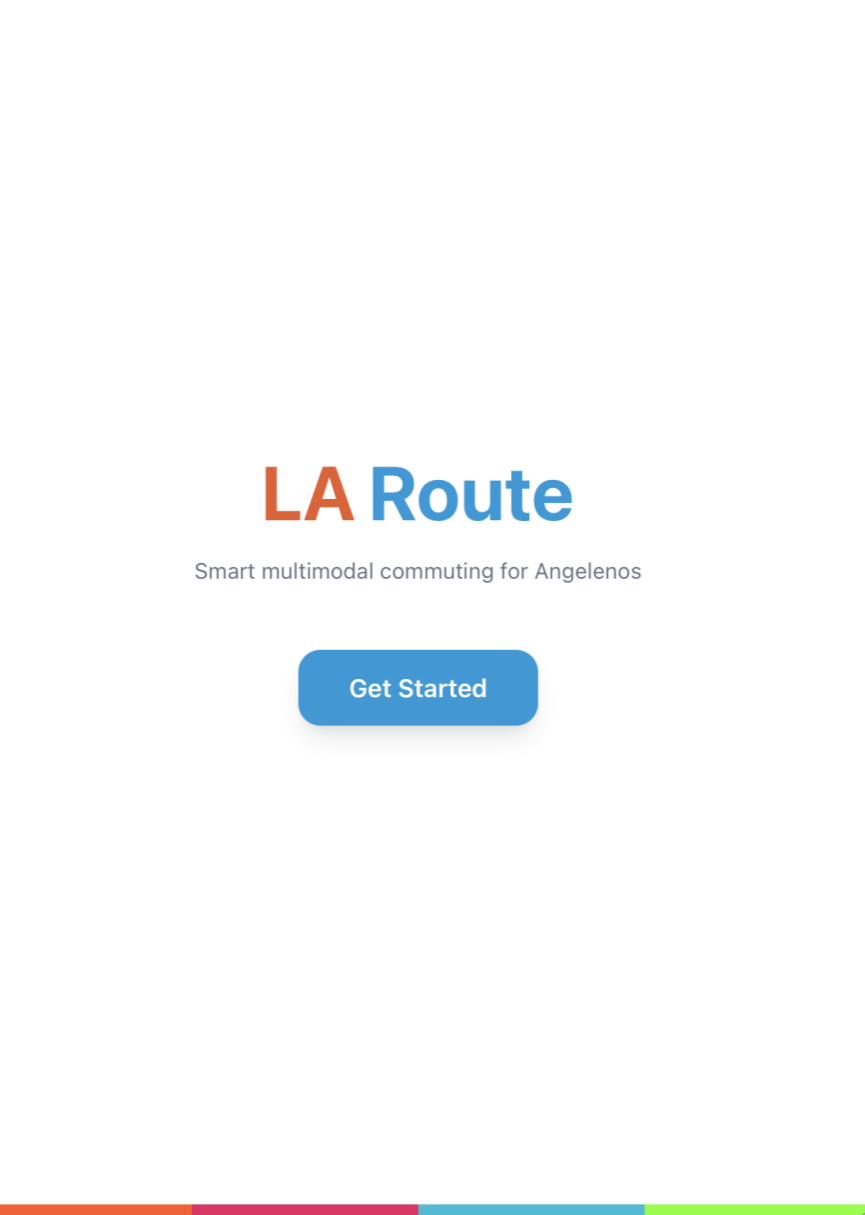
Logo
-
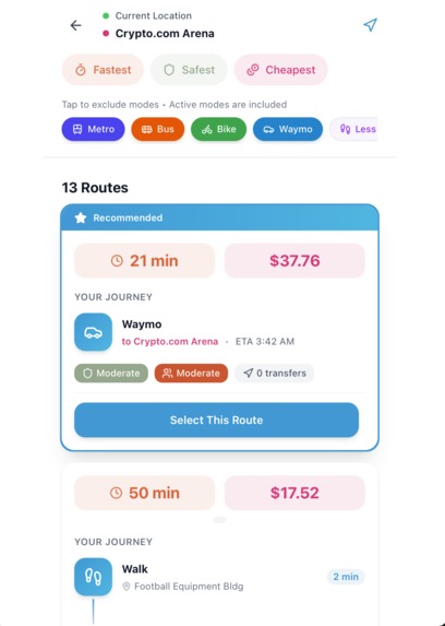
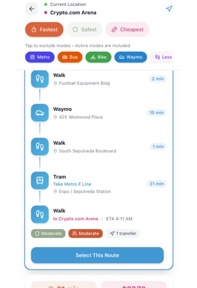
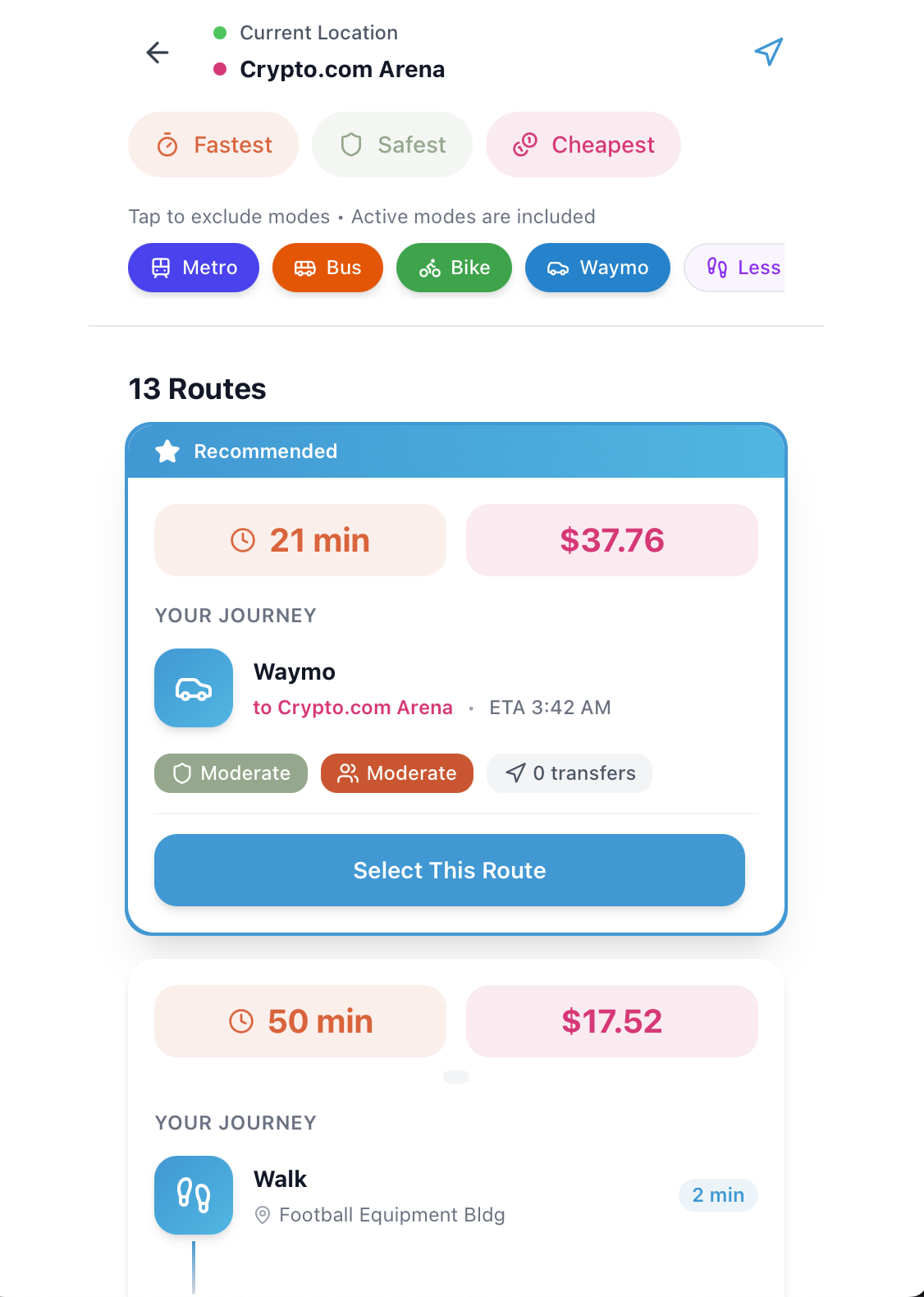
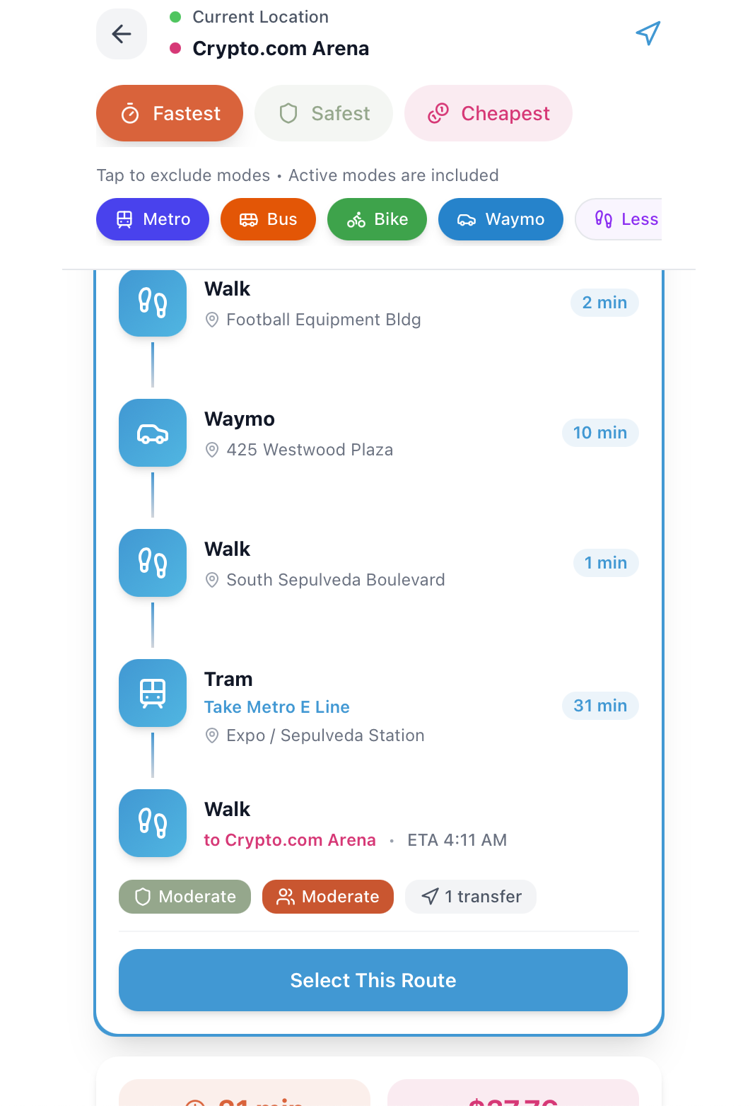
Default Routes
-
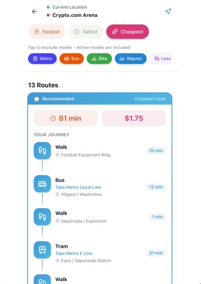
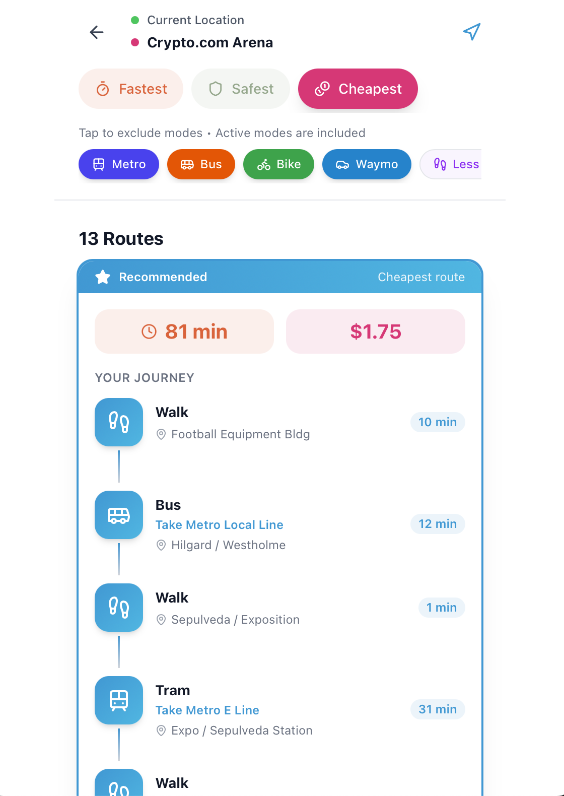
Cheapest Option
-
-

Heatmap
-

Inspiration
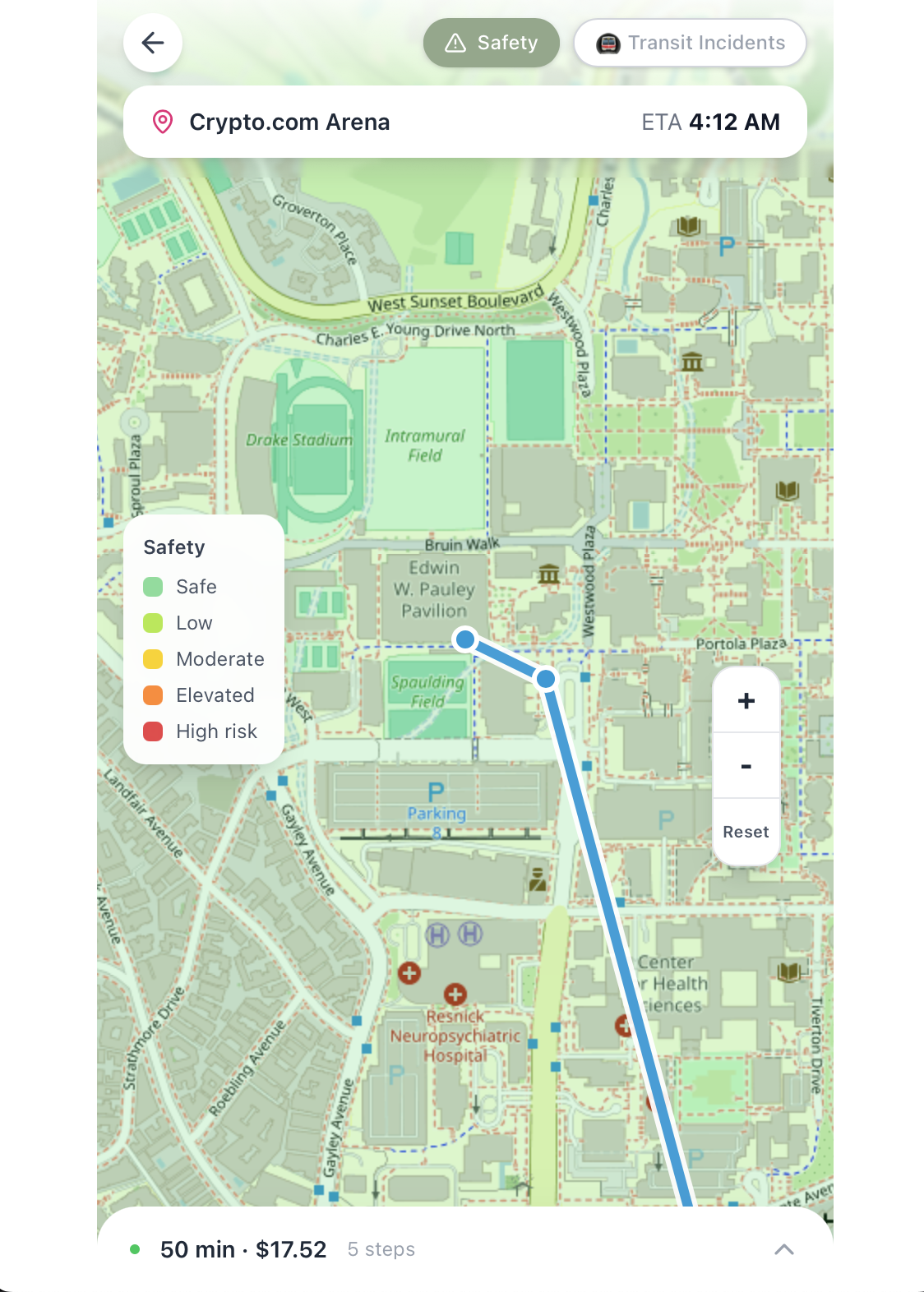
There is a misconception that it is impossible to get around LA without owning a car. In truth, it is possible, though it often requires some creativity and planning. Over 14.3% of LA households are car-free, and more than 21,000 UCLA students depend on public transportation daily. With the 2028 LA Olympics approaching, conservative estimates put the incoming crowd at 1.5 million visitors. Millions of people, many of them tourists unfamiliar with the city, will be navigating LA's transit network for the first time. Additionally, navigating LA without owning a car can feel daunting and, at times, even risky, especially for women who are disproportionately affected by harassment and safety concerns. In response to these challenges, we wanted to build a tool that makes getting around LA feel safer, simpler, and more accessible.
What it does
LA Route is a personalized multi-modal app designed to help people navigate LA without owning a car. Users can choose preferred modes of transportation, including walking, biking, taking the metro, and ride sharing. Users can also view routes that prioritize minimal cost, maximum safety, high speed, or minimal walking.
How we built it
Routing Engine: Built on OpenTripPlanner (RAPTOR + A*) using LA Metro GTFS and OpenStreetMap data to generate multimodal routes.
Backend Processing: Hosted on Vultr, where routes are enriched with cost and safety scoring before being sent to the frontend.
Rideshare Modeling: Approximated Waymo routes using drive-time estimates and a regression model trained on community-collected cost data.
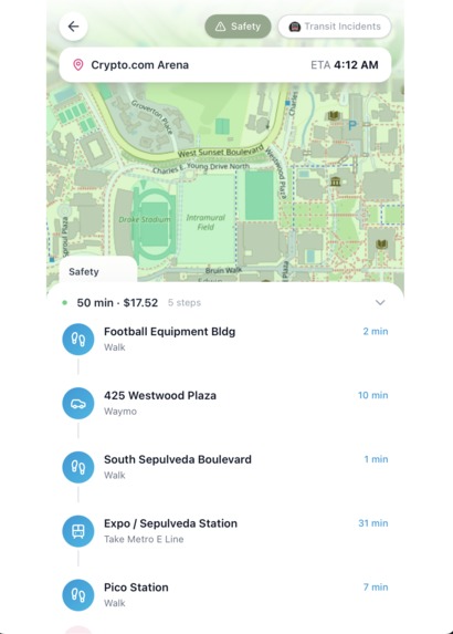
Safety System: Processed LA crime data (2023–2026) into a 100m grid heat map, weighted by severity of incidents.
Safest Routes: Used a KD-tree to efficiently evaluate nearby crime data and score each route based on its highest-risk segment.
Challenges we ran into
- Balancing multiple factors (time, cost, safety) in route selection without overwhelming the user
- Designing a safety heat map that was both visually clear and actually useful (not just aesthetic)
- Keeping the UI intuitive while handling complex multimodal routes and transfers
Accomplishments that we're proud of
- Successfully building a working multimodal routing system combining transit, walking, and rideshare
- Creating an intuitive safety heat map that meaningfully impacts route decisions
- Implementing personalized routing across fastest, cheapest, and safest options
- Designing a clean, user-friendly interface despite complex underlying logic
- Rapidly iterating and validating ideas using Figma Make, saving time and avoiding rework
What we learned
- Figma Make Workflow: Used Figma Make to rapidly prototype the UI with live previews and code generation, allowing quick iteration and easy integration into the codebase
- Data Integration: Combined multiple real-world datasets (transit, crime, and rideshare estimates) into a unified system to power routing and safety insights
- No LLM Dependency: Built the core system without relying on LLM calls, focusing on deterministic logic and efficient algorithms
- Graph-Based Backend: Developed a backend powered by graph algorithms (RAPTOR + A*) to generate and optimize multimodal routes based on user preferences
- Vultr Deployment: Ran graph processing, algorithms, and API queries on a deployed instance
What's next for LA Route
- AI-assisted routing: Introduce smarter route recommendations that adapt to user preferences, real-time conditions, and past behavior
- Street-level previews: Add visual snapshots at key stops and transfer points to improve user confidence and navigation clarity
- Social features: Enable users to connect with friends, share routes, and coordinate trips in real time
Built With
- opentripplanner
- python
- react-native
- typescript
- vultr

Log in or sign up for Devpost to join the conversation.