-
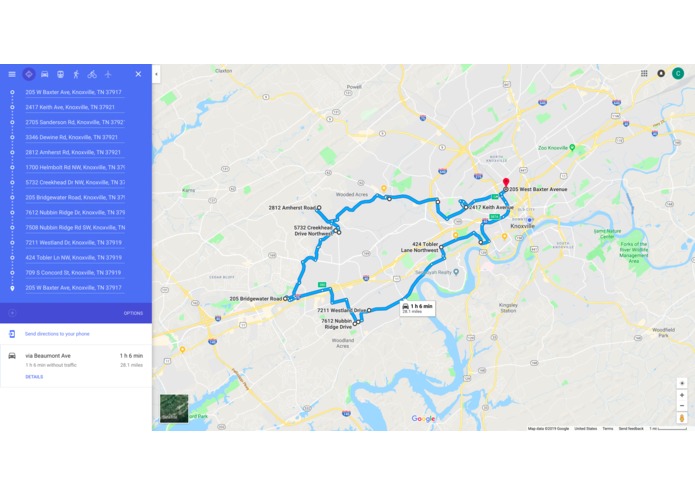
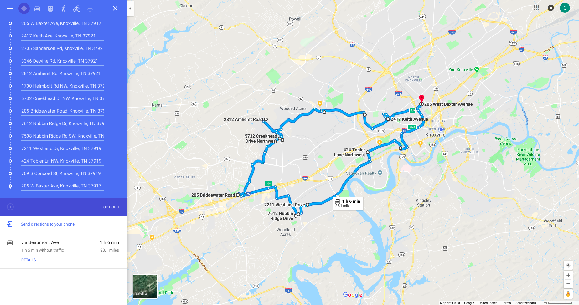
Route for truck 1 from example data
-
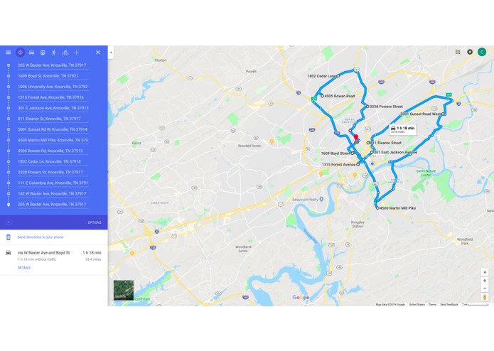
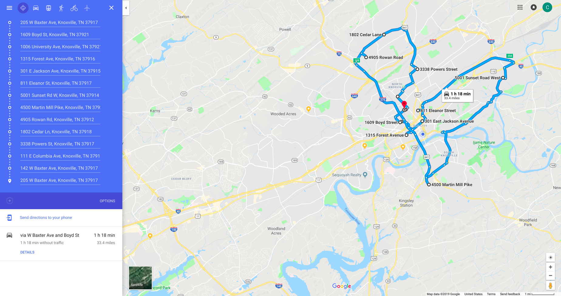
Route for truck 2 from example data
-
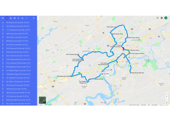
Route for a single truck from example data. Missing a few points from both routes due to prioritizing first in queue.
-
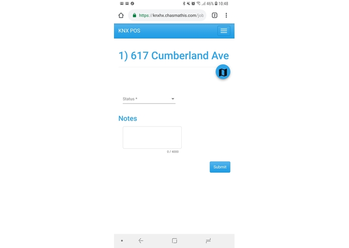
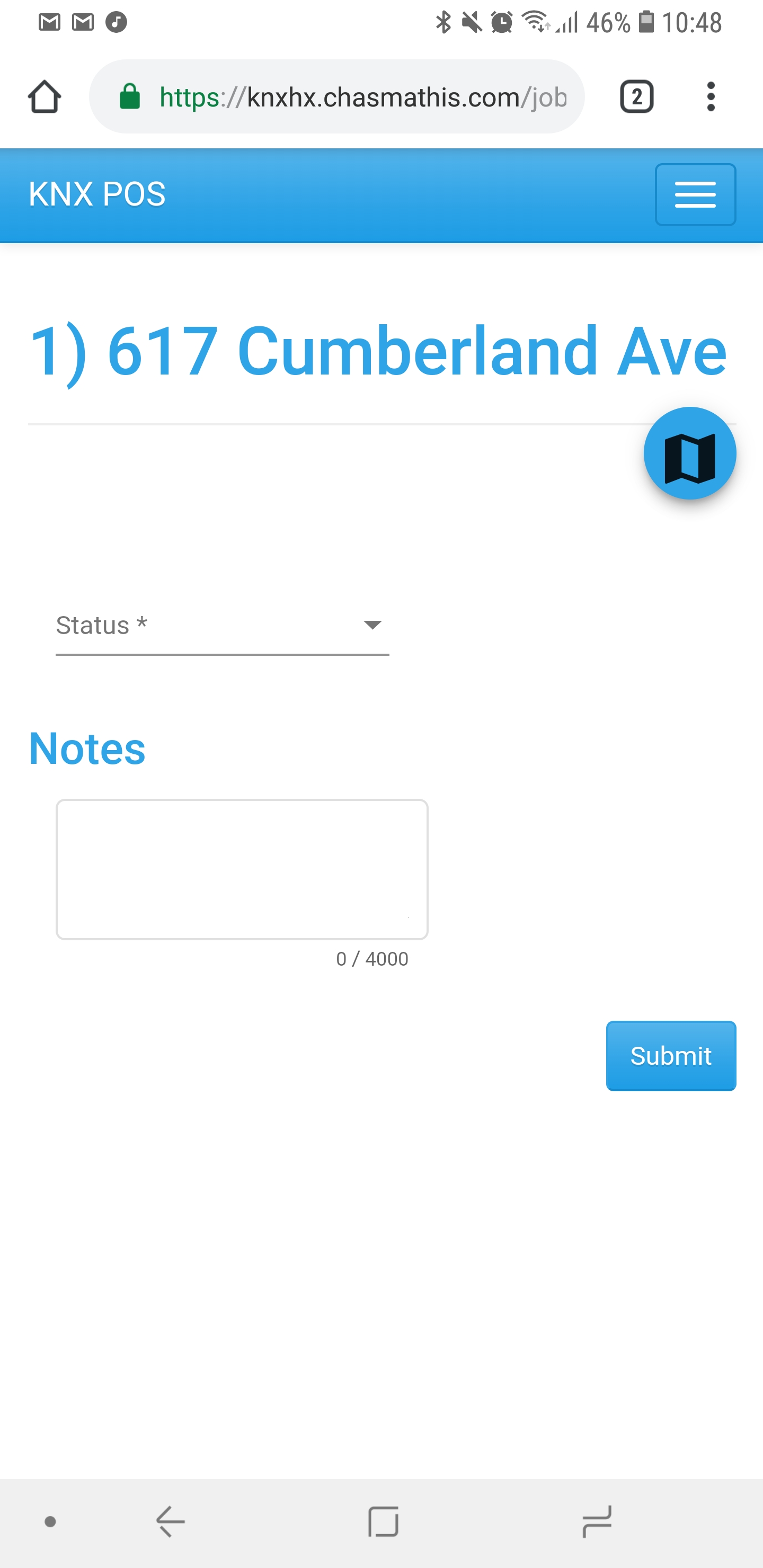
For the truck crew, see the next pothole address, google maps link (map icon) and change the status and add notes before the next site
-
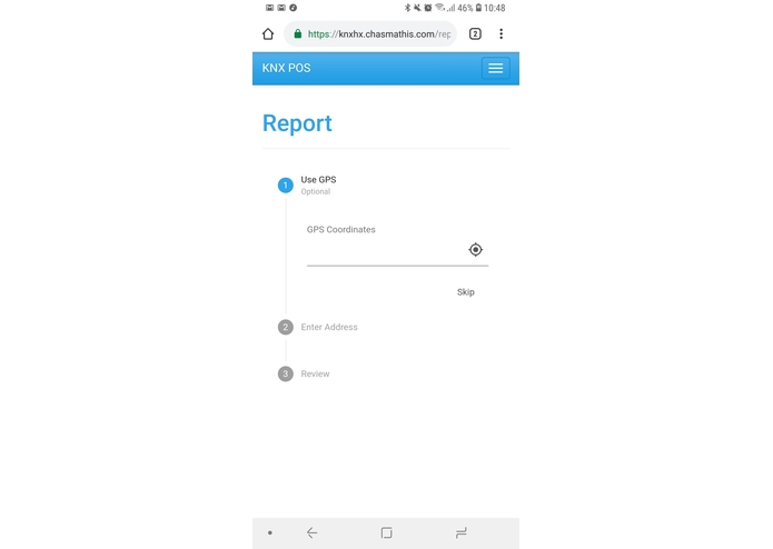
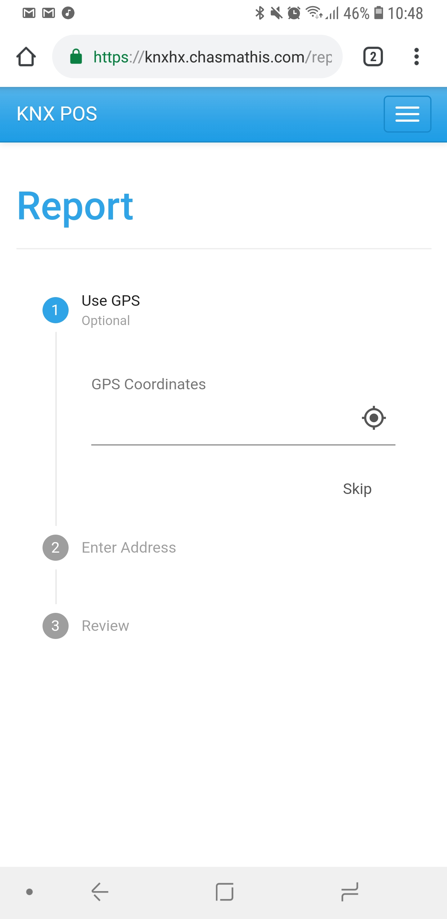
Report a Porthole location with either GPS location (click the crosshair to automatically grab) or enter in an address

Inspiration
Potholes are an endemic problem within municipalities. They affect all citizens, both those with self owned transportation, and many using public transportation.
What it does
The Pothole Operations System allows self reporting of Potholes and generation optimal paths for pothole repair truck crews, reducing time overhead in processing call center requests, as well as overall navigation time to location.
How we built it
Angular front-end tied in with a MySQL and Python Flask API back-end with OpenAPI v3 documentation via Swagger, integrated with Google Maps API.
Challenges we ran into
Time limitations limited the full implementation of the front-end and API, however we have solved the optimization of planning routes for truck drivers.
Accomplishments that we're proud of
Integrating with google, we can expand this code to include any number of truck crews, any number of daily jobs, and still calculate optimal paths based on WO, and self reported potholes.
What we learned
Google Map API integration Reinforcement of Python and API creation, as well as Mysql database design
What's next for KNX POS
Finalizing API work User authentication Administrative control Support for multi truck dispatch configuration within user interface Handling rate limiting possibilities for external API calls


Log in or sign up for Devpost to join the conversation.