Inspiration
The idea behind JKUAT Digital Twin came from a simple question:
Can we build a system that allows us to ask questions about our environment and get evidence-based answers?
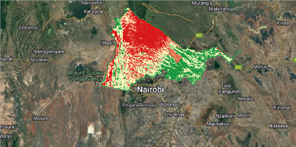
JKUAT and its surrounding areas experience flooding during rainy seasons. With the possibility of heavy rainfall events such as El Niño, I wanted to explore how we could better understand the factors contributing to flooding and prepare for different scenarios.
This led to the idea of using a digital twin to move beyond simply asking “Where is flooding likely to occur?” toward:
What is happening? Why is it happening? Who or what could be affected? What could happen if conditions change?
What it does
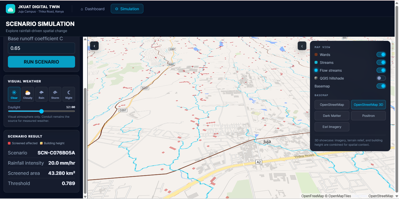
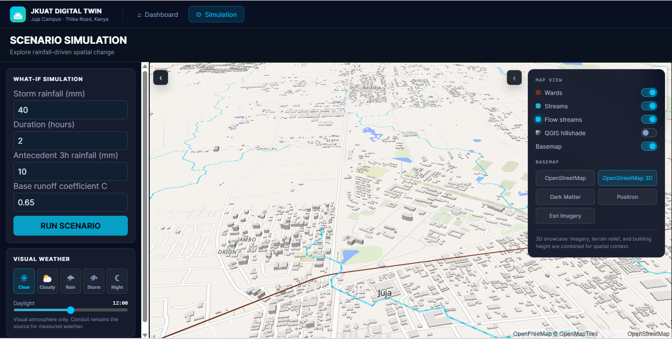
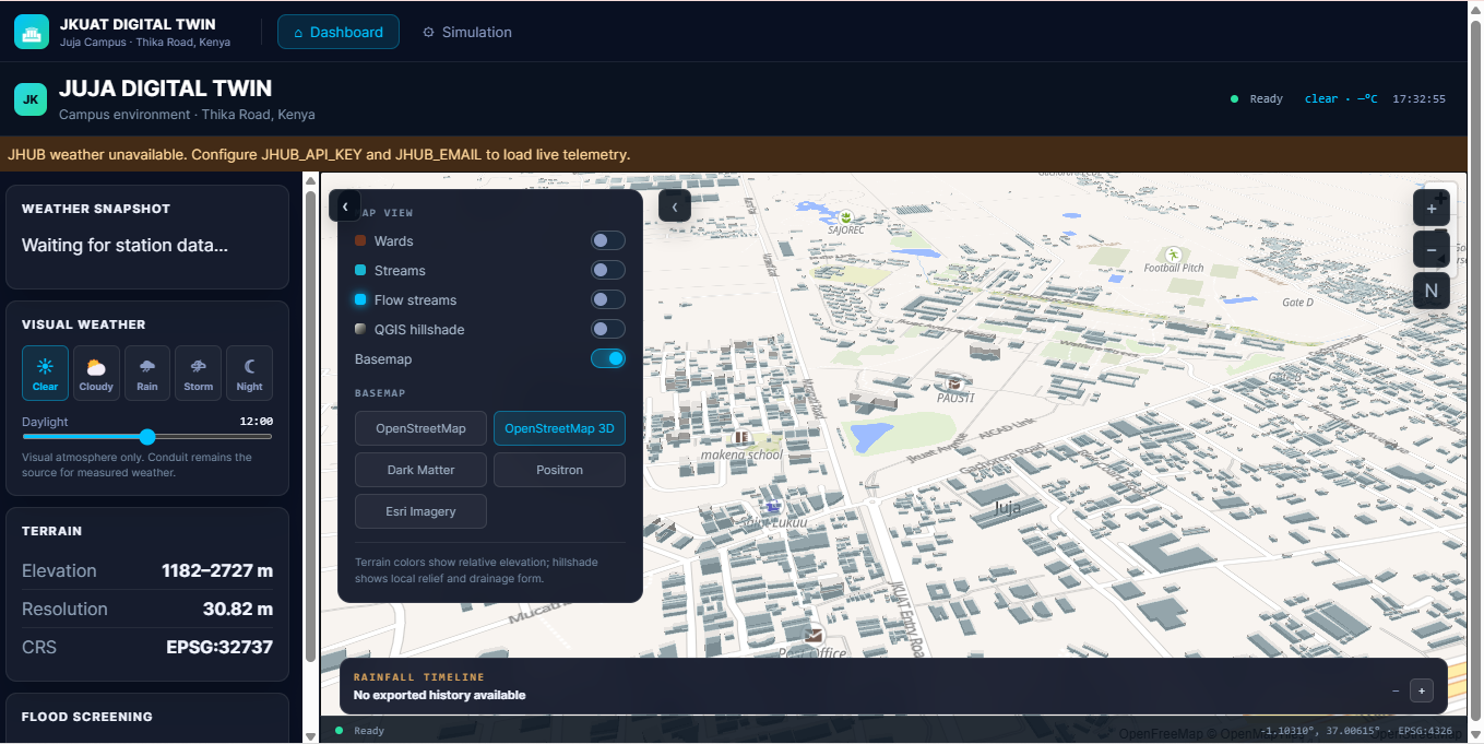
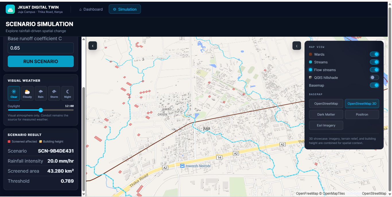
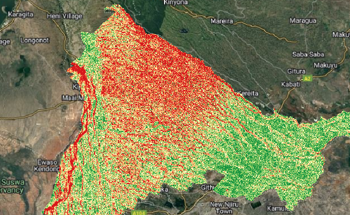
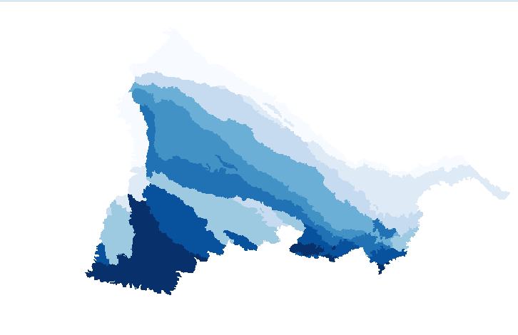
The JKUAT Digital Twin combines spatial and environmental information to explore flood susceptibility and what-if scenarios.
It brings together:
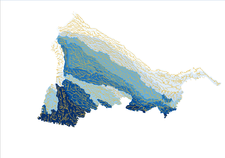
Terrain and elevation Slope Flow direction Flow accumulation Drainage and watersheds Rainfall observations Remote sensing and land-surface information
The system allows these factors to be viewed and analysed together rather than as isolated datasets.
The current prototype focuses on flood susceptibility and scenario-based simulation, rather than claiming to provide fully validated flood predictions.
How we built it
The project combines GIS, Remote Sensing, Python, web technologies and environmental data.
Geospatial processing QGIS for GIS analysis and visualization Python for reproducible processing GeoPandas for vector data Rasterio / Xarray / Rioxarray for raster and environmental data DEM-derived terrain and hydrological products Backend FastAPI Python-based services for environmental data, GIS layers and simulation JHUB Conduit API for environmental sensor observations Frontend React TypeScript Vite MapLibre GL JS 3D technologies as the project develops The architecture allows environmental inputs to be combined with spatial analysis and then presented through an interactive digital-twin interface.
Challenges we ran into
The biggest challenge was computing power to be able to calculate different drives that may cause flooding and realizing that rainfall alone cannot explain flooding.
Flood behaviour depends on the interaction between rainfall and the physical environment, including terrain, slope, flow accumulation, drainage, land cover, built-up areas and other factors.
Another challenge was distinguishing between:
A map showing where something is
and
A system capable of reasoning about why something is happening and exploring what could happen under different conditions.
We also had to deal with data processing, coordinate reference systems, large raster datasets, hydrological analysis and integrating GIS outputs with a web application.
Accomplishments that we're proud of
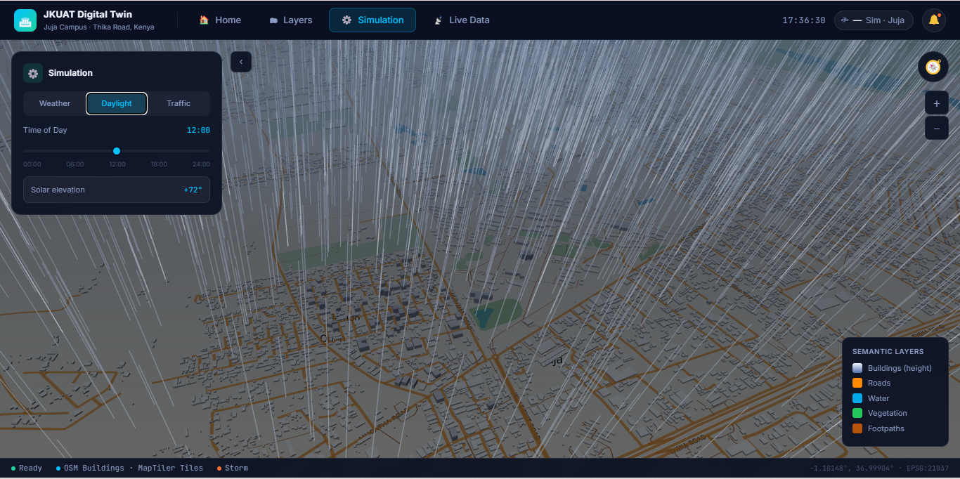
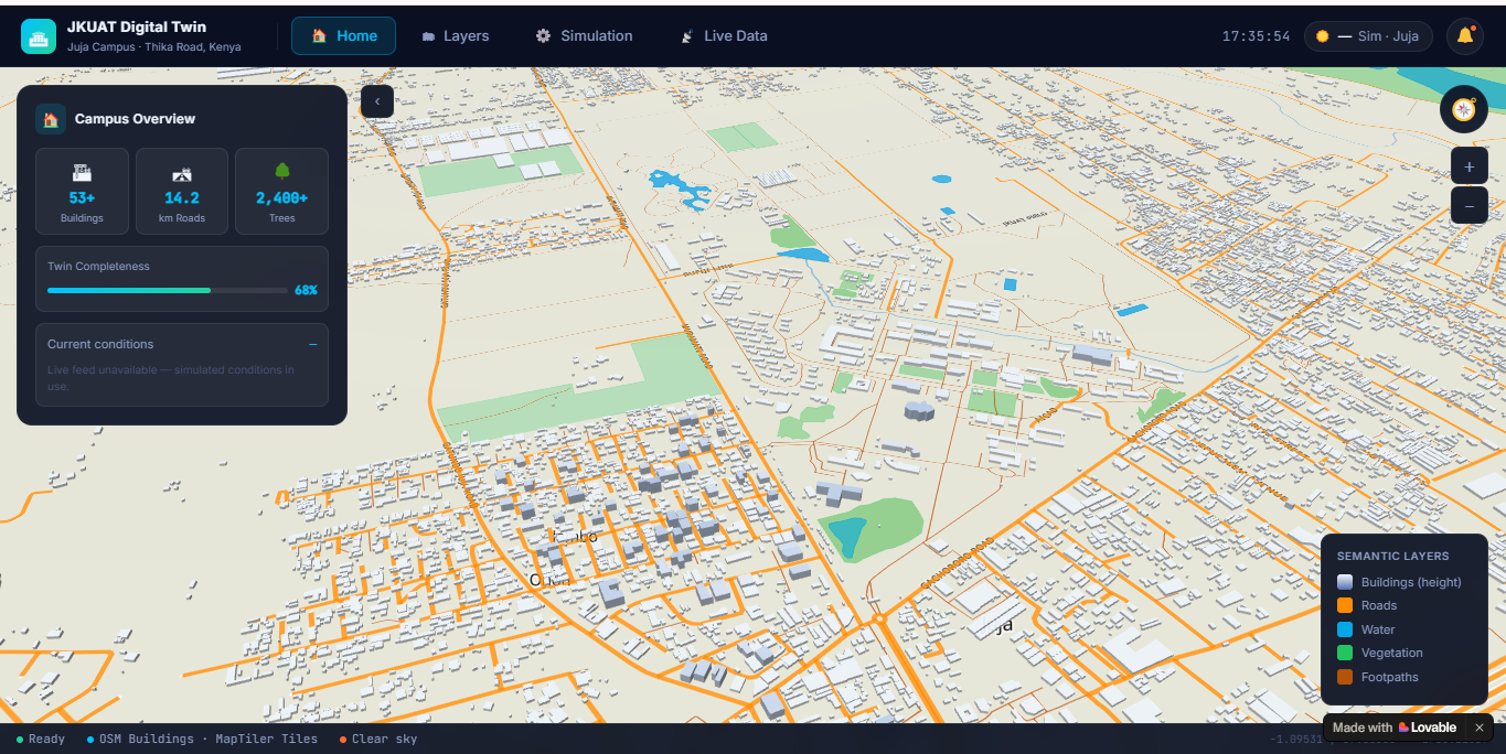
We developed an initial JKUAT Digital Twin prototype that brings together GIS analysis, environmental data and interactive visualization.
We were able to:
Process real terrain data. Derive slope, flow direction and flow accumulation. Analyse drainage and watershed patterns. Integrate environmental observations. Build an interactive web-based environment. Introduce rainfall-driven scenario exploration. Create a foundation that can be extended into a more advanced 3D and intelligent digital twin.
Most importantly, the project shifted our thinking from “making a map” toward “building a system that can answer questions.”
What we learned
We learned that building a digital twin is not simply about creating a 3D visualization.
The real value comes from connecting:
Data → Spatial relationships → Models → Simulation → Questions → Answers
We also learned that GIS provides an important foundation for understanding environmental systems, while Remote Sensing provides information about the Earth's surface.
Going forward, Machine Learning and AI can help analyse larger datasets and identify patterns that may be difficult to detect manually — but reliable ML models require appropriate training data, observations and validation.
What's next for Jkuat Digital Twin
The current prototype is only the beginning.
Our next steps are to introduce:
More environmental observations Historical flood-event data Rainfall-runoff modelling Hydraulic modelling Improved flood validation Machine Learning and AI More spatial rainfall data Real-time and forecast information Interactive 3D terrain and infrastructure More advanced scenario simulation
We are also exploring how tools such as Adaption Labs could support future dataset preparation and ML experimentation.
The long-term vision is to move from:
“What is happening?”
to
“What can happen under different scenarios?”
and eventually:
“What might happen next?”
The JKUAT Flood Twin is therefore not the final product — it is the starting point for a larger environmental digital twin.
Built With
- dem
- dem-data
- fastapi
- geopandas
- jhub
- maplibre-gl-js
- python
- qgis
- rasterio
- react
- remote-sensing
- typescript
- vite
- xarray

Log in or sign up for Devpost to join the conversation.