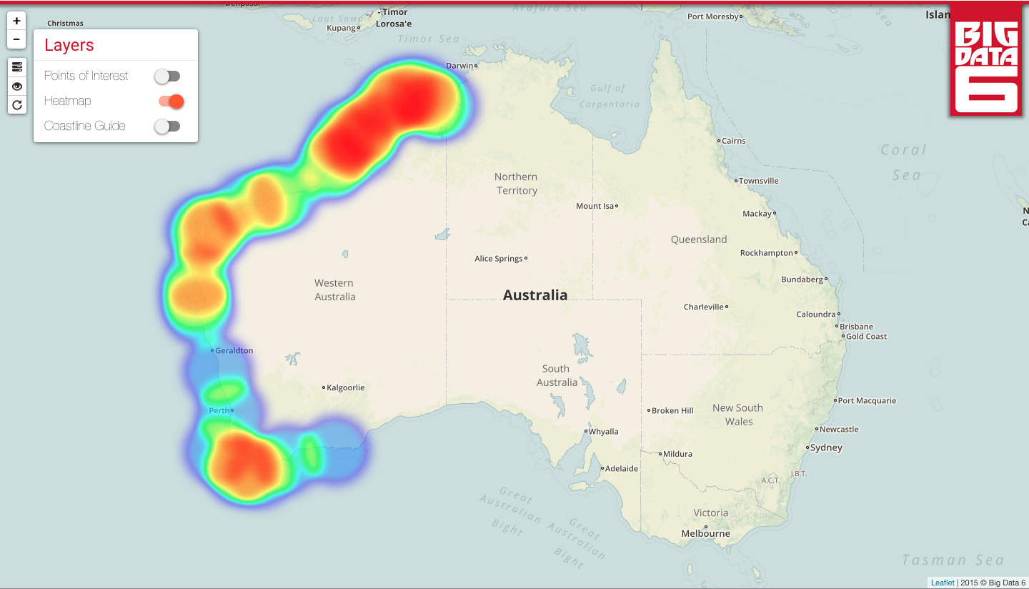
Jaywatch detects coastal features that are associated mineral sands deposits using fractal geometry and machine learning. The resulting GIS web application assists exploration geologists by generating a heatmap of these coastal features. We are most proud of our algorithm and overall approach to the problem, given none of us have any previous experience with GIS.
Jaywatch
Using coastal features to identify mineral sand deposits


Updates

Leave feedback in the comments!
Log in or sign up for Devpost to join the conversation.