-
-

you could select start and end point just by tapping on the requires location
-
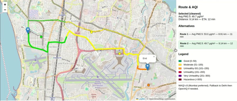
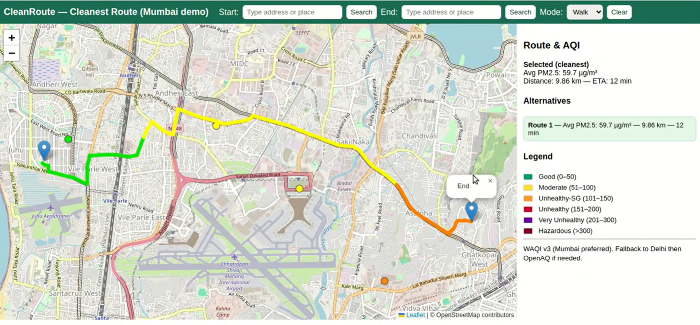
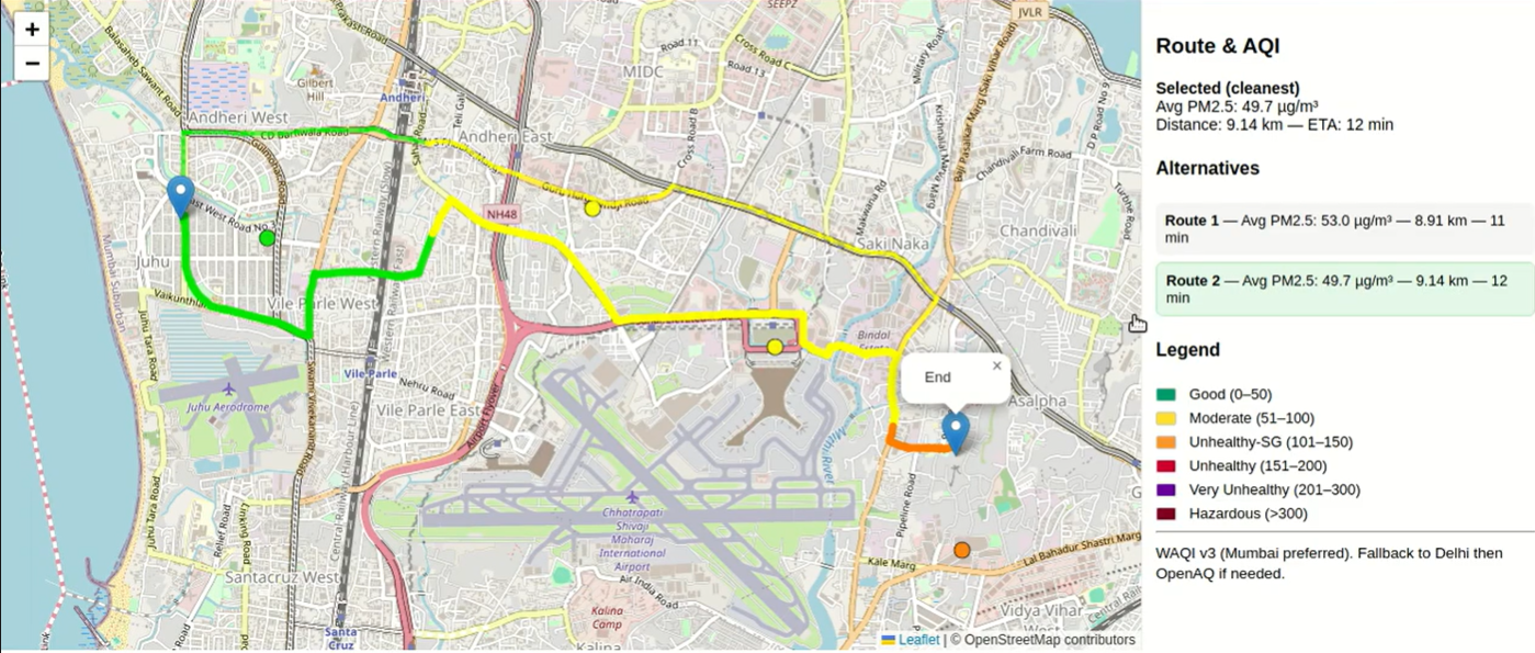
it shows alternate paths for the selected destination
-
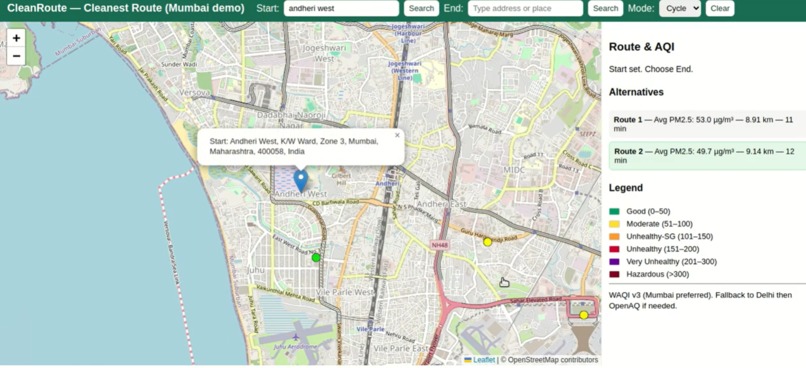
user could select precise start and destinnation place by using search bar to set the location precisely

Inspiration
I travel nearly 50 km each way by RTC to reach my college every day. During my first year, I observed how drastically the weather has been changing. We once had four distinct seasons, but recently the climate has become unpredictable. Summers are longer, the heat is rising, and it is clear that climate change is real and visible around us.
I realized that protecting the environment doesn’t start with just an environmentalist or authority—it starts with us, our government, and the community.
While existing maps focus on traffic and time, none of them prioritize healthier routes. Many people who once preferred walking or cycling are now shifting to autos or vehicles due to unsafe or polluted routes. That’s where the idea of EcoRoutes was born—a map that highlights eco-friendly and healthy travel paths for pedestrians and cyclists.
What it does
EcoRoutes is a smart mapping solution that doesn’t just show the fastest path but the healthiest and safest one. It helps pedestrians and cyclists choose routes with:
- Less pollution (air & noise)
- More greenery/shade
- Safer conditions (cycle lanes, footpaths, accident-free zones)
- Lower carbon footprint
Encouraging people to walk or cycle not only reduces pollution but also promotes better health and supports sustainability.
How we built it
We used OpenStreetMap (OSM) as the base mapping layer. Integrated pollution and weather datasets to identify areas with cleaner air. Designed an algorithm that assigns a “Health Score” to every possible route: Health Score=𝛼⋅(1−𝑃)+𝛽⋅𝐺+𝛾⋅𝑆
Where: P = Pollution index along the route G = Green cover/shade score S = Safety index (cycle lanes, accident history) α,β,γ = adjustable weight factors
Built a web interface to visualize route comparisons (Fastest vs Healthiest). Added a mobile-friendly UI for cyclists and walkers.
Challenges we ran into
Collecting reliable pollution and greenery datasets was difficult. Balancing between accuracy (real-time data) and performance (fast route suggestions). Designing a fair scoring algorithm that considers multiple factors without biasing towards just one. UI/UX challenge: How to present route suggestions clearly without overwhelming the user.
Accomplishments that we're proud of
-Successfully built a working prototype that shows healthier routes. -Integrated multiple datasets into a single system. -Created awareness among our peers about eco-friendly travel choices. -Developed a concept that is unique, impactful, and scalable.
What we learned
How to work with mapping APIs and open datasets. Importance of data normalization and scoring models for fair comparisons. That even small steps, like walking or cycling, can positively impact climate change. Team collaboration, time management, and the balance between innovation and feasibility in a hackathon.
What's next for Eco Routes
-Introduce gamification – reward points for users who choose eco-routes. -Collaborate with city authorities to include official cycle lanes and safe routes. -Expand to a mobile app with voice-guided navigation. -Use AI/ML models to dynamically improve route scoring over time.
Built With
- css
- html
- javascript
- leaflet.js
- osmr
- waqi

Log in or sign up for Devpost to join the conversation.