-
-
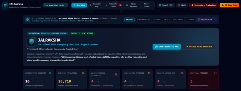
Dashboard
-
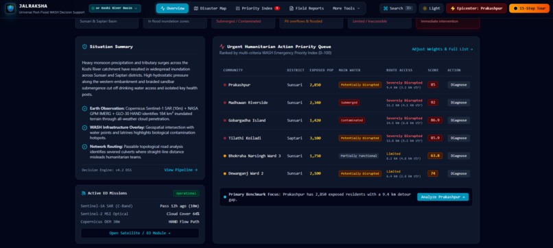
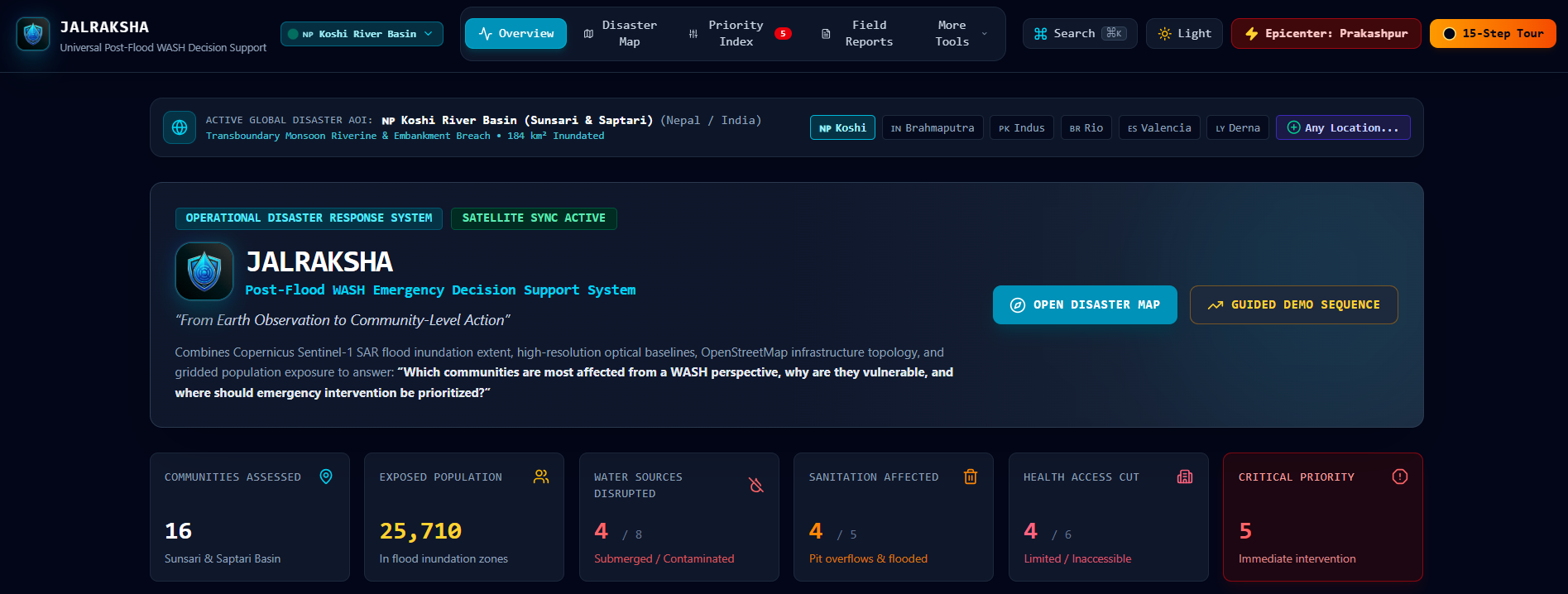
Overview
-
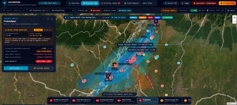
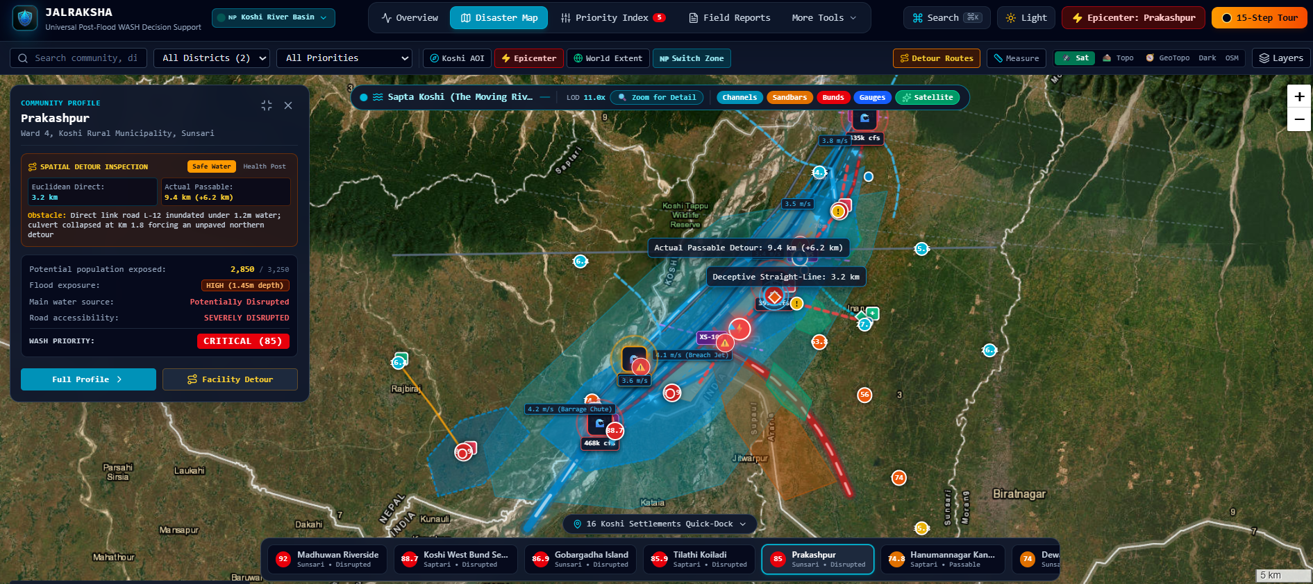
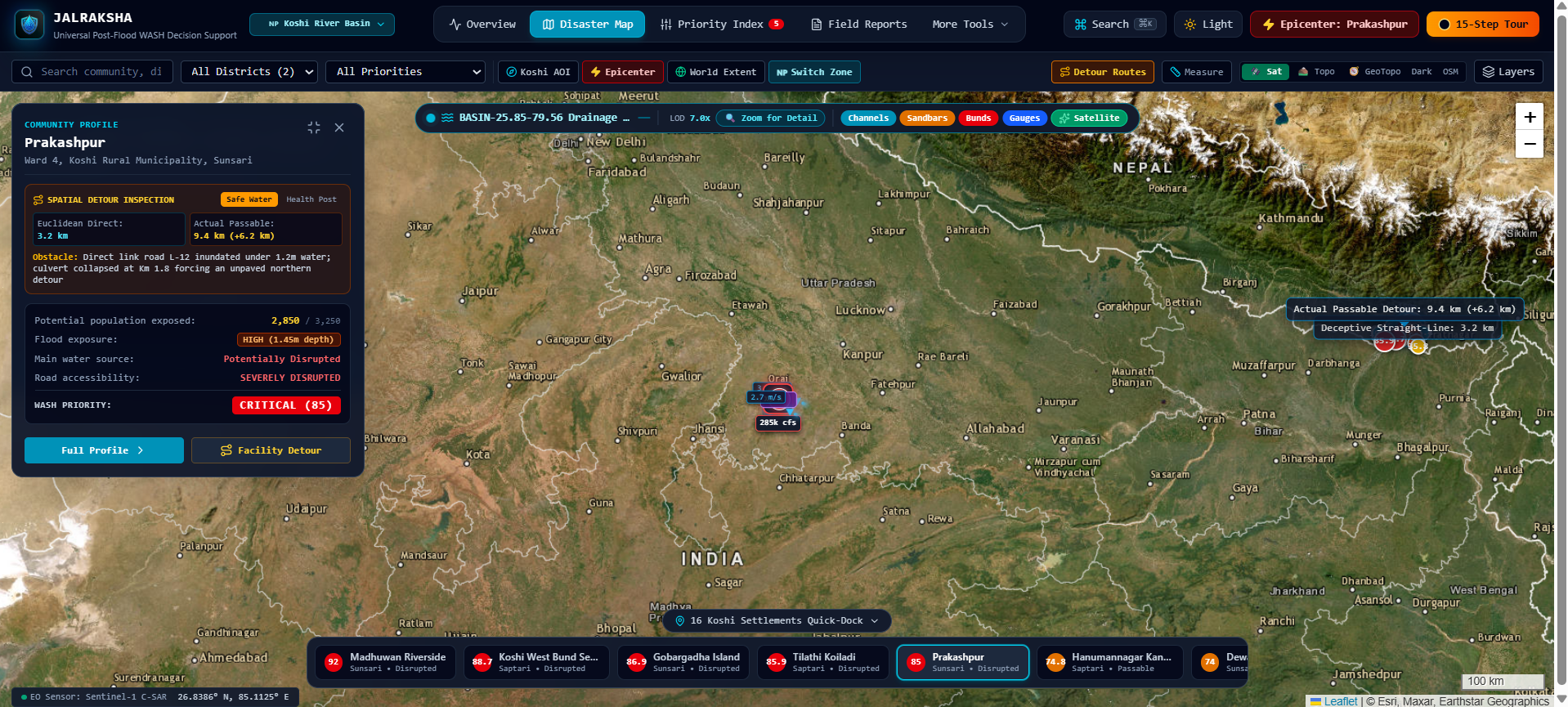
Geospatial River mapping
-
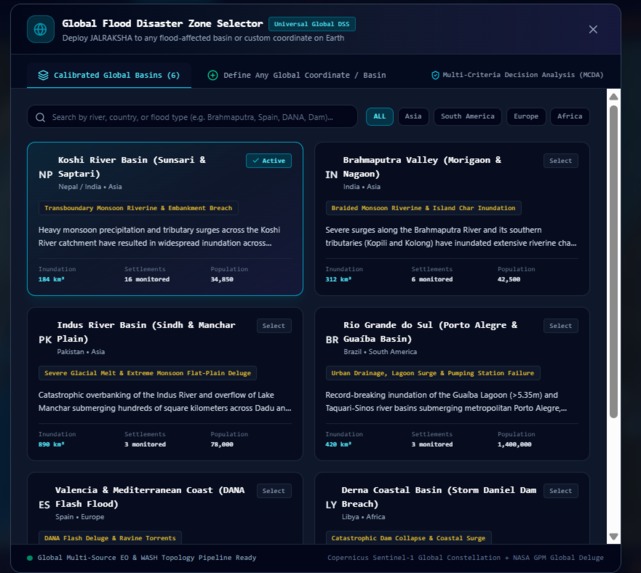
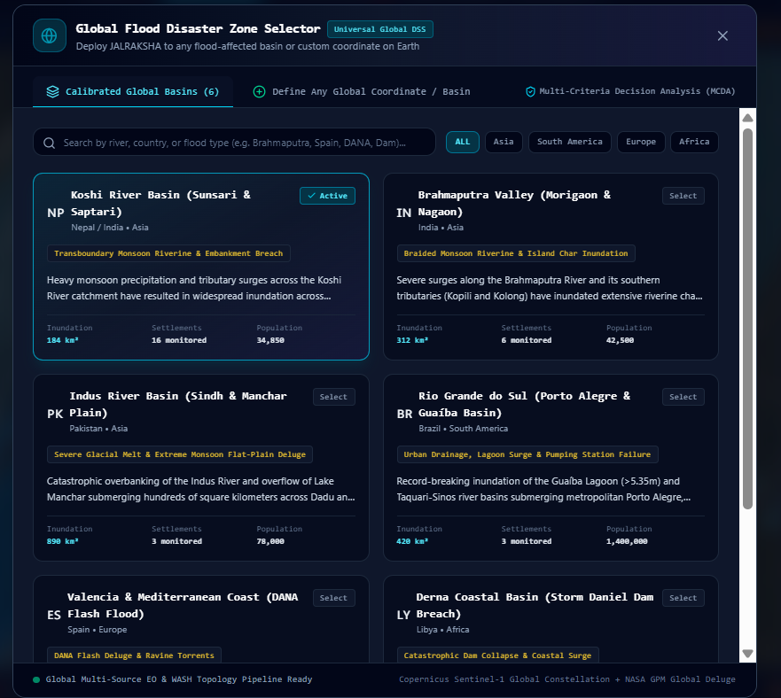
Global flood disaster zone selector
-
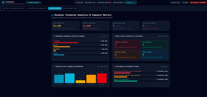
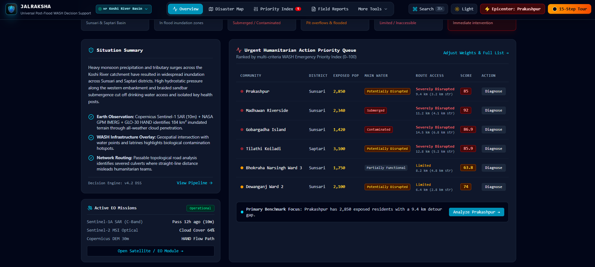
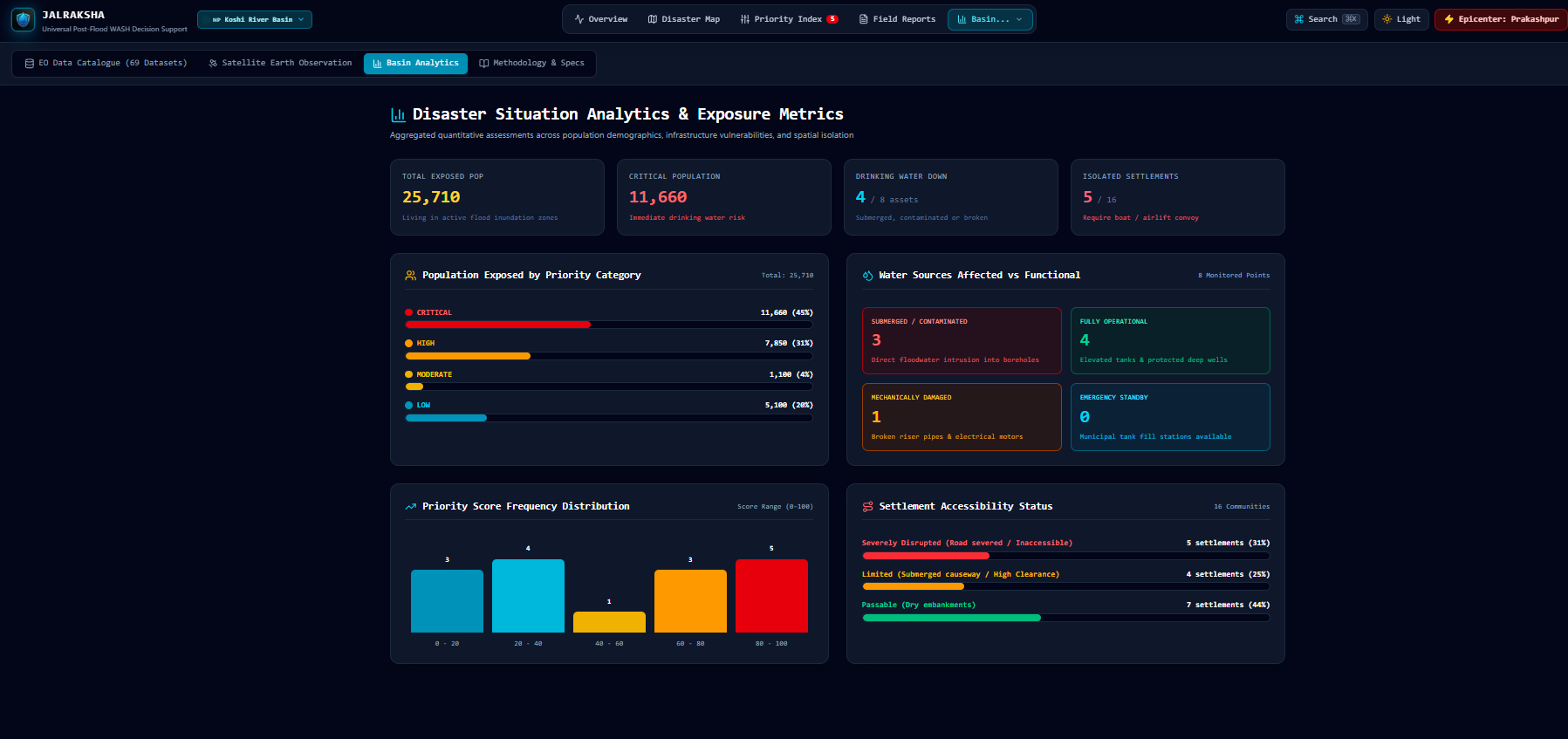
Disaster situation analytics & exposure metrics
-
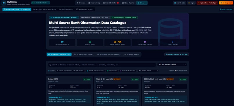
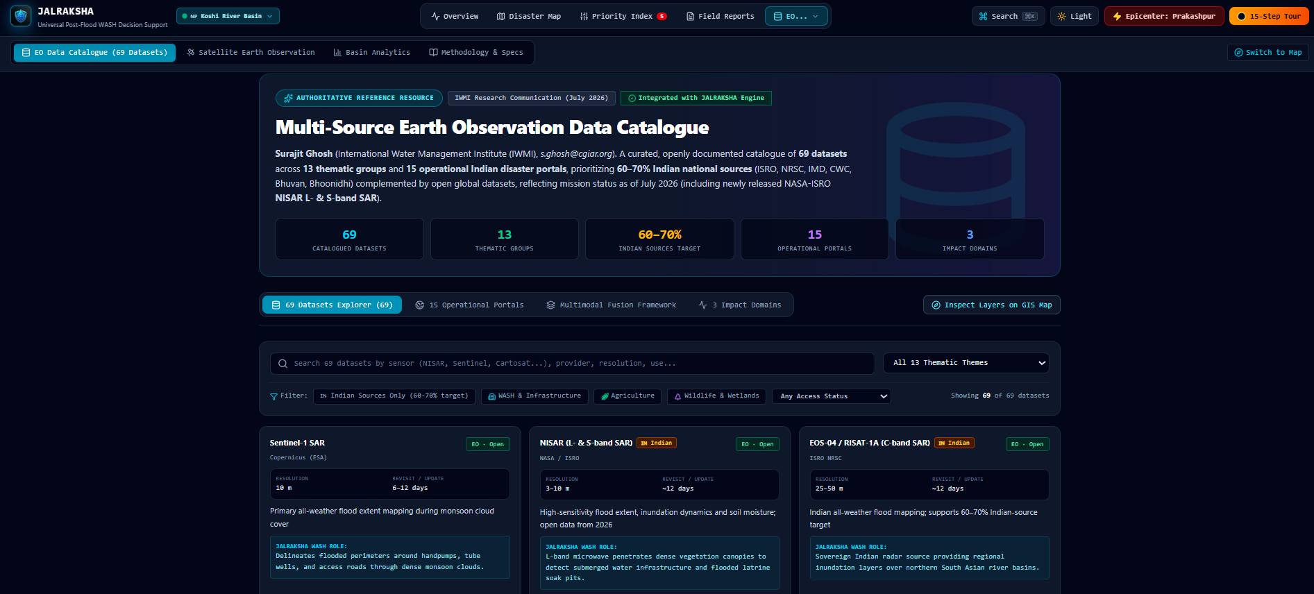
Multi source earth observation data catalouge
-
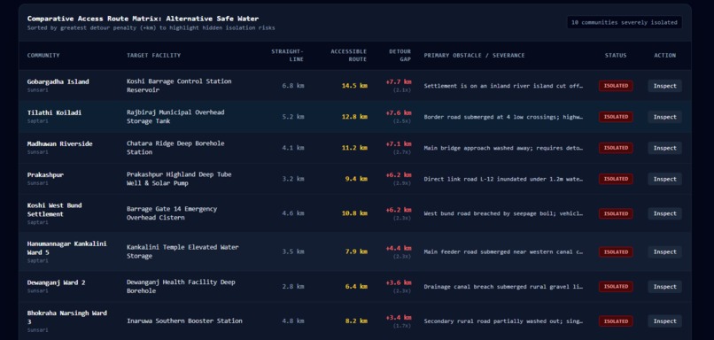
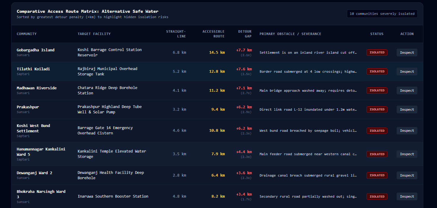
Comparative access route matrix
-
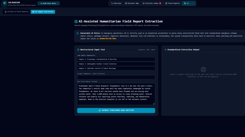
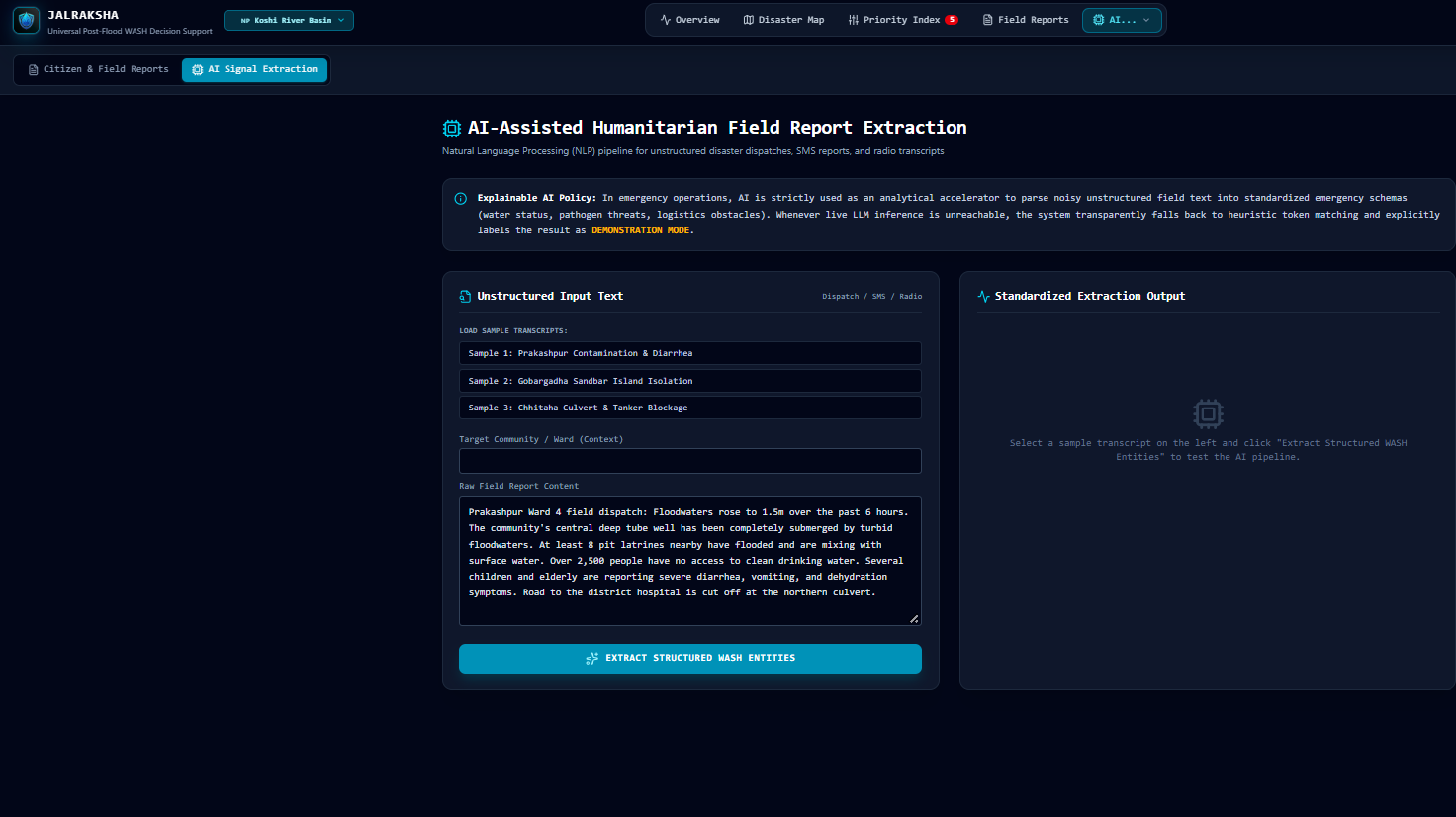
AI assisted humanitarian field report extraction
-
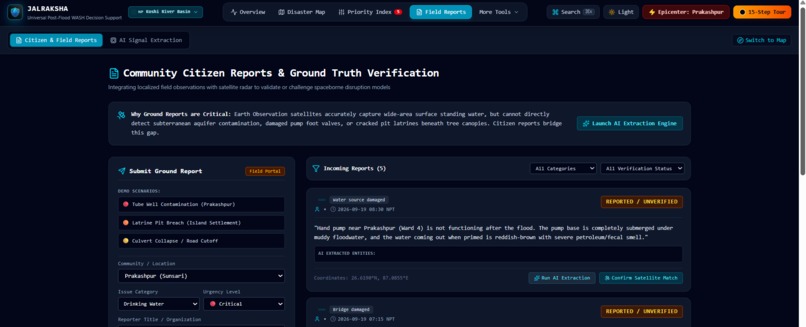
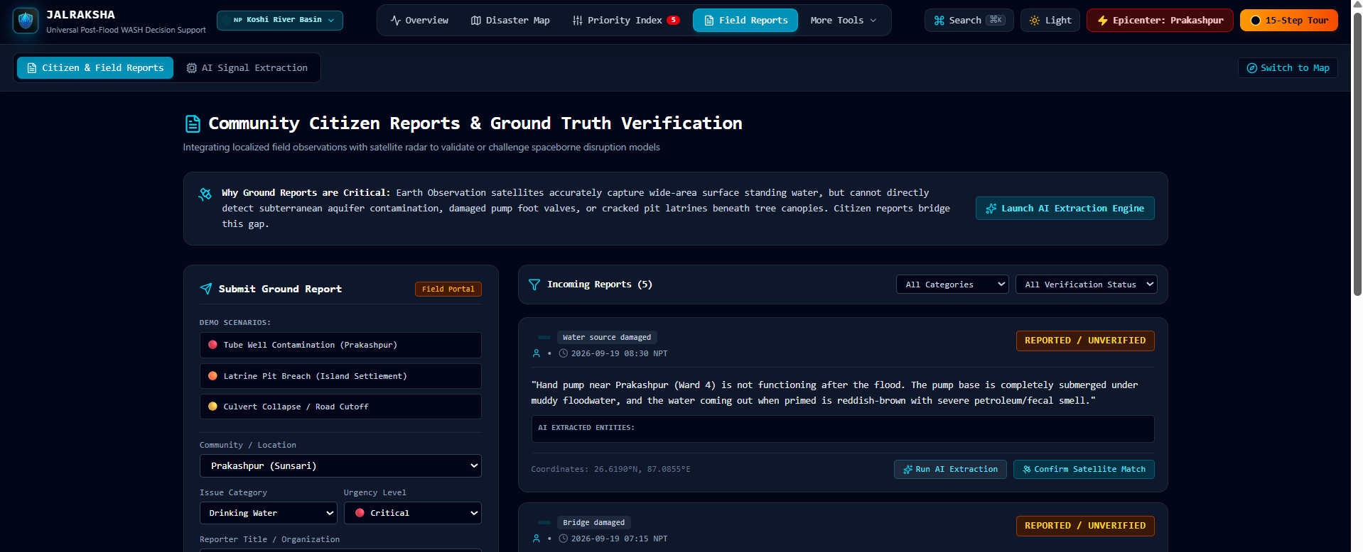
Community citizen reports & Ground truth verification
-
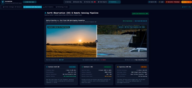
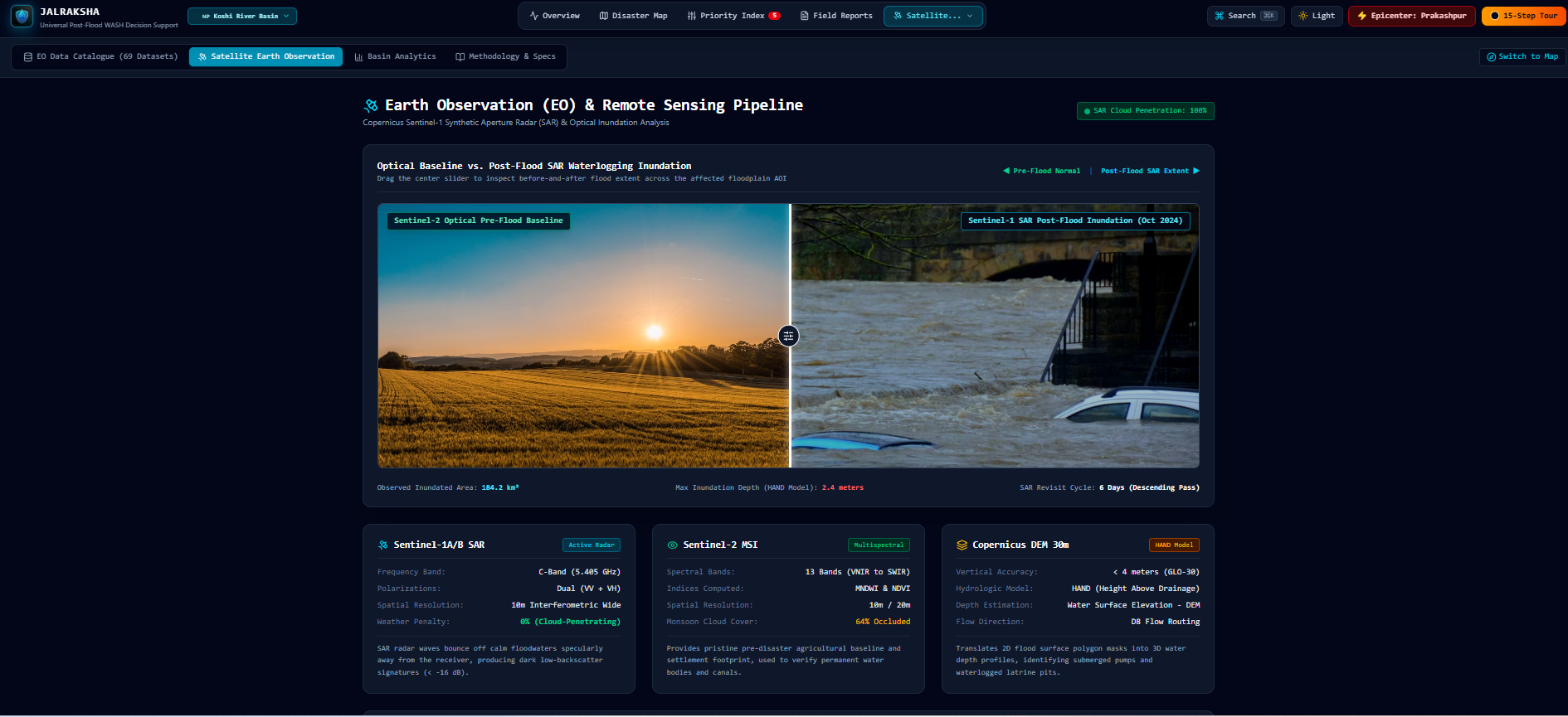
Earth observation & Remote sensing pipeline
-
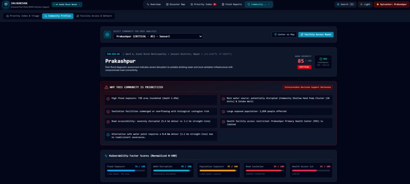
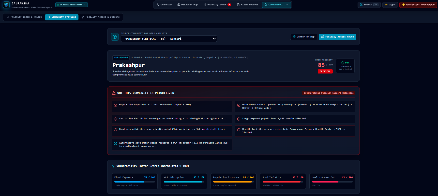
Community profile and risk analysis
-
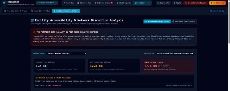
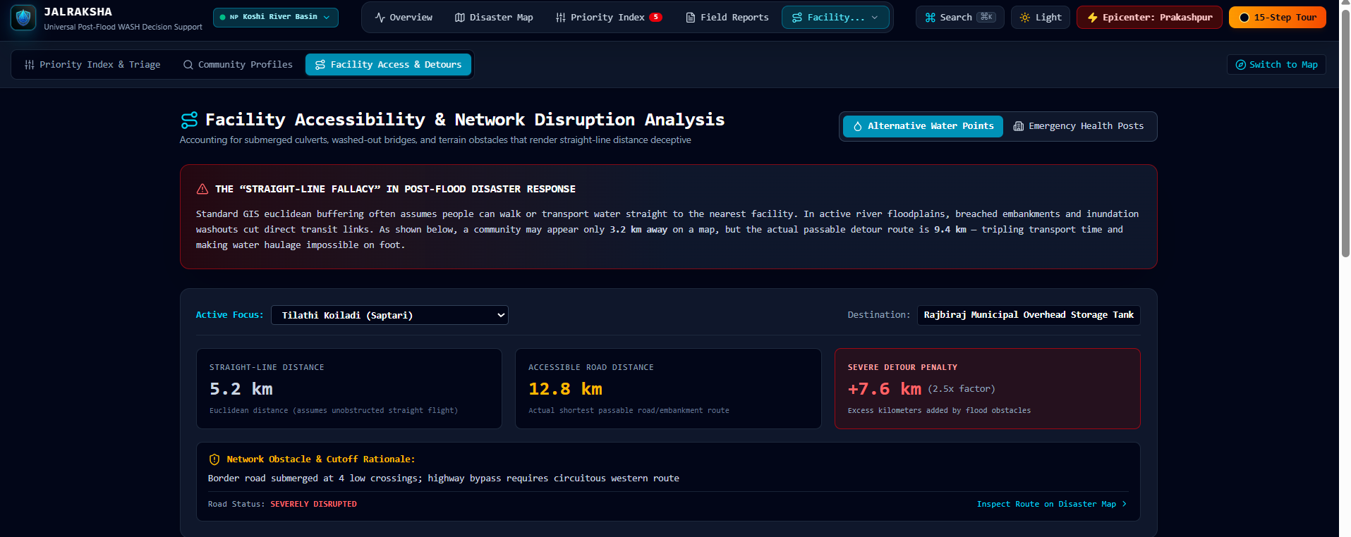
Facility accessibility & network disruption analysis
-
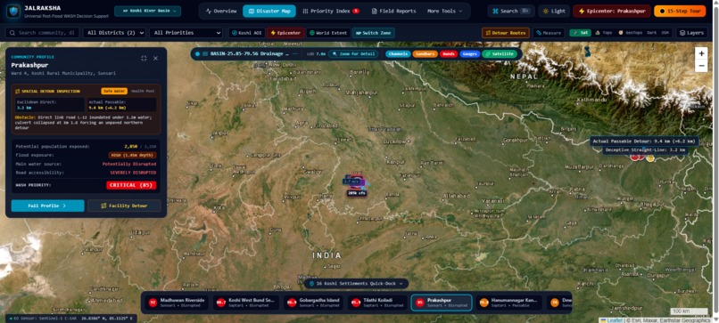
Geo mapping
-
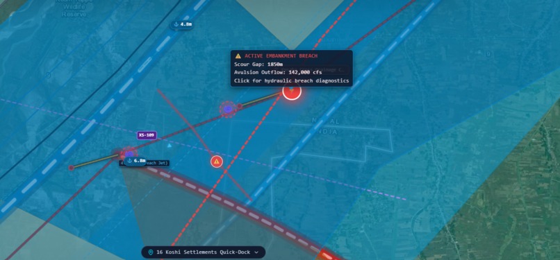
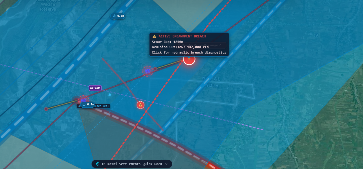
High risk area and report
Inspiration
During a disaster, critical information comes from many sources such as satellite imagery, ground photographs, maps, emergency reports and location data. The challenge is not simply collecting this information, but turning it into useful decisions quickly. This inspired us to build JalRaksha, a multimodal AI platform designed to help understand disaster impact and identify areas that need urgent attention.
How We Built It
JalRaksha brings multiple data modalities into a single platform. AI can analyze satellite imagery, ground images, maps and text based reports to identify affected regions, assess the situation and prioritize vulnerable villages, hospitals and critical infrastructure. The platform presents this information through an intuitive disaster intelligence interface.
What We Learned
Building JalRaksha helped us understand how multimodal AI can combine different forms of information to solve real world problems. We also learned about disaster mapping, information prioritization, AI assisted analysis and designing technology around the needs of emergency responders.
Challenges
One of our biggest challenges was deciding how to combine different data sources while keeping the system simple and useful. Disaster situations can also involve incomplete, outdated or conflicting information, so presenting AI generated insights clearly while keeping humans in control was an important consideration.
JalRaksha is built around one idea: turn scattered disaster information into clear, actionable intelligence when every second matters.
Built With
- artificial-intelligence
- computer-vision
- css
- data-visualization
- disaster-management
- emergency-response
- flood-detection
- gemini
- geospatial-data
- google-ai-studio
- google-maps
- html
- javascript
- machine-learning
- multimodal-ai
- natural-language-processing
- risk
- satellite-imagery
- web-application

Log in or sign up for Devpost to join the conversation.