-
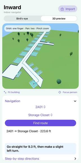
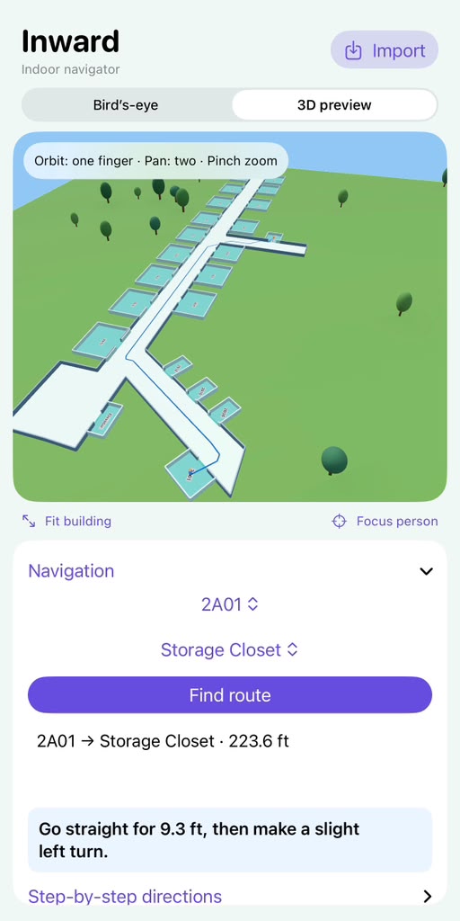
Demonstration of the final product
-
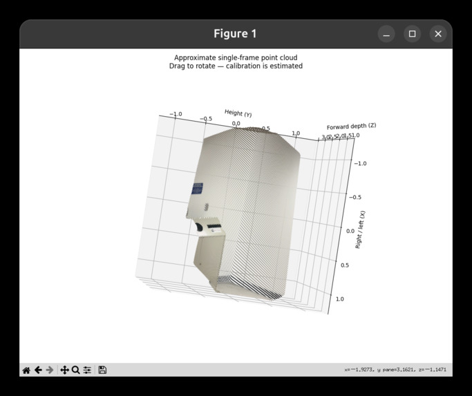
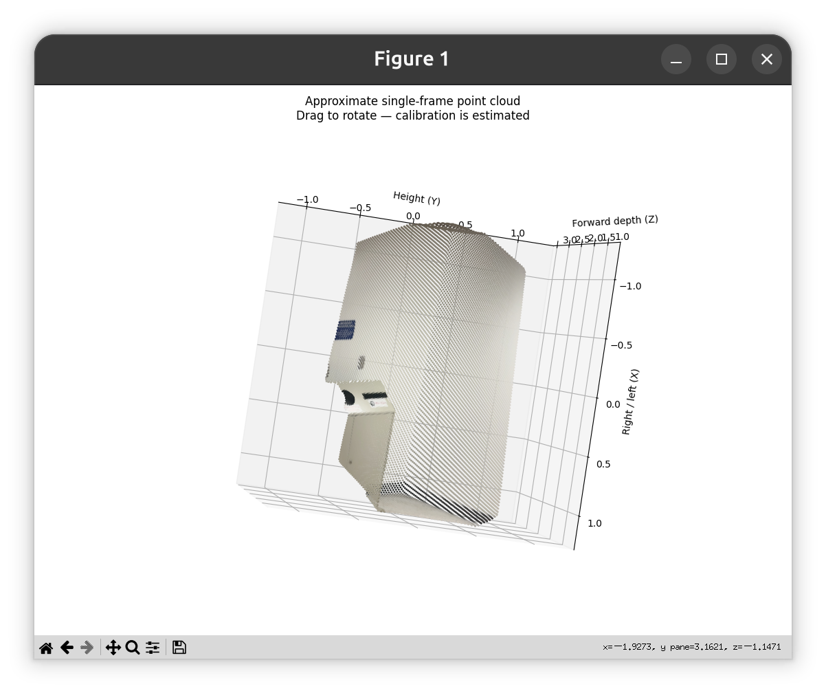
A preview of the point cloud obtained from a single image
Inward: Room-Level Indoor Navigation from an iPhone Scan
Inspiration
We walked into the hackathon building and could not find our way around. We knew which room we needed, but the unfamiliar hallways made it hard to locate.
That experience inspired Inward, an indoor navigation platform for the last leg of any journey: getting from the building entrance to a specific room.
We wanted navigating an unfamiliar building to feel as easy as navigating outdoors, without extensive manual mapping or expensive infrastructure.
What It Does
Inward turns a scan of a real building into an interactive 3D map that people can search and navigate.
We combine LiDAR scanning, 3D Gaussian Splatting, and AI-powered room detection so users can explore a building, search for a room, and get a route to it.
Our iPhone application shows the reconstruction in a WebXR-based 3D interface. Users select a destination and follow the path our pathfinding algorithms compute. Automatic positioning of the user inside the map is not yet implemented (see Challenges).
Inward also tests a broader idea: portable scanning hardware and automated software pipelines can make detailed indoor mapping accessible.
How We Built It
We started with iLiDAR, an open-source iOS application that captures LiDAR and image data. We modified it to record the device's position and rotation, which lets us tie each measurement to where the phone was during scanning.
With a LiDAR-equipped iPhone, we collected three kinds of data:
- LiDAR depth data for the building's geometry.
- RGB imagery for visual appearance and room signage.
- Position and rotation data to align measurements within the reconstruction.
We built two custom processing pipelines and an iPhone app to turn this data into a navigable 3D map.
1. 3D Reconstruction
The first pipeline produces a 3D mesh and a Gaussian Splatting file. The LiDAR mesh supplies geometry, and Gaussian Splatting supplies appearance. Together they give a realistic scene that keeps the spatial structure navigation needs.
2. AI-Powered Room Detection
The second pipeline runs Qwen3-VL-2B-Instruct, a vision-language model, on images captured during scanning to read room numbers. Using the position and rotation recorded with each image, we place every detected number at a location in the reconstruction. Rooms are annotated and searchable without manual labeling.
3. Interactive Navigation
Our iPhone application displays the annotated environment through a WebXR-based 3D interface and uses pathfinding algorithms to calculate routes to selected destinations. The result is an end-to-end pipeline from scan to route.
Challenges We Faced
Learning iOS development
None of us had built an iOS application. Modifying iLiDAR meant learning iOS development and Apple's sensor APIs quickly, and working out how the different sensor measurements relate to one another.
Sensor drift and alignment
Small errors in position and rotation accumulated during scanning and produced inconsistencies in the reconstruction. Mapping image colors onto LiDAR points required careful coordinate transformations between the camera and the depth sensor.
Navigating without GPS
GPS is unreliable indoors, so we reconstructed the building's layout and used its geometry to calculate routes. Determining a user's position within that map automatically remains unsolved.
Making a reconstruction navigable
Gaussian Splatting captures how a space looks, but it does not know where the walls, hallways, or traversable areas are. We combined it with LiDAR-derived geometry to support pathfinding.
Proposed Dedicated Scanner
Our prototype used only a LiDAR-equipped iPhone, which packs a depth sensor, camera, and motion tracking into one device. For larger deployments, we propose a dedicated portable scanner with:
- A 3D LiDAR sensor to capture geometry and measure distances.
- An RGB camera for Gaussian Splatting and room identification.
- An inertial measurement unit (IMU) for motion and orientation data to support localization.
- A compact computing module, such as a Raspberry Pi 5, to coordinate data collection, synchronization, and storage. Reconstruction would run on a more powerful computer or server.
- Portable power and storage so an operator can scan without permanent installations.
Sensors chosen for spatial mapping could improve scanning efficiency and accuracy. They would also require work on calibration, timestamp synchronization, and localization to control accumulated error, the same problems we met with the iPhone.
Separating the scanner from the navigation experience makes this practical. One scanner could map many buildings, while visitors use the resulting maps on their own phones.
What We Learned
This was our first project involving iOS development, LiDAR integration, and spatial data processing. It was also our first time working with 3D Gaussian Splatting, mesh reconstruction, Qwen3-VL-2B-Instruct, WebXR, and pathfinding.
Our main takeaway is that reconstructing a space visually and making it navigable are different problems. A realistic 3D model still needs underlying geometry, identified destinations, and viable routes.
We also saw how closely hardware and software depend on each other. The quality of the navigation experience depends on the accuracy, consistency, and completeness of the sensor data as much as on our algorithms.
Business Potential
Inward is a business-to-business indoor navigation platform. Our first market is small businesses in shared office buildings, where customers often struggle to find individual suites. Institutions would pay an initial mapping fee and an ongoing subscription for map hosting, updates, and navigation services.
Many mapping workflows require extensive manual annotation or specialized equipment at every location. Inward pairs a reusable portable scanner with automated reconstruction and room identification, which may cut the time and effort needed to build a detailed indoor map. Visitors use their own devices, and institutions never have to build or maintain their own mapping systems.
Easier wayfinding could improve accessibility, reduce missed appointments, and increase customer visits.
What's Next for Inward
We plan to pilot Inward in shared office buildings with property managers and small-business tenants. We will measure navigation success, customer feedback, mapping cost, and whether tenants see a meaningful return.
On the technical side, we want to:
- Improve the accuracy and efficiency of the scanning pipeline.
- Investigate SLAM-based localization for real-time indoor positioning without GPS.
- Add accessibility-aware routing.
- Build the dedicated scanner and test whether it improves mapping accuracy, speed, and consistency over the iPhone approach.
Longer term, we want to expand to larger commercial buildings, university campuses, hospitals, airports, and shopping centers.
Our goal is simple: make navigating indoors as effortless as navigating outdoors.


Log in or sign up for Devpost to join the conversation.