-
-
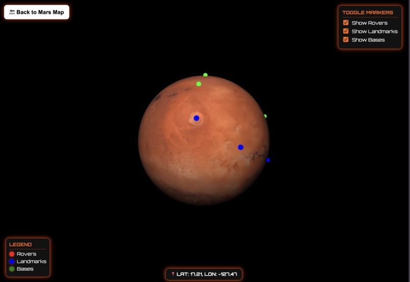
3D Mars Map
-
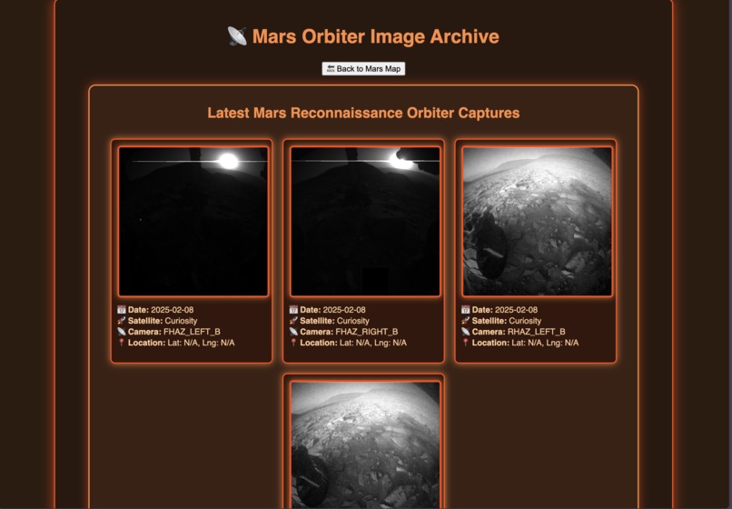
Real-Time Satelite Imagery with Descriptions
-
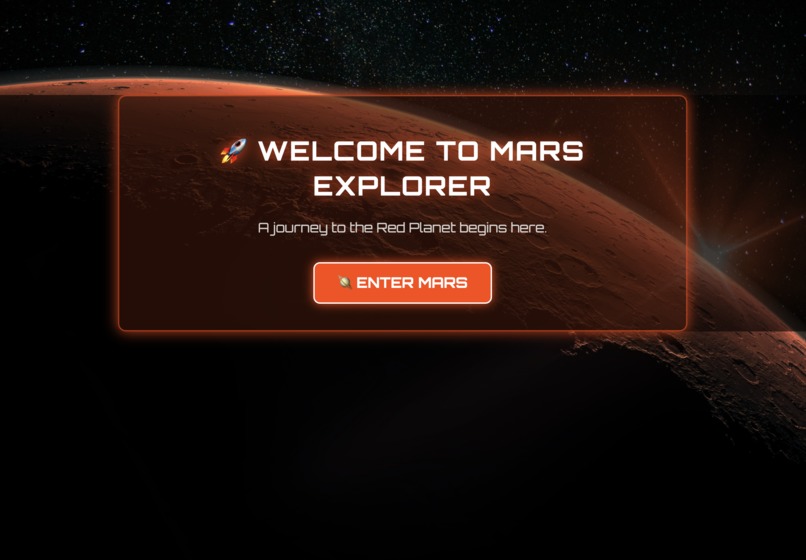
Landing Page


Inspiration
Space exploration has always fascinated people, but understanding the complexities of planetary science, rover missions, and satellite imaging can often feel overwhelming. Young learners, students, and even researchers often struggle to find an interactive way to explore space without sifting through dense scientific papers or scattered online resources. While curiosity about Mars is at an all-time high, most educational tools focus on static content rather than hands-on experiences.
We wanted to change that. Our goal was to create an immersive and interactive system that brings Mars exploration to life. Inspired by the challenges astronauts and planetary scientists face, Explore Mars: An Immersive Martian Analysis System bridges the gap between curiosity and knowledge. Our platform starts with Interstellar, a fun and engaging introduction where users take on the role of an astronaut, making crucial decisions about oxygen filtration, fuel management, and navigation calibration. Once players complete their mission, they transition to the real-world Martian analysis system, where they can track rovers, view satellite images, explore a 3D model of Mars, and study its surface in detail—just like real planetary scientists.
What it does
Explore Mars is an interactive platform that provides multiple ways to experience the Red Planet. The journey begins with Interstellar, a short immersive simulation that introduces users to the challenges of space travel, requiring them to make key decisions to ensure a successful mission. This serves as an engaging entry point before transitioning to the full Explore Mars system.
The core of the platform includes a 2D map of Mars that displays real-time positions of active rovers like Curiosity and Perseverance, along with famous landmarks and past landing sites. Clicking anywhere on the map reveals latitude, longitude, and key information about that location. A built-in satellite photo gallery updates dynamically, allowing users to browse through the latest high-resolution images captured by orbiters, complete with timestamps and locations. Additionally, our 3D Mars model lets users rotate and explore the planet in an interactive way, with markers for rovers, notable landforms, and historical landing sites. Users can toggle different data layers, analyze geographic features, and even simulate potential future base locations, making Mars exploration more accessible than ever before.
How we built it
We developed Explore Mars using a combination of HTML, CSS, and JavaScript, integrating several advanced web technologies. The 2D map was built using Leaflet.js, allowing us to display real-time rover tracking, satellite data, and important landmarks. NASA’s Mars Rover API provides live updates on rover positions and their latest images, while API calls retrieve fresh satellite images from Mars orbiters.
For the 3D model, we used Three.js to create an interactive, rotatable Mars globe, complete with clickable markers that provide details about specific locations. One of the biggest challenges was mapping latitude and longitude coordinates onto a 3D sphere while keeping markers aligned as the planet rotated. We also implemented a toggle system that allows users to control which markers they want to see, improving usability.
To enhance engagement, we designed Interstellar as an introductory module using JavaScript to manage branching storylines, guiding users through simulated astronaut tasks before leading them into the full Mars analysis system. This ensures that even those unfamiliar with space exploration can ease into the experience before diving into detailed planetary data.
Challenges we ran into
One of the biggest challenges was ensuring that the markers on the 3D model stayed accurate as the planet rotated. Since Mars is a sphere, converting 2D latitude and longitude coordinates into 3D space required precise calculations to maintain proper positioning. Another challenge was integrating real-time data from NASA’s APIs. The data often required formatting and optimization to be displayed correctly without slowing down the system. Additionally, balancing the educational and interactive elements in Interstellar took careful planning to ensure users learned key aerospace concepts while still enjoying a smooth and engaging experience.
Accomplishments that we're proud of
We are incredibly proud of how immersive the Explore Mars system has become. The combination of real-time rover tracking, dynamic satellite imagery, and an interactive 3D model allows users to explore Mars in ways that were previously scattered across different sources. The integration of Interstellar as an introduction makes the experience more approachable, giving users a hands-on way to understand space exploration before diving into real-world analysis.
We are also proud of how smoothly the platform runs despite handling large datasets and real-time API calls. Optimizing performance while ensuring high-quality visuals was a major technical achievement. The successful implementation of interactive features, such as the toggle system for different markers, enhances usability and makes planetary exploration more accessible to a wide audience.
What we learned
Through this project, we learned how to integrate multiple complex technologies into a single platform. From handling real-time NASA data to developing an interactive 3D model, every aspect of Explore Mars required problem-solving and optimization. We also gained experience in user interface design, ensuring that both casual users and space enthusiasts could easily navigate the system.
Additionally, designing Interstellar taught us how to blend storytelling with education. Creating a simulation that balances engagement with real-world aerospace concepts helped us understand how gamification can enhance learning. This experience has given us valuable insights into interactive media and how it can be used to make complex scientific topics more accessible.
What's next for Explore Mars
We have big plans for expanding Explore Mars. In the future, we want to integrate real-time orbital data to track active satellites around Mars, allowing users to see their exact positions at any given moment. We also plan to add historical rover paths so users can analyze how each rover has traveled across the Martian surface over time. Another exciting idea is a simulation mode where users can explore potential Mars base locations, considering factors like elevation, sunlight exposure, and resource availability.
Long term, we hope to expand the educational aspect of Interstellar, incorporating more aerospace engineering challenges and in-depth space travel scenarios. We also want to refine our satellite image processing to provide even higher-resolution data for users interested in planetary geology. Ultimately, we see Explore Mars as a continuously evolving platform, bringing the excitement of space exploration to learners, researchers, and dreamers alike.
Built With
- api
- css
- github
- html
- javascript
- vscode


Log in or sign up for Devpost to join the conversation.