Inspiration
A project online detailing the "future cities index," a statistic that aims to calculate the viability of building a future city. After watching the Future Cities presentation, we were interested to see where Future Cities would be built, if a project like the one we saw was funded in the US. This prompted us to create a tool that may help social scientists answer that question — as many people work to innovate the various components of future cities, we tried to find possible homes for their ideas.
What it does
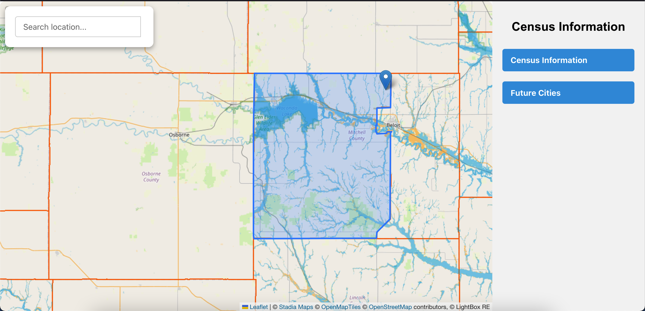
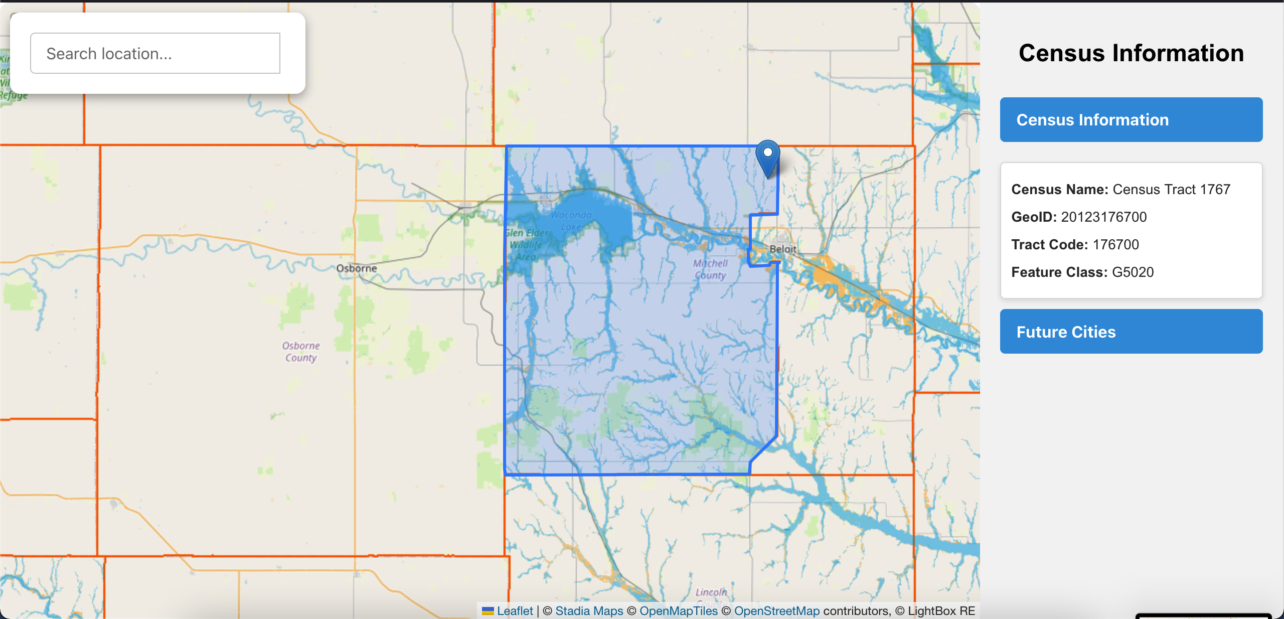
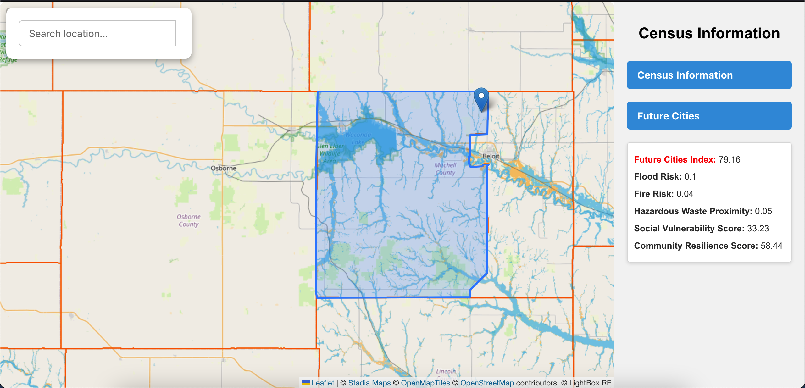
Allows Social Scientists and amateur researchers to access aggregated census and economic data through Lightbox API, without writing a single line of code. The program calculates a Future Cities Index based on the resilience of a census tract to natural disaster, housing availability, and the social vulnerability in the area.
How we built it
Interactive UI built with ReactJS, data parsed from Lightbox API with Javascript.
Challenges we ran into
Loading in the census tracts in our interactive map, finding appropriate data to display for each tract, and calculating the Future Cities Index
Accomplishments that we're proud of
Creating a working interactive map, successfully displaying a real-time Future Cities Index
What we learned
How to use geodata to make interactive maps that behave as we wish. We are able to overlay different raster images and polygons onto a map.
What's next for Future Cities Index
Using more parameters in the Future Cities Index, displaying data on the County and City level, linking each county tract to available census data, and allowing users to easily compare tracts
Built With
- javascript
- lightbox
- python
- react

Log in or sign up for Devpost to join the conversation.