-
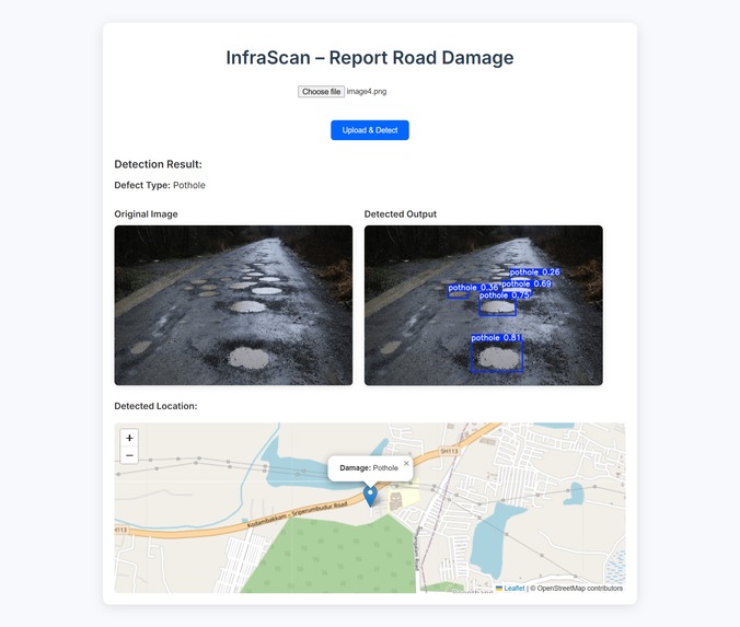
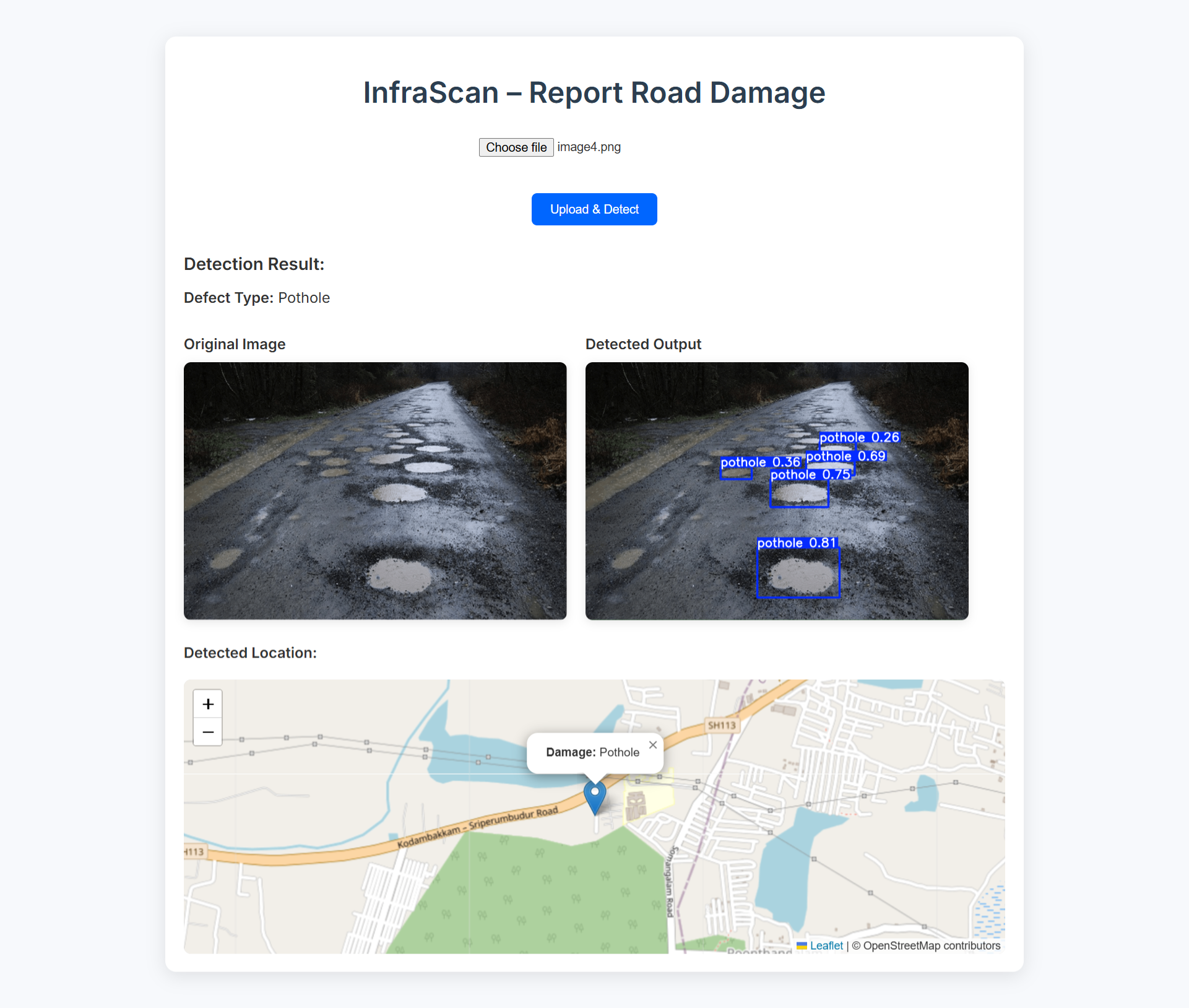
pothole detection
-
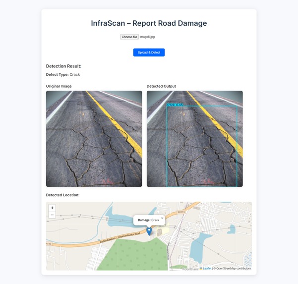
crack detection
-
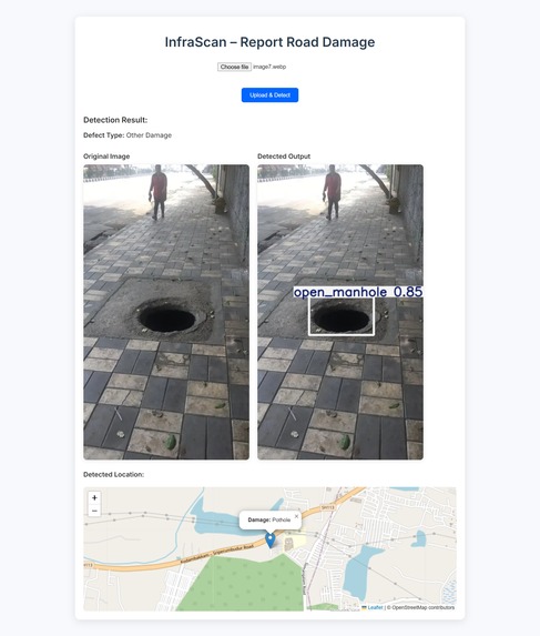
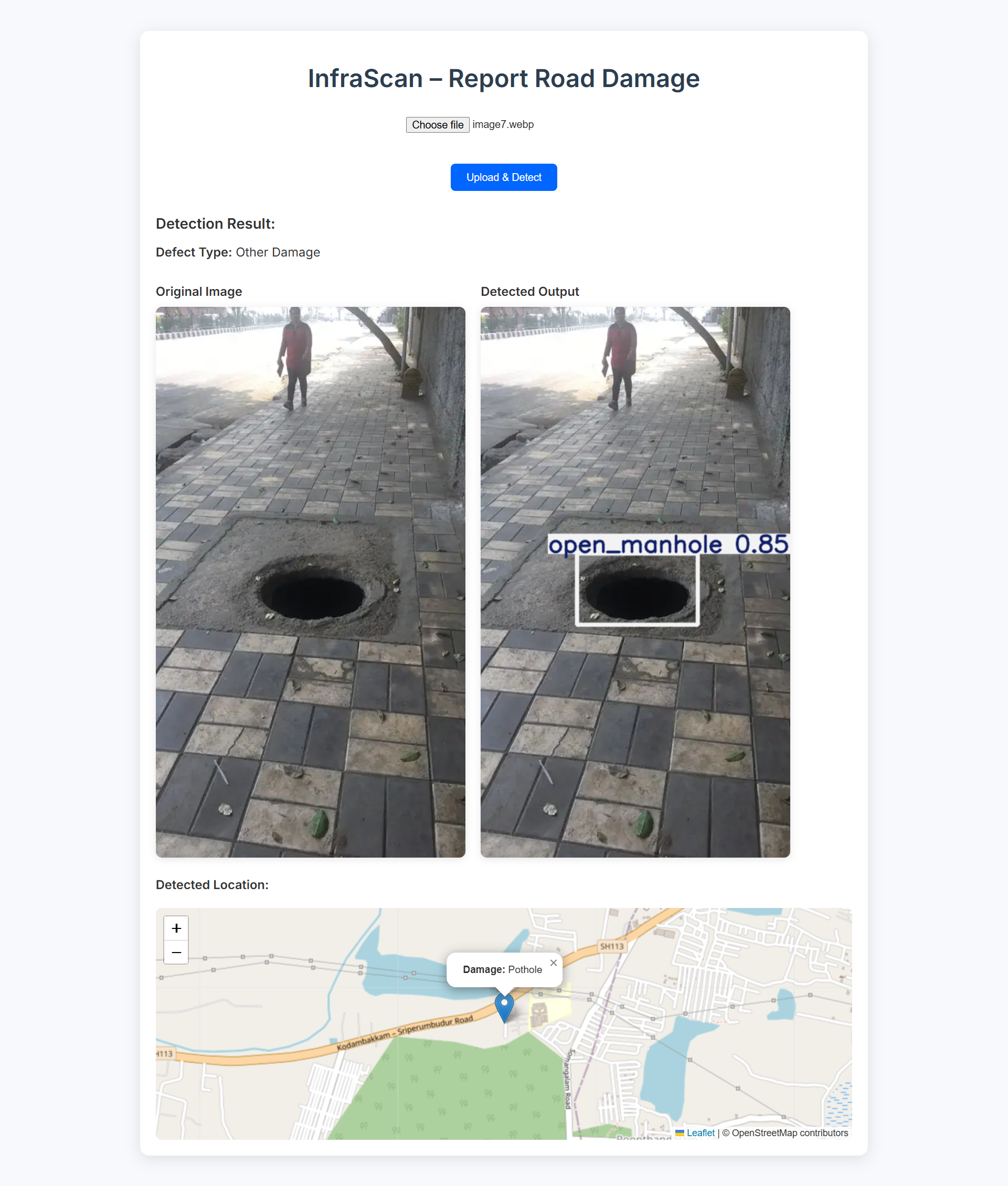
manhole detection
-
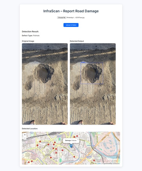
pothole detecction


Inspiration
The lack of real-time, scalable infrastructure monitoring in urban areas inspired us to build InfraScan. We were motivated by the daily struggles faced by commuters due to unattended potholes, cracks, and dangerous open manholes. Existing systems either required manual uploads or lacked integration with maps and GPS, which made them unsuitable for wide civic deployment. We wanted to create a passive yet powerful tool that not only detects damage but also aids city planners and authorities with actionable data.
What it does
InfraScan is a road damage detection and mapping system that uses deep learning to identify potholes, cracks, and open manholes from dashcam or phone camera inputs. It allows users to upload images through a web interface, automatically detects and classifies the damage, and geotags the location using GPS data. The results are visualized on an interactive OpenStreetMap dashboard in real-time, enabling authorities to prioritize repairs based on verified, location-tagged reports.
How I built it
We trained a YOLOv5-based model using a curated dataset containing labeled images of potholes, cracks, and open manholes. Augmentation techniques were applied to increase model robustness. The frontend was developed using HTML, CSS, and JavaScript with map integration via Leaflet and OpenStreetMap APIs. The backend uses Flask to handle image uploads, run inference using the trained model (best.pt), extract GPS metadata, and push the output to the map. All components were tested and deployed in a Colab-friendly setup for smooth training and inference.
Challenges I ran into
One of the major challenges was ensuring accurate GPS tagging, especially when image metadata was missing. We had to implement fallback options for manual input. Another hurdle was balancing detection accuracy across classes, especially for open manholes which are underrepresented in many datasets. Integrating real-time map updates and ensuring a lightweight yet responsive web interface also required careful handling of data flow and rendering.
Accomplishments that I'm proud of
We are proud that InfraScan achieves a high mAP@50 of 0.917 for open manholes, with balanced performance across all defect types. The system supports both automatic and manual location tagging, making it flexible for real-world use. Our seamless dashboard integration with OSM provides an intuitive way for users and authorities to visualize issues city-wide. The project successfully combines machine learning, geospatial data, and community engagement in a single, unified platform.
What I learned
We deepened our understanding of object detection models, particularly how to fine-tune and evaluate them using precision, recall, F1-score, and PR curves. We also gained hands-on experience with GPS metadata extraction, OpenStreetMap integration, and designing intuitive user interfaces for civic applications. Managing end-to-end flow from model inference to real-time visualization was a valuable learning experience in full-stack ML deployment.
What's next for Infra Scan
We plan to scale InfraScan into a fully deployable civic tool by adding mobile app support, video-based continuous detection from dashcams, and support for more defect types like waterlogging or obstructions. We're also looking into partnerships with local municipalities to pilot the system in real traffic conditions. Long-term, we envision InfraScan as a standardized, AI-powered platform for smart city infrastructure monitoring and planning.
Built With
- css
- flask
- google-colab
- gps-metadata-extraction
- html
- javascript
- leaflet.js
- matplotlib
- numpy
- openstreetmap-(osm)
- pandas
- python
- torch
- yolov5


Log in or sign up for Devpost to join the conversation.