-
-
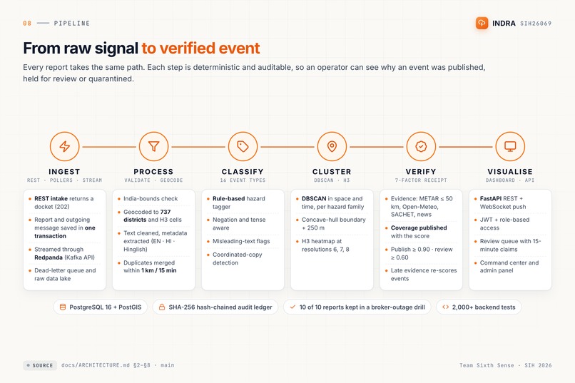
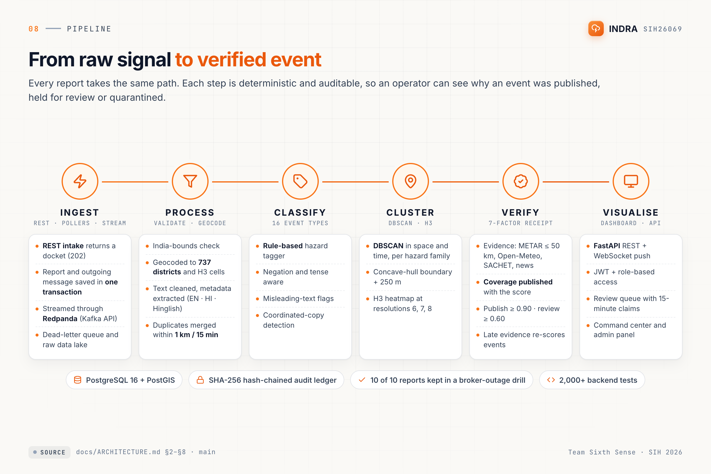
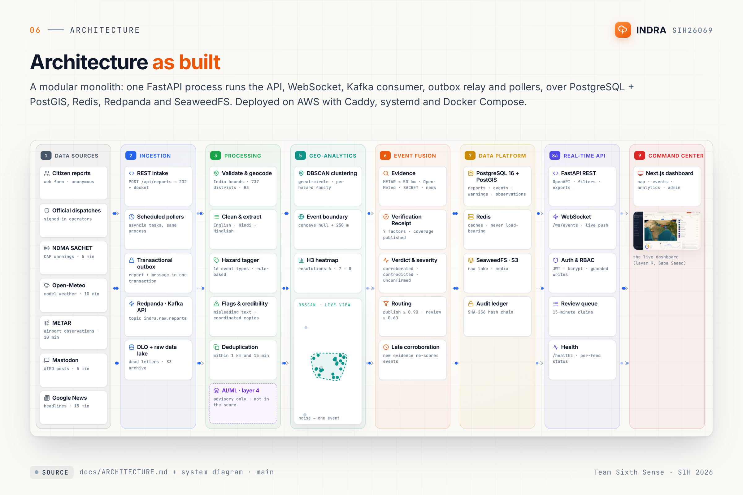
Ingest → process → classify → cluster → verify → visualise
-
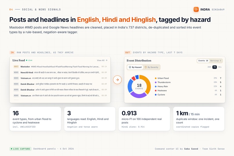
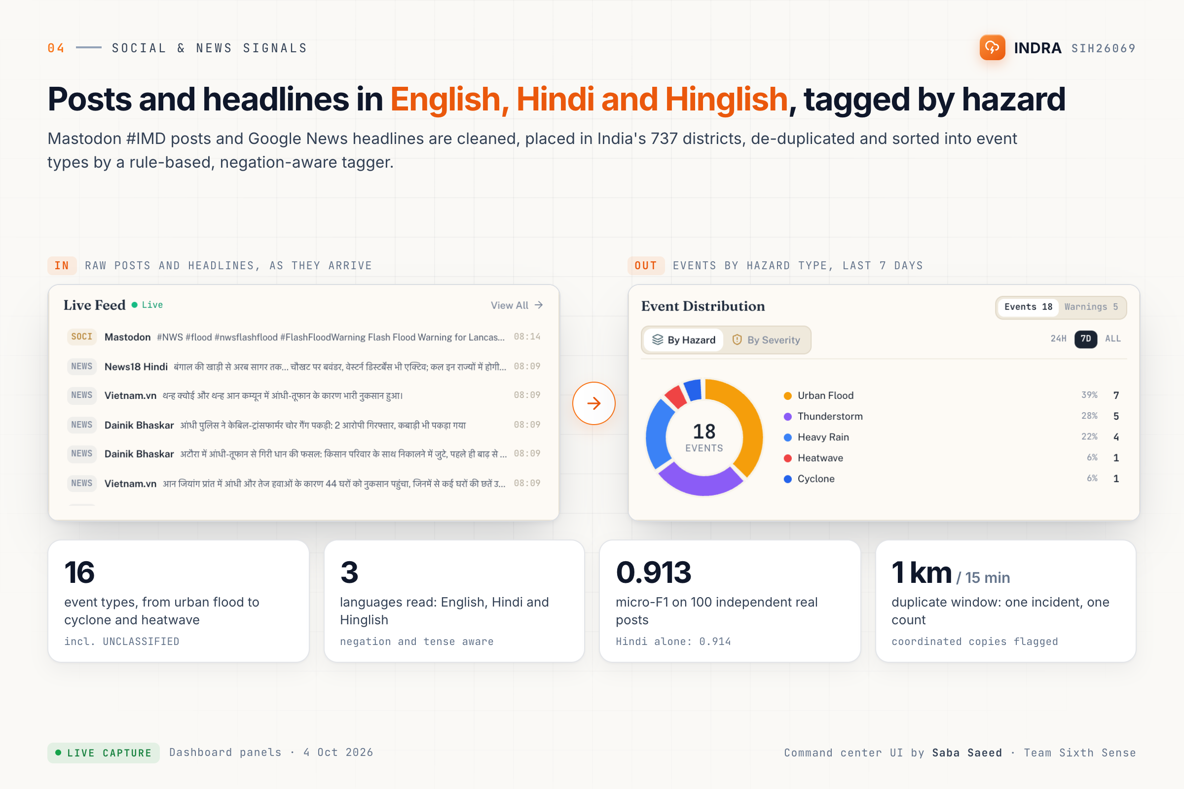
Posts and headlines in English, Hindi and Hinglish, and the events they're tagged into, with the tagger's numbers
-

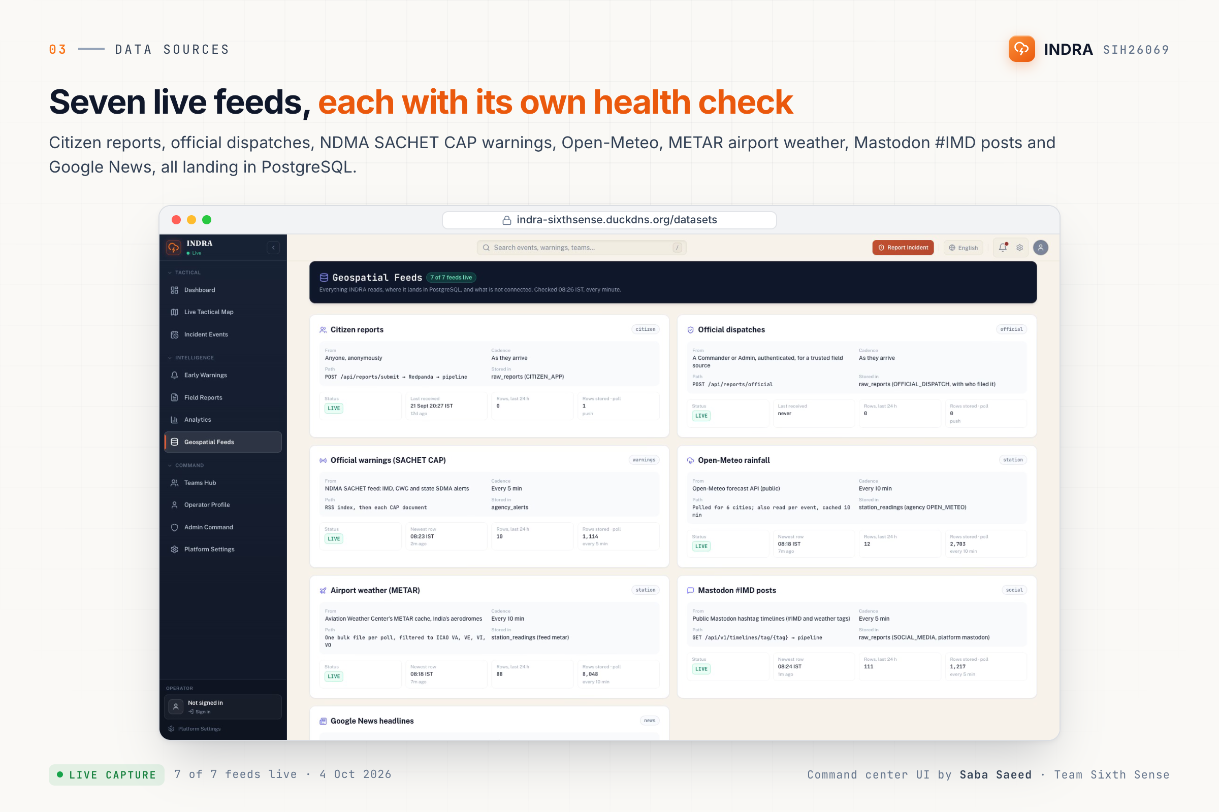
The 7 live feeds and the health status of each
-
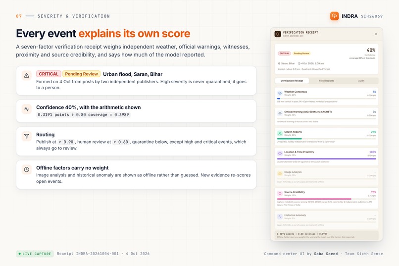
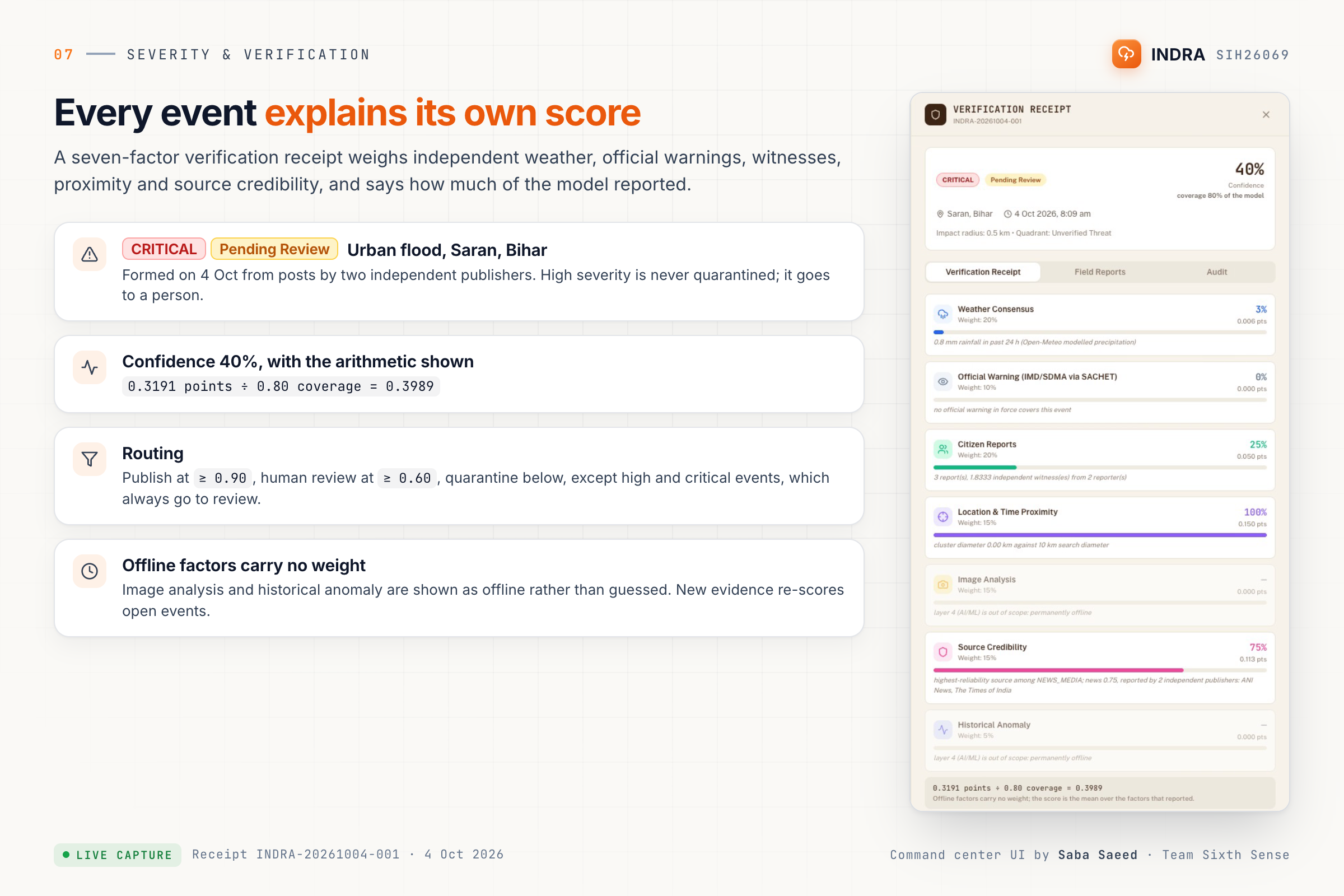
The Saran, Bihar CRITICAL event and its seven-factor receipt
-
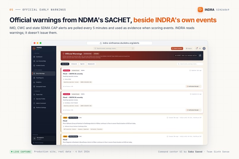
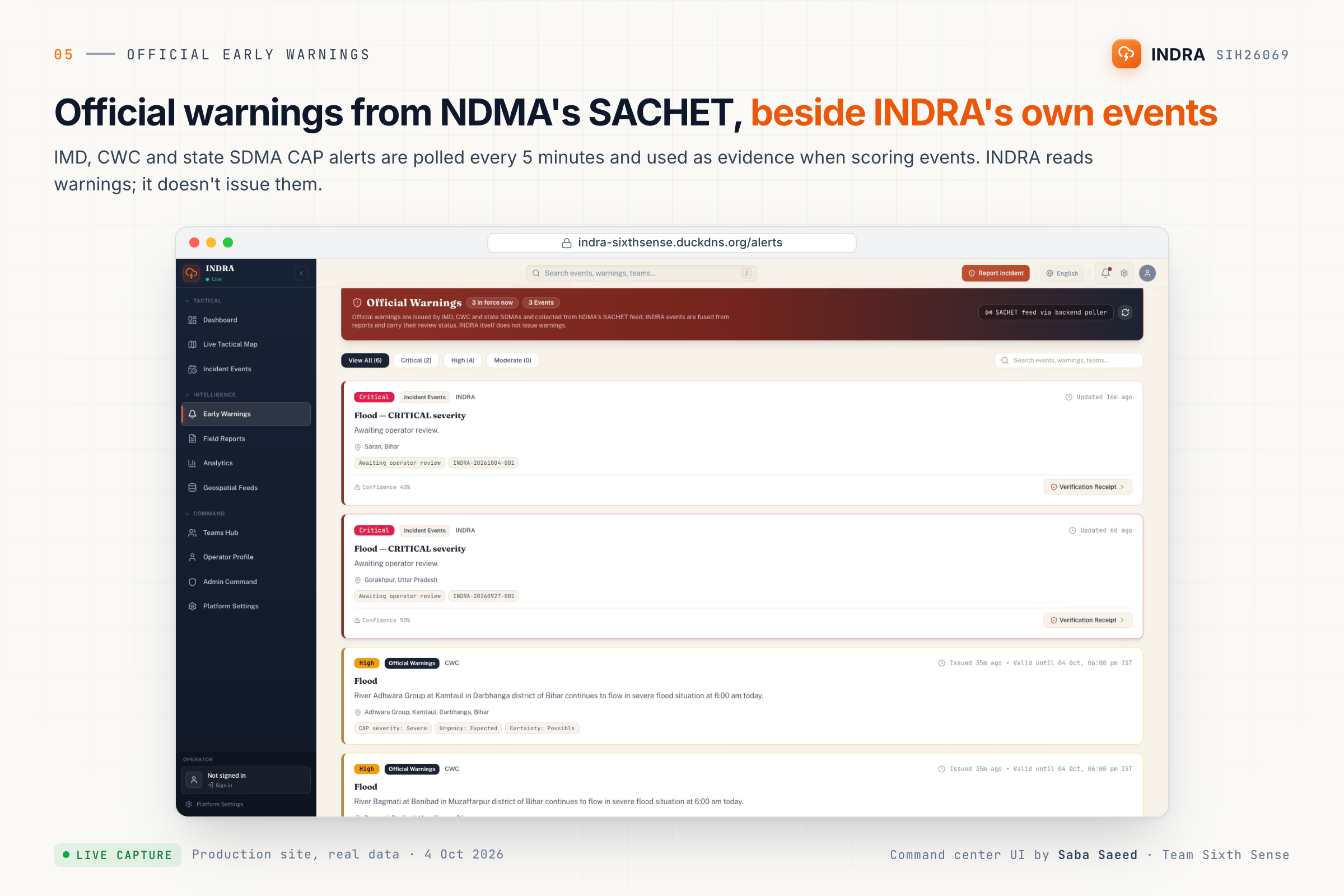
Official SACHET warnings shown next to INDRA's own events
-
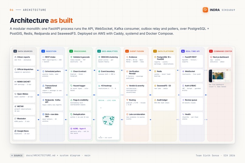
The architecture as built (a sharp re-render of the video scene)
-
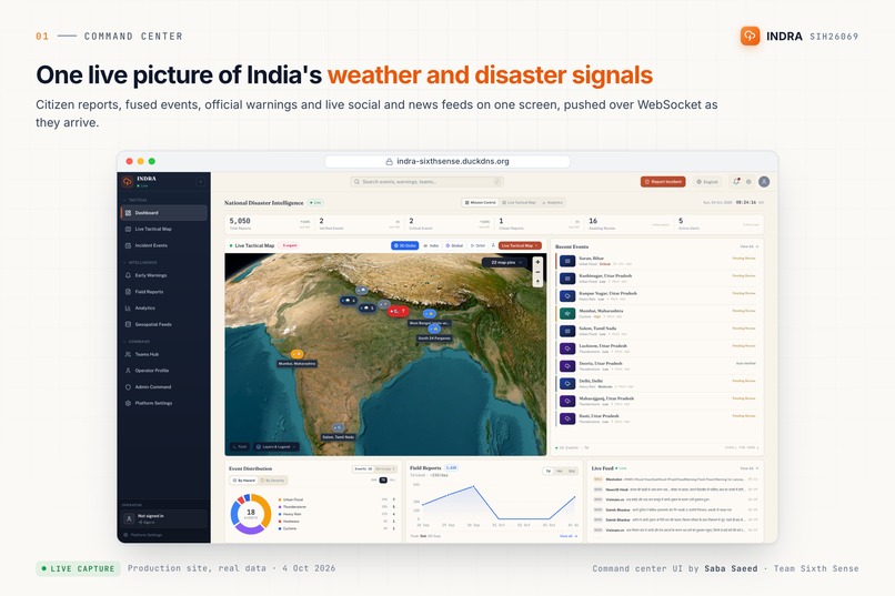
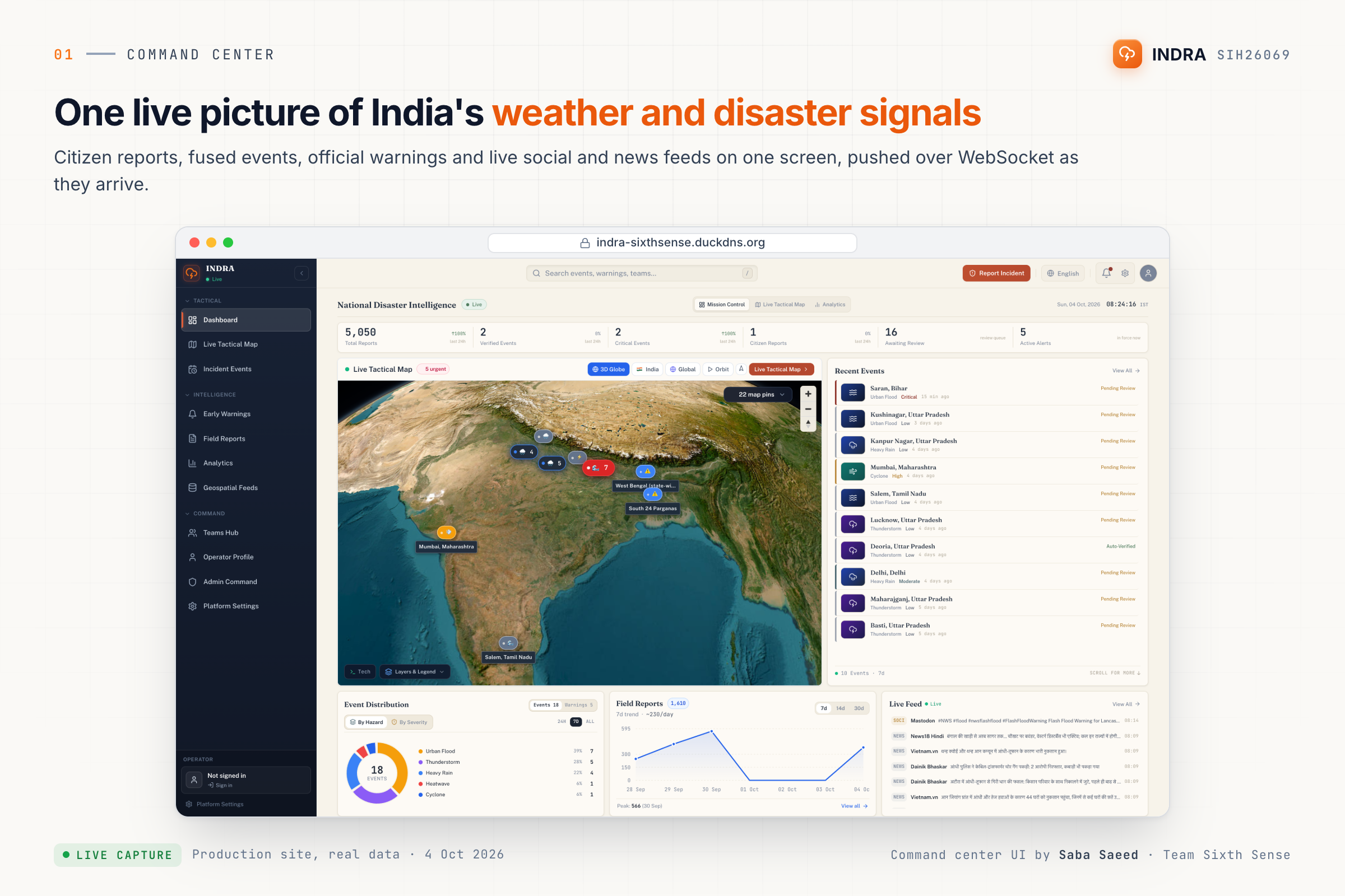
The command center dashboard
-
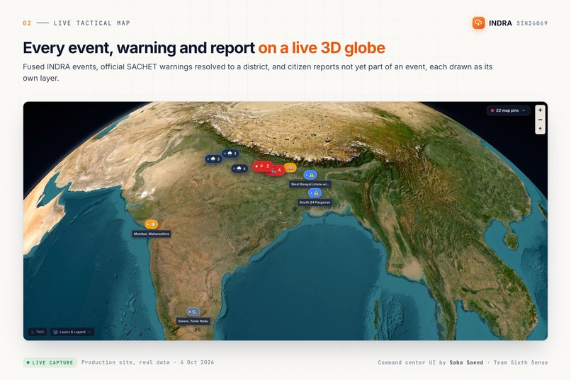
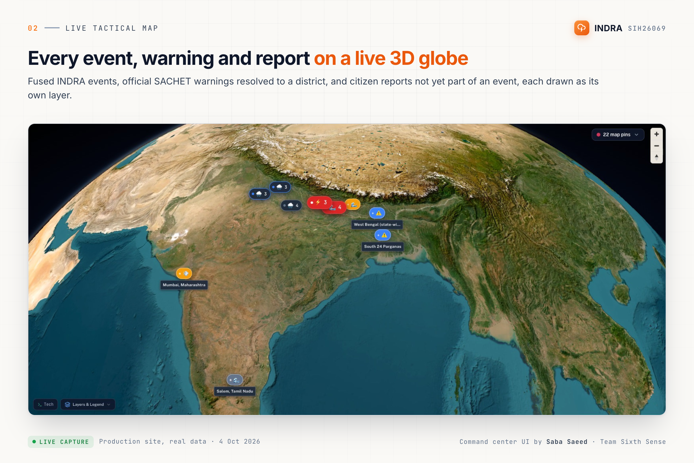
The live 3D globe with events, warnings and reports
Inspiration
Disaster response depends on information arriving quickly and being interpreted correctly. However, critical information is often fragmented across weather data, satellite imagery, social media, and predictive systems.
We wanted to explore whether multimodal AI could bring these different signals together into a single disaster intelligence platform.
That idea led to INDRA — Disaster & Weather Intelligence Platform.
The Problem
During a disaster, responders may need to process multiple types of information simultaneously:
- Weather conditions and forecasts
- Satellite imagery
- Social and textual reports
- Historical disaster data
- Geospatial information
These sources have different formats, update frequencies, and levels of reliability. Looking at them independently makes it difficult to build a unified picture of what is happening.
Our Solution
INDRA is a multimodal AI platform designed to transform heterogeneous disaster data into a unified intelligence layer.
The platform combines:
- Weather intelligence
- Satellite imagery analysis
- Computer vision
- NLP-based social intelligence
- Machine-learning-based forecasting
- Risk and impact analysis
- Interactive visualization
The goal is to move from fragmented raw information toward actionable disaster intelligence.
How It Works
The system follows a multi-stage pipeline:
Data Sources → Data Processing → AI/ML Models → Intelligence Layer → Visualization
Different models handle different data modalities.
Computer vision models process visual information such as satellite imagery. NLP techniques analyze disaster-related textual information. Machine-learning and forecasting models provide additional predictive signals.
The resulting intelligence is presented through an interactive dashboard.
Technical Architecture
Data Layer
The platform works with multiple sources of disaster-related information, including weather data, satellite imagery, textual/social data, and historical datasets.
AI/ML Layer
The pipeline uses machine learning and deep learning techniques for computer vision, image segmentation, object detection, NLP, classification, and forecasting.
Backend
FastAPI provides the backend/API layer for serving application functionality and model outputs.
Visualization
Streamlit provides the interactive interface for exploring disaster intelligence, analytics, maps, and model outputs.
Key Features
Satellite Intelligence
AI-assisted analysis of satellite imagery to identify potentially affected areas and extract useful visual signals.
Social Intelligence
NLP-based processing of disaster-related text to identify useful information from unstructured reports.
Weather Intelligence
Weather information provides environmental context for understanding disaster conditions.
Predictive Analytics
Machine-learning and forecasting models provide additional signals for understanding possible future conditions.
Unified Dashboard
Multiple intelligence components are presented through a centralized interactive interface.
Challenges
The hardest part of the project was not implementing a single machine-learning model.
The real challenge was integrating multiple heterogeneous data modalities into a coherent system.
Satellite imagery, text, weather data, and predictive outputs have different structures and characteristics. Designing a pipeline that connects these components while keeping the final output understandable was a major engineering challenge.
What We Learned
INDRA taught us that building a useful AI system requires much more than model training.
A real-world AI application also needs:
- Reliable data pipelines
- Model integration
- Backend APIs
- Visualization
- Evaluation
- Deployment
- A clear user workflow
The project reinforced the importance of designing AI systems around the actual decision-making problem rather than around individual machine-learning models.
Future Scope
Future versions of INDRA could incorporate:
- Real-time satellite feeds
- Additional geospatial datasets
- IoT and sensor data
- Drone imagery
- Multimodal foundation models
- Automated emergency alerts
- Resource allocation optimization
- Evacuation route optimization
- Edge AI deployment
- Integration with disaster-response organizations
Why INDRA
Disaster response is fundamentally an information problem.
The faster heterogeneous information can be collected, interpreted, and transformed into useful intelligence, the faster informed decisions can be made.
INDRA explores how multimodal AI can contribute to that process by connecting weather, satellite, textual, and predictive information in one platform.
Built With
- computer
- deep
- docker
- fastapi
- imagery
- learning
- lstm
- machine
- natural-language-processing
- opencv
- python
- pytorch
- resnet
- satellite
- streamlit
- tensorflow
- u-net
- vision
- xgboost
- yolo


Log in or sign up for Devpost to join the conversation.