-
-
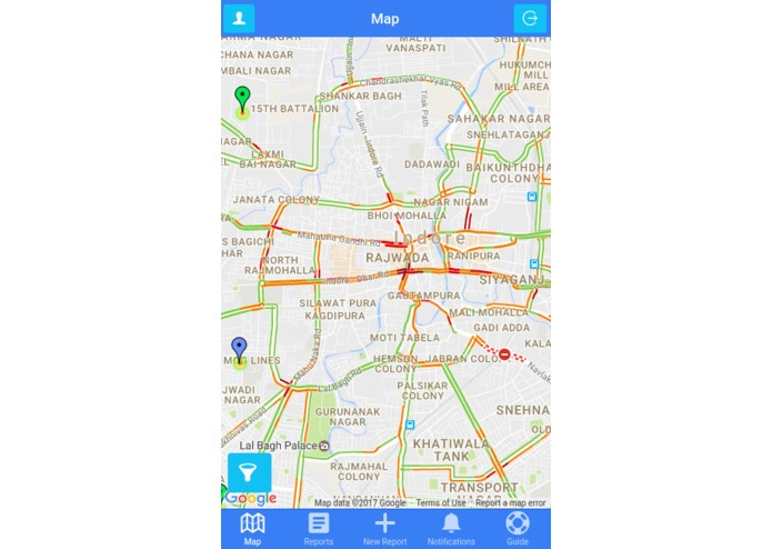
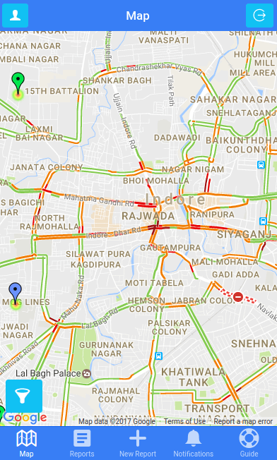
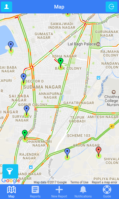
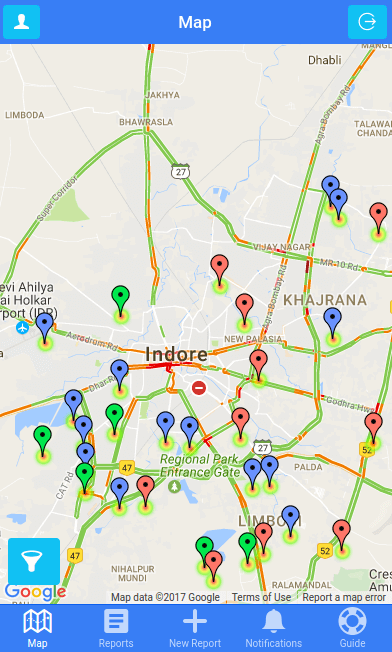
Real-time traffic information with different colors : green: (no traffic delays), orange: (medium amount of traffic), red: (traffic delays)
-
Real-time traffic information part 2
-
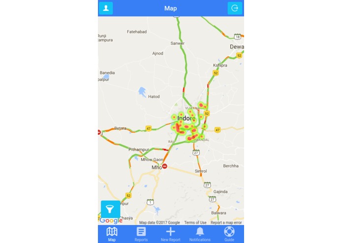
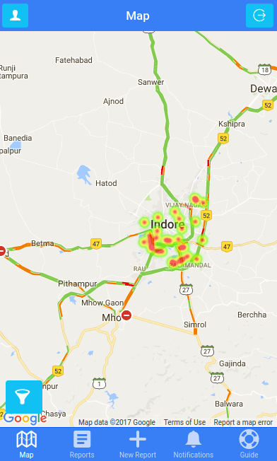
A comprehensive heatmap to help road users and especially bicyclists and pedestrians identify the safest routes to their destination
-
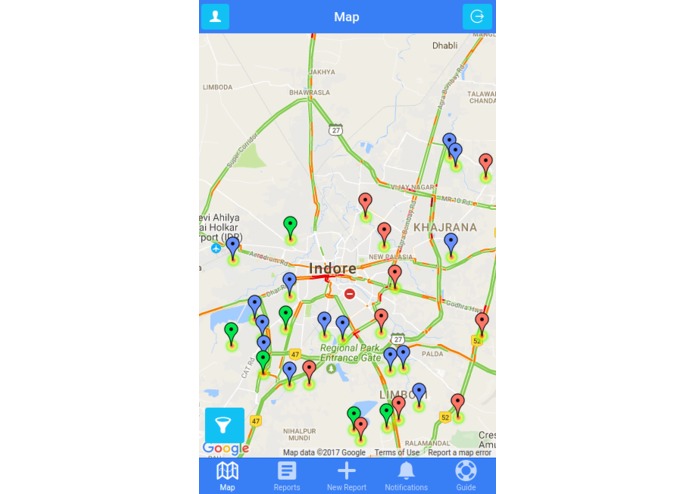
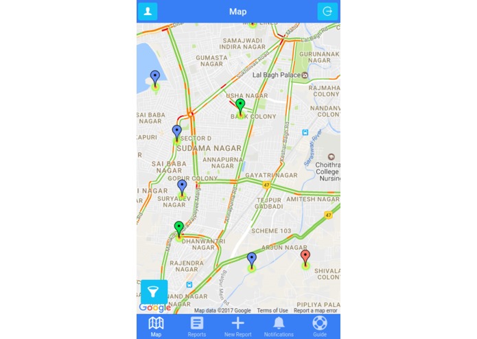
Markers with different colors depending on the status of the reports : green (open), blue (processing), red (closed)
-
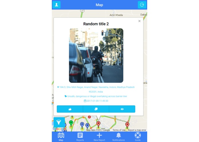
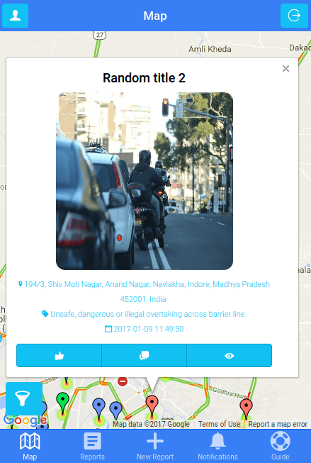
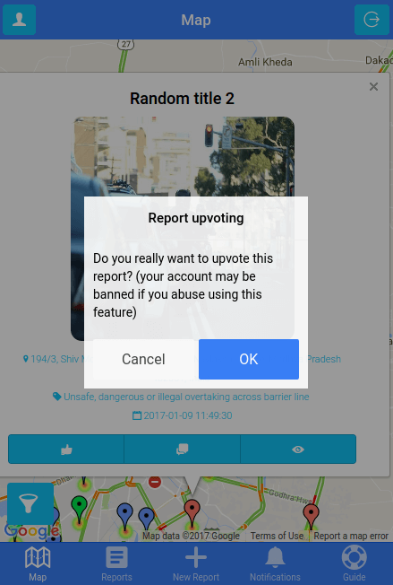
Quickview option for reports which have some unique features like : upvoting, comments and report details
-
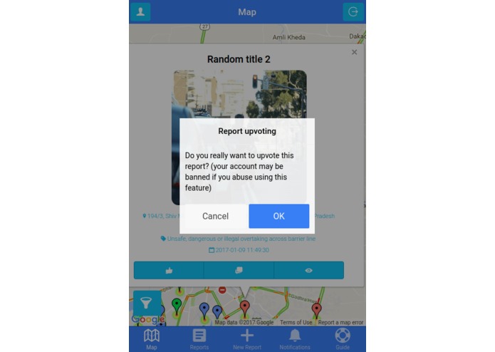
Upvoting option
-
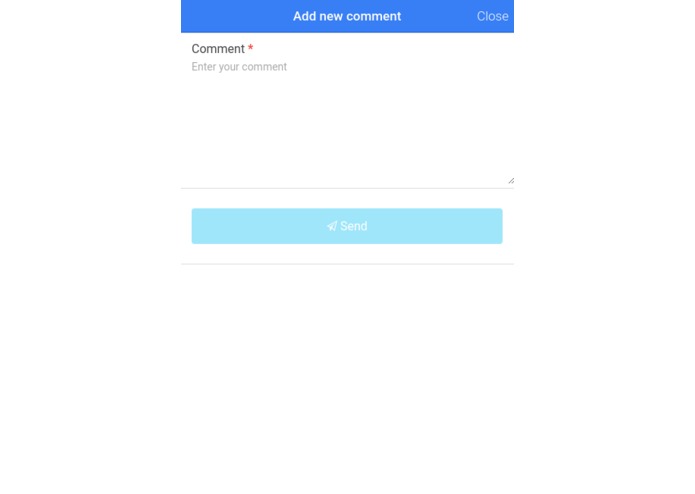
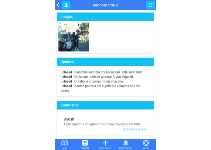
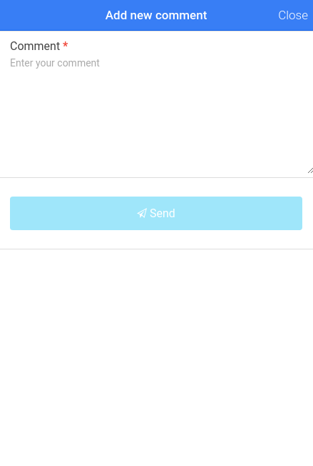
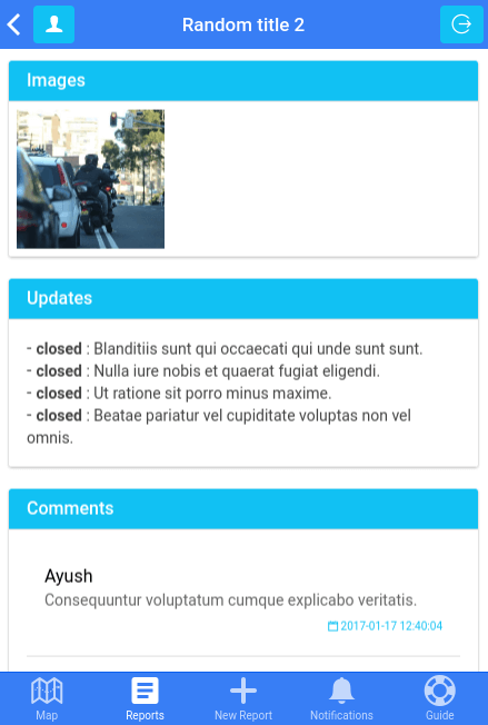
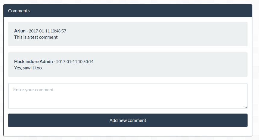
Adding comments using the mobile app
-
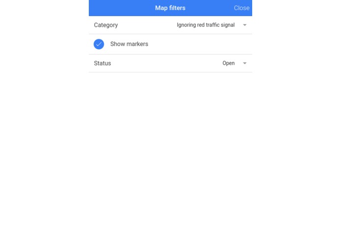
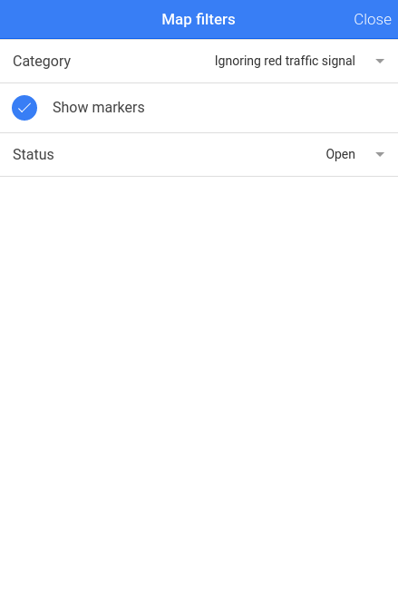
The main map can be filtered by category and report status, users can also hide or display the markers
-
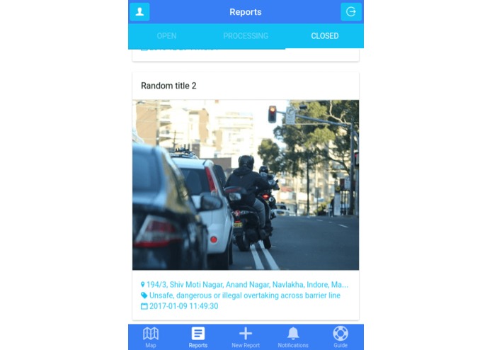
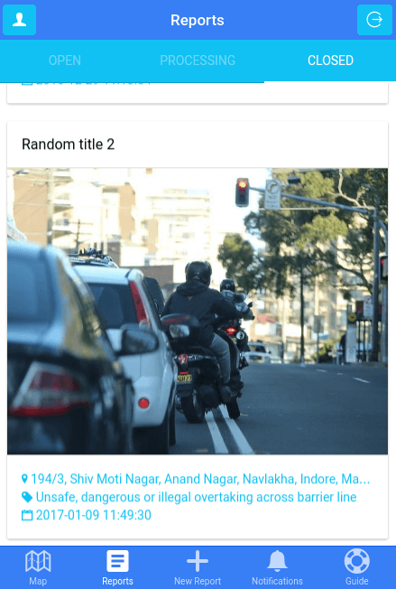
Reports listing where the reports are sorted by status and can be accessed by the top tabs
-
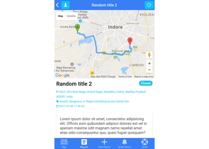
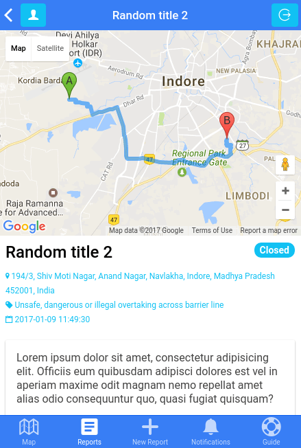
Report details with : draggable location and report destination, mobile friendly slider, updates, comments etc. - part 1
-
Report details part 2
-
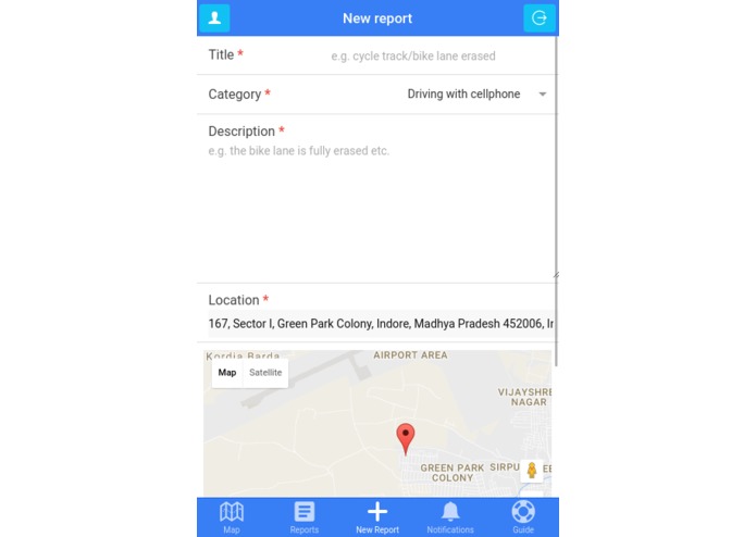
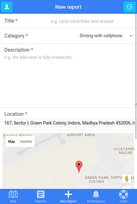
Sending a new report with image recognition for number plates, current location etc. part 1
-
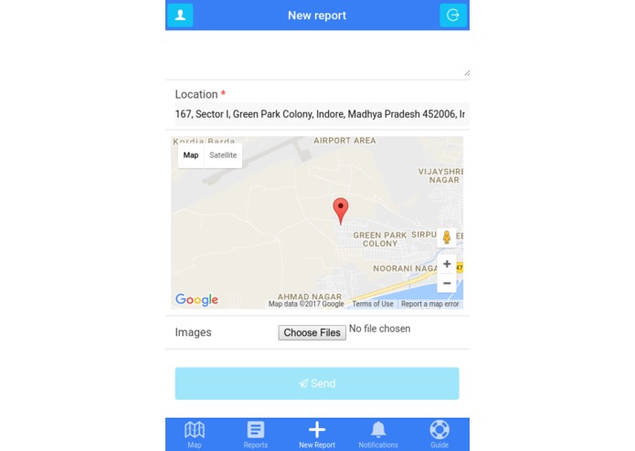
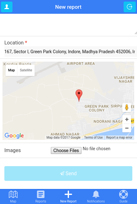
Sending a new report part 2
-
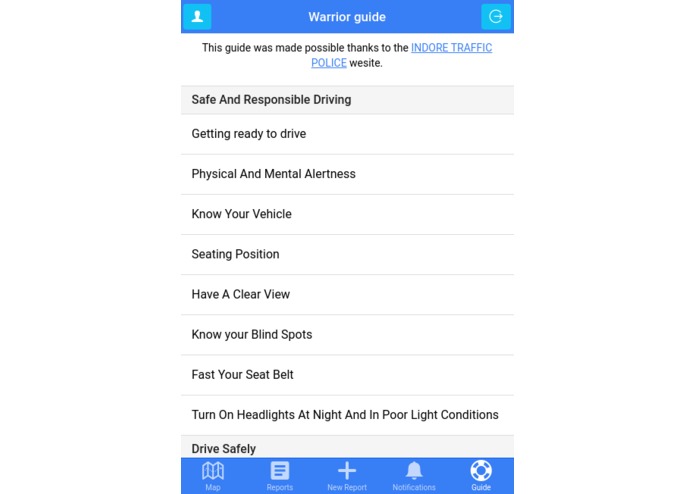
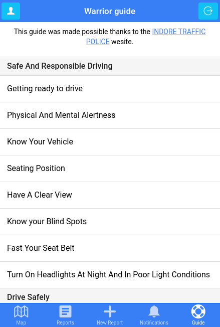
A user guide or manual to help all the warriors
-
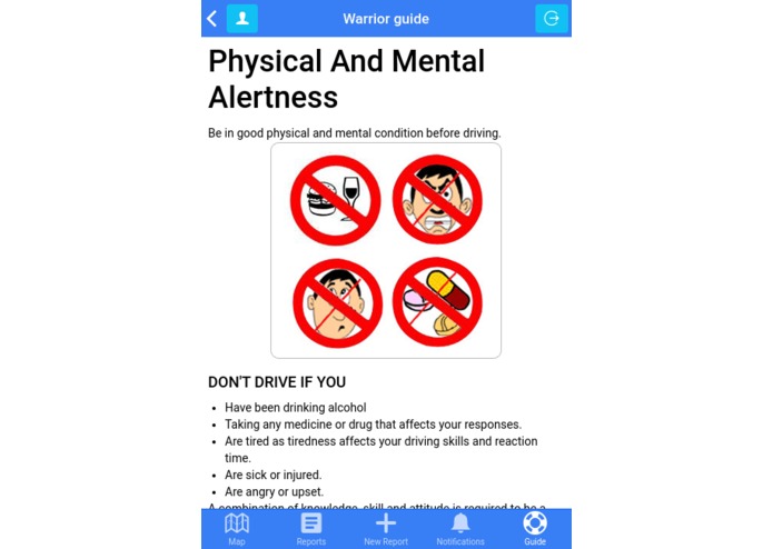
User guide part 2
-
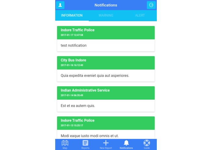
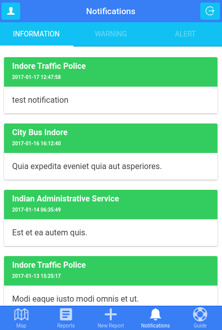
Notifications listing where all the notifications are sorted by type and can be accessed by the top tabs - part 1 (information)
-
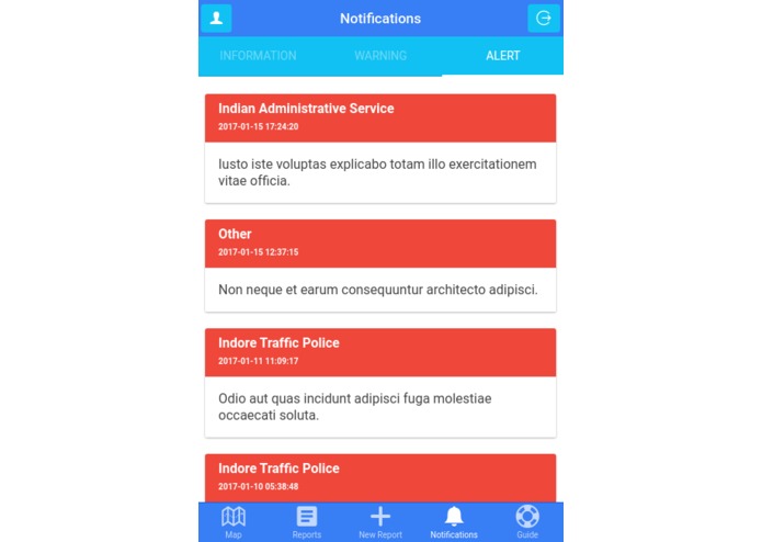
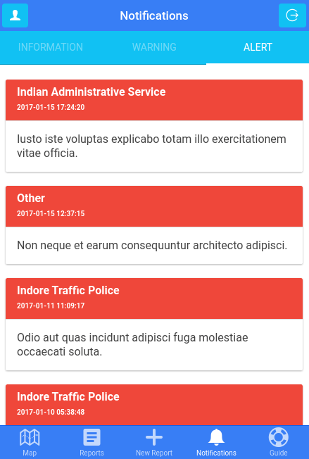
Notifications part 2 (alerts)
-
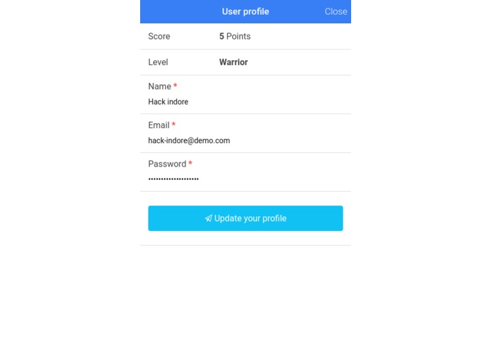
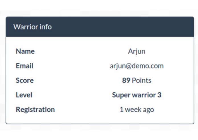
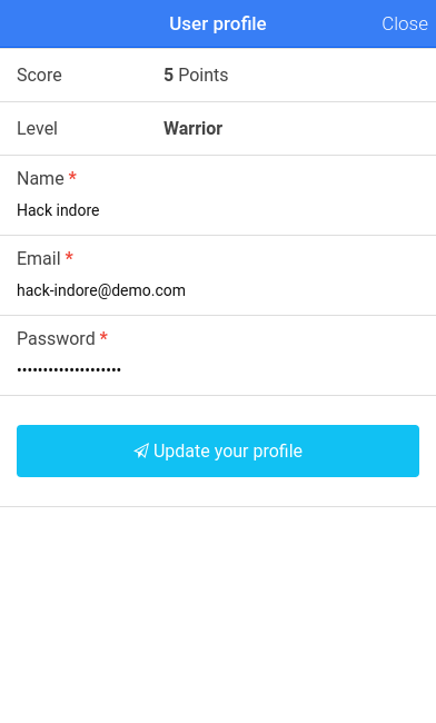
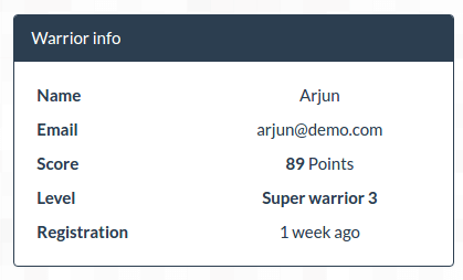
User profile with points and level (warrior, super warrior, super warrior 2, super warrior 3)
-
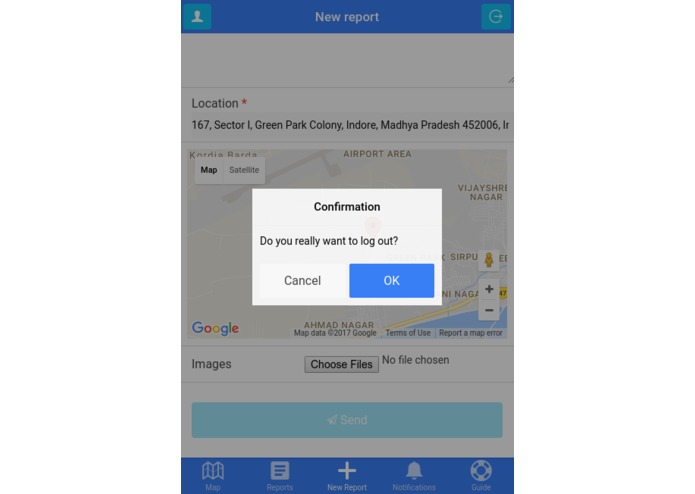
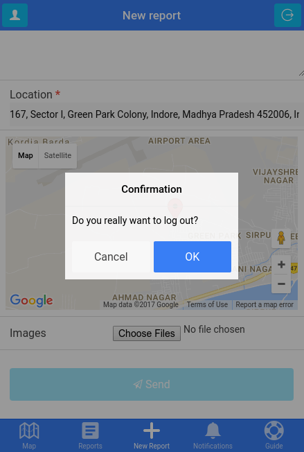
Log out option
-
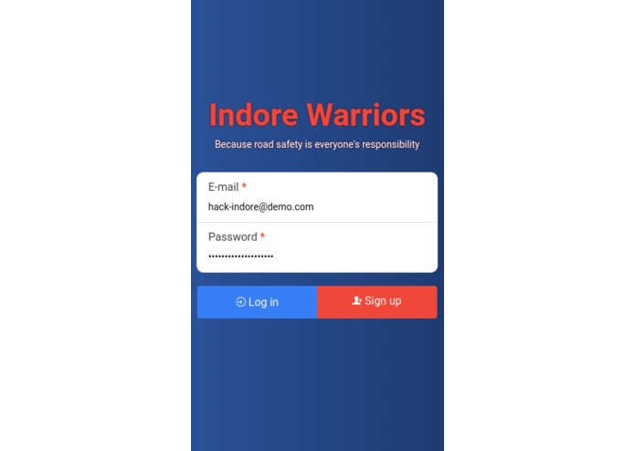
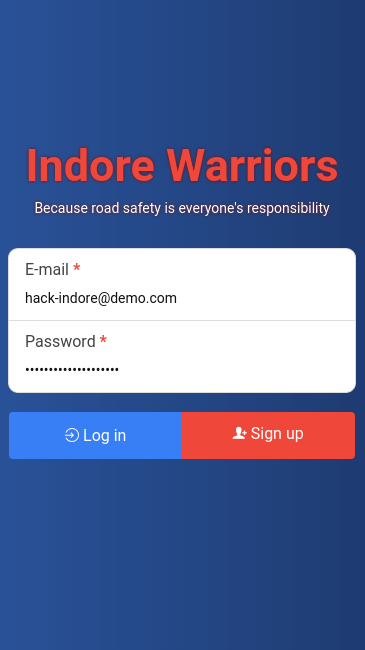
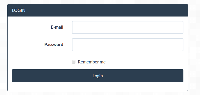
Log in screen
-
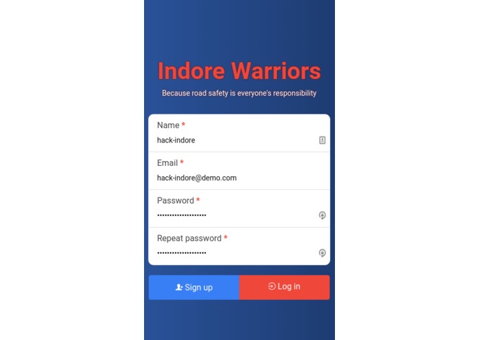
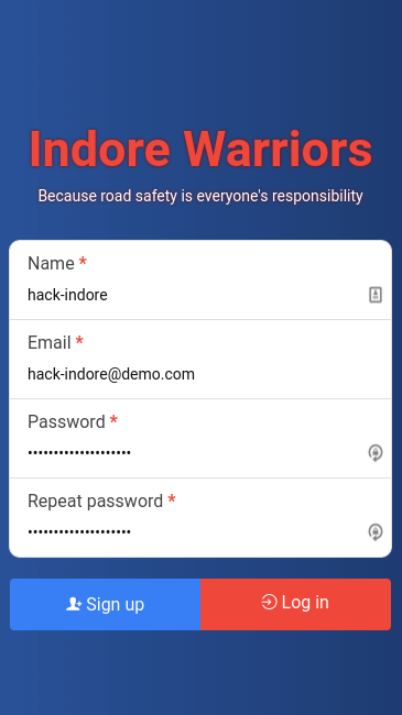
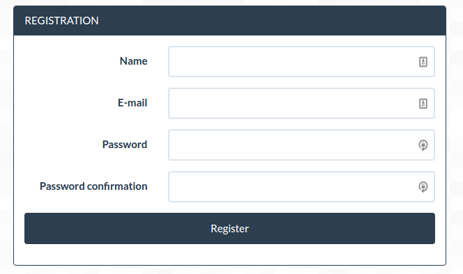
Sign up screen
-
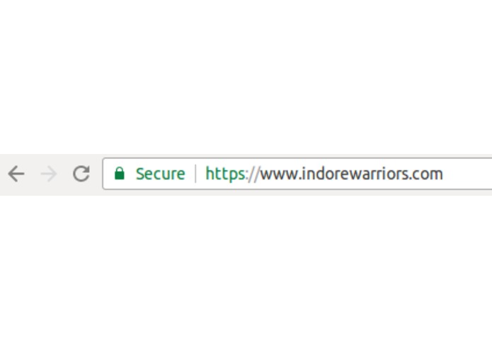
All reports and requests sent to the server are secure using HTTPS
-
Administrators and users can access their accounts or manage the reports (if they have the necessary permessions) directly on the web app
-
Reports are listed on the main archive page where content can be filtered to show specific results
-
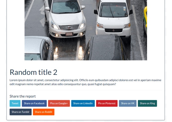
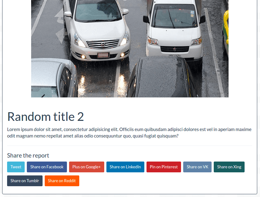
Report details with social sharing
-
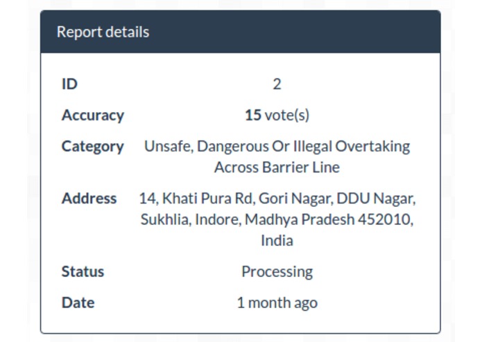
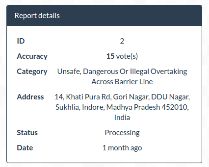
Report details
-
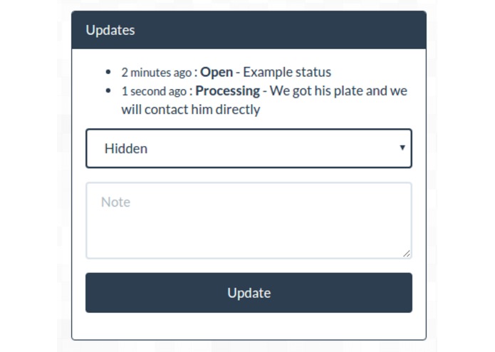
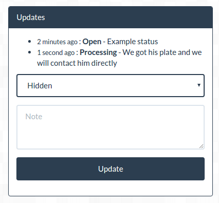
Report updates, this form will be visible only for administrators and the updates for all users
-
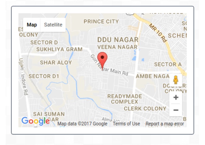
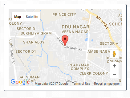
Exact location of the report
-
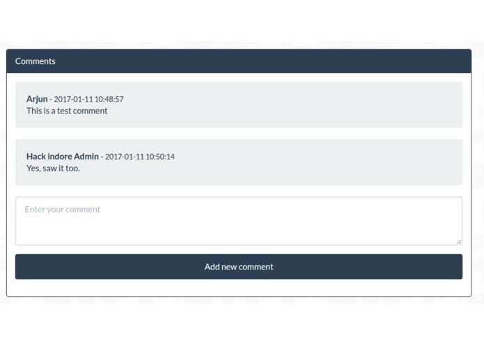
Comments can be added to each report (like the mobile app)
-
Reporter info where the email is hidden for simple users and visitors
-
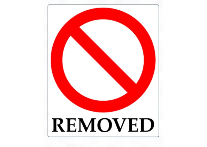
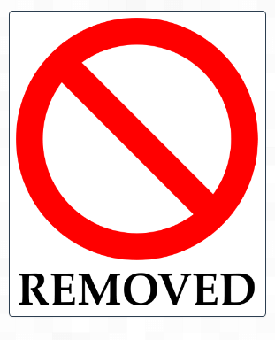
If a report is hidden by an administrator it will be removed from the listing for users but it will still appear for other administrators
-
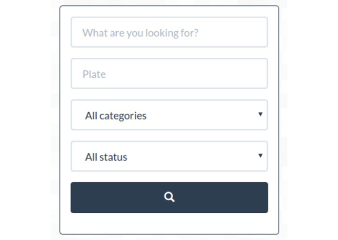
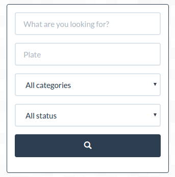
Report filters
-
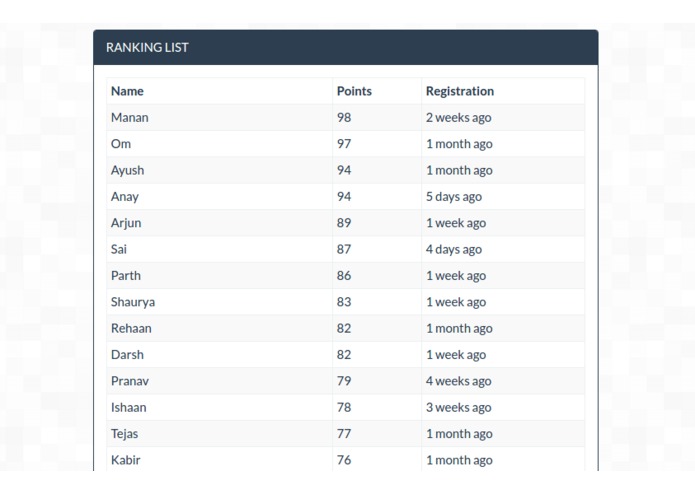
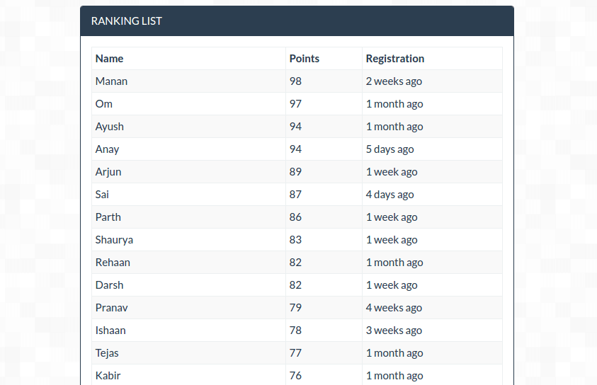
Ranking list of all the users
-
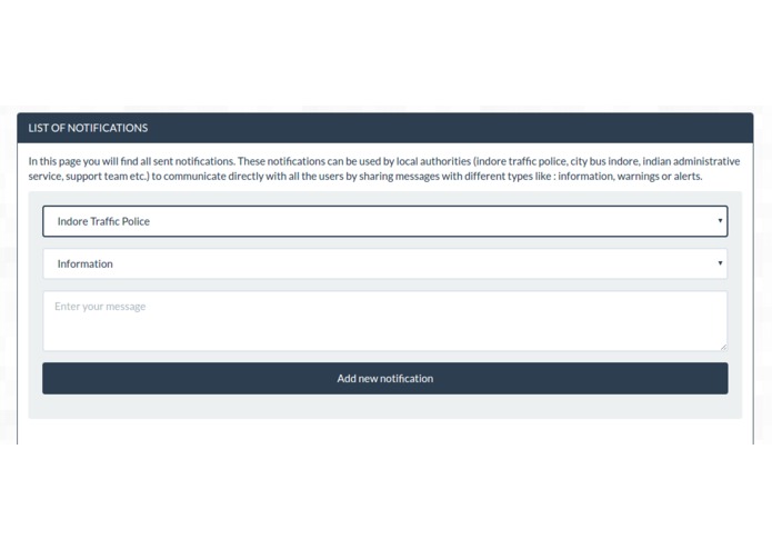
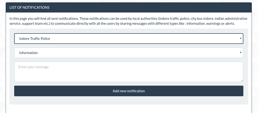
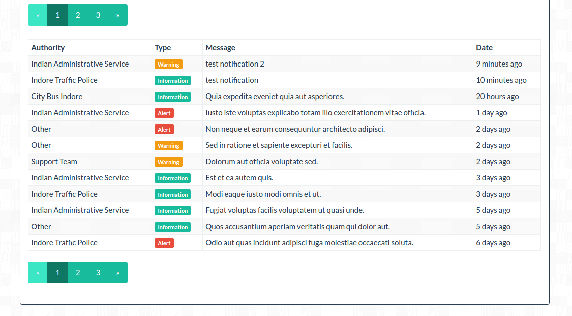
Notifications can be used by local authorities and others to communicate directly with all the users - part 1
-
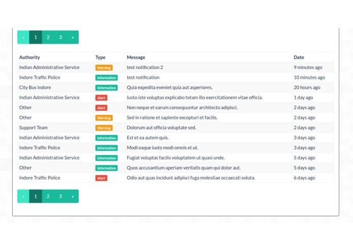
Notifications part 2
-
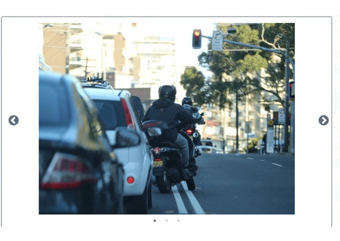
Reports can have multiple images and the app will display them using a responsive and mobile friendly slider
-
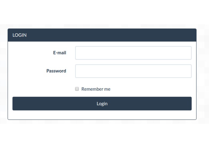
Log in page
-
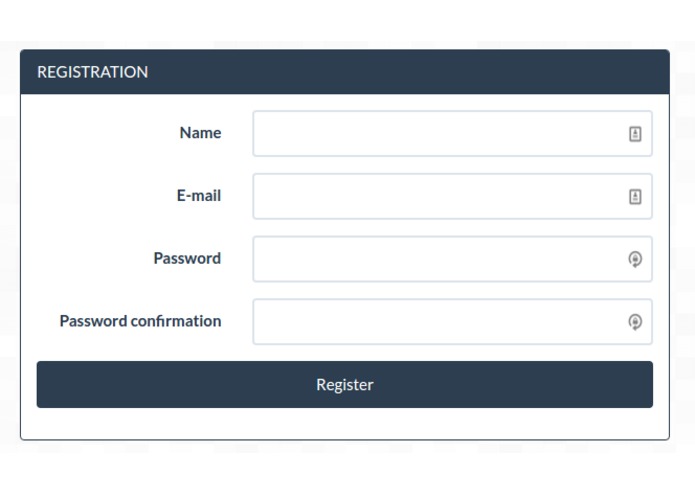
Sign up page
-
Both the mobile and the web app share same list of categories which can be edited easily


Indore Warriors - https://indorewarriors.com
Because road safety is everyone's responsibility

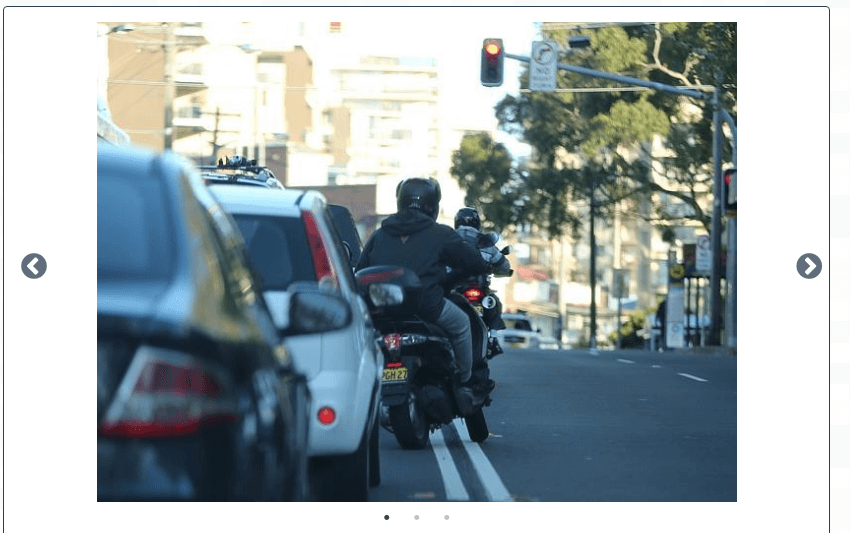
As warriors, users can save lives by reporting : bad drivers, local problems and incidents like street lighting, broken paving slabs, potholes, fly tipping etc. They will also earn points which will make their reports, up-votes and comments more trustful.
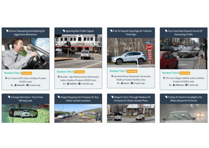
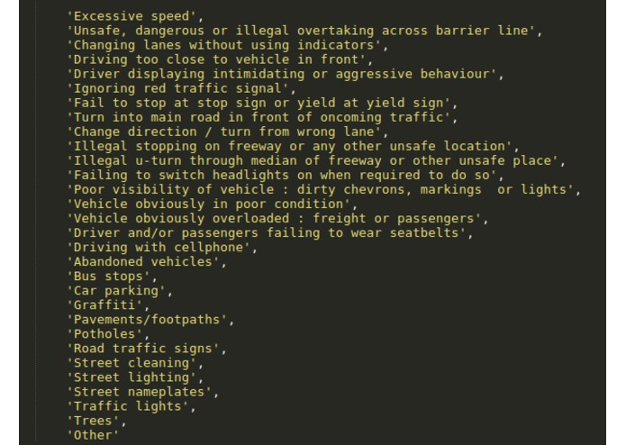
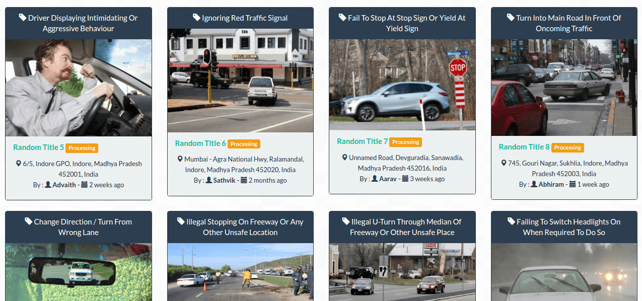
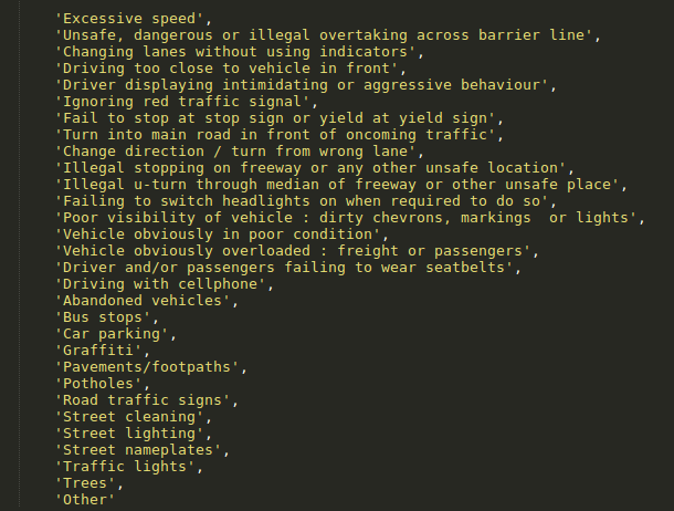
Here is the list of all used categories which can be managed easily on the app :
- Changing lanes without using indicators
- Change direction / turn from wrong lane
- Poor visibility of vehicle : dirty chevrons, markings or lights
- Illegal stopping on freeway or any other unsafe location
- Illegal u-turn through median of freeway or other unsafe place
- Ignoring red traffic signal
- Fail to stop at stop sign or yield at yield sign
- Road traffic signs
- Failing to switch headlights on when required to do so
- Driving with cellphone
- Excessive speed
- Street cleaning
- Turn into main road in front of oncoming traffic
- Vehicle obviously overloaded : freight or passengers
- Traffic lights
- Unsafe, dangerous or illegal overtaking across barrier line
- Driving too close to vehicle in front
- Abandoned vehicles
- Bus stops
- Trees
- Car parking
- Potholes
- Other
- Vehicle obviously in poor condition
- Pavements/footpaths
- Graffiti
- Driver displaying intimidating or aggressive behaviour
- Street lighting
- Street nameplates
- Driver and/or passengers failing to wear seatbelts
Indore's moonwalking cop
Personally, the first time I heard about Indore was thanks to this exceptional traffic police officer and by viewing some of his videos we can have an idea about the traffic he is dealing with

https://www.youtube.com/watch?v=DkMNJQXmSE0
By dancing, laughing and entertaining the public, Ranjeet Sinch which is a popular police officer in Indore is regulating the traffic in a very unique way. What's interesting is that people are admiring him and following the rules.
The problem

Cars, pedestrians, bicyclists, and motor vehicles act with caution when they know that they are being watched and as soon as they are "free" many of them don't respect the rules.
"Commuters flout local traffic laws, contributing to a culture of recklessness that persists despite local police efforts to raise road safety awareness. That's why In 2015, Indore recorded 5,873 road accidents, ranking it fourth in India behind Mumbai, Delhi, and Chennai"
The reason

According to the resources of the hackathon and to this detailed study Road Safety in India: Challenges and Opportunities made by the University of Michigan, the major causes of road accidents are the violation of road rules (assuming that pedestrians, bicyclists, and motor vehicles are the most vulnerable) :
Speeding, Reckless Driving, Running Red Lights, Running Stop Signs, Unsafe Lane Changes, Distracted Driving, Wrong-Way Driving, Improper Turns, Tailgating, Drunk Driving, Road Rage, Rain, Potholes, Drowsy Driving, Tire Blowouts, Deadly Curves, Animal Crossings, Etc.
My first idea

After a long brainstorming, my idea at first was making car, bicyclists, motor vehicles and even pedestrians "smarter" by creating a distance measurement system with radio waves using Arduino and Raspberry pi which can communicate with smartphones (wifi/bluetooth) and cars (OBD/OpenXC) to send alerts, track locations, share data between users etc.
But in Indore a solution like this can't work due to : the nature of the road traffic, the quality of the road surface marking and especially, the culture of recklessness among almost all road users.
The final solution
Became a warrior and start saving lives & helping local authorities by sending reports anytime, anywhere.

Thanks to the reports of all the warriors, road users will be more careful even without police officers, public cameras or traffic radars ... because they know that if they violate the rules a warrior may take his smartphone and send a report with all the necessary information and share it on the community site*. (*unless an administrator hide it for a specific reason)
In addition to that, local authorities can prevent road accidents by fixing problems and incidents like street lighting, broken paving slabs, potholes ... and can communicate directly with all the users of the app by sending different types of notifications from multiple sources (indore traffic police, city bus indore, indian administrative service, support team etc.)
Conclusion
I had great experience with Ford Innovate Mobility Series and this time I worked harder to create a better solution in order to increase my chances of wining the first prize which will help me start my own startup dedicated to smart technologies especially for cities.


Log in or sign up for Devpost to join the conversation.