Inspiration
There are a lot of tools for mapping and sometimes people need only indoor mapping without world map. I found that there is no interactive mapping system for indoors. So I decided to make one :)
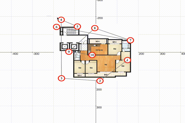
What it does
zoomable floorplan with markers can be dragged/grouped/.. along with grid system!
How I built it
Challenges
I ran into performance, optimization, keeping markers and connection lines on zoom
Accomplishments that I'm proud of
What I learned
Fabricjs and html canvas
What's next for IndoorJS
measurement, floorplan image, multiple units support


Log in or sign up for Devpost to join the conversation.