-
-
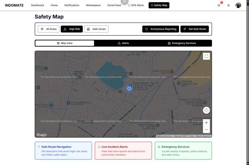
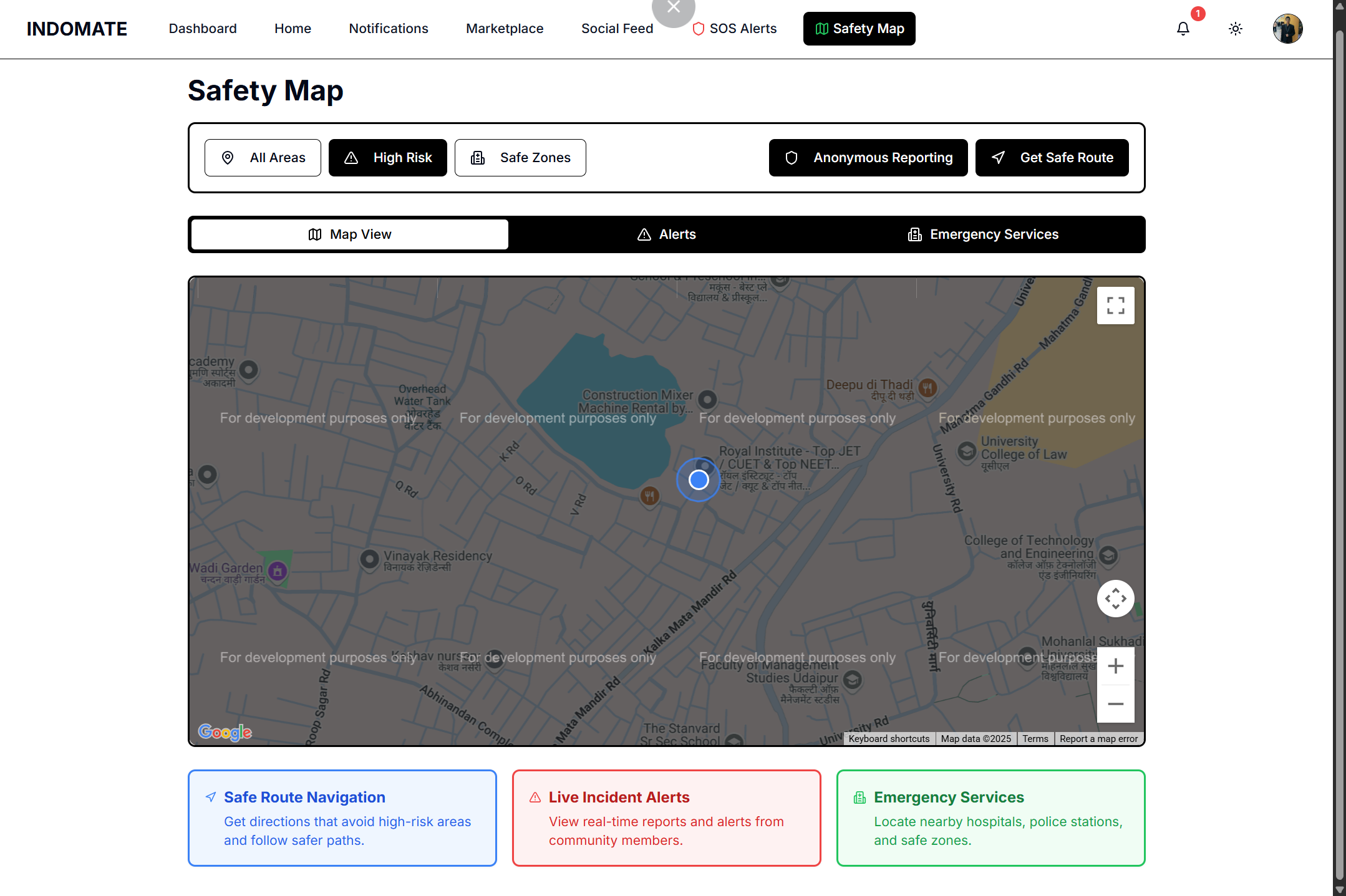
Map View and Features of IndoMate
-
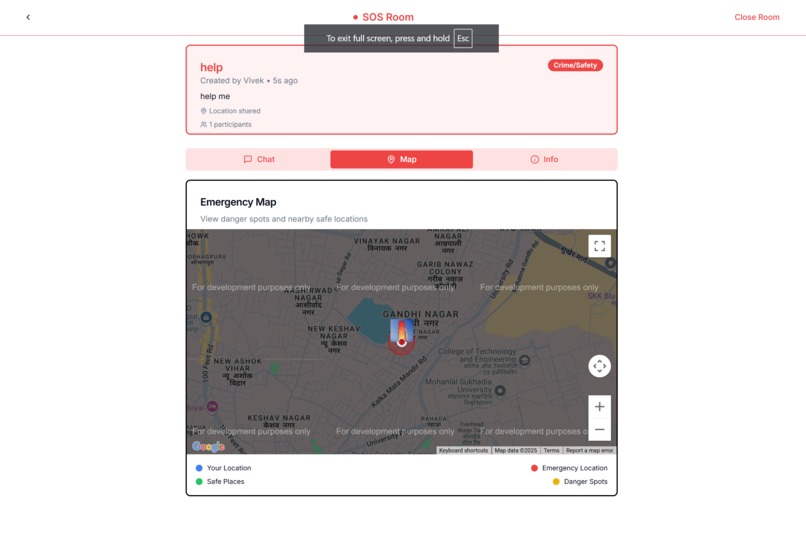
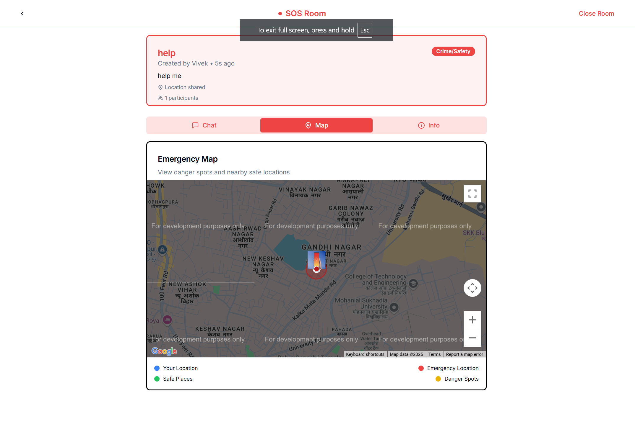
SoS room view of IndoMate
-
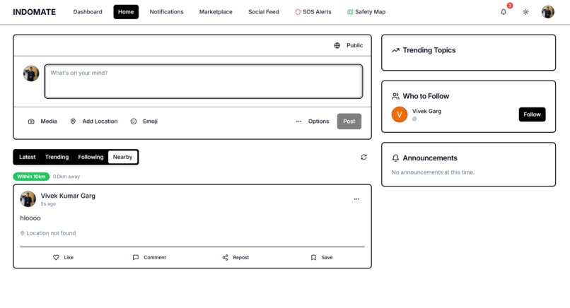
socialMedia view of indomate (use coords to check nearby users)

🚀 Inspiration
In a world where safety is becoming a rising concern—especially in urban areas—we wanted to create a tool that empowers people to make smarter decisions in real-time. From choosing safer routes to reporting live incidents, IndoMate was born to help people stay aware, connected, and protected, using the power of maps and verified community support.
💡 What it does
IndoMate is a safety and social awareness platform that uses Google Maps API to provide real-time insights and community support.
Key features include:
- SOS & Crime Spot Mapping: When a user reports an SOS or a crime, it is marked with a red spot on the map—helping other users avoid that area and choose safer routes.
- SOS Room Navigation: A live map inside the SOS room shows nearby public places like police stations, hospitals, and malls to assist the victim.
- Nearby Social Posts: A "Nearby" feed that displays user posts from around the user’s current location—enabling the community to share relevant, hyperlocal information.
🛠️ How we built it
- Frontend: Built with Next.js for fast rendering and performance
- Backend & Auth: Managed via Firebase (Authentication, Firestore, and Storage)
- Real-time Updates: Firebase Realtime Database + Firestore for syncing SOS alerts and posts
- Maps Integration: Google Maps API for geolocation, nearby places, markers, and route assistance
- Deployment: Vercel for frontend deployment, Firebase for backend services
🧩 Challenges we ran into
- Handling real-time updates on maps using Firebase and Google Maps API smoothly
- Managing accurate geolocation and syncing it with user actions
- Ensuring privacy and secure handling of sensitive SOS data
- Designing a clean, quick UI for users in emergency scenarios
🏆 Accomplishments that we're proud of
- Building a working prototype with real-time SOS mapping
- Creating an interactive SOS Room with map-based assistance
- Implementing a dynamic Nearby Posts system
- Receiving positive validation from mentors and users during early-stage events
📚 What we learned
- Mastered Google Maps APIs for dynamic, real-world safety applications
- Leveraged Firebase to build scalable real-time features
- Improved our understanding of UX for critical and time-sensitive use cases
- Gained experience in building map-centric, community-based platforms
🔮 What's next for IndoMate
- Adding heatmaps for high-risk areas based on SOS density
- Smart route suggestion that avoids unsafe locations
- Enabling verified responder features (badges for police, medics, etc.)
- Launching mobile-first version with offline emergency tools
- Expanding community reporting and gamifying safety contributions
Built With
- figma
- firebase
- github
- javascript
- next
- postman
- react


Log in or sign up for Devpost to join the conversation.