-
-

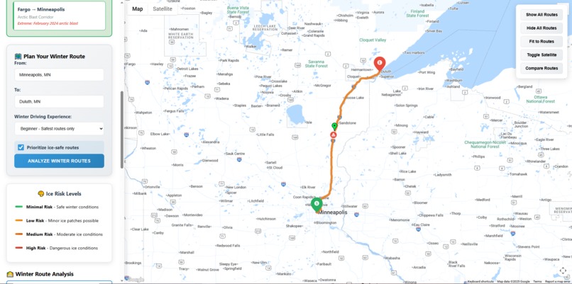
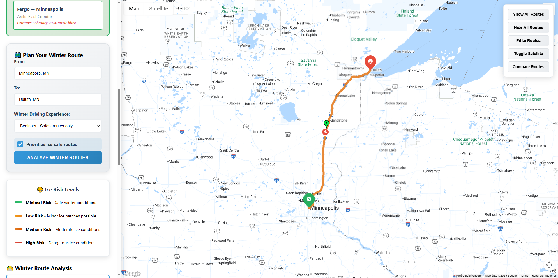
IcyRoute shows winter route planning with color-coded risk levels and multiple route alternatives based on driving experience.
-
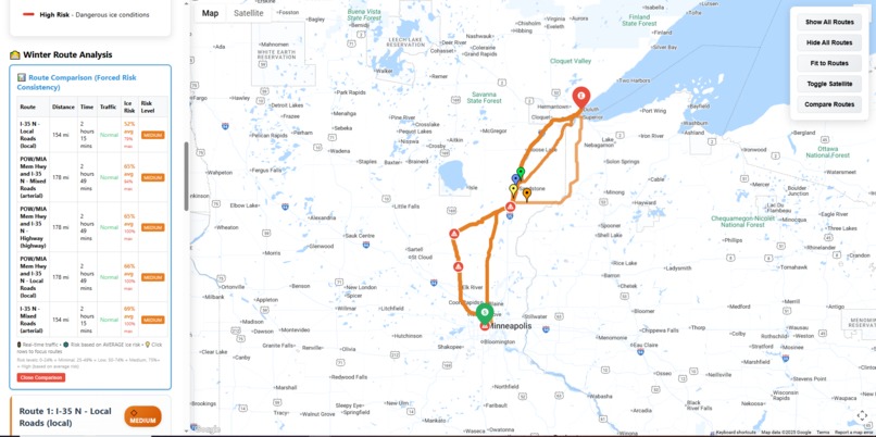
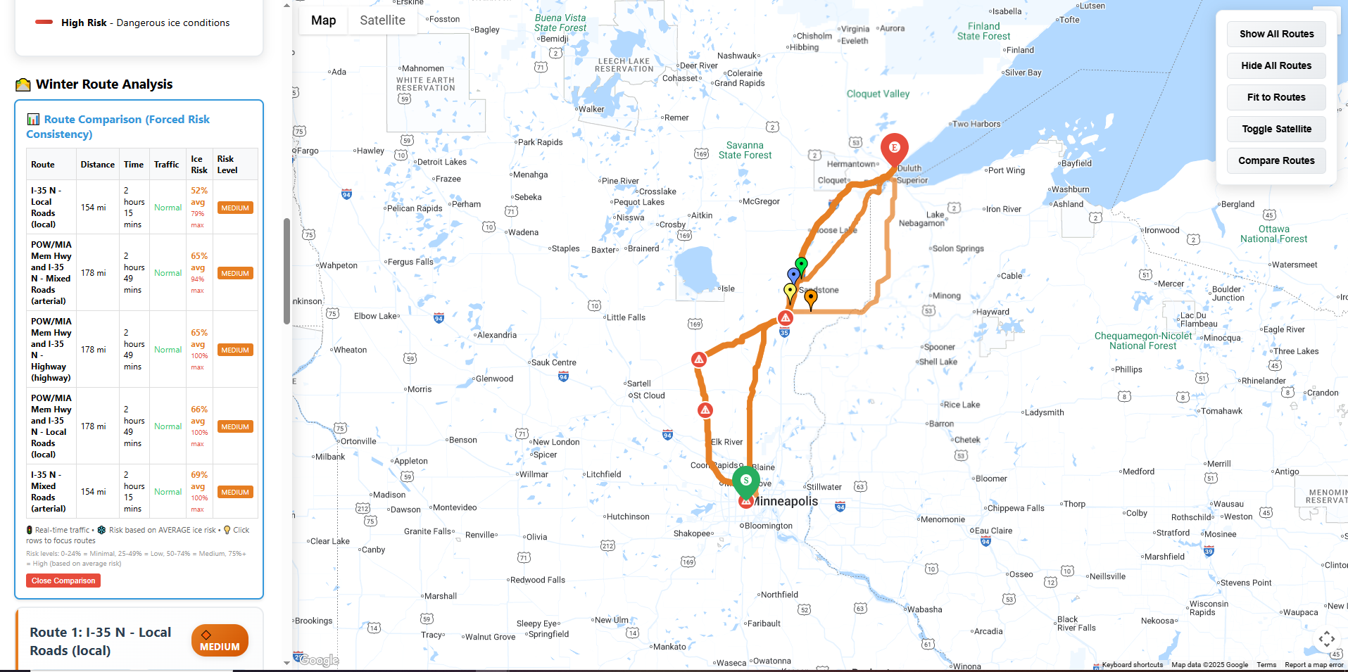
Route comparison table displays ice risk percentages, travel times, and safety levels.
-
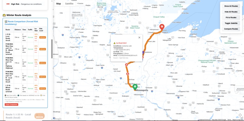
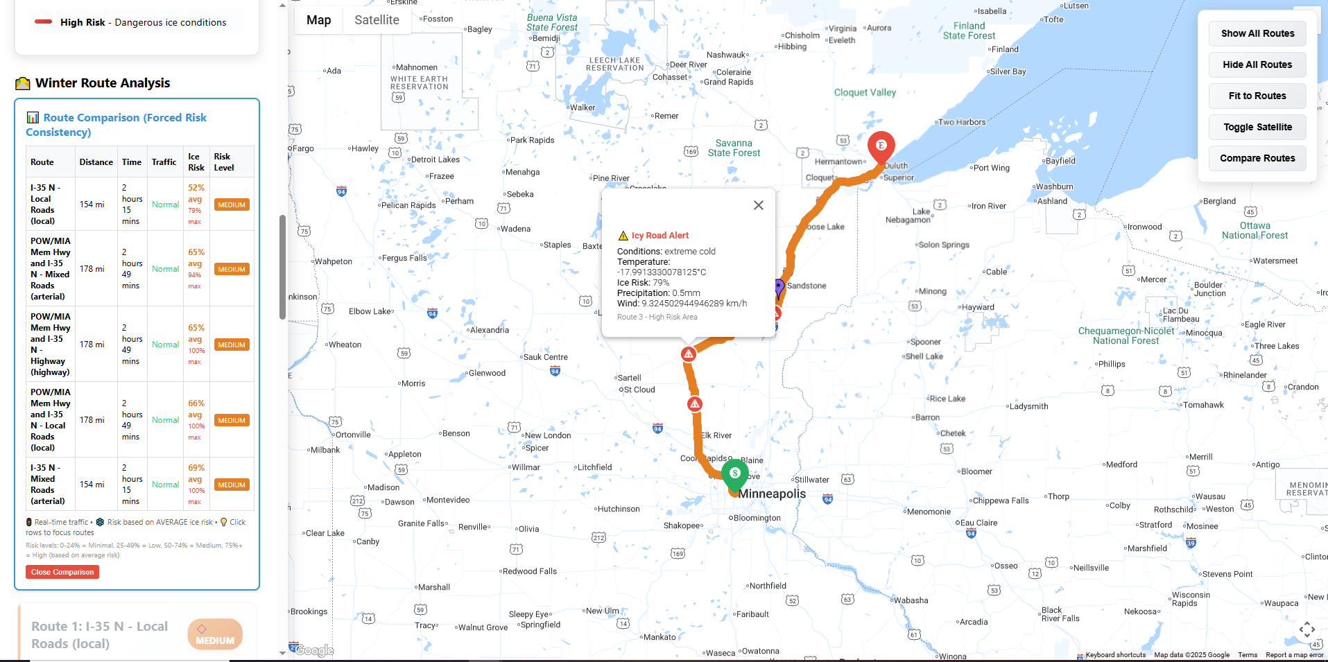
Warning popup shows icy road alerts within selected route.
-
Recommends routes with varying risk levels based on user's driving experience
Inspiration
Each year, winter ice contributes to over 150,000 crash injuries in the U.S. Alerting drivers to icy road segments and offering safer route alternatives can help prevent these accidents.
What it does
- Risk scoring from green (safe) to red (dangerous) using real-time weather + geography.
- Multiple routes, tailored to driver skill, with pop-up weather alerts and side-by-side risk/time comparisons.
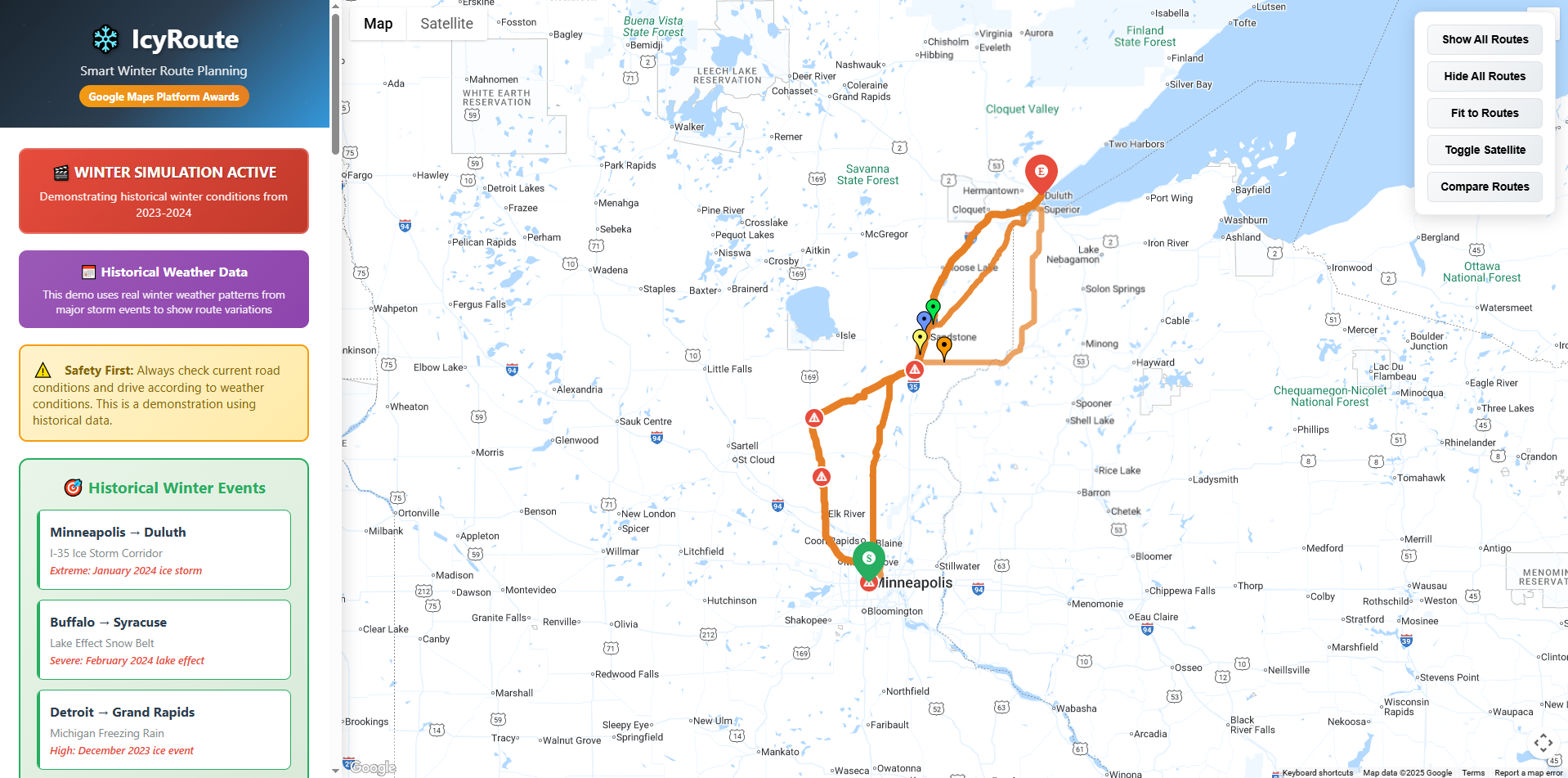
- Storm replay of 2023–24 winter events for demos.
How we built it
- Backend (Python + Flask) – 8-factor ice-risk model, OpenMeteo + historical feeds, Google Directions generator.
- Frontend (JavaScript) – Google Maps JS API for color-coded polylines, markers, and keyboard UI.
- Other APIs – Geocoding & Places for search/validation; custom map styling.
Challenges
- Very hard to get historical icy road data
- Verification of whether or not the developed risk metrics for classifying roads are accurate
Accomplishments
- Integrated 4 Google APIs with live risk scoring.
What we learned
- Maps APIs can power safety-critical insights.
- Ice risk isn’t just temperature—humidity, wind, precipitation, and elevation matter.
- Real value can be generated by building on top of existing valuable products like Google Maps, which does the heavy lifting.
What’s next
- Near term: ML-refined risk, training an ML model to better predict and estimate icy road risk.
- Use case Extension: Extending it to more use cases like flooded roads or roads during wildfire.

Log in or sign up for Devpost to join the conversation.