-
Front page.
-
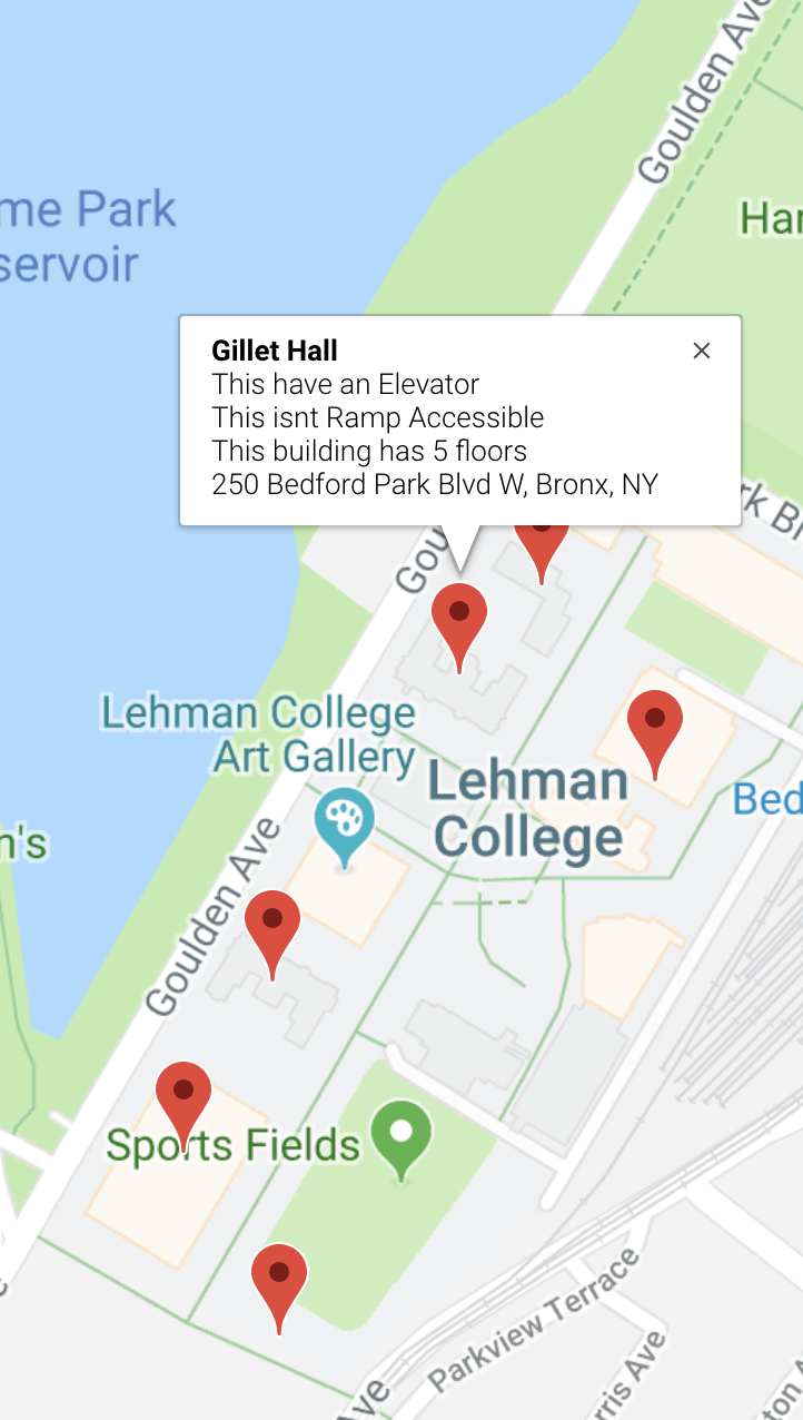
Desktop View
-
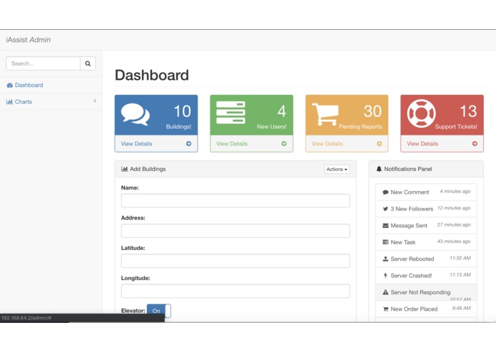
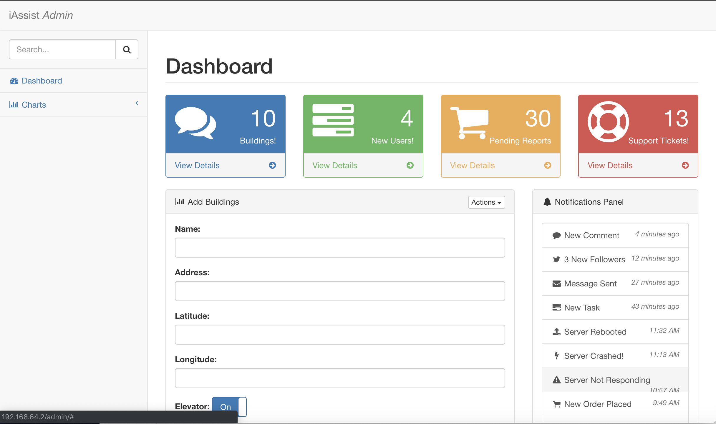
Admin View
Inspiration
In terms of accessibility, public transportation and public spaces (mostly parks and outdoor spaces) have been documented by New York City and other organizations -- we can easily find, through a quick Google search, which subway stations and which public parks are accessible. However, there's insufficient information in this regard for all of the in-between spots, e.g. restaurants, grocery stores, etc. Keeping those with visual and/or mobility impairments in mind, we hope to make everyday exploration a bit friendlier for those demographics.
What it does
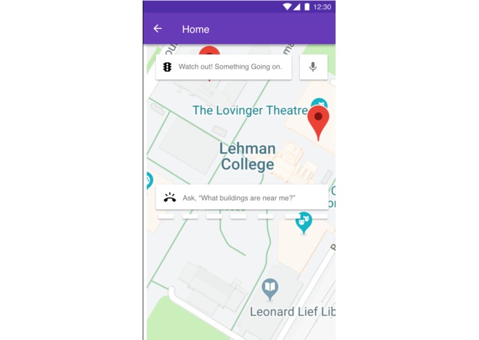
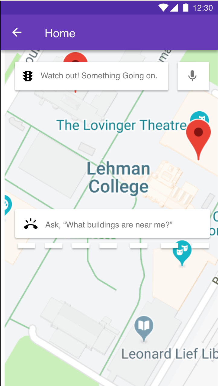
_ Mobile/Web App _ 1) Provides accessibility information for buildings around the user's current geo-location via voice recognition.
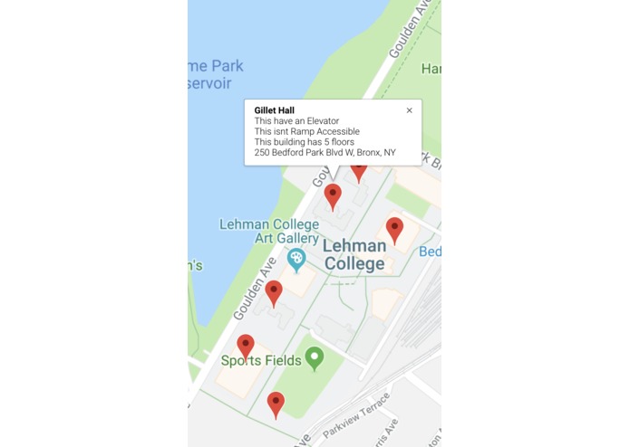
_ Crowdsourcing _ 2) Allows the community to contribute to a central database with important information, such as elevators, wheel ramps, number of floors, building name, address, geo-location via coordinates.
How we built it
_ App: _ Adobe XD for the front-end prototype with multiple "screens", and voice recognition commands.
_ Crowdsource Site: _ HTML & CSS for markup language, heavily supported by Bootstrap, PHP as the backend programming language, and MYSQL for Database.
_ Data Collection: _ Google Maps API with Python to collect data such as surrounding buildings, current location and storing them into a JSON file, for the Crowdsource Site to mainly feed from, as well as hypothetically the app.
Challenges we ran into
Initial Approach on how to face the challenge, then integrating each component of our project, and facing poor documentation and inconsistent data from Google.
Accomplishments that we're proud of
Building a prototype that (sort of) works, and using multiple languages and databases to empower and help those with accessibility issues.
What we learned
Better understanding of APIs for all languages and platforms.
What's next for iAssist
Stay tuned for the next hackathon.


Log in or sign up for Devpost to join the conversation.