-

Icon
-
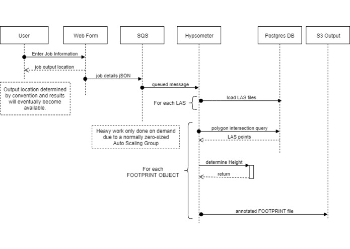
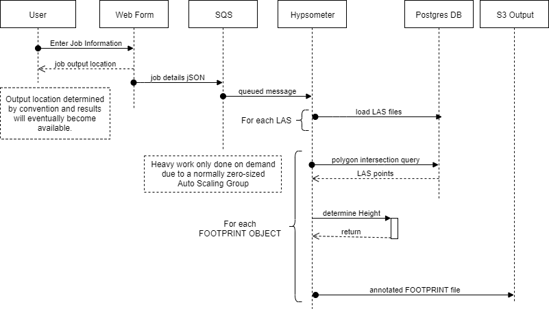
Sequence Diagram
-
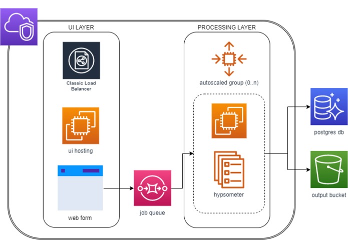
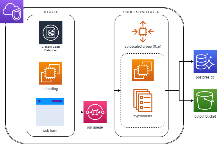
Current Architecture
-
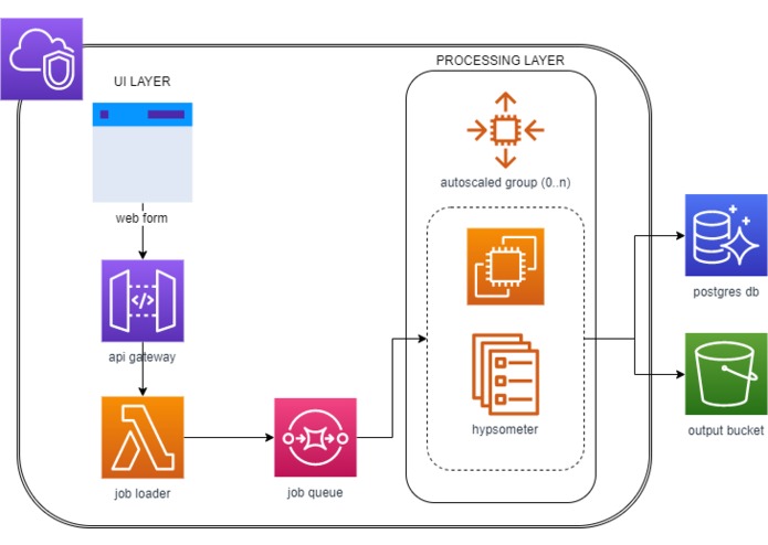
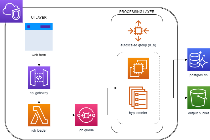
Future Architecture
Inspiration
AWS Hackathon for Public Good 2019 Urban Institute Challenge
What it does
Given two sets of input data: 1: a FOOTPRINT file containing polygons of defined houses 2: one or more LAS files containing LIDAR information.
Annotate the FOOTPRINT file with a new column "ALTITUDE_M", which is the altitude (in meters) of each individual building.
How We built it
Lightweight front end to submit URLs of data location Heavy lifting done by Autoscaled EC2s which listen to a queue of job requests
Challenges we ran into
Provided data was in the wrong projection Suggested Python library was incompatible with LAS 1.4 format Lambda is insufficient (memory and time) for the job execution
Accomplishments that we are proud of
Worked with the customer to verify the provided data set Considered Speed of Execution and Cost in the solution
What we learned
Working with GIS data has a learning curve GIS Coordinate systems need to be aligned Working with very large datasets slows down prototyping
What's next for Hypsometer
Swap UI layer for S3 web hosting, API Gateway and Lambda Containerize the ASG to work in Fargate for on-demand compute
Built With
- autoscaling
- ec2
- gis
- lambda
- postgresql
- s3


Log in or sign up for Devpost to join the conversation.