-
-
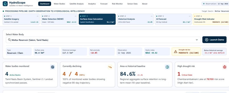
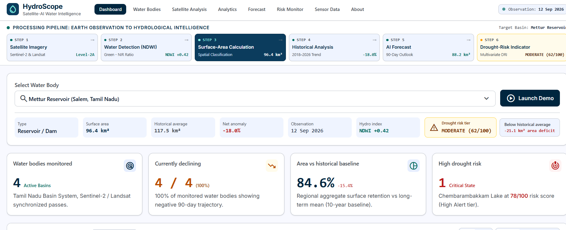
Dashboard with surface area, change vs. baseline and drought risk. Demo data.
-
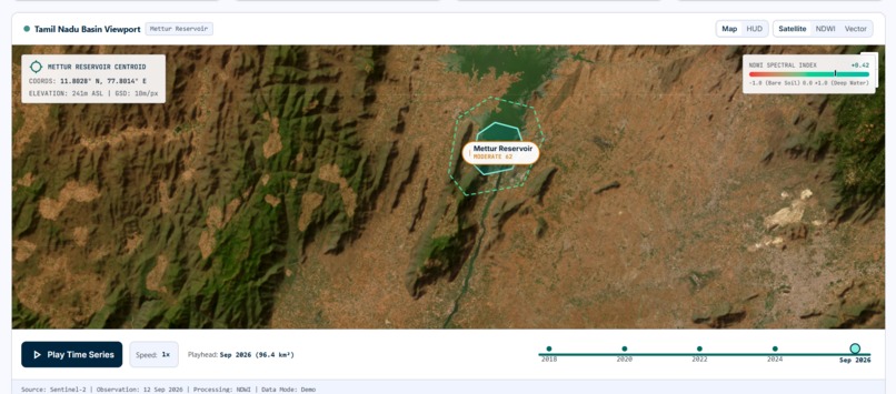
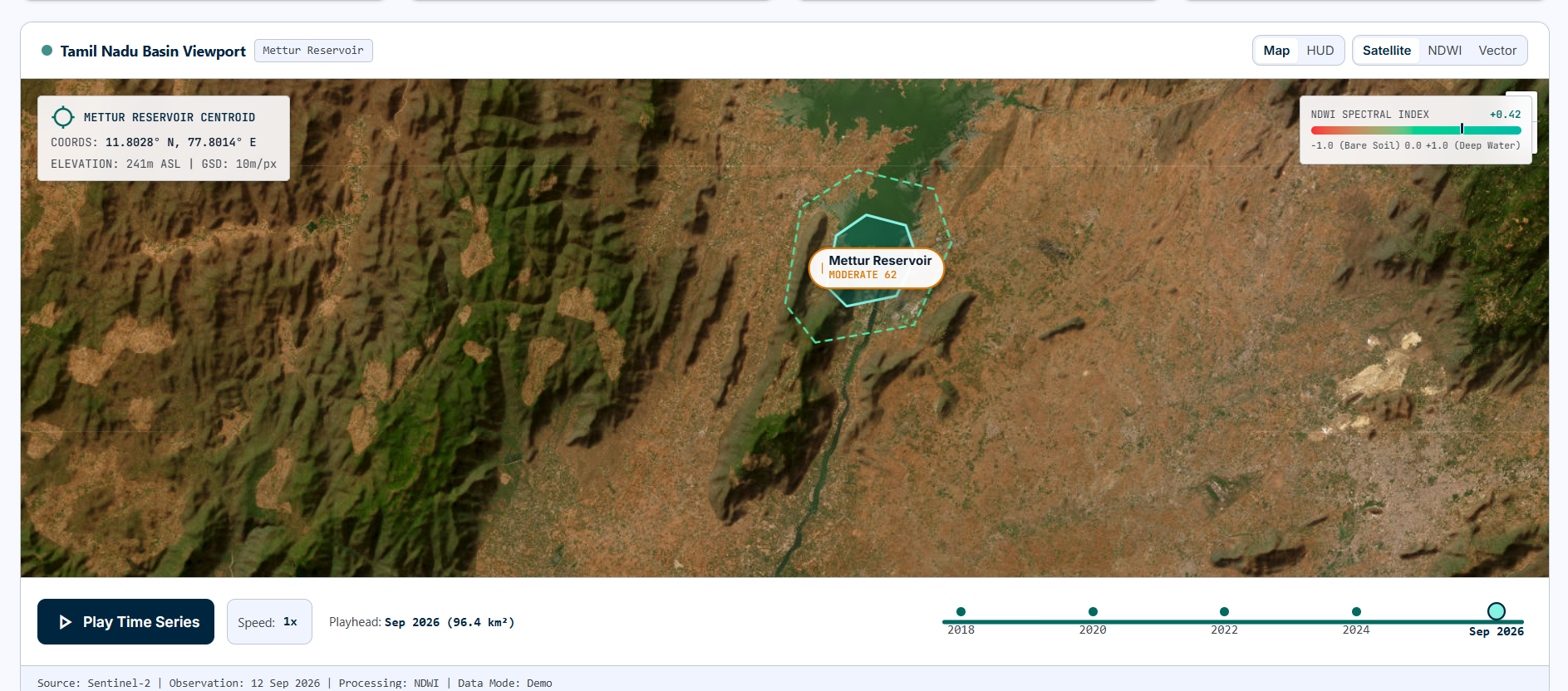
Interactive map with a date slider (2018-2026) and "Play Time Series" to watch a reservoir's water extent change over time.
-
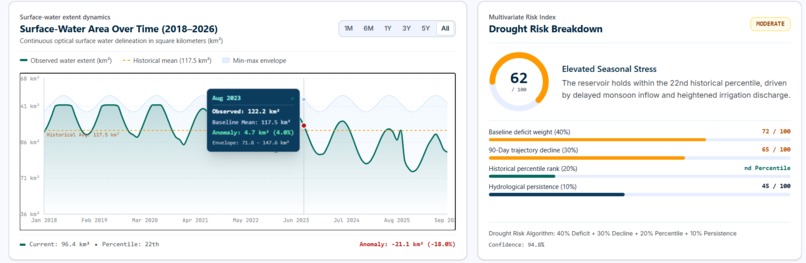
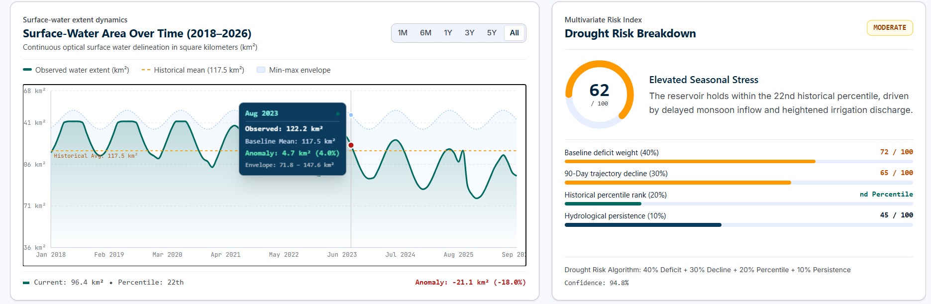
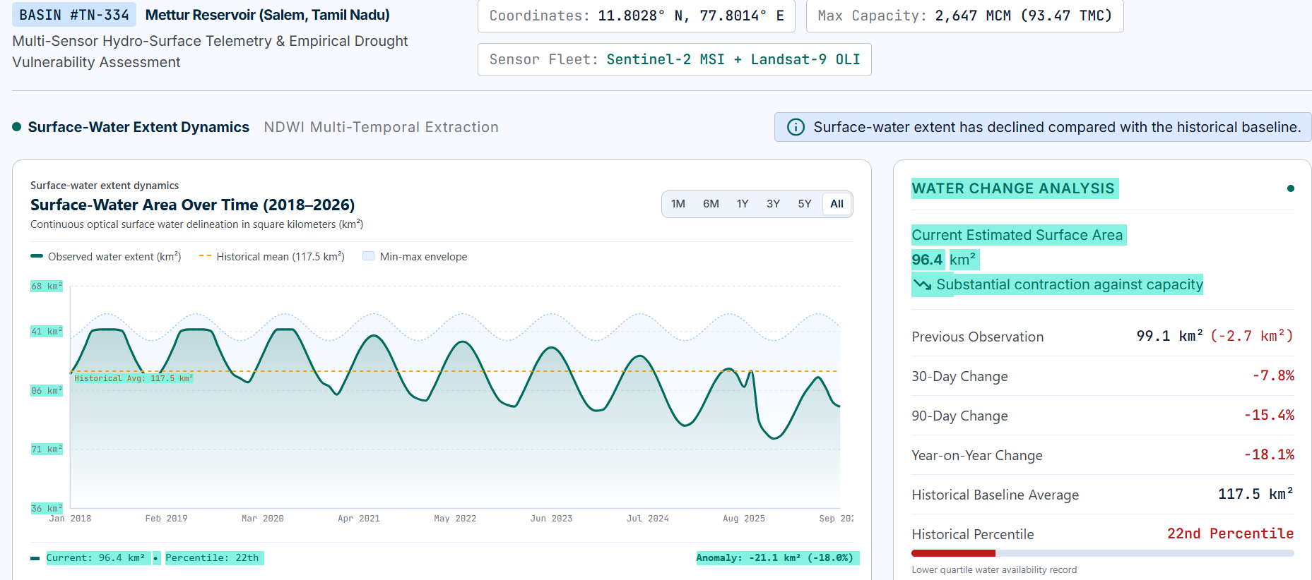
Surface-water area over time with historical baseline, plus a transparent drought-risk score (62/100, Moderate). Demo data
-
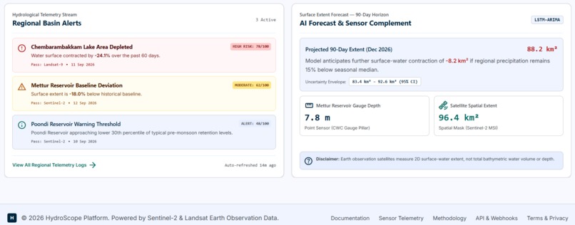
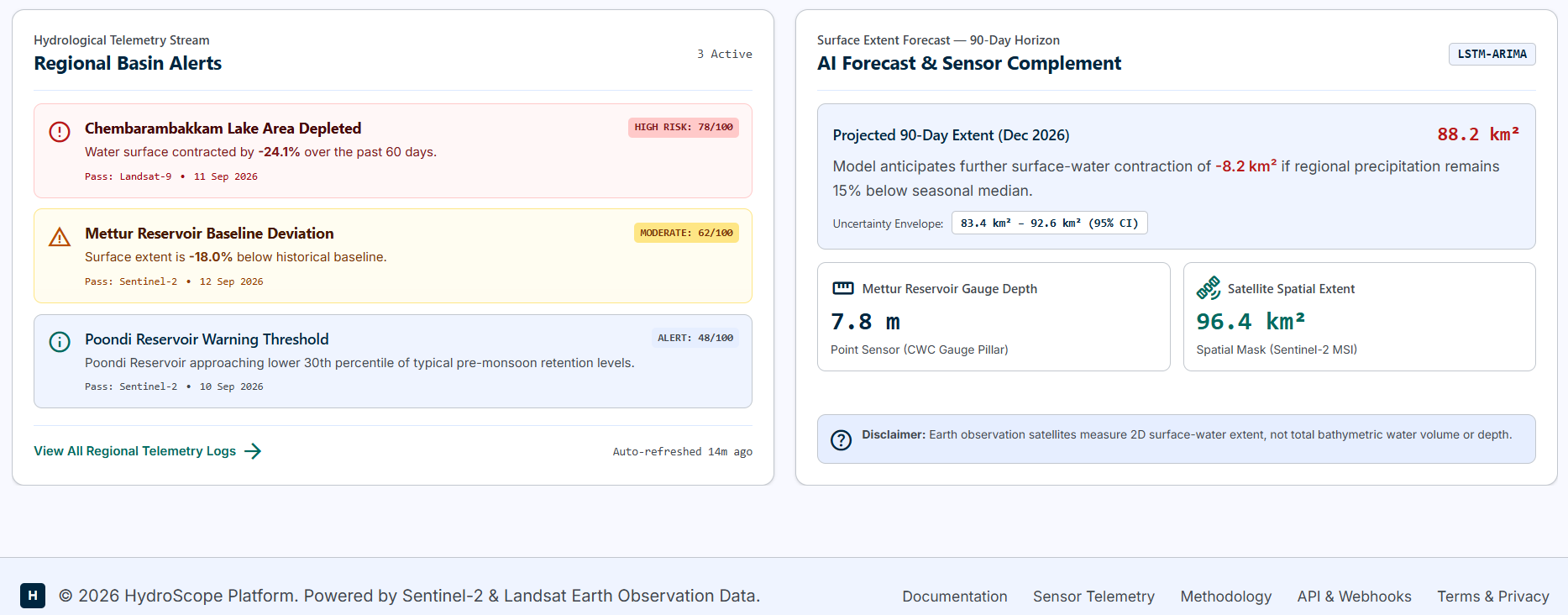
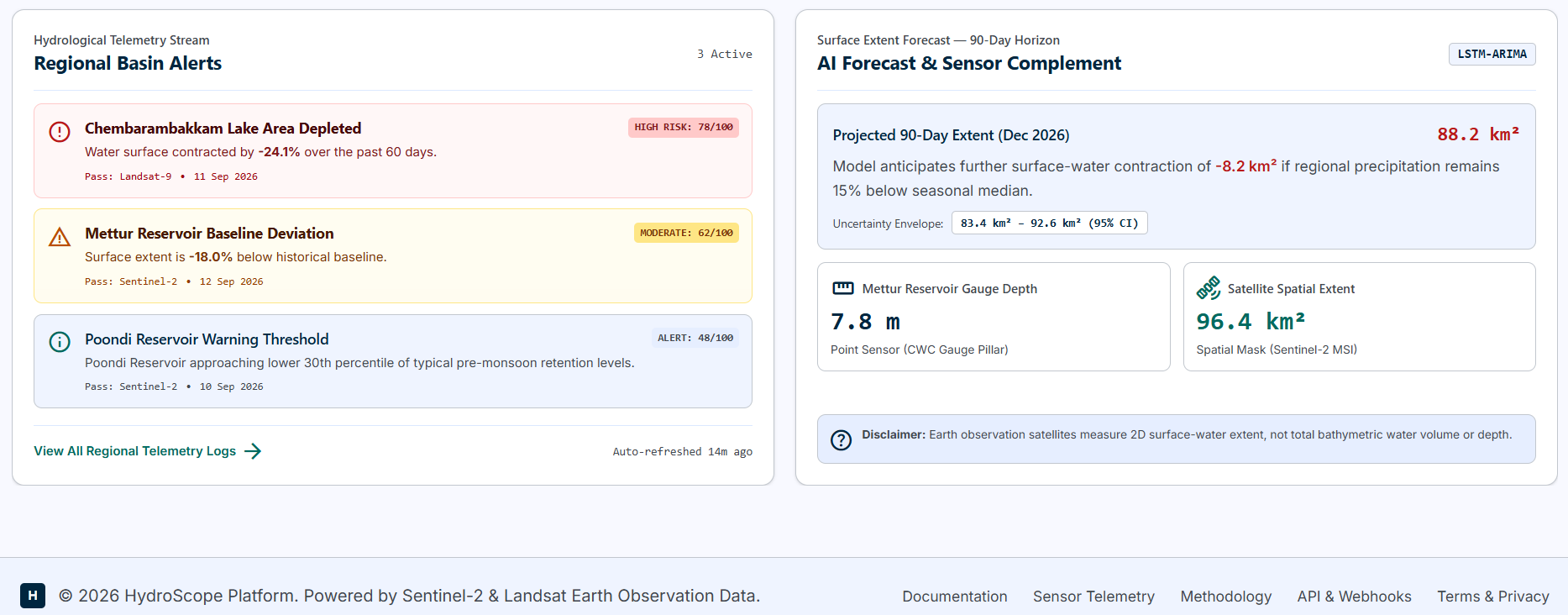
Regional alerts and a 90-day surface-extent forecast with uncertainty, alongside a ground-sensor vs. satellite comparison. Demo data
-
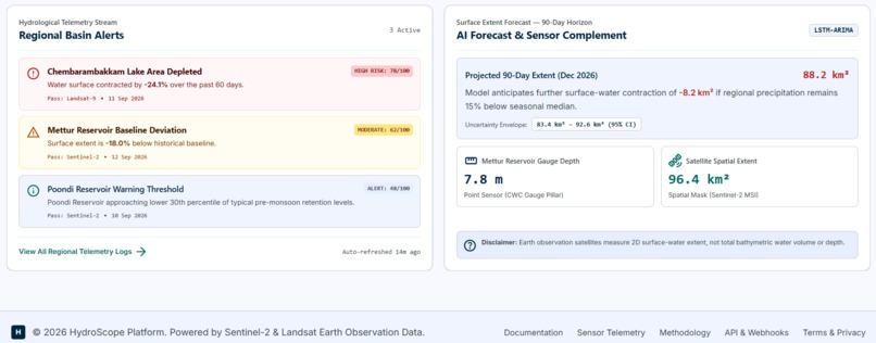
Searchable catalog of monitored water bodies with surface area, historical comparison, trends and risk level. Demo data.
-
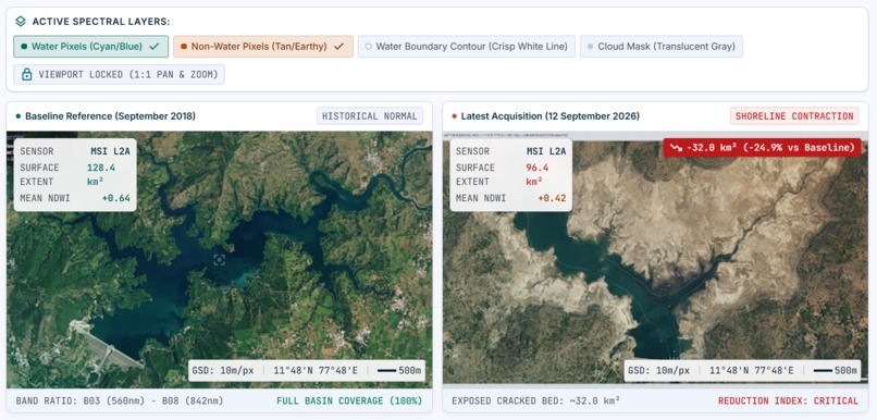
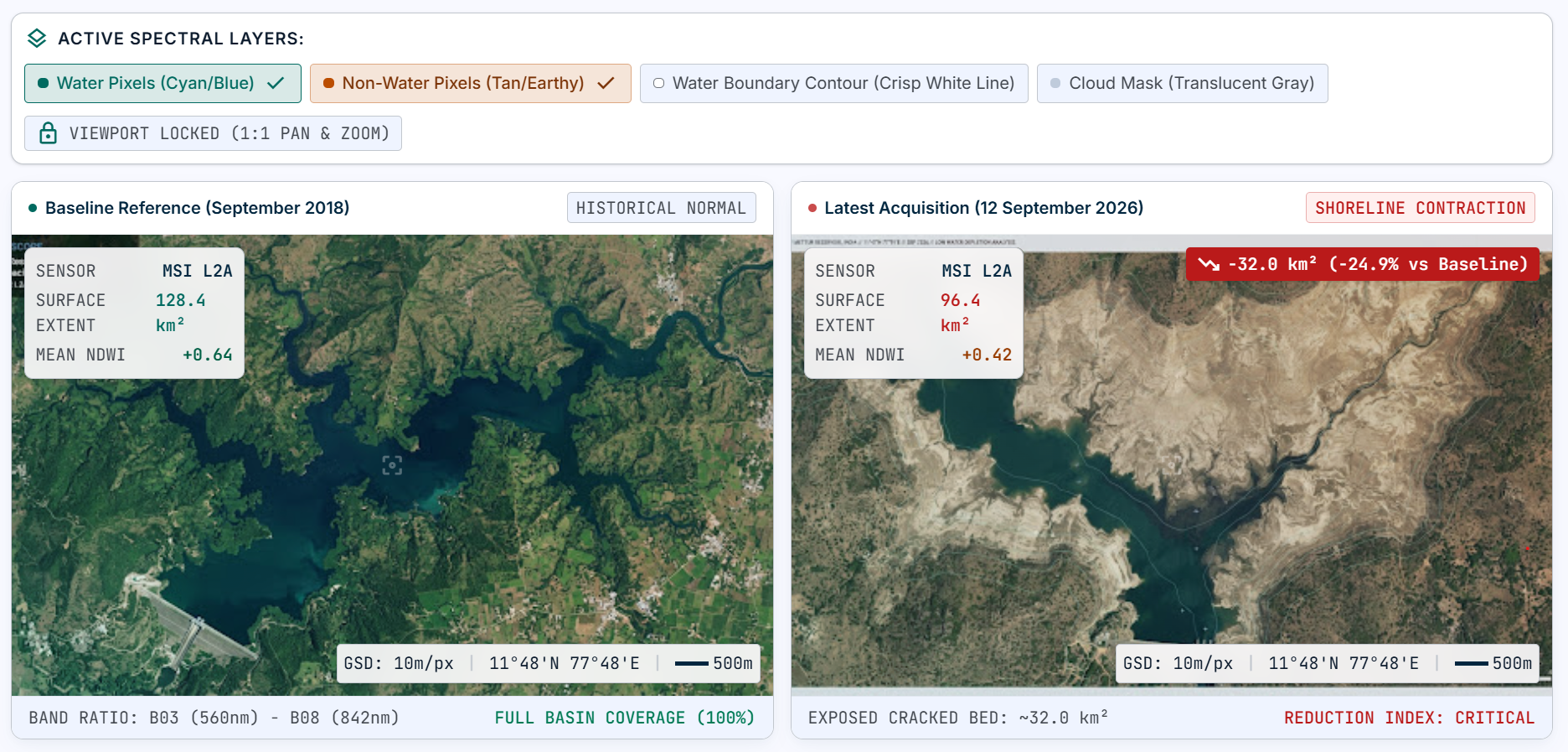
Before/after satellite view with NDWI water-mask overlay. Demo data.
-
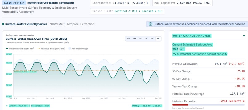
Historical analytics: surface-water area over time with range filters, the historical average, and 30-day, 90-day and year-on-year change.
-
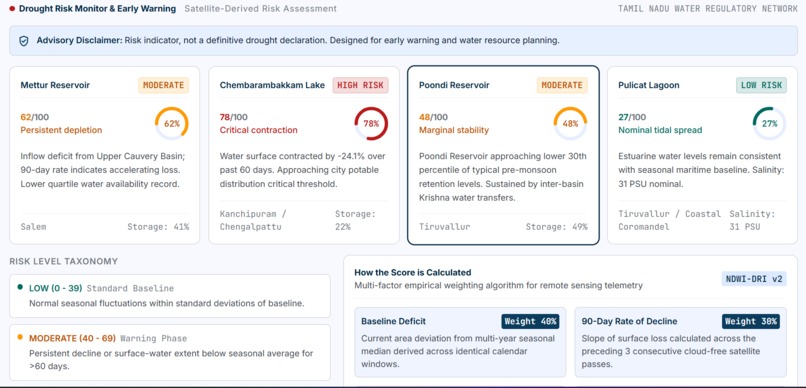
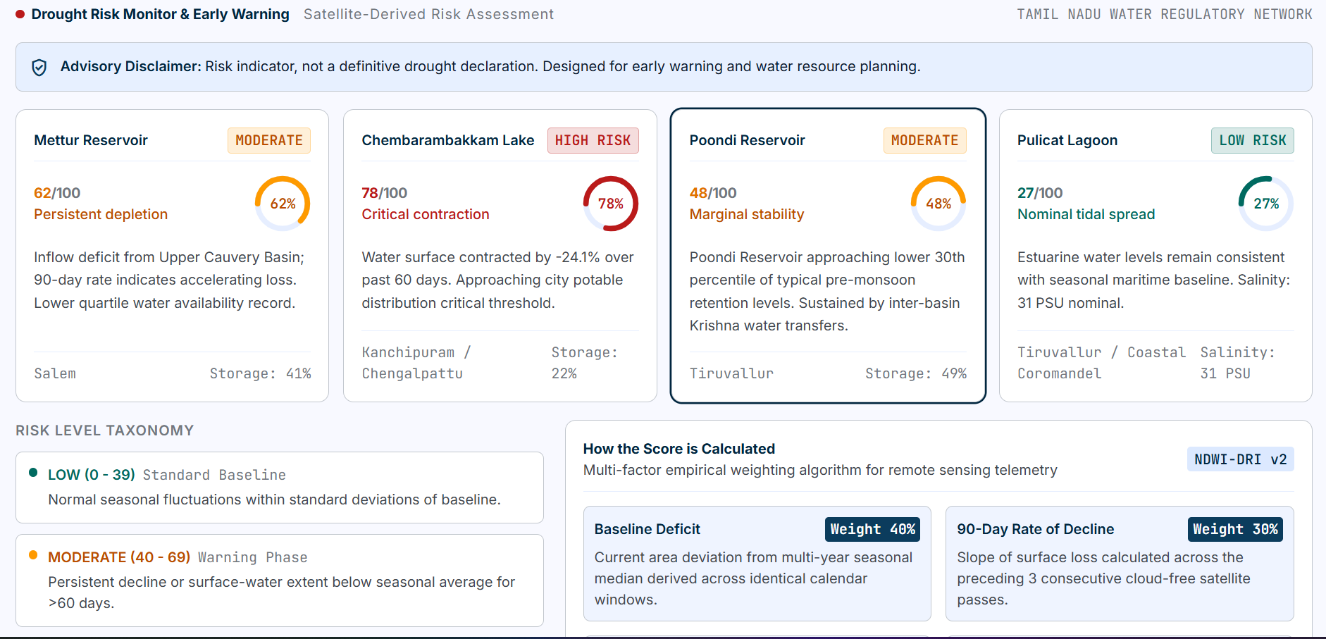
Drought-risk indicator (Low, Moderate, High) with a transparent score. It is an analytical indicator, not an official drought declaration.
-
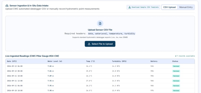
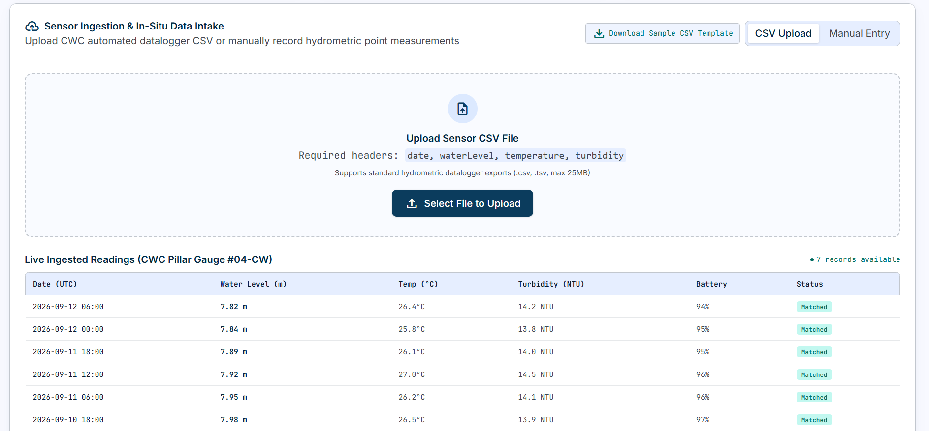
Ground sensor data alongside satellite surface area. Demo data.
🌊 Inspiration
Water scarcity and drought do not happen suddenly. Water bodies often show gradual changes in their surface area before the situation becomes critical.
We were inspired by a simple question:
Can we use satellites as a digital eye to continuously monitor water resources without installing hardware everywhere?
Existing reservoirs may have water-depth sensors, but many smaller lakes, ponds, wetlands, and remote water bodies do not have continuous monitoring systems. HydroScope was created to complement existing sensors by providing a wider view of how entire water bodies change over time.
💡 What We Built
HydroScope is a satellite-AI system for monitoring changes in the surface-water extent of lakes, reservoirs, ponds, and other water bodies.
Our workflow is:
Satellite Imagery → Water Detection → Surface-Area Calculation → Historical Analysis → AI Forecasting → Drought-Risk Indicator
We use freely available satellite imagery such as Sentinel-2 and Landsat. Spectral information is processed using the Normalized Difference Water Index (NDWI):
$$ NDWI = \frac{Green - NIR}{Green + NIR} $$
This helps distinguish water from surrounding land. We then calculate the water-covered area across different dates and create a historical time series.
The results are presented through an interactive dashboard with satellite maps, water-area trends, historical comparisons, and AI-based forecasts of future surface-water conditions.
🧠 What We Learned
Building HydroScope helped us explore several areas:
- Remote sensing and satellite imagery
- Water-body detection using spectral indices
- Geospatial data processing
- AI and time-series forecasting
- Data visualization
- Environmental applications of technology
We also learned that AI is only as useful as the data behind it. Real-world environmental data requires careful processing, filtering, and interpretation before it can produce meaningful results.
🛠️ How We Built It
HydroScope is designed as a software-based solution that can monitor water bodies without requiring additional hardware at every location.
Technology stack:
- Sentinel-2 / Landsat — satellite imagery
- Google Earth Engine — satellite-data processing
- Python — data processing and analysis
- NDWI — surface-water detection
- Time-series ML — forecasting
- Streamlit — interactive dashboard
- Maps and visualizations — spatial and historical analysis
The system can also be extended by integrating existing ground-sensor measurements, rainfall data, and other environmental datasets.
🚧 Challenges
One of our biggest challenges was working with real satellite data rather than clean, pre-prepared datasets. Cloud cover, image quality, changing environmental conditions, and differences between observations can affect water detection.
Another important challenge was understanding the difference between water level and water-surface area. Satellite imagery can help us observe the spatial extent of water, while ground sensors can provide point-based depth or level measurements. Therefore, HydroScope is designed to complement existing monitoring systems rather than replace them.
We also had to make complex satellite and AI analysis understandable to non-technical users. We addressed this by converting the analysis into simple visual outputs such as maps, water-area trends, forecasts, and drought-risk indicators.
🌍 Impact and Future Vision
HydroScope aims to make water-resource monitoring more scalable and accessible.
Instead of relying only on physical monitoring infrastructure at individual locations, the same satellite-based approach can potentially be applied to many lakes, ponds, reservoirs, and wetlands.
In the future, HydroScope can combine satellite observations with water-level sensors, rainfall, temperature, and other environmental data to provide more comprehensive water-resource intelligence.
Our long-term vision is to use satellite data + AI to help communities and decision-makers understand changes in water resources earlier and make better-informed plans for drought preparedness and water management.

Log in or sign up for Devpost to join the conversation.