
Inspiration Inspired by India’s growing water crisis and rapid depletion of groundwater, we aimed to make rainwater harvesting easy, practical, and accessible for everyone.
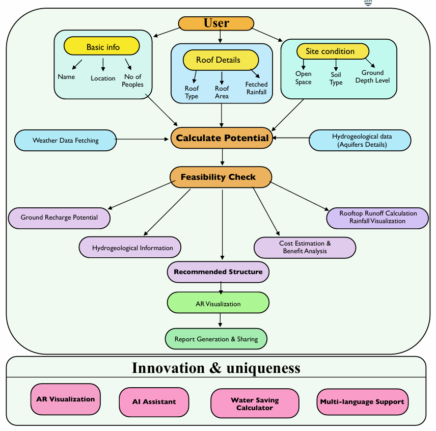
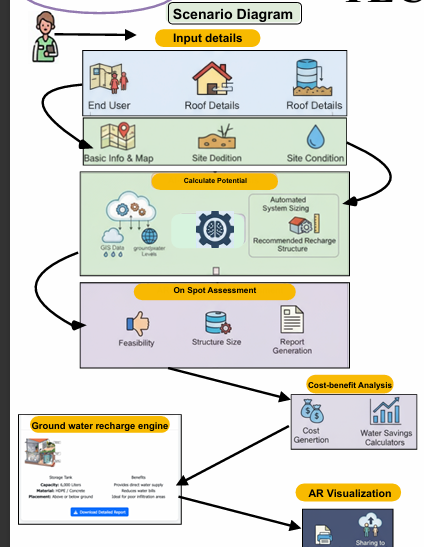
What it does Instantly analyzes user input (location, roof/soil type, area, rainfall) to provide accurate, personalized rainwater harvesting and recharge recommendations.
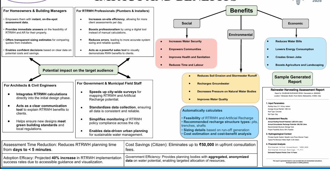
Generates reports on water potential, structure size, cost estimates, and savings—available in multiple Indian languages.
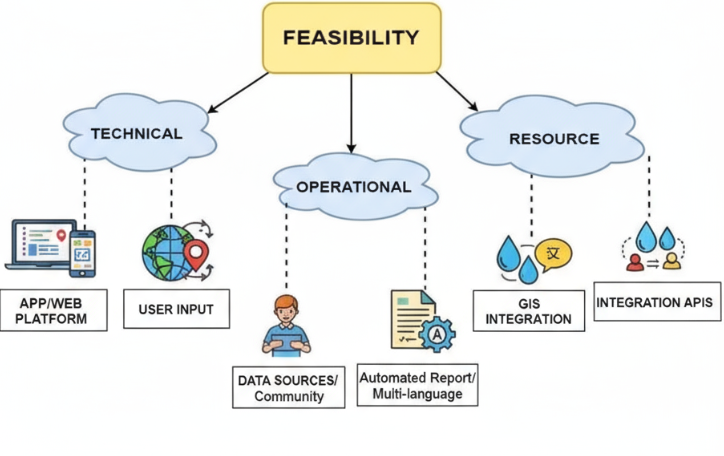
How we built it Developed as a web platform with interactive GIS area selection, integrated local rainfall data, and dynamic scientific calculations for sizing and feasibility.
Used HTML, CSS, JavaScript, and mapping APIs for a user-friendly, responsive experience.
Challenges we ran into Merging diverse geographic and rainfall data for accurate results.
Designing an interface that works for both urban and rural users with varied digital skills.
Handling localization for multi-language support.
Accomplishments that we're proud of Built a multilingual platform accessible to ordinary citizens and experts alike.
Combined real geospatial data with personalized economic analysis for households and institutions.
Delivered on-spot, actionable, and scientifically sound recommendations.
What we learned The importance of blending technology and user empathy to address real-world environmental problems.
Practical ways to integrate GIS, data science, and financial analysis for social impact.
What's next for Hydro Heroes Add offline support and AR features for enhanced visualization.
Automate connection with government water databases for more dynamic guidance.
Launch mobile apps to reach a broader audience and support field usage.
Built With
- arcore
- azure
- chart.js-(data-visualization)-platforms:-web-(responsive-design-for-mobile/desktop)-cloud-services:-aws
- chart.js-(for-data-visualization)-platforms:-web-(responsive-for-desktop-and-mobile)-cloud-services:-aws-or-azure-(for-hosting-and-scalable-compute)-databases:-mongodb-or-firebase-(for-user/input-storage)-apis:-open-meteo
- css-frameworks/libraries:-leaflet.js-(gis-mapping)
- css-frameworks:-leaflet.js-(for-gis-mapping)
- database
- flask
- for
- html
- i18n
- i18n-libraries-for-multi-language-support-feel-free-to-update-with-your-exact-stack-or-preferred-services.##-built-with-languages:-javascript
- imd-weather-api
- india-meteorological-department-(rainfall-data)
- languages:-javascript
- multi-language
- openstreetmap-(mapping-basemap)-other-technologies:-progressive-web-app-features-for-offline-use
- openstreetmap-other-technologies:-pwa/offline-features
- or-firebase-(hosting
- python
- storage)-databases:-mongodb/firebase/firestore-apis:-open-meteo

Log in or sign up for Devpost to join the conversation.