Inspiration
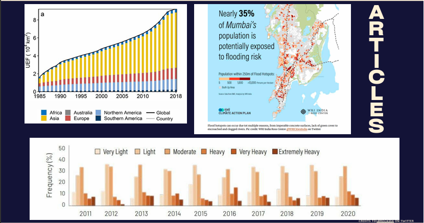
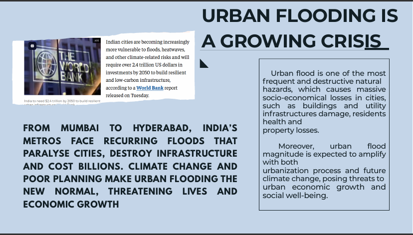
Urban flooding is one of India's most recurring and destructive disasters from Mumbai to Hyderabad, metros face floods every monsoon that paralyze cities, destroy infrastructure, and cost billions. The core problem isn't a lack of weather data, it's that flood alerts operate at the city level, not the micro-level where flooding actually happens. Drainage monitoring is limited, predictive intelligence is largely absent, and by the time emergency response kicks in, it's already too late. We built HydraSense AI because cities need predictive systems, not reactive ones.
What it does
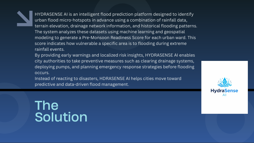
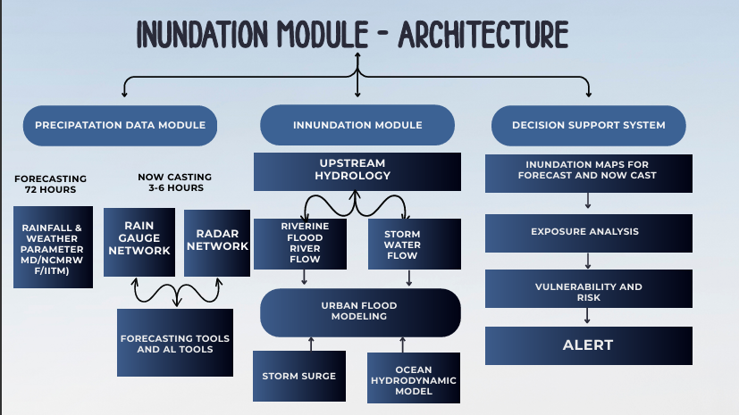
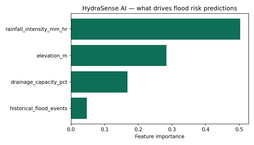
HydraSense AI identifies urban flood micro-hotspots in advance by combining rainfall intensity, terrain elevation, drainage network capacity, and historical flooding patterns for each urban ward. It generates a Pre-Monsoon Readiness Score, a single number from 0-100 that tells city authorities exactly how vulnerable a specific ward is before extreme rainfall hits not after. This turns flood response from reactive to preventive: authorities can clear drainage systems, deploy pumps, and plan emergency response in wards flagged high-risk, before flooding occurs.
How we built it
The current prototype implements a transparent, weighted risk-scoring model across the four core factors, run and validated on representative ward-level data. Each factor is normalized and combined into the readiness score, with wards automatically grouped into Low, Moderate, and High risk tiers. This weighted approach was a deliberate choice for the prototype stage: it's fully explainable, so city officials can see exactly why a ward scored the way it did, which matters for a tool meant to inform real infrastructure decisions.
Challenges we ran into
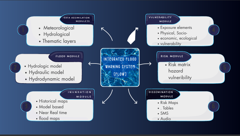
Getting real, ward-level granularity right is harder than city-level flood alerts because it requires combining multiple data types (meteorological, hydrological, and geospatial) that don't naturally live in one dataset. We also had to think carefully about the difference between a black-box ML score and one that officials can actually trust and act on, which shaped our decision to start with an interpretable weighted model before layering in a trained ML model.
What's next for HYDRASENSE AI
The roadmap moves in three stages: first, replacing the current weighted formula with a trained machine learning model (gradient boosting or random forest) validated against real historical flooding outcomes. Second, integrating real-time IoT flood sensors and live rainfall monitoring so predictions update dynamically as conditions change, rather than relying on static pre-monsoon data. Third, adding a citizen reporting layer so residents can submit real-time waterlogging reports, and eventually integrating with city command centers and national disaster management systems as a centralized urban climate resilience layer.
Built With
- climate-resilience
- data-science
- disaster-management
- early-warning-system
- environmental-monitoring
- flood-prediction
- geospatial-analysis
- gis
- github
- hydrology
- machine-learning
- ml/data
- numpy
- pandas
- predictive-modeling
- python
- rainfall-data
- risk-scoring
- smart-cities
- sustainability
- tech
- terrain-analysis
- urban-planning


Log in or sign up for Devpost to join the conversation.