-
-
-
result
Inspiration
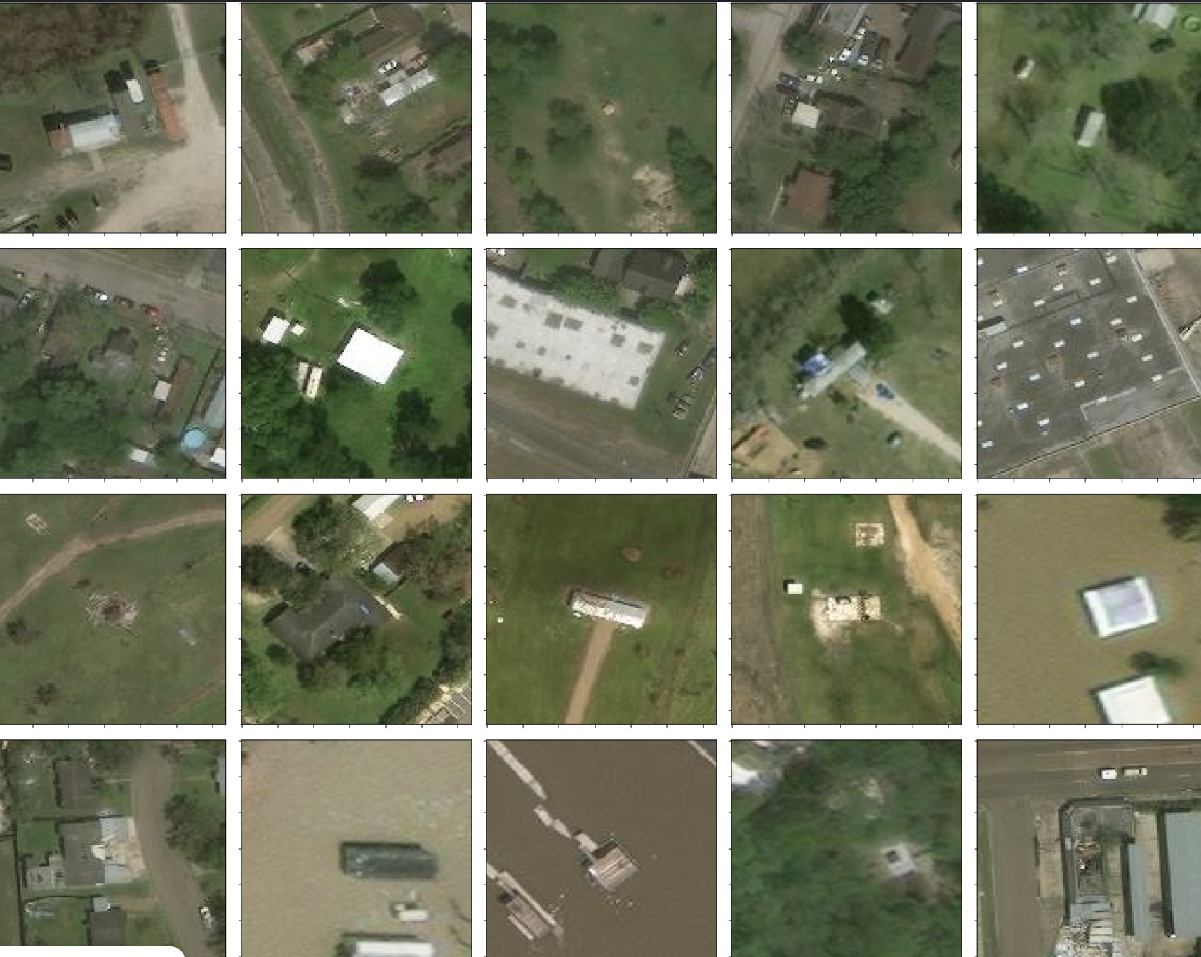
Natural disasters like hurricanes can devastate communities, leaving behind massive destruction. Rapid damage assessment is crucial for timely disaster response, but it’s often delayed due to limited resources. We were inspired to create a solution that could help automate the detection of hurricane-related damage in satellite images using machine learning.
What it does
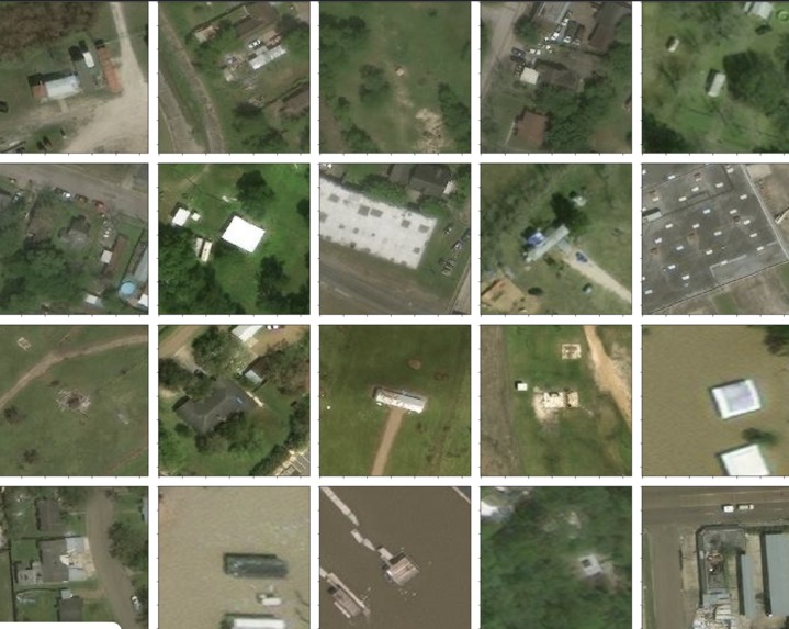
Our project uses transfer learning to classify satellite images into two categories: damaged and undamaged. This binary image classifier leverages a pre-trained convolutional neural network to understand visual patterns and make predictions with a high level of accuracy. The model is fine-tuned specifically for hurricane aftermath detection, helping speed up assessment efforts.
How we built it
We used TensorFlow and Keras to build the model. The process included:
Starting with a pre-trained model (like MobileNetV2)
Freezing the base layers and adding a custom classifier on top
Training the new top layers with our dataset
Fine-tuning the top layers of the base model for better performance
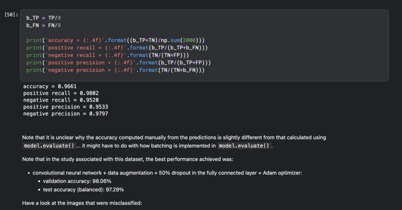
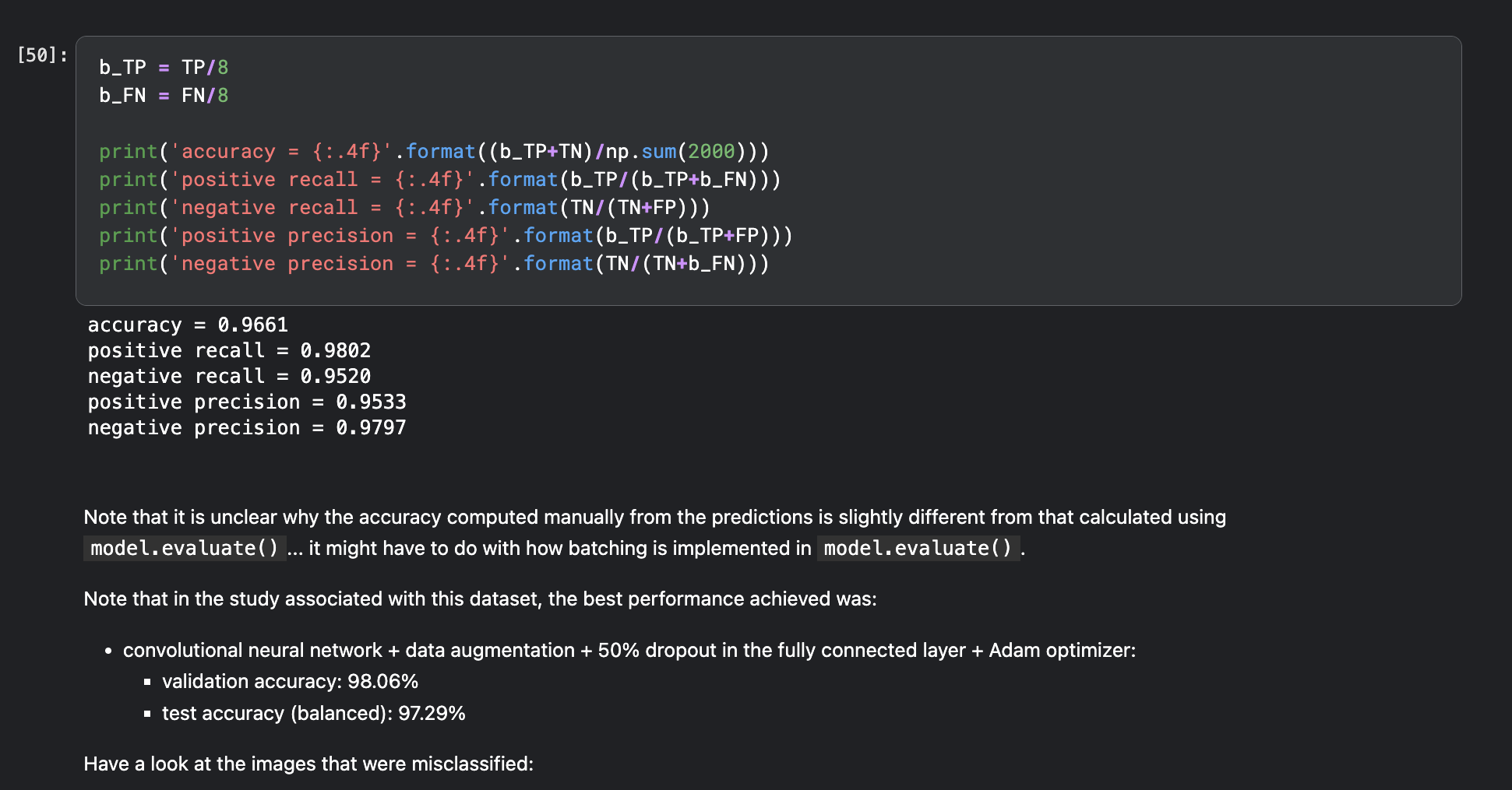
Evaluating the results with metrics like accuracy, precision, recall, and F1 score
We visualized learning curves and confusion matrices to monitor model performance and identify areas for improvement.
Challenges we ran into
Balancing the dataset: Ensuring equal representation of both classes was critical to avoid bias.
Overfitting: Fine-tuning required careful adjustments to avoid the model “forgetting” its pre-trained knowledge.
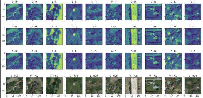
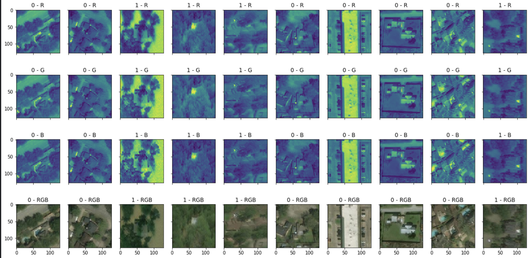
Interpretability: Understanding why the model misclassified some images was not always straightforward.
Accomplishments that we're proud of
Achieved strong validation and test accuracy
Successfully fine-tuned a deep learning model without overfitting
Gained insights into how transfer learning can be applied to real-world disaster response problems
What we learned
The power of transfer learning in reducing training time and improving accuracy
The importance of gradually unfreezing layers when fine-tuning deep models
How to interpret model performance using detailed metrics and visualizations
What's next for Hurricane Impact Detection via Transfer Learning
We plan to:
Integrate data augmentation to make the model more robust
Extend the model to multi-class classification (e.g., low, medium, high damage)
Deploy the model as an interactive web app for field use
Explore combining satellite with aerial drone images for better resolution and accuracy


Log in or sign up for Devpost to join the conversation.