
Structured Abstract:
Question: How does mobility inform epidemic dynamics on the district level in Sierra Leone
Data Used/Wrangled/Processed: Sierra Leone Roads; Sub-national infection dataset, Sierra Leone; general demography Sierra Leone (CIA World Factbook); NEJM article for certain parameters
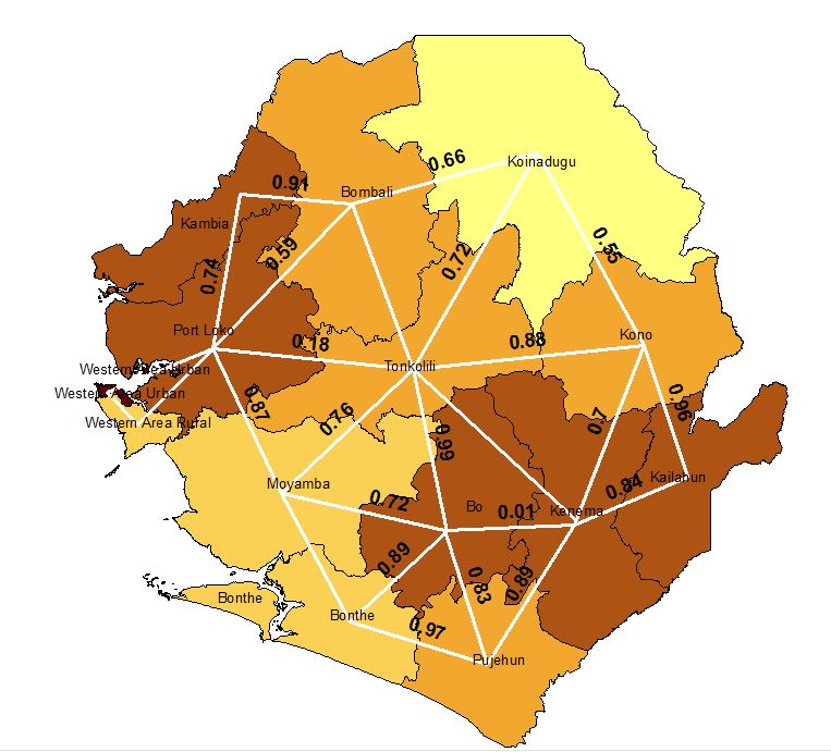
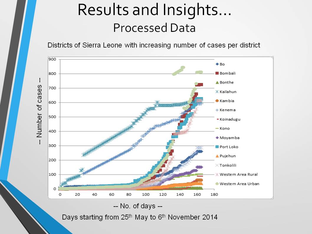
Analysis Approach: SEIR Model with Metapopulation Model Approach (Multi-compartments / SEIR for each district and flows between); Preliminary Training & Testing; Graphs/Visuals; GIS;
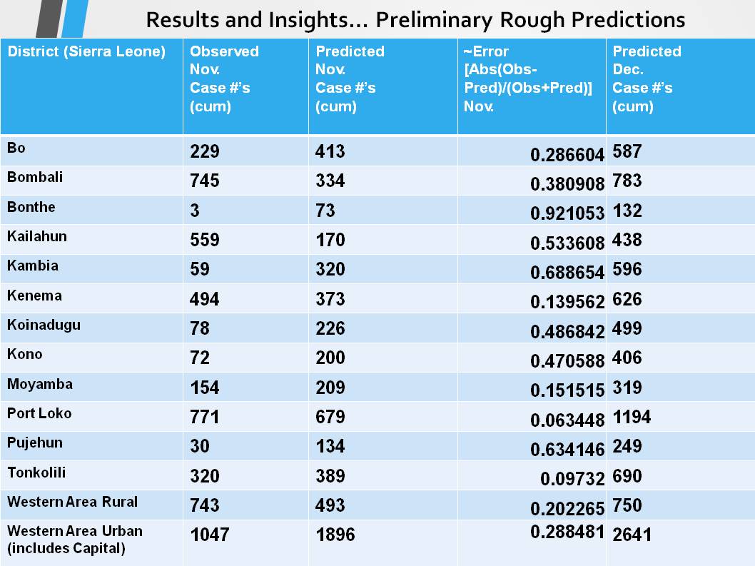
Findings/Limitations: Estimated ~Mobility Weights between Districts; Tested November Predictions Compared to November Observations Cumulative Case Numbers with preliminary measurement of error (need to extend to p-values? need to measure cross-validation by district &/or time); Predicted December
Possible Applications: 1) Predict Epidemic Dynamics In Future Over Time & Space (By District); 2) Use Trained, Validated, Tested Model + all current data mobility + case data to predict optimal locations/expansions of mobility checkpoints/restrictions (locations to test/treat/isolate/restrict-movement/etc.) in order to stem epidemic
Built With
- general-demography-cia-world-factbook
- gis
- nejm-article-parameters-cfr-incubationperiod
- python
- sierra-leone-roads
- sub-national-infection-dataset

Log in or sign up for Devpost to join the conversation.