Inspiration
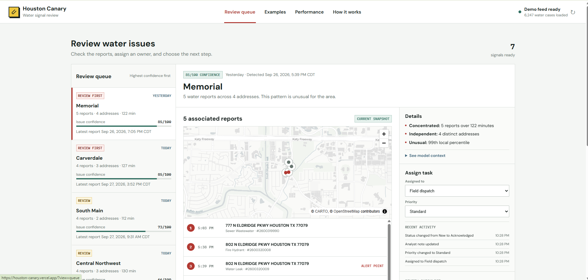
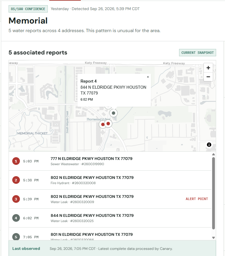
Houston Canary began as a Houston Hackathon project with a central question: could Houston's existing 311 reports act like a distributed human sensor network to reveal larger infrastructure problems before they become obvious? Our initial hypothesis was that crossing different complaint categories—like a street hazard combined with a water leak—might reveal hidden incidents. However, after analyzing 481,091 canonical 2024 Houston 311 requests, we discovered that same-category water clustering was a much stronger predictor of escalation. This inspired us to pivot and build a dedicated early-warning radar for emerging water-report surges.
How we built it
Rather than asking residents to download a new app, Canary sits downstream of the official Houston 311 ArcGIS data stream. We built a live ingestion pipeline that handles pagination, coordinate validation, and canonicalization to extract water cases.
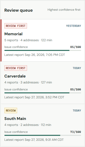
For the predictive engine, we engineered a scoring system (BASELINE_V1) that ranks events based on four critical factors: local historical anomaly, arrival acceleration, address diversity, and spatial coherence. We also integrated official Houston water infrastructure GIS data to map 290,977 water-main segments. Finally, we built a strictly chronological "future-locked" Replay mode that simulates historical events exactly as they unfolded, ensuring our model never benefits from hindsight.
Challenges we ran into
Our biggest technical surprise was that complex machine learning underperformed our statistical baseline. We trained Logistic Regression, XGBoost, calibrated ML, and ExtraTrees models, but all of them performed worse than our interpretable rules-based model at the exact same alert volume. We also found that integrating water network GIS features actually lowered our predictive accuracy in testing, forcing us to relegate the GIS data to an explanatory UI layer rather than a production scoring dependency.
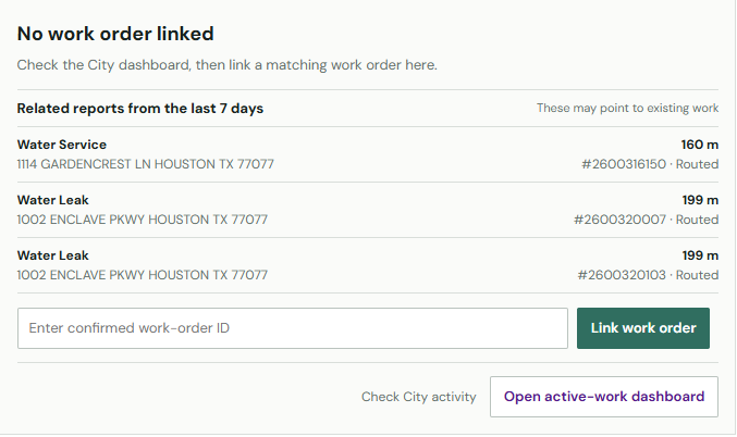
Additionally, we faced ground-truth limitations: because there is no reliable public row-level work-order match to confirm physical pipe failures, we had to define our target strictly around 311 report escalation (a Tier D verification). We also had to build safeguards around the official city data endpoint, which occasionally serves stale data, requiring us to design robust UI freshness states.
What we learned
We learned the importance of focusing on high-quality alerts over sheer volume. Simple fixed triggers fire constantly, but our BASELINE_V1 model successfully prioritizes the strongest events, capturing a 3.38x predictive lift while keeping analyst volume manageable at roughly one priority alert per day. We also learned that true spatial coherence requires more than just proximity; looking at address diversity prevents us from over-indexing on a single resident repeatedly reporting the same issue.
What's next for Houston Canary
Our immediate engineering priority is building a Phase 5 "Time Travel" mode, which will allow analysts to use a datetime slider to freely explore validated historical data and see exactly what the Canary radar would have known at any given minute in the past. Long-term, our vision is to partner directly with Houston Water/Public Works to ingest internal work-order ground truth. With actual crew dispatch and pipe-break repair data, Canary can evolve from a 311-triage tool into a confirmed infrastructure-incident early warning system.
Built With
- api
- duckdb
- esri
- gis
- parquet
- xgboost


Log in or sign up for Devpost to join the conversation.