Inspiration
When disaster strikes, communication networks fail, and chaos ensues, connecting those in immediate need with nearby resources or volunteers is incredibly difficult. Centralized shelters are often overcrowded, and good samaritans with available beds, food, or medical supplies struggle to find the people who need them. We wanted to build a decentralized, localized, and resilient network that seamlessly bridges the gap between those experiencing a crisis and those equipped to help, empowering communities to support each other directly.
What it does
Waypoint is an AI-powered crisis intervention and resource mapping platform. It features two mirroring interfaces built on top of an interactive, full-bleed map:
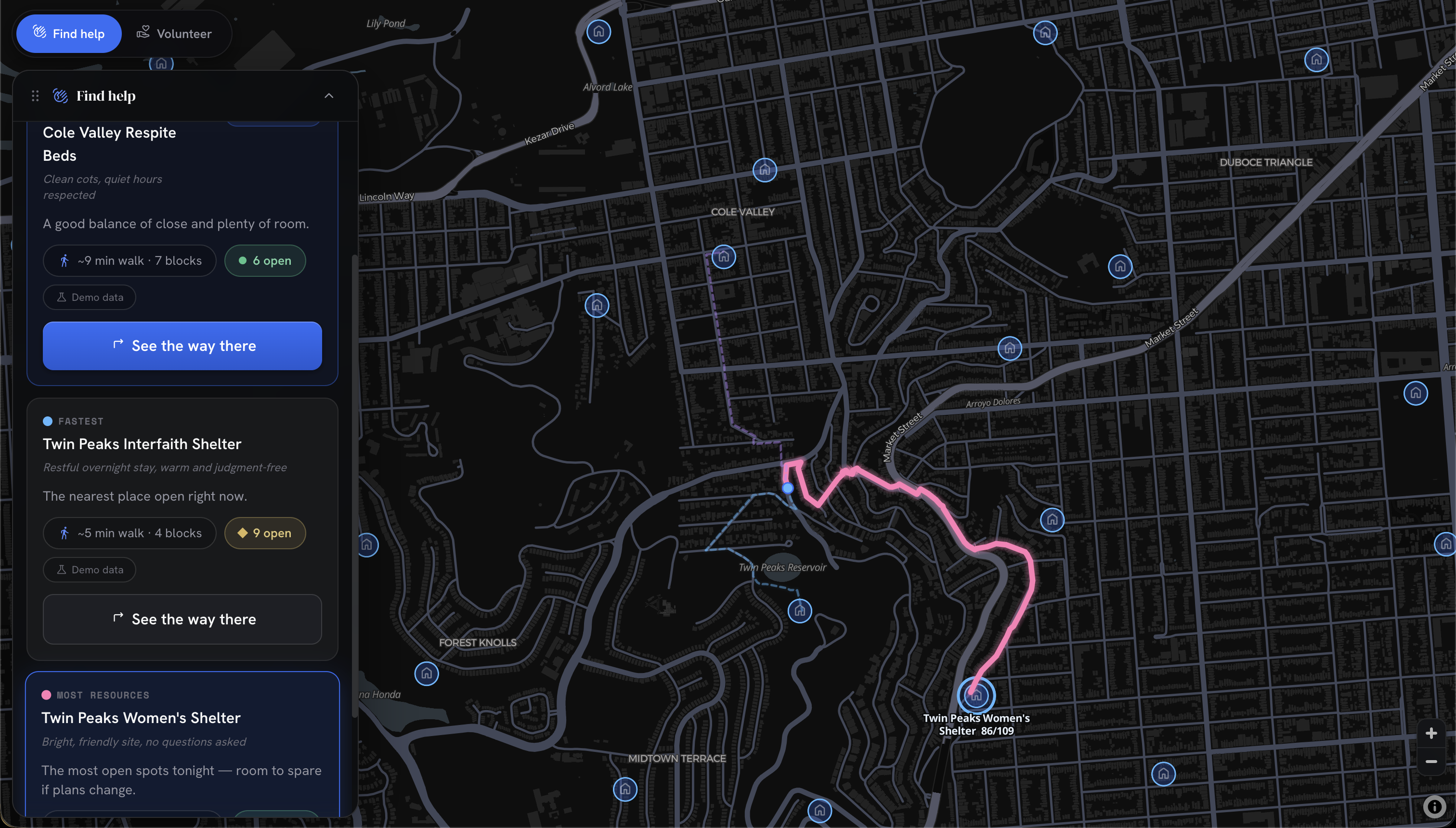
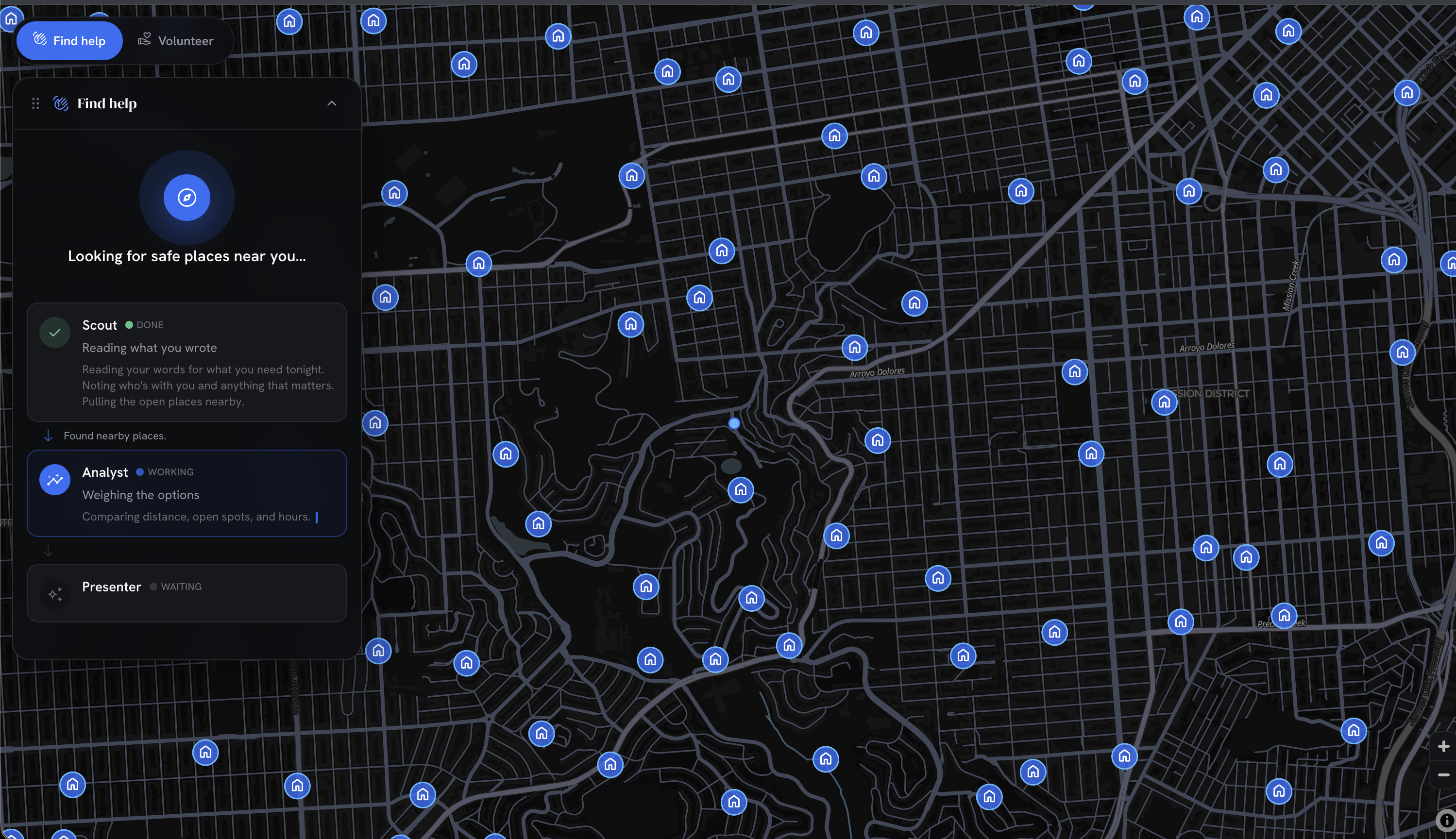
- For People in Crisis: A zero-friction, login-free experience where users can simply type their needs in plain English (e.g., "I lost my home and need a place to sleep for my family of four"). The system uses an AI agent crew to analyze their request, geolocate them, and match them with the three best resource options (Closest, Best Fit, and Best Overall), providing turn-by-turn routing to safety.
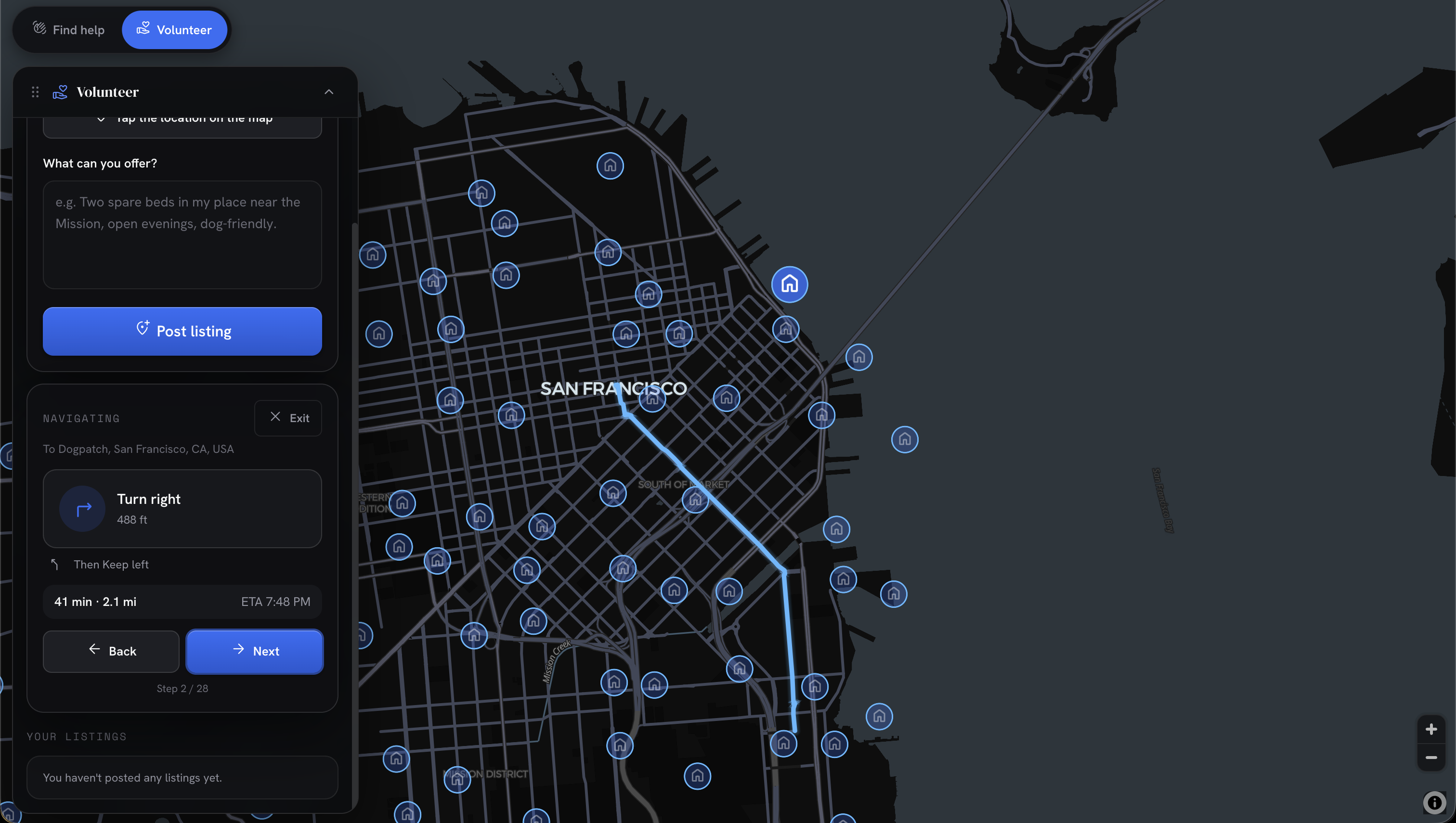
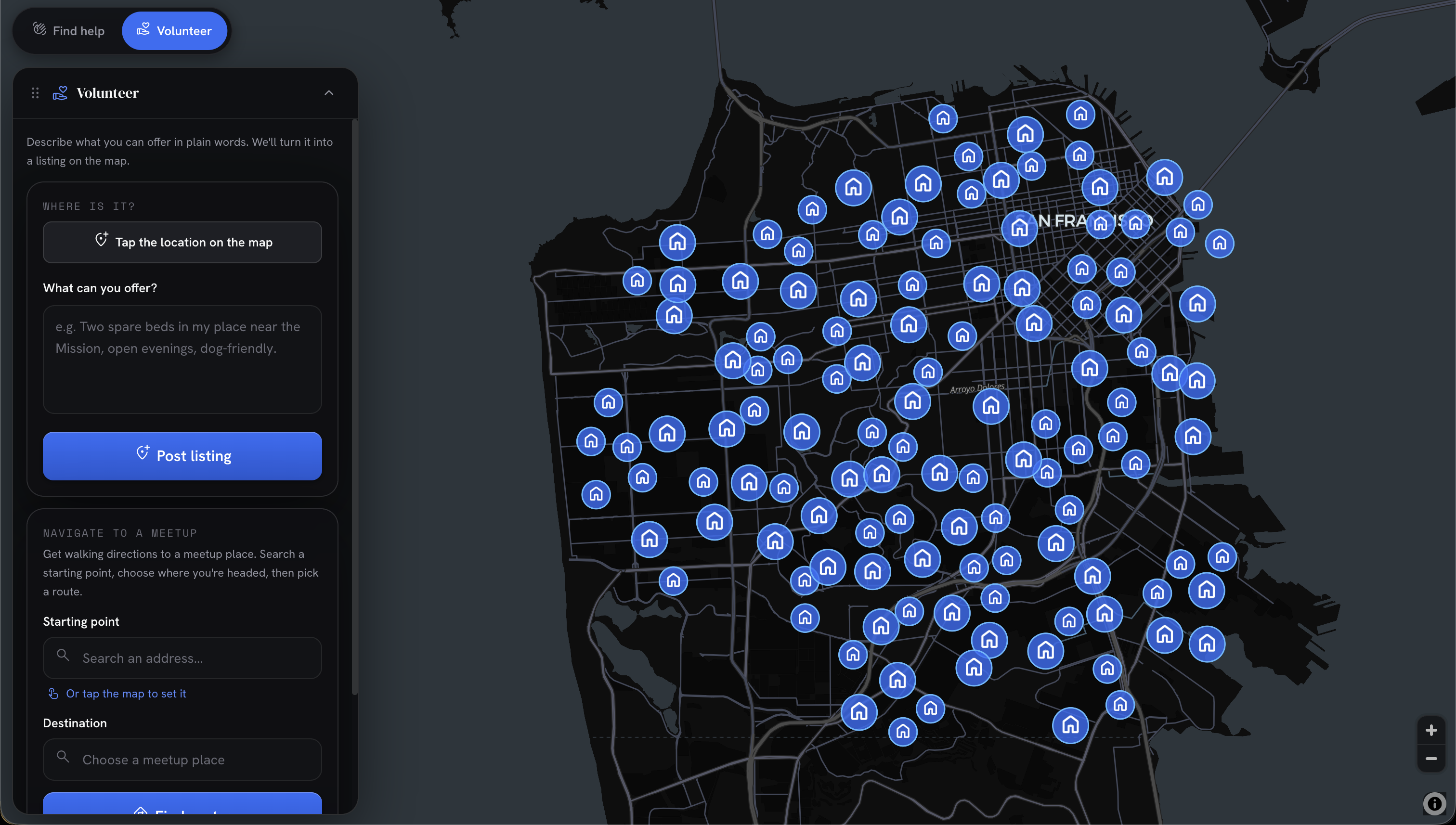
- For Volunteers: An intuitive dashboard where good samaritans can tap their location on the map and describe what they can offer. An LLM parses their text into structured resource nodes (beds, food, hygiene, medical, charging/wifi) with capacity tracking, immediately publishing them to the live map.
How we built it
We built the frontend as a responsive, mobile-first web app using React and Vite, styled with Tailwind CSS. The core map experience is powered by MapLibre GL, allowing for fluid, interactive geographic data visualization. We implemented a custom dual-panel UI (draggable glass cards) to ensure the map remains the central focus.
For the AI matching and resource parsing, we integrated the Anthropic Claude API. The AI operates as a crew of reasoning agents that evaluate crisis requests against available volunteer nodes. We also built custom geolocation services, implemented robust accessibility standards, and utilized i18next to ensure the platform is accessible to non-English speakers during emergencies.
Challenges we ran into
- Unstructured Data to Structured Resources: Volunteers write what they have in a myriad of ways. Reliably using an LLM to parse freeform text ("I have a couch and some canned soup") into structured database entities (Capacity: 1 Bed, Food) with fallback offline heuristics took significant iteration.
- Privacy vs. Utility: Protecting the privacy of vulnerable people in crisis while sharing the public locations of volunteers required careful architectural separation. We designed the "Crisis" side to be entirely anonymous and session-based.
- Map-Centric UI/UX: Building a dual-mode interface where a full-bleed map serves as the home screen, without the UI feeling cluttered on mobile devices, required fine-tuning draggable panels, touch targets, and map controllers.
Accomplishments that we're proud of
- The Zero-Login Crisis Flow: We successfully removed all friction for a person in an emergency, getting them from "I need help" to a routed safe haven in just a few taps.
- AI "Crew" Matching: Instead of simple keyword search, our multi-agent reasoning panel analyzes the nuance of a user's request to find the genuinely best fit, explaining its reasoning to the user to build trust.
- The seamless Offline Fallback logic that ensures the volunteer resource posting still functions (using client-side keyword parsing) even if the AI endpoints fail or connectivity degrades.
What we learned
We learned a lot about spatial data management, specifically how to handle map states and real-time markers using MapLibre GL within a React ecosystem. We also discovered the profound impact that well-designed, empathetic UI (like reassuring copy and accessible tap targets) can have in high-stress, crisis scenarios. Finally, we refined our skills in prompt engineering to ensure our LLMs consistently output structured data for resource allocation.
What's next for Waypoint
- Offline-First Capabilities: Implementing Service Workers and PWA features so the app can function entirely offline or over mesh networks during cellular outages.
- Verification Systems: Adding an optional lightweight verification layer for volunteers to ensure safety without adding too much friction.
- Integration with Official Emergency Services: Allowing local authorities (like FEMA or the Red Cross) to broadcast official shelters directly onto the Waypoint map alongside grassroots volunteer resources.
Built With
- crewai
- maps
- openrouteservice
- python
- typescript

Log in or sign up for Devpost to join the conversation.