


Concept\
After experiencing a recent storm, and the subsequent pandemonium, we were inspired to create a system that would conglomerate all current emergency, weather, and public works data into a seamless and easy to use interface. Using the revolutionary ESRI mapping system, we were able to layer 311, Police, Fire, Weather, and Hurricane data, resulting in one map that accomplishes what previously took four.
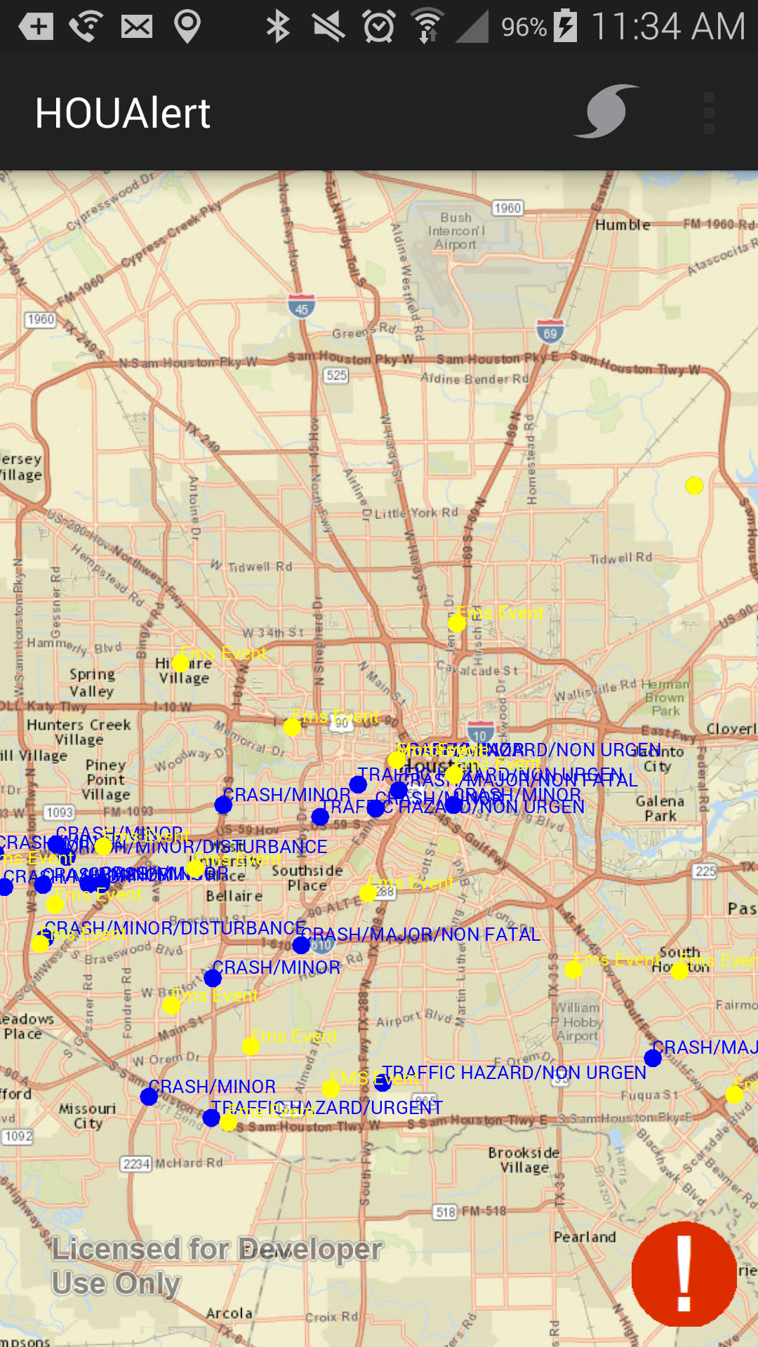
Android\
Our Android application allows mobile users to quickly view and distinguish different public works as well as emergency data, and lets the public quickly submit new 311 requests without going through the current nightmarish forms. It also lists various emergency data that people might find useful weather in times of distress or calm.
Web\
The web interface implements many of the same things as the Android application while allowing room to grow. 311 data is fully operational, while HPD and HFD data is frameworked in anticipation of direct API access. It lists the same preparation, recovery, and relief information as the app, letting users prepare at home and on the move.
What we learned\
This was our first hackathon, so we had a lot to learn. We changed our idea within the first 30 minutes, decided to use a different mapping service than we had tested, and even managed to lock ourselves out of a server. Despite all the hardships, we had a lot of fun and met some awesome people. In the end we feel HOUalert.us is a solid representation of the tears, sweat, and redbull we poured into this 24 hour event.
What's next for HOUalert.us\
We hope to continue work on HOUalert.us, and adapt it to fit whatever is best for the citizens of Houston.


Log in or sign up for Devpost to join the conversation.