Inspiration
Have you ever met the situation that you searched for a building on Google, and it shew that the building is only a 3-minute walk, but you just couldn’t find it? Yes, Google Maps sometimes just doesn't know our campus at all. But we, BLUE JAYS, do. So we want to build an app that can present the information which is only known by Hopkins students. Our ultimate goal is that by using our app students can gain full access to JHU campus life
What it does
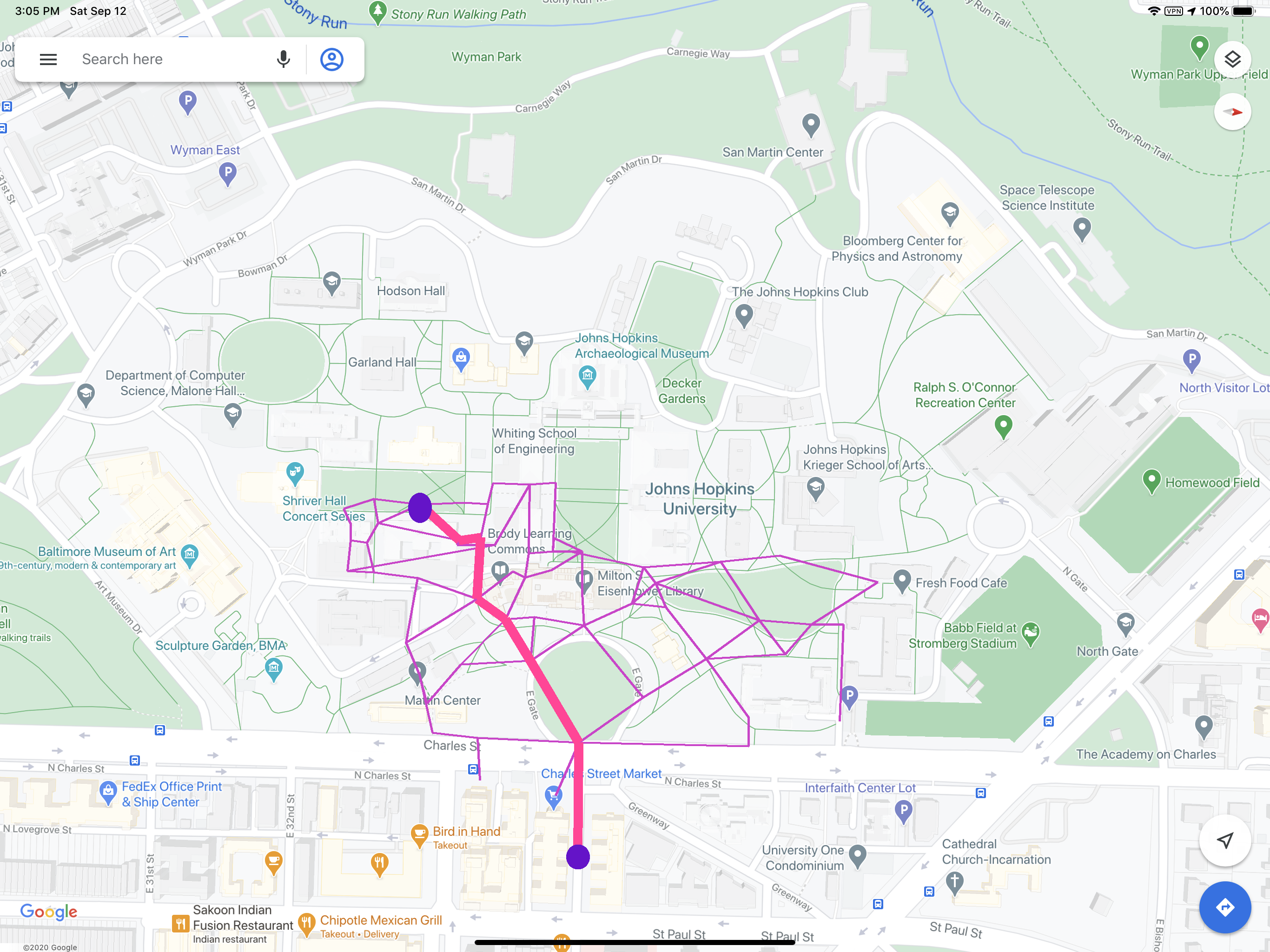
This app's map system embeds all short cuts of our campus, including tunnels and passages between buildings. We will give customized route planning based on different weather situations. For example, the app will prioritize the route through buildings and arcades when raining. Also, when planning path for people with disabilities, we always avoid stairs. Besides all these, users can also search for places by functions. Now we have three types of functions: meal, workout, and self-study. When searching for a certain function, all buildings that match the condition will be listed with their differences and transit time for users to choose.
How I built it
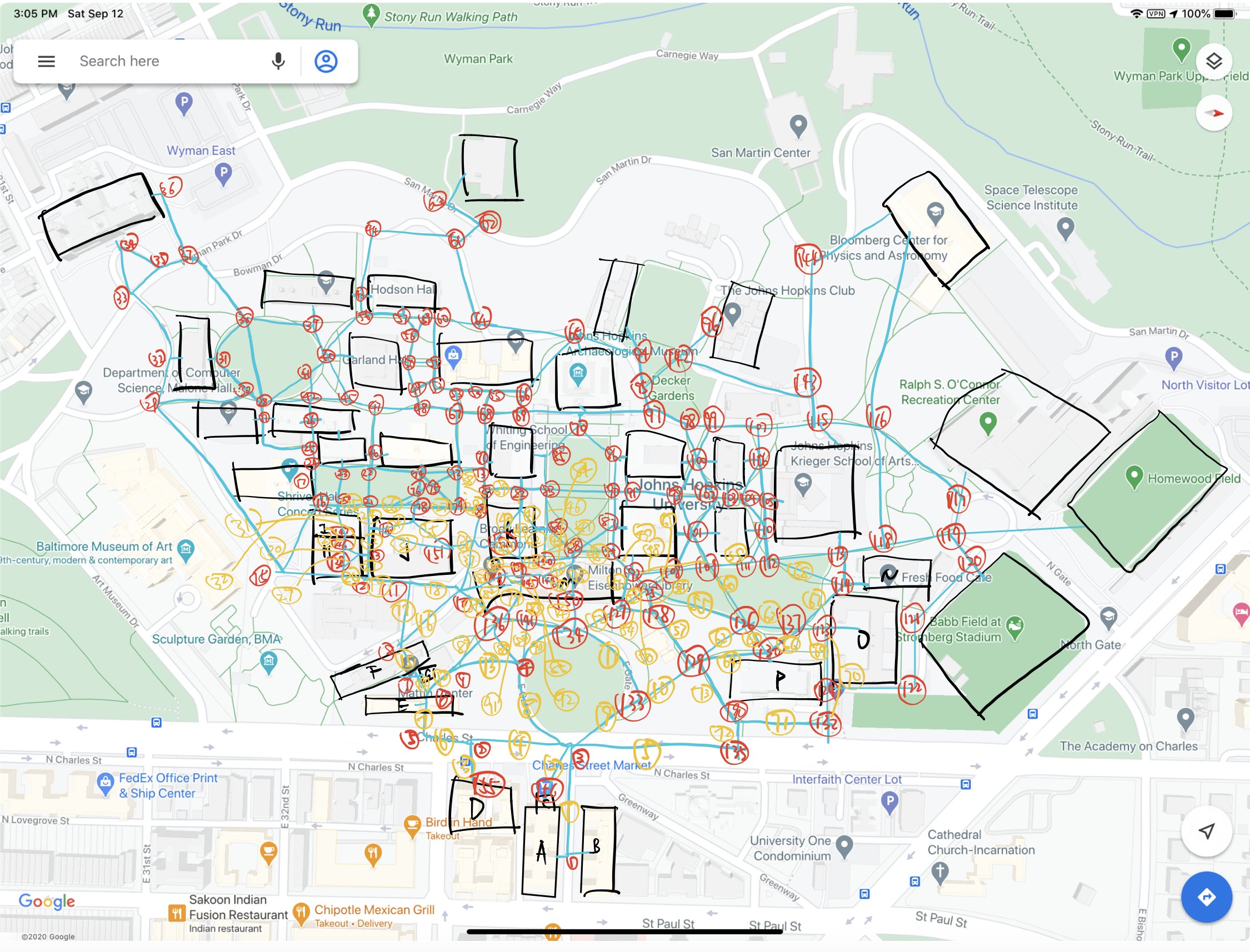
We built it with Python. We constructed the data structure with nodes class(which includes junctions, and building entrances) and roads class. We assign different attributions to different roads and buildings. We used Dijkstra's Algorithm to do the pathfinding. Because of time limit and lack of experience, we utilized Pillow to achieve the visualization of the map and route. For the database, we manually drew the campus map to make sure that it includes all short cuts. Then we input them into .csv files for the program to scan
Challenges I ran into
It is hard to integrate so much information on the map to a .csv file. And we spend plenty of time adjusting the visualization of routes and nodes to make the map more readable.
Accomplishments that I'm proud of
The route planning based on different weather situations is so useful
What I learned
How to build a simplified map system
What's next for HopGuide
We plan to add time factors in the future so that we can reflect the population density of different buildings at different times in a day. Also, we plan to integrate professors' office locations with our map so that students can found where to meet professors simple by typing in their names


Log in or sign up for Devpost to join the conversation.