-
-
Himalayan Relief Project from Avalanche
-
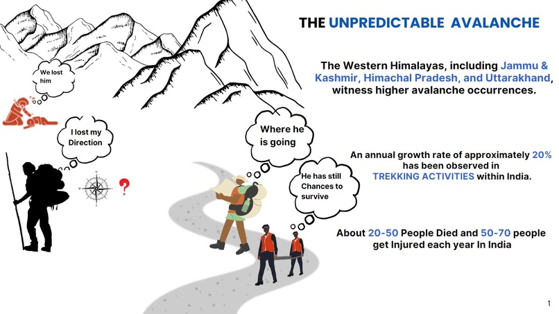
The Unpredicted Avalanche and their Effects on Trekkers and people out there
-
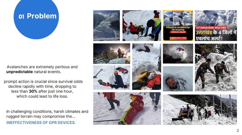
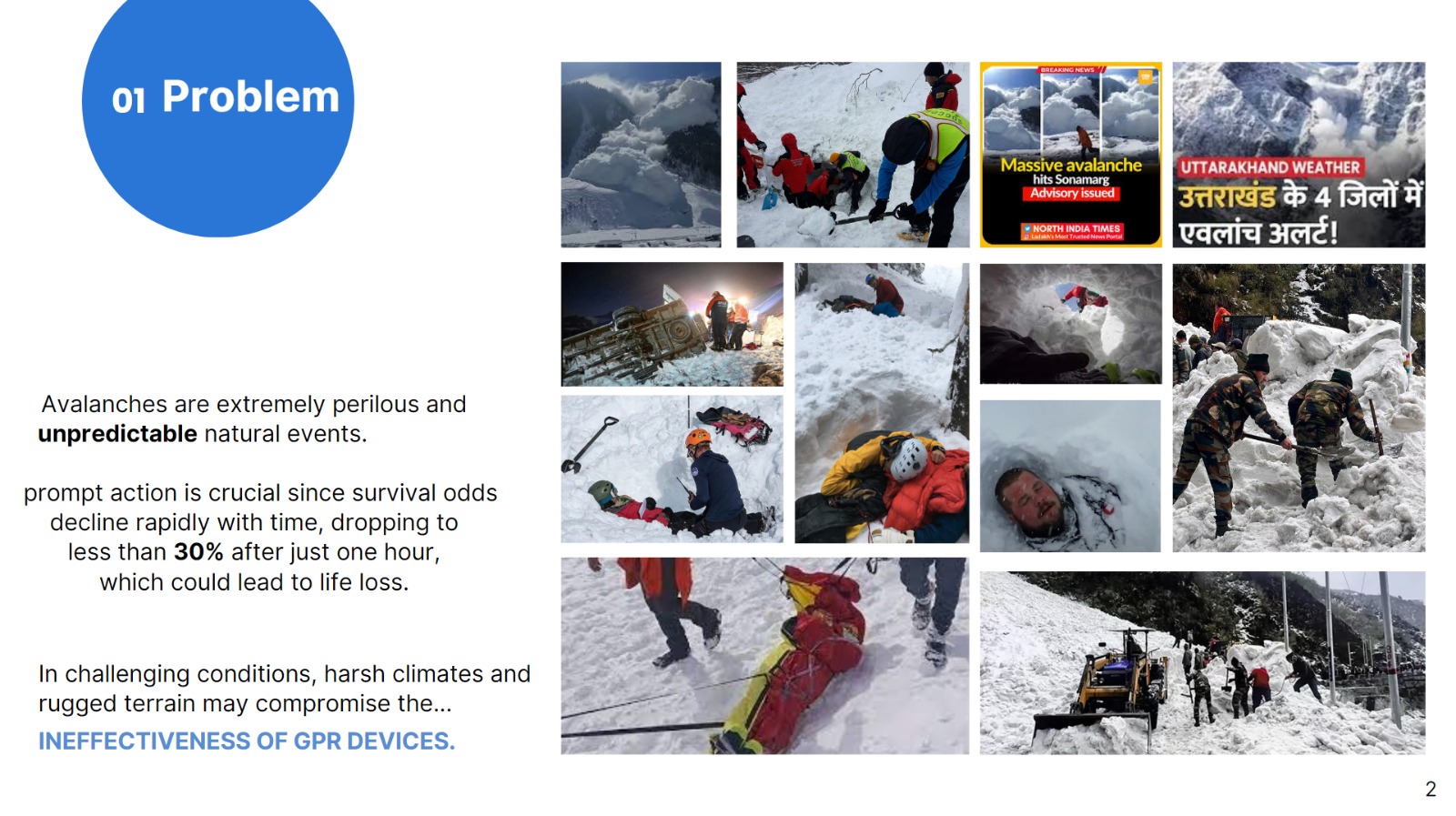
Problem Statistics and Images
-
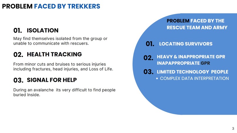
Problem Faced by both Trekkers and By Rescue Team
-
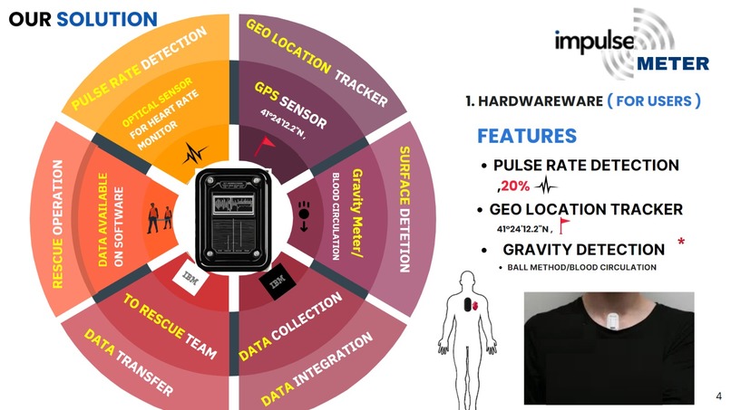
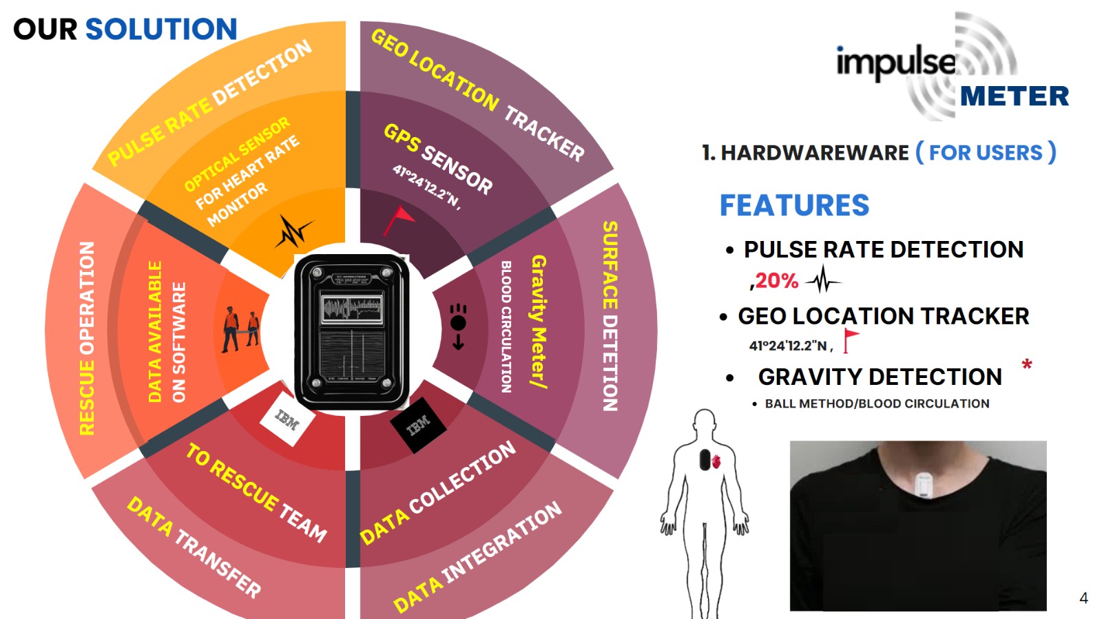
Solution ( Hardware)
-
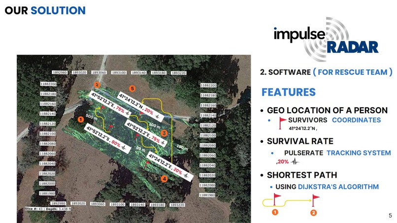
Solution( Software)
-
 GIF
GIF
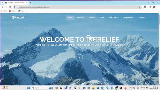
**CLICK ON** Website Demo ( SaaS) Software as a service
-
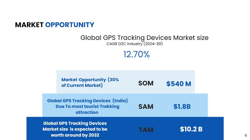
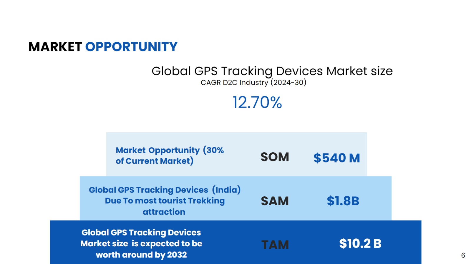
Market Opportunity ( TAM, SAM, SOM)
-
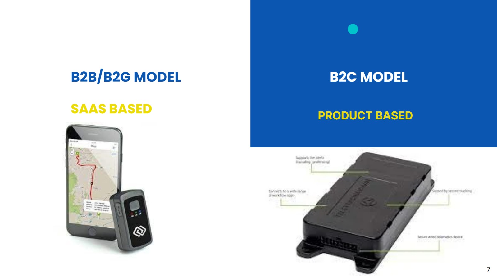
Business Model
-
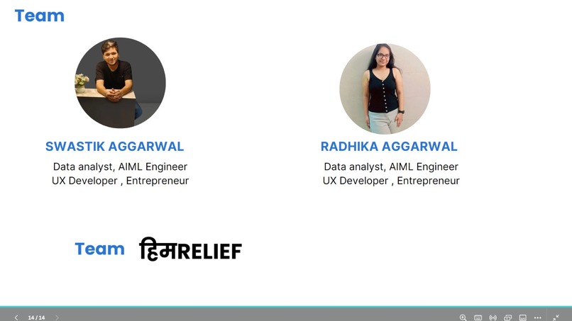
Our Team


Story
We meet a person who is the survivor of the Mount Everest Avalanche which recently came in 2023. He told us how he and his Team lost many people during the Avalanche, and how they faced lots of Issues such as
- Lost of Directions: when buried in Snow, People cannot find which side is Up⬆️, Down⬇️, Left⬅️, or Right ➡️ and die because of Suffocation and lack of Oxygen 😷💀
- Lack of Communication with the Rescue team: At times when buried inside snow it's hard to communicate with the rescue team and Teams find it a challenge to get the exact location of the Trekkers, 🤳📞🗣️🗺️🫡
- Heavy and Bulky Machines with inappropriate and insufficient data: This is always the Biggest Challenge for the Rescue teams and requires a lot of Manpower to rescue at such places. 📠
Problem Statement
An unpredictable avalanche would indeed be a force of nature to contend with!
PROBLEM FACED BY TREKKERS
- Isolation: At times avalanche occurs when trekkers are completely isolated and lose their direction. It isn't easy to find the exact directions, where to dig, to come outside the access snow.
- Health Tracking: This is the biggest challenge for the rescue team to track the health status of Each trekker who got stuck during the Avalanche and Their Exact identity. It's very hard to predict the conditions of each trekker if they are alive or dead. and gives a pure dilemma to save whom first and what's the exact location...
- Signal for Help: During an avalanche its very difficult to find people
buried inside.
PROBLEMS FACED BY THE RESCUE TEAMS AND ARMY
- Locating Survivors
- Heavy & Inappropriate GPR System
- Limited Technology People - Complex Data Interpretation
Solution
We are Bringing HimRelief, an Embedded Technology (Including both hardware and software)to rescue People in avalanche conditions in Mountain areas saving many precious lives.
Hardware Solution: In our Hardware solution we are introducing an impulse Meter, Specially designed for Trekkers for Data Collection, such as Pulse Rate Detection for Life Expectancy, Geo location using Satellite API integration for appropriate location of Trekker and Gravity Detection, To help Users find which one is a downside so they can always dig upwards whenever they are stuck in the snow, during an avalanche and all these data will be collected from each device and transferred to the Authorities concerned with rescue which directly helps them to understand the number of people stuck out there, and decision-making,
Software Solution: In our Software solution, we introduce Impulse Radar, which is specifically designed for Rescue Teams having features such as Exact Geo location of a person, Data for survival rate ( with most accurate data for health Tracking) and most importantly, Finding the shortest Path, to save the nearest and those who had more chances to survive during the avalanche For this we have used a famous and efficient Algorithm, Dijkstra's Algorithm.
Not only does it help in decision-making, also helps to communicate better with the survivals and relieve those heavy and Bulky Machines
Market Opportunity
Not only this, we saw this as a good Market Opportunity worldwide, with a TAM Of more than 10.2 Billion dollars in the Tracking device Industry,
also, this Technology can be useful in disaster-prone areas of landslides, where Trekking is majorly done.
TAM: $10.2 B Global GPS Tracking Devices Market size is expected to be worth around by 2032.
SAM: $1.8B Global GPS Tracking Devices (India) Due To most tourist Trekking attractions.
SOM: $540M Market Opportunity (30% of Current Market).
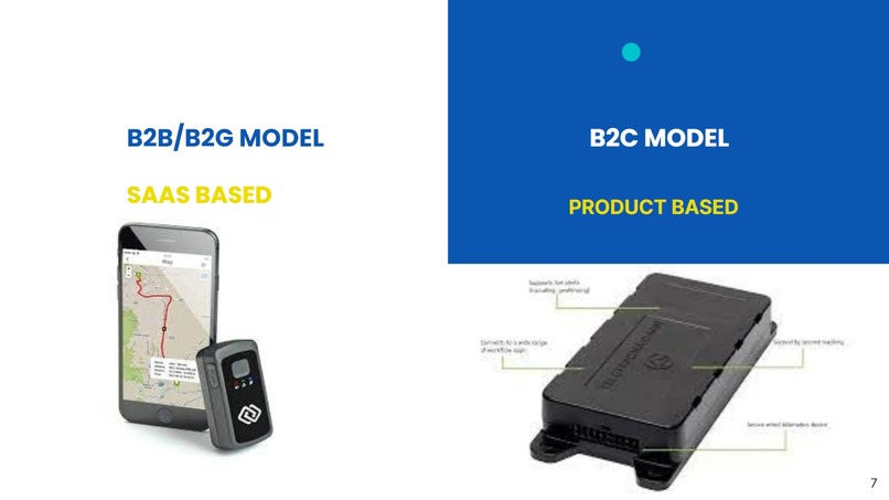
Business Model
We are Dealing with Both B2B/B2G and B2C, where:
B2C: We will be selling the Devices to the users ( ⛷️Trekkers) which can be easily wearable and will collect Necessary data ( Pulse rate, Geo Locations) to rescue you at times of Natural Calamities🏔️ ❄️
B2B/B2G: we will be Dealing with governments/Non-profits or the Rescue teams of countries for accessing the Data
Accomplishments that we're proud of
- Implementing Data Structures that we learned in Tenure of College: Diskrajas's Algorithm ## Challenges we ran into Range Testing is what we looking to continue forward
What's next for HimRelief
We Just not stoping till Avalanche, But this system can also be much more effective in many areas such as Forest Fires, Land slides , Earthquakes etc to rescue people


Log in or sign up for Devpost to join the conversation.