


Inspiration
Heirs’ property issues disproportionately affect low-income communities, leading to generational loss of wealth, displacement, and community instability. Inspired by the need to address this hidden crisis, our project aims to protect vulnerable households from legal and economic challenges.
What it does
identify high areas for heir property issues
How we built it
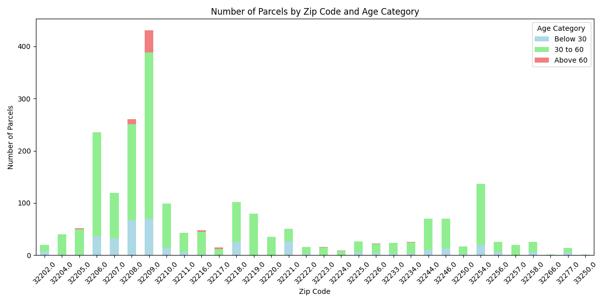
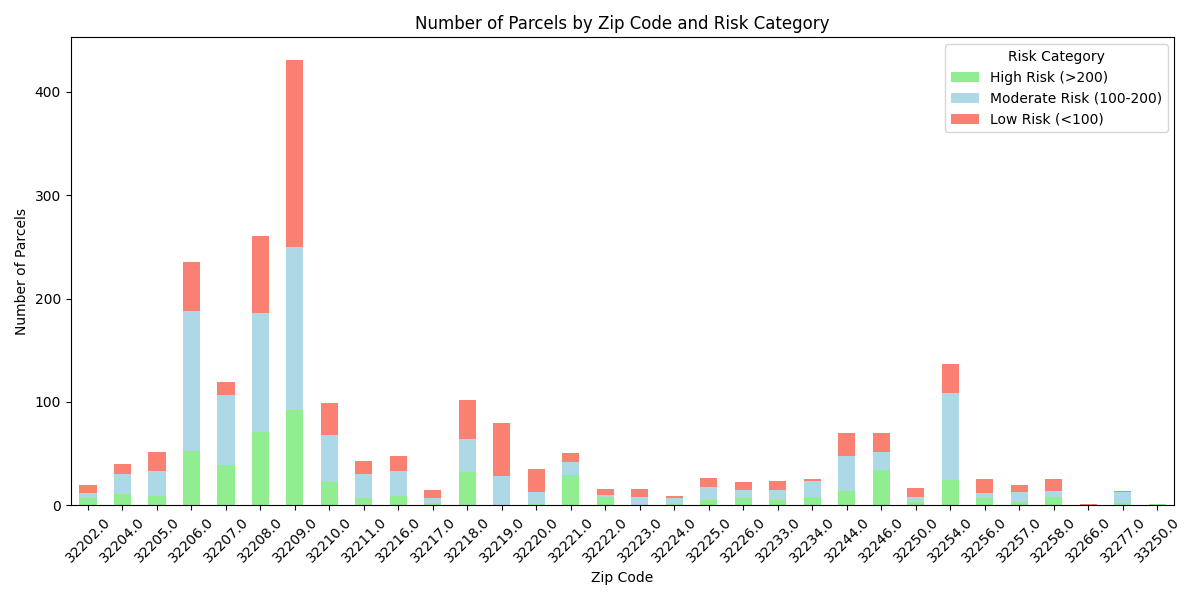
Here, as first step, we cleaned and prepped the data sets before starting the analysis then stated looking at the data and figured out which properties we can help/ which are already sold or in selling phase. based on the previous records for zip codes, we identified high risk areas where properties are getting sold and map them with the property data who needs active help. in similar way, we also did analysis on age and income categories. gave the cumulative risk number for each parcel and based on that, we get the data on very high risk properties for each zip code and narrowed down which area needs substantial help.
Challenges we ran into
Data Gaps: Identifying accurate and comprehensive property data, including ownership histories, was difficult due to incomplete records or lack of digitization. Geographic Mapping: Integrating geographic data with demographic and property information presented technical challenges in ensuring accuracy and scale.
Accomplishments that we're proud of
Created a visual map of high-risk areas in Duval County, enabling policymakers and community groups to easily target interventions.
What we learned
We learned that historical and land data is often fragmented, necessitating creative solutions for filling gaps and cross-referencing various sources.
What's next for Heirs property: Risk Mapping & Analysis for Duval County
Launch community workshops and webinars to educate vulnerable households about their property rights, legal resources, and steps to prevent loss of heirs’ property.


Log in or sign up for Devpost to join the conversation.