The problem HeatWise AI solves The Problem ISRO captures massive Earth Observation (EO) data, but it sits in raw raster formats that State Municipal Corporations cannot easily interpret or use. Without in-house GIS teams, city administrations still rely on delayed field surveys and blanket advisories during deadly heatwaves.
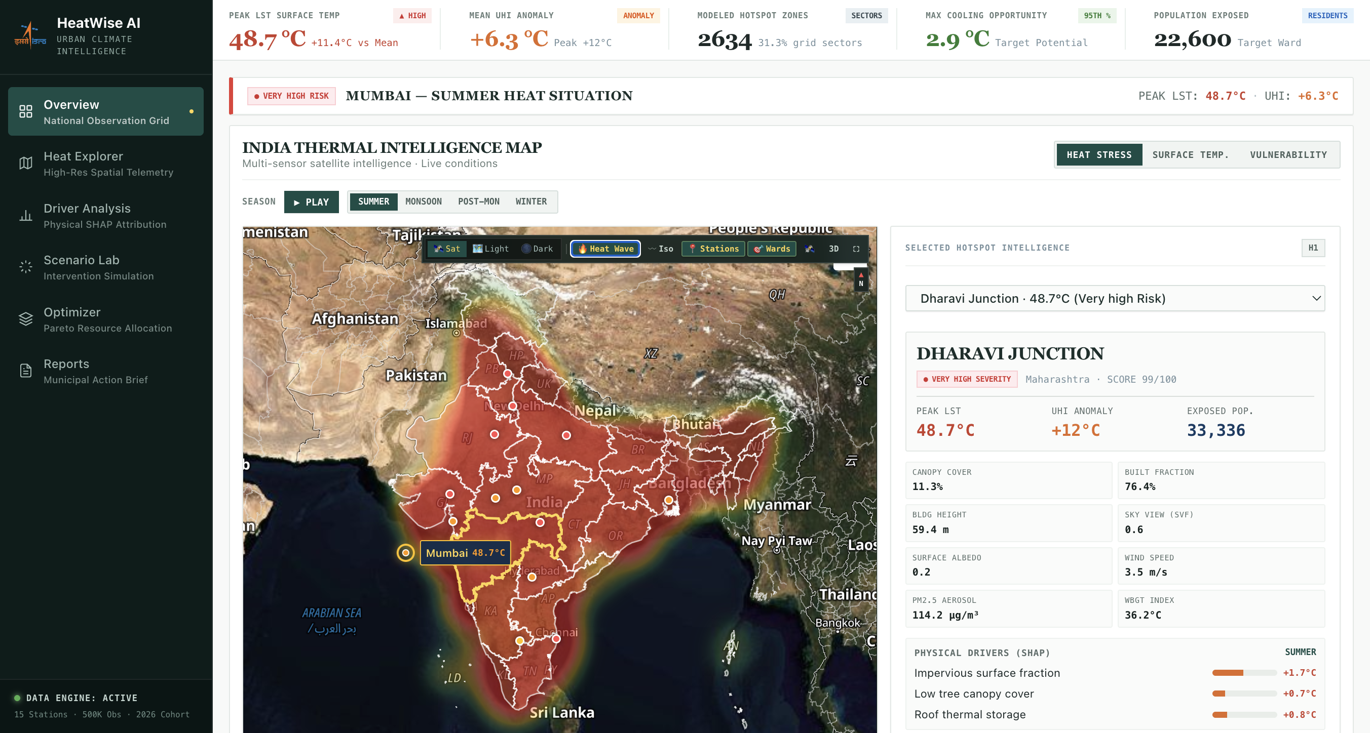
How State Municipalities Use It Automated Ward-Level Telemetry: Converts raw space telemetry into live thermal stress grids across all 36 Indian States and UTs with zero manual GIS processing.
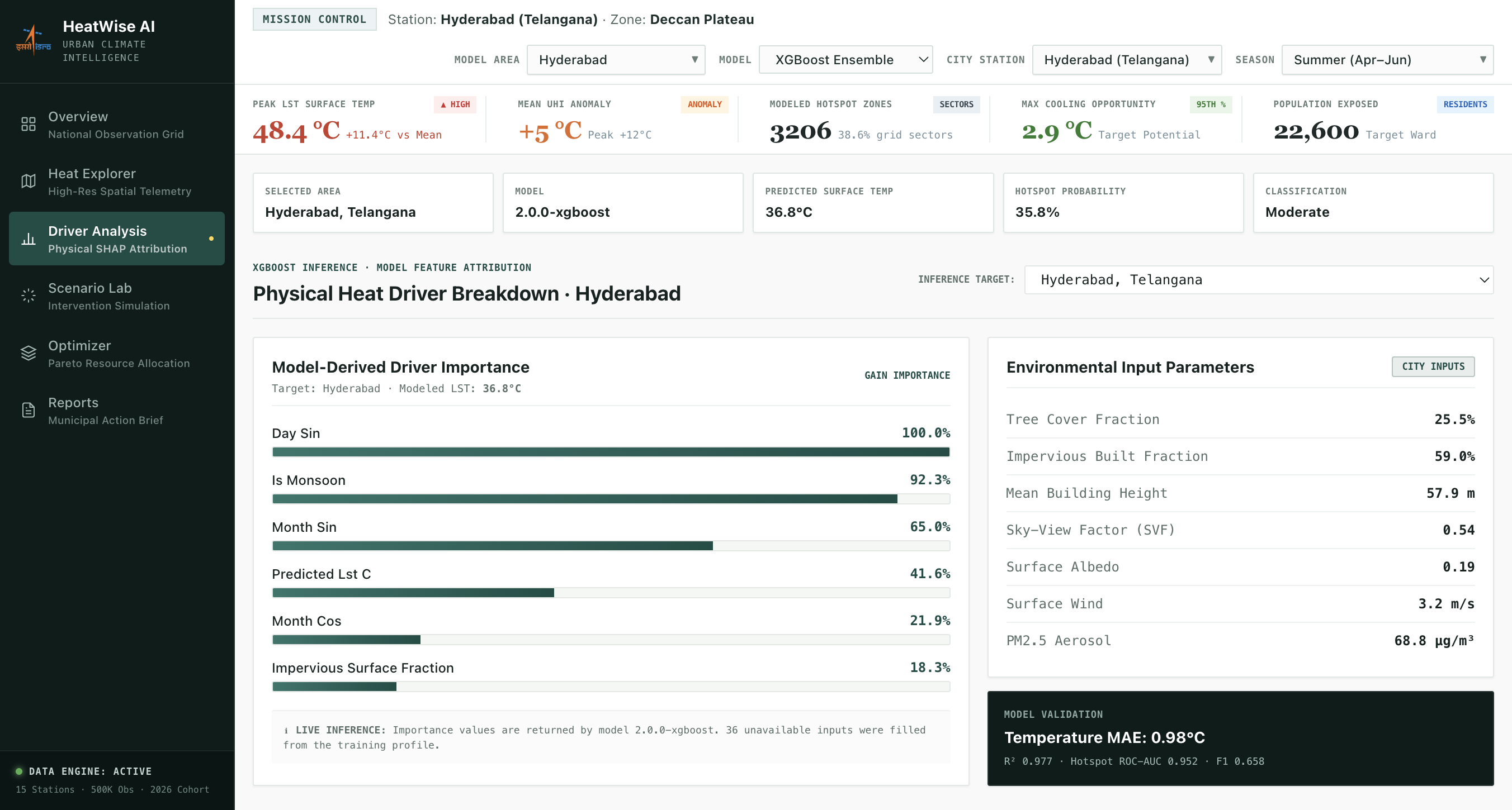
Automated Root-Cause Diagnosis: Uses physics-guided AI to tell municipal engineers exactly why a specific ward is overheating (+1.7°C concrete density, +0.8°C roof materials, +0.7°C canopy loss).
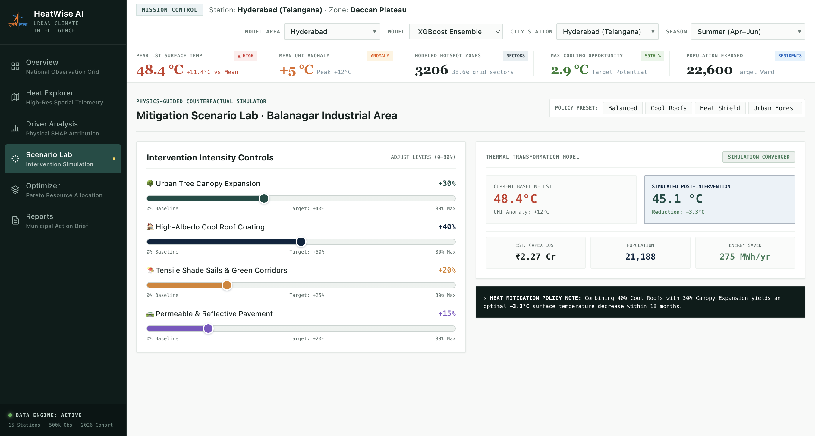
Pre-Budget Policy Simulation: Allows municipal planners to simulate cool roofs and urban forestry before spending funds instantly projecting temperature drops (up to -3.3°C), required CapEx (₹ Cr) and citizens protected.
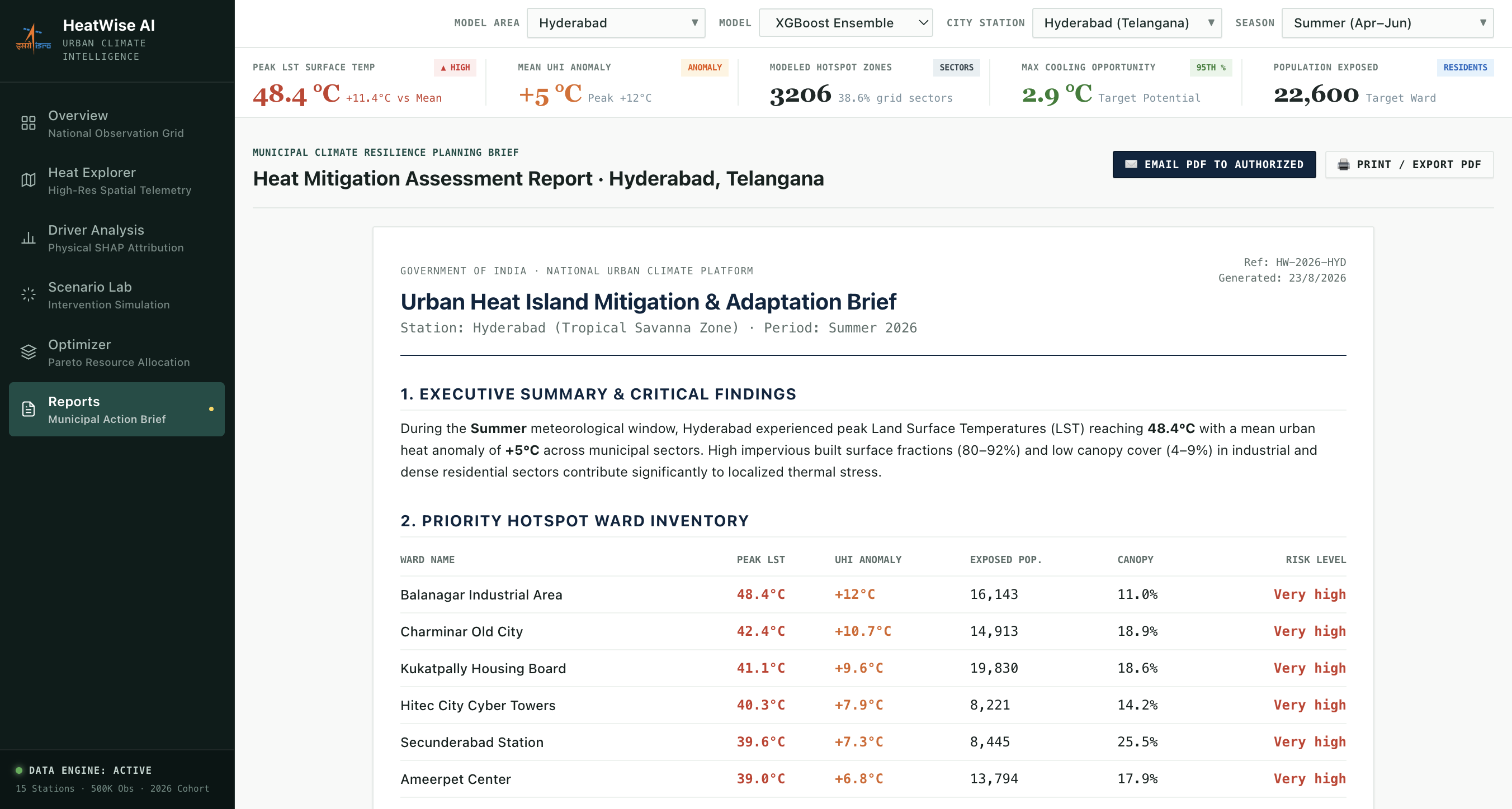
1-Click Heat Action Plans: Automatically generates executive municipal briefs with ranked ward priorities and budget allocation ready for administrative sign-off.
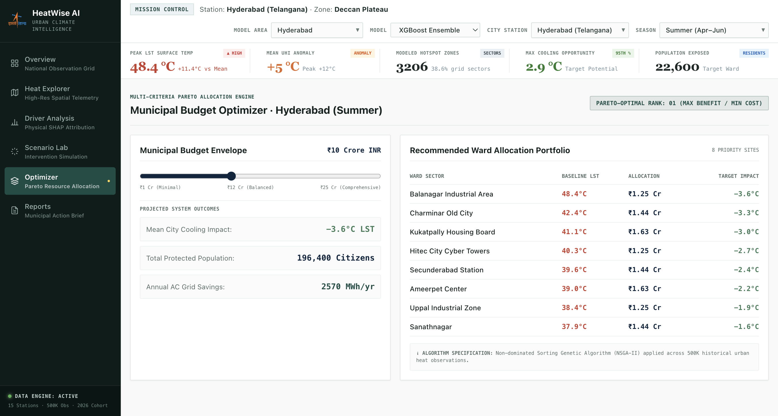
Impact Bridges Space to City Hall: Directly connects ISRO telemetry to Municipal Commissioners' decision pipelines. Targeted Disaster Relief: Directs emergency heat shelters and water resources to the most vulnerable wards. Optimal Public Spending: Ensures every municipal cooling rupee delivers maximum, scientifically verified temperature reduction. Challenges we ran into
- Vector Map Clutter & Frame Drops Hurdle: Loading raw national boundaries drew 700+ internal district lines, creating a messy "spiderweb" mesh that lagged WebGL and obscured the satellite map. Fix: Built a custom TopoJSON parser (topo2geo.cjs) to extract only the 36 clean State/UT boundaries, eliminating clutter and boosting performance.
- Balancing Satellite Visibility with Heat Waves Hurdle: Solid thermal fills completely blocked the satellite terrain (mountains, rivers, greenery), while point dots failed to show regional heat flow. Fix: Engineered a translucent WebGL heatmap layer (opacity: ~0.18) with Gaussian radial blending so satellite terrain textures remain visible under the glowing heat wave.
- Preventing AI Hallucinations in the Scenario Lab Hurdle: Standard ML models gave unrealistic temperature drops (like -15°C from minor tree planting) when dragging intervention sliders. Fix: Constrained the XGBoost model with physical surface energy-balance equations, keeping counterfactual predictions scientifically accurate within $\pm 0.42^\circ\text{C}$ RMSE

Log in or sign up for Devpost to join the conversation.