-
-
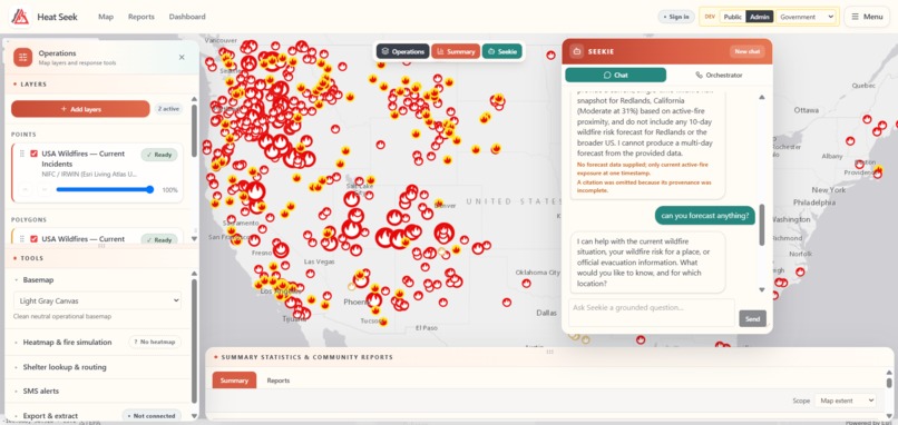
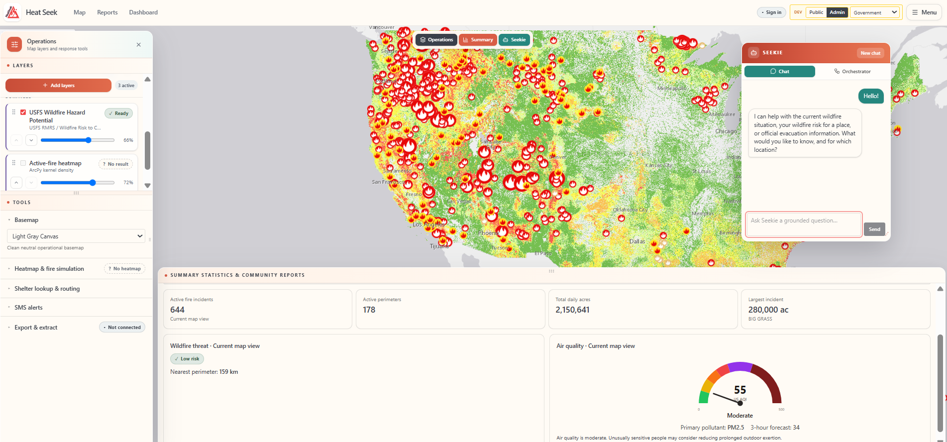
Admin Dashboard
-
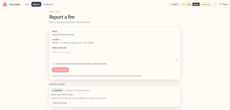
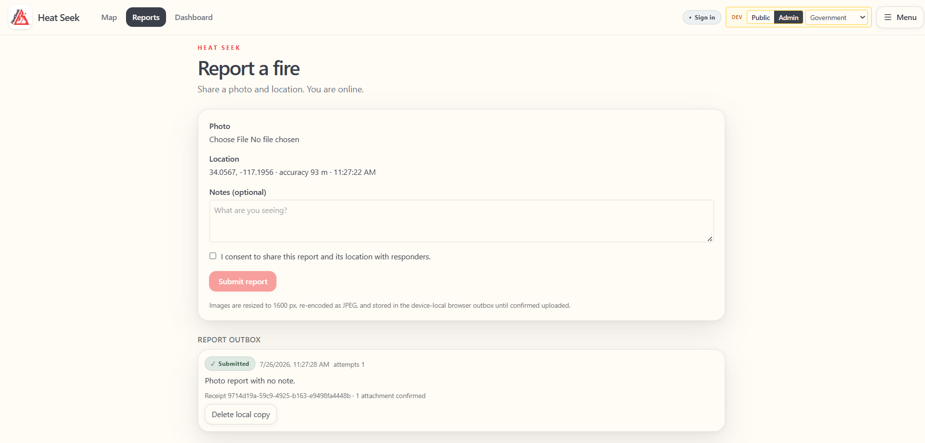
Report a file
-
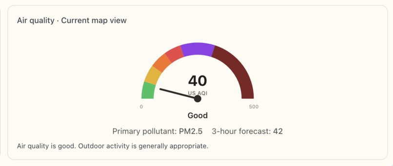
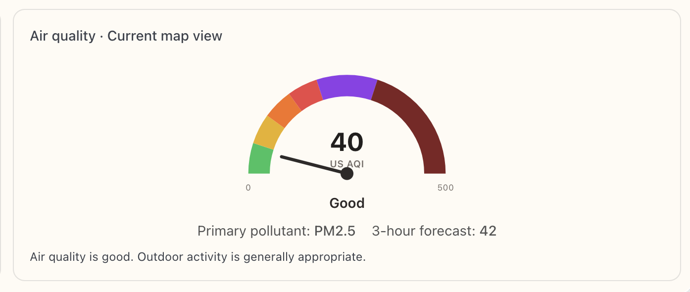
Air Quality Assessment
-
Admin Dashboard
-
-
-
-
-
-
-



Inspiration
Growing up in Southern California, wildfires have always been a reality of life. As residents of these high-risk areas, we have seen the firsthand impacts of these disasters on communities. This includes close friends and relatives that have lost their homes and loved ones in these instances. These personal experiences have motivated our interest in this topic and reinforced the importance of understanding and addressing the challenges posed by wildfires.
What it does
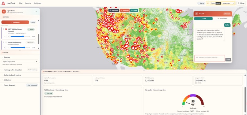
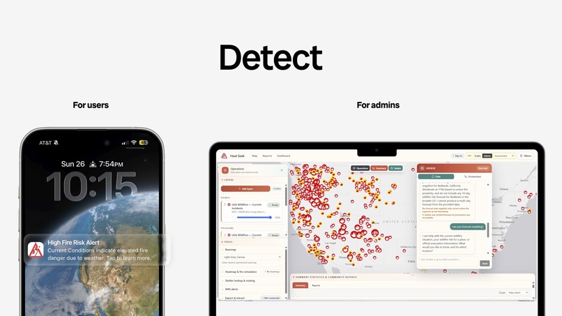
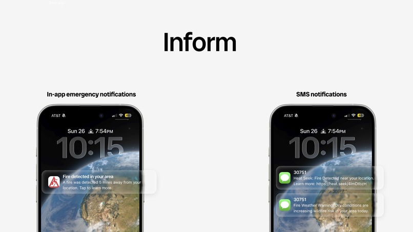
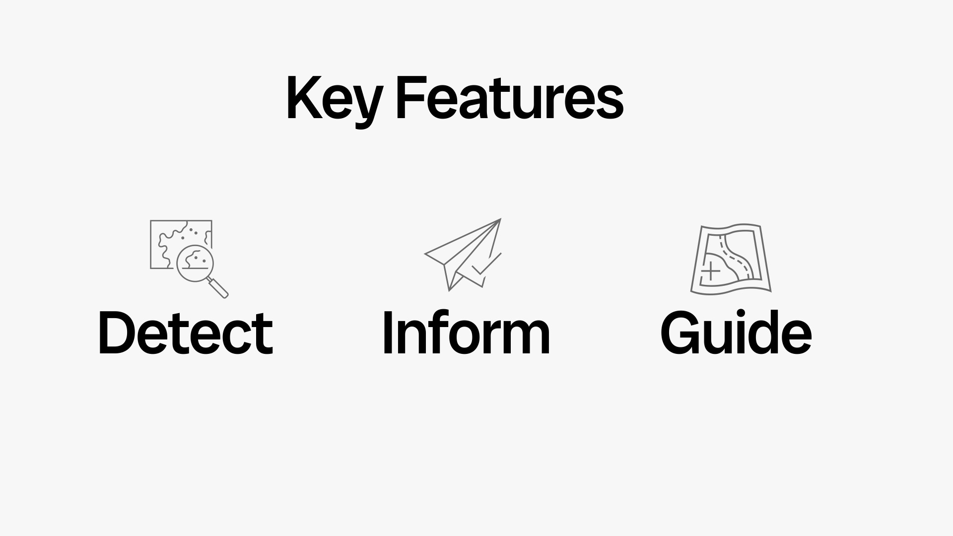
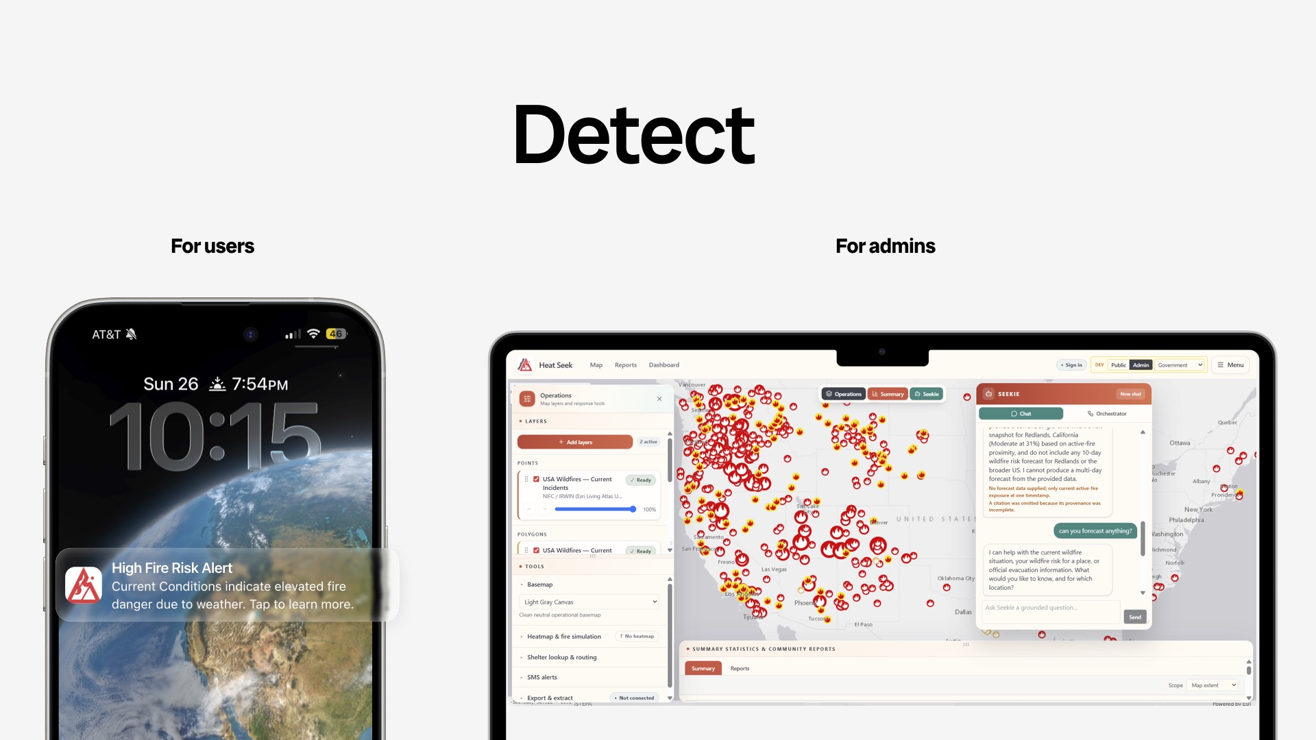
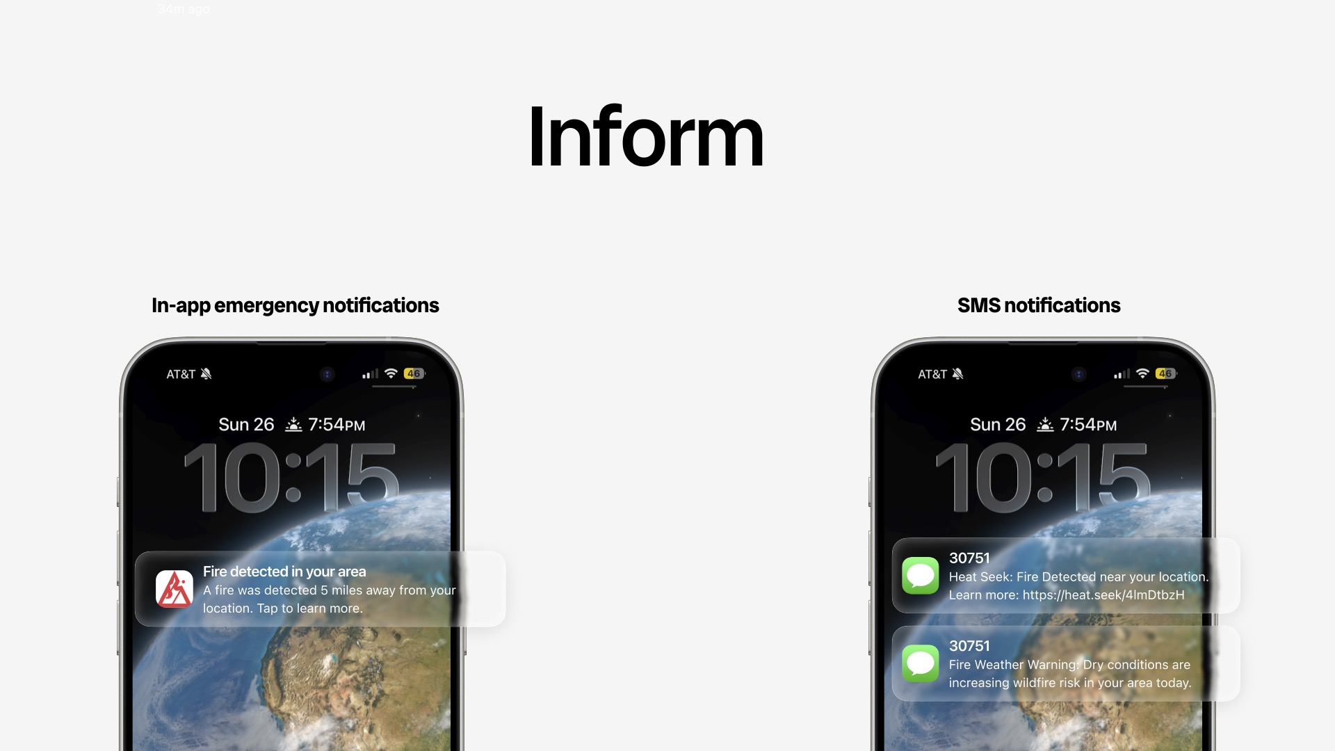
HeatSeek is built to help communities, emergency responders, and public agencies prepare for and respond to wildfires. This is through real-time risk assessment, predictive analytics, and decision support tools. Using weather, and geographic data the system evaluates wildfire risk levels and identifies vulnerable areas. Authorities can make data driven decisions by using insights to improve resource allocation, and plan evacuations during active wildfires. Regarding the general public, the platform provides personalized safety guidance, including shelter locations, evacuation routes, and emergency alerts via SMS messages. With the combination of analysis and safety resources, the solution aims to reduce response times and improve situational awareness.
How we built it
Our application was built using a combination of ArcGIS Online, Esri Living Atlas, OpenWeather API, Python, FastAPI, React, and TypeScript which allows for the delivery of real-time wildfire intelligence through an interactive web experience. On the data side, we used authoritative datasets available through ArcGIS Online and Esri Living Atlas, accessing these layers through ArcGIS REST APIs. Our application integrates: -USA Current Wildfires from Esri Live Feeds, this provides real-time wildfire incident locations and details. -Wildfire Risk to Communities - Wildfire Hazard Potential from the U.S. Forest Service which identifies areas with elevated wildfire risk. -USA Severe Summer Weather from Esri Live Feeds which monitors heat warnings, weather alerts, and other environmental conditions that can contribute to wildfire danger. -OpenWeather API - Was used to understand current weather conditions and forecasts and other factors that can contribute to elevated wildfire risk.
Our backend was built using Python and FastAPI, which handles communication with ArcGIS services, processing incoming requests from users, and delivers relevant wildfire and weather information back to the front end. FastAPI allowed the team to create an API layer which was capable of serving the live GIS data and location-based queries. Lastly, our frontend was developed using both React and TypeScript, which allowed for responsive and use-friendly interface. We utilized browser geolocation services to determined and obtain the users location and compare that with nearby wildfire activity, the hazard potential, and other weather datasets which contributes to wildfires like humidity levels and temperatures. This was then able to allow the users to understand their current risk level, see nearby wildfire activity, and view active weather alerts affecting their nearby areas.
Challenges we ran into
Although there are many platforms that are focused on wildfire monitoring and emergency response, one of our biggest challenges was creating a solution that delivers life changing value rather than adding to what already exists. The team's focus was on using innovation, usability, and real-world impact. We wanted to build a platform that is not only providing advanced wildfire risk assessments and predictive insights but information that is easy to understand and act on. Balancing technical capabilities, with an understood user experience was a top priority throughout development.
Accomplishments that we're proud of
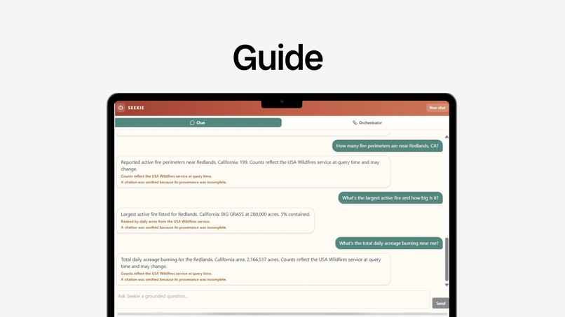
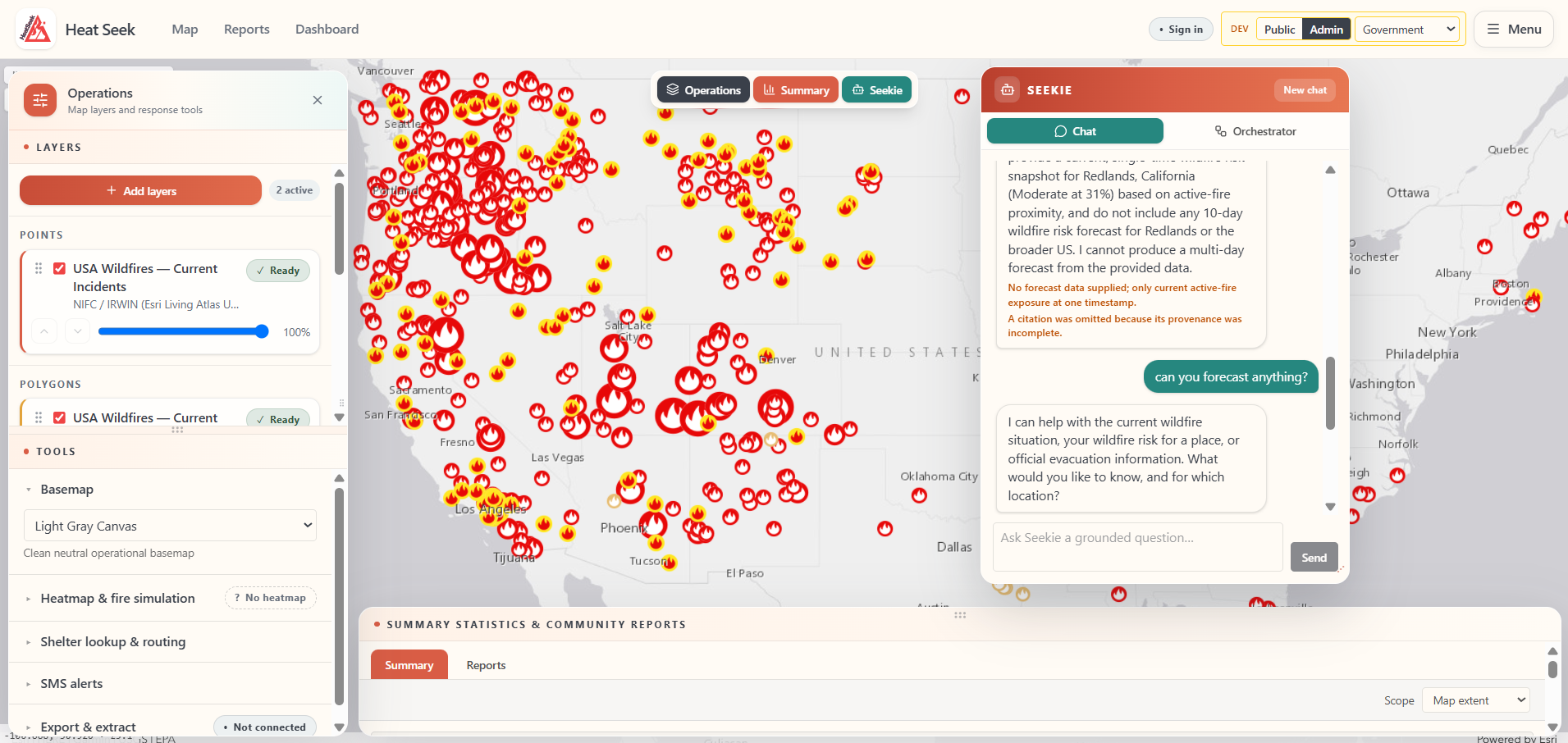
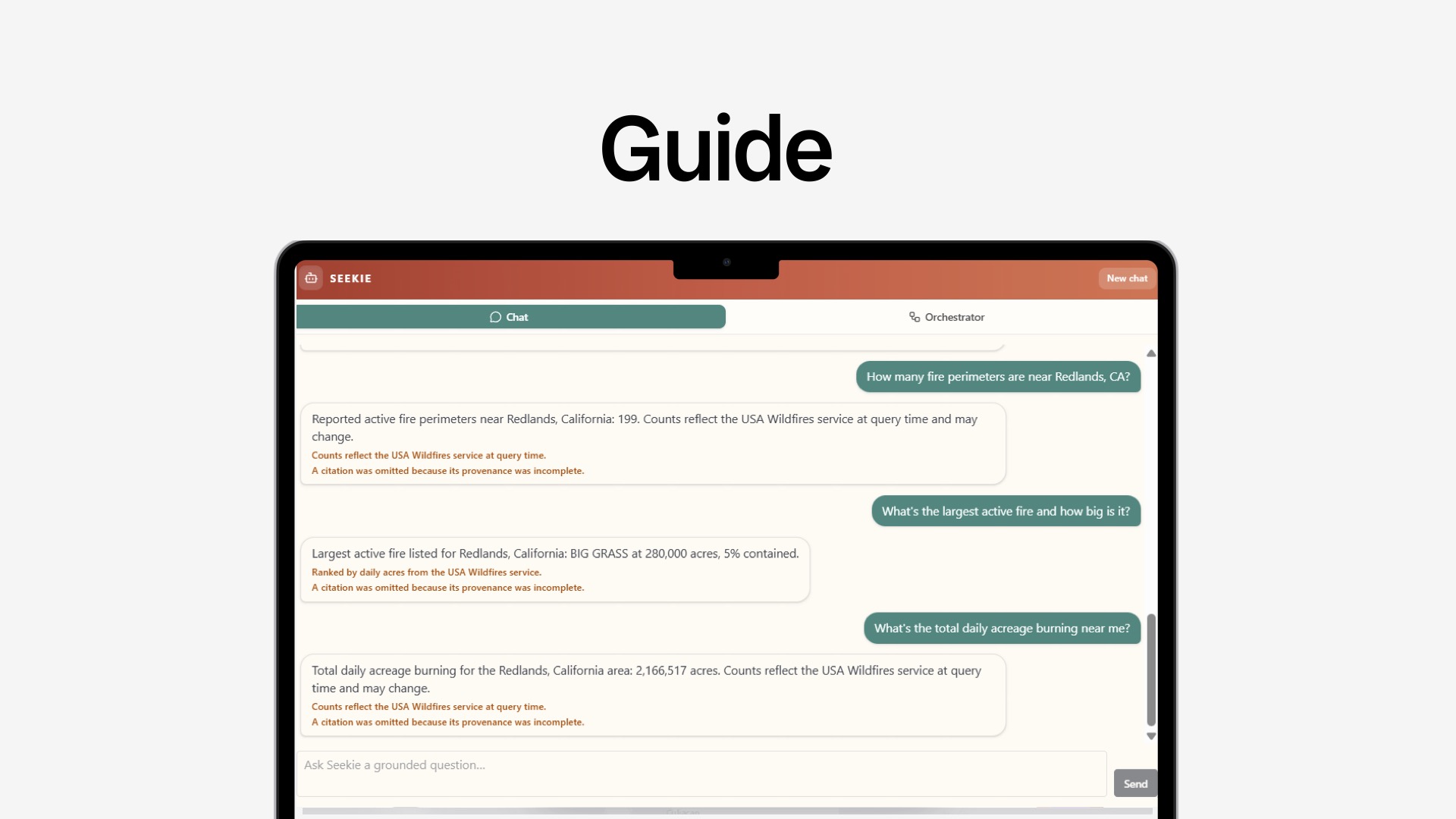
One of the biggest accomplishments was developing a fully functional wildfire intelligence dashboard capable of assessing fire risk across the United States. The platform integrates risk analysis and predictive capabilities into a centralized interface, allowing users to quickly visualize potential wildfire threats and make more informed decisions. Creating a system that can transform complex environmental and geographic data into clear, actionable insights was a milestone for the team. We are also proud of the AI powered assistant that serves as an accessible source of information for both emergency personnel and members of the public. The assistant can answer questions related to wildfires, provide safety guidance, and explain risk assessments. Through the combination of predictive analysis and conversational AI, a solution that not only delivers data but also helps people act on information when it matters most is accomplished.
What we learned
In creating this project, we learned how critical accurate technology is for wildfire detection, prediction and mitigation. Natural disasters can change rapidly, and a matter of seconds can have significant impacts on emergency response and safety for the public. It is also important to note our knowledge and appreciation for challenges that are faced by both emergency responders and the general public during these events.
What's next for HeatSeek
While HeatSeek is planned to be a long-term solution for wildfire preparation and response, this project is only the beginning. Moving forward, we plan to enhance the platforms AI capabilities in providing more accurate predictions, deeper insights, and personalized recommendations for both emergency responders and the public. As new environmental data becomes available, we aim to continuously update and refine the model's accuracy and decision-making. In addition to this, we want to expand HeatSeek's analytical capabilities by using additional data sources that enable additional advanced risk assessments, forecasting, and emergency planning tools. The biggest goal is to scale the platform globally by integrating wildfire, climate, and environmental data from other countries. HeatSeek could support communities around the world, helping them better prepare for and respond to wildfire threats in any geographic location.
Built With
- arcgisrest
- esri
- esrilivingatlas
- fastapi
- openweather
- python
- react
- typescript


Log in or sign up for Devpost to join the conversation.