-
-
HeatPilot
-
The problem
-
The Solution
-
VENTURA V³ Framework
HeatPilot
VENTURA Hackathon — Project Submission
The Problem
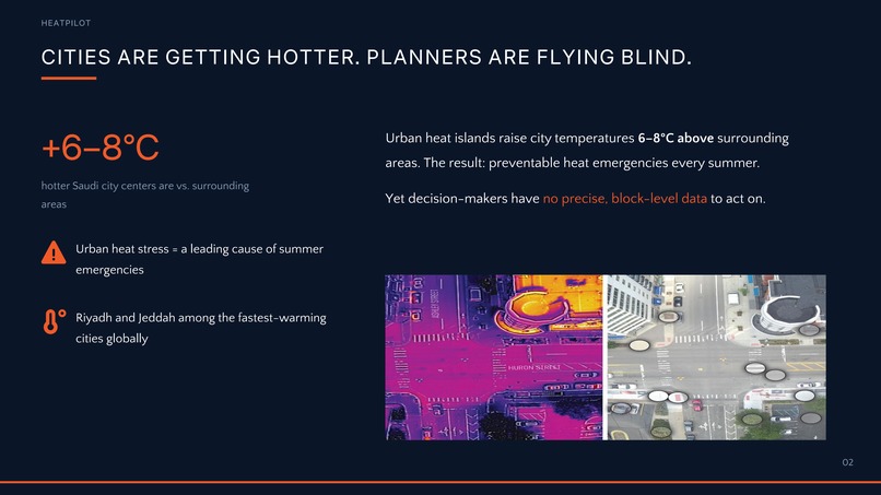
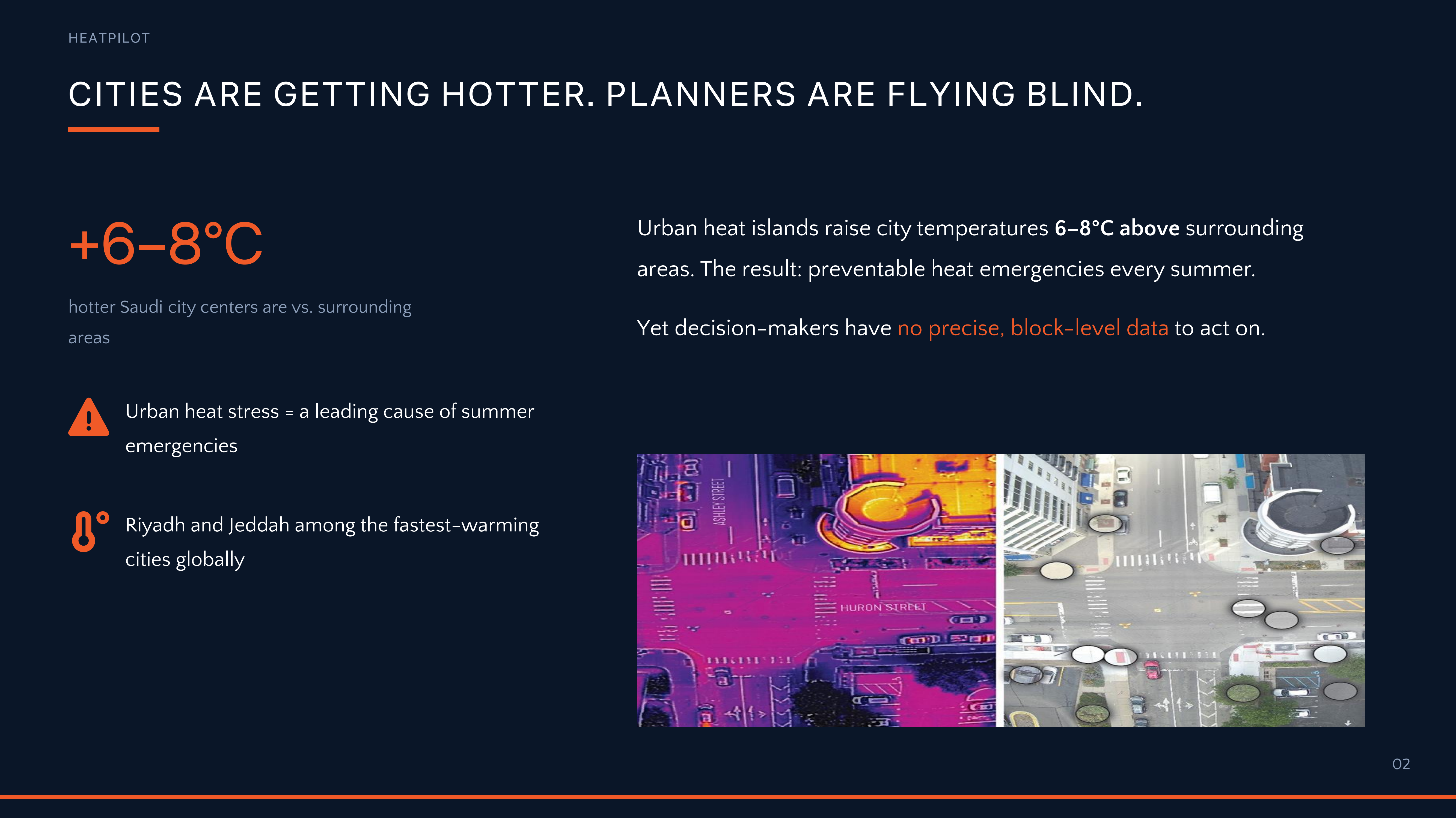
Every summer, Riyadh and Jeddah experience urban heat islands — a phenomenon where city temperatures rise 6–8°C above surrounding areas due to dense construction, heat-absorbing surfaces, and limited green cover. The consequences are severe: heat stress accounts for a significant share of summer emergency cases in Saudi cities, most of which are preventable.
Yet the tools available to urban planners remain dangerously inadequate:
- Sparse data: Existing weather stations cannot capture street-level or building-level thermal differences. The gap between two corners of the same neighborhood can reach 6°C — completely invisible to decision-makers.
- Uninformed decisions: Tree planting, shading, and roofing interventions are selected based on aesthetics or intuition, not thermal impact data.
- Misallocated budgets: With no model to compare options, municipalities spend on low-impact interventions while the most dangerous heat pockets go untreated.
This is not just a comfort problem. It is a public health crisis with a measurable, solvable cause.
The Solution
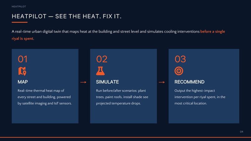
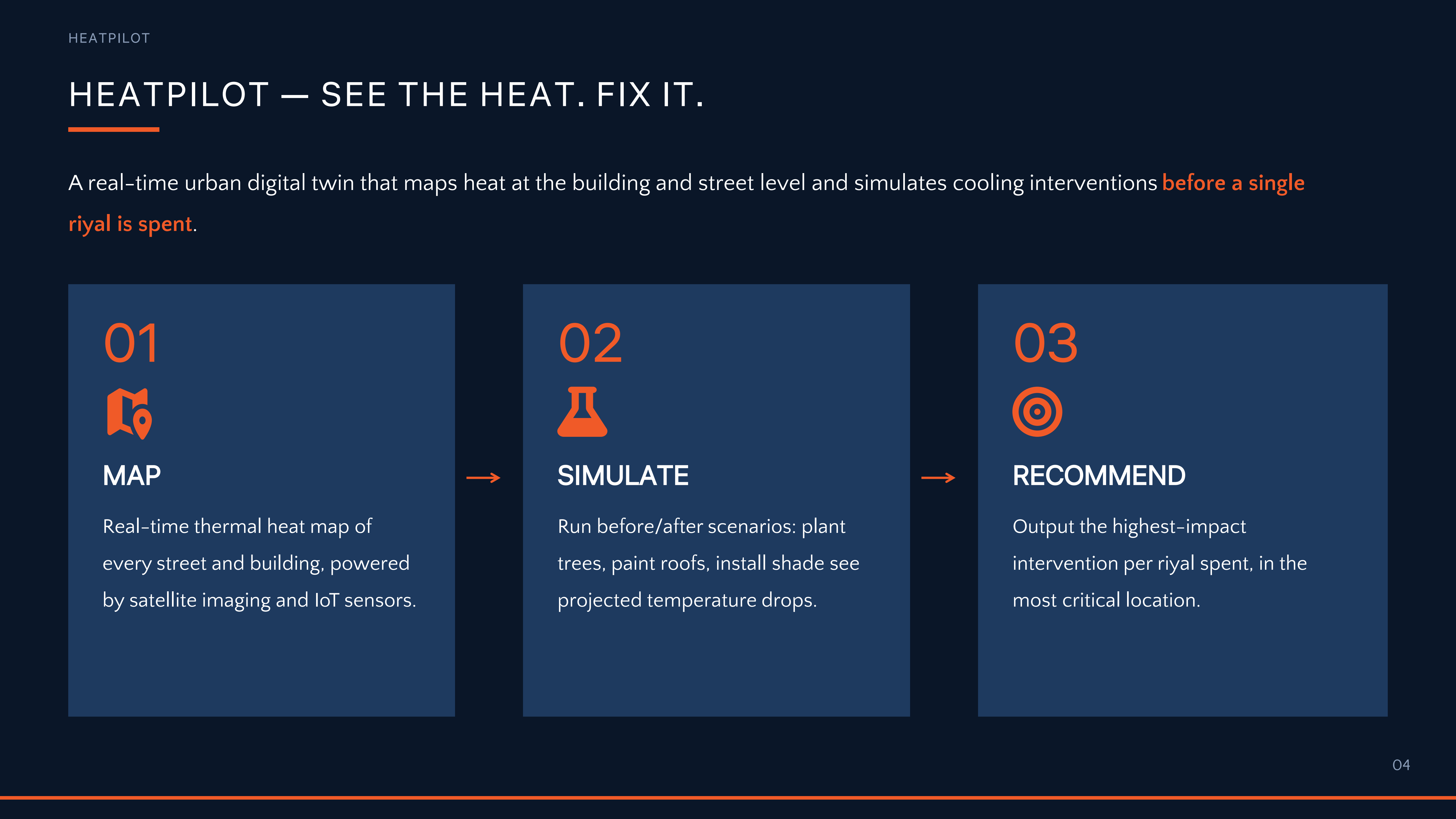
HeatPilot is a real-time urban digital twin platform that creates a precise, hyper-local heat map of every street and building in a city — updated continuously, accurate to within a single block.
The platform runs simulation scenarios before any riyal is spent: Plant a palm tree here? Paint this roof white? Install a shade canopy on this street? HeatPilot computes the projected temperature drop for each option and outputs a ranked, cost-aware recommendation.
The core question HeatPilot answers:
"Where does your riyal cool the most?"
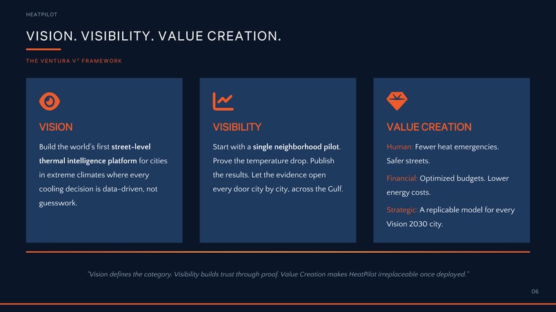
VENTURA V³ Framework
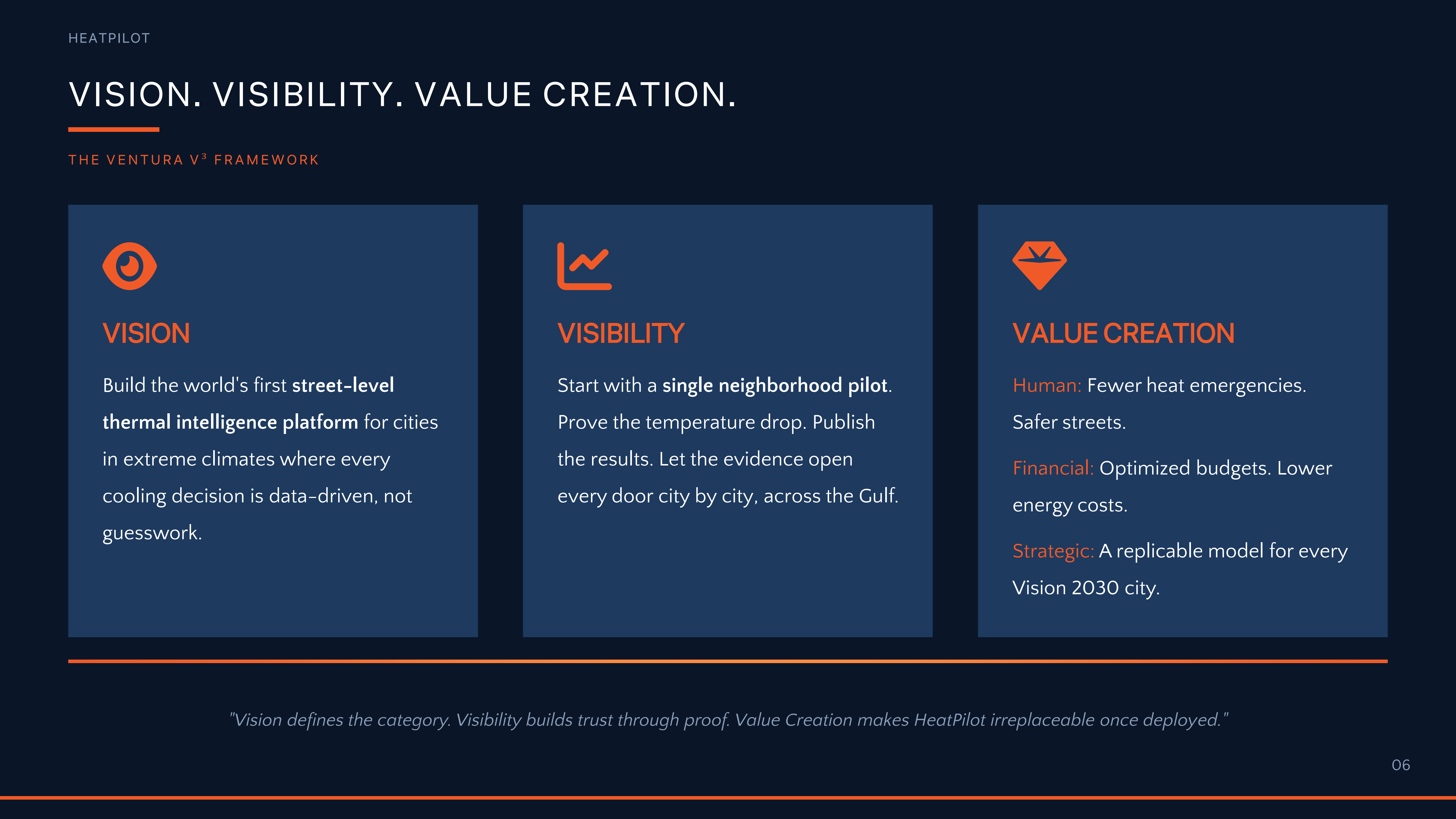
Vision — What Are We Building?
HeatPilot is building the first street-level urban thermal intelligence platform designed for cities in extreme climates. Our vision is a future where every cooling riyal spent is guided by data — where city planners can see heat pockets before they become emergencies, and where urban design is shaped by thermal science, not guesswork.
We are not building another weather app. We are building a decision engine for livable cities.
Long-term, HeatPilot becomes the standard thermal planning layer for all Vision 2030 cities and a blueprint exportable to every Gulf country facing the same climate challenge.
Visibility — How Does It Get Seen and Adopted?
HeatPilot makes the invisible visible — transforming raw thermal data into an interactive, real-time city heat map that any urban planner can read and act on immediately. No technical expertise required.
Go-to-market strategy:
- Entry point: A neighborhood-scale pilot in Riyadh or Jeddah, partnered with the local municipality. One neighborhood. Measurable results. Documented proof.
- Growth path: Expand city-by-city across Saudi Arabia, leveraging Vision 2030 smart city initiatives as a structural entry point.
- Regional expansion: Export to UAE, Qatar, Kuwait, and Bahrain — all sharing the same climate profile and facing the same problem.
Why adoption is realistic:
- Municipal governments already allocate budgets for urban greening and cooling — HeatPilot does not require new spending, it redirects existing spending more effectively.
- The platform integrates with satellite imagery and existing IoT infrastructure, minimizing deployment friction.
- Results are measurable and verifiable, making the ROI case simple to present to city leadership.
Value Creation — Why Does It Matter?
HeatPilot creates value at three levels simultaneously:
| Level | Value Created |
|---|---|
| Human | Fewer heat stress emergencies. Safer streets for workers, children, and the elderly during peak summer months. |
| Financial | Optimized municipal budgets. Lower cooling energy consumption in treated areas. Higher long-term property value in cooler neighborhoods. |
| Strategic | A replicable, exportable model for cities across the Gulf and global arid-climate markets. First-mover advantage in a region with no equivalent product. |
How the three V's create sustainable competitive advantage:
The Vision defines a category no one has claimed. The Visibility strategy ensures fast, credible adoption through measurable pilot results rather than theoretical promises. The Value at every level — human, financial, and strategic — makes HeatPilot defensible: once a municipality sees temperature drops and emergency reductions tied directly to our recommendations, switching to a generic alternative becomes unthinkable. Together, Vision + Visibility + Value create a platform that is hard to replicate, easy to justify, and urgently needed.
Research & Validation
The problem is real and documented:
- Studies on Middle Eastern cities confirm urban heat island intensities of 4–10°C in dense urban cores during summer months.
- The WHO classifies extreme heat as the leading climate-related cause of death globally, with Gulf cities among the highest-risk zones.
- A peer-reviewed analysis of urban greening interventions shows that strategic tree placement can reduce localized air temperatures by 2–4°C — but only when positioned based on thermal modeling, not visual preference.
The gap is confirmed:
- Current municipal planning tools in Saudi Arabia do not offer real-time, block-level thermal data.
- Interviews with urban planning stakeholders confirm that cooling intervention decisions are currently made without comparative simulation data.
- Budgets for greening and urban cooling in Saudi cities run into the hundreds of millions annually — with no systematic framework for measuring thermal ROI.
Feasibility evidence:
- Urban digital twin technology is proven and actively deployed in cities including Singapore, Amsterdam, and Helsinki.
- Satellite thermal imaging at 30–90m resolution is commercially available today via Landsat 8, ECOSTRESS, and commercial providers.
- IoT ground sensor networks for microclimate monitoring have been successfully deployed in smart city pilots globally.
Innovation & Real-World Feasibility
What makes HeatPilot innovative:
- No existing platform combines real-time thermal mapping + intervention simulation + cost-ranked recommendations in a single tool designed for municipal use.
- The "cost per degree cooled" metric is a novel, actionable KPI that bridges the gap between data science and city budget decisions.
What makes it feasible:
- Technology stack is proven. We are not inventing new science — we are integrating existing tools into a decision-ready product.
- The pilot model requires minimal upfront infrastructure.
- Vision 2030's smart city and sustainability mandates create a direct institutional pathway for adoption.
- The climate problem is not going away — urgency increases every year, not decreases.
Next Steps
- Pilot — Deploy thermal mapping in one Riyadh or Jeddah neighborhood.
- Partner — Formalize a data-sharing agreement with municipal authority.
- Build MVP — Integrate satellite imagery + sensors + simulation engine into a unified planning dashboard.
- Measure — Document temperature change and emergency reduction data to validate and scale.
- Scale — City-wide deployment, then regional expansion across the Gulf.
Team
| Name | Role |
|---|---|
| Naif Ali Bin Dair | Leader |
Contact Information
- Email: [email protected]
- Phone: +966501229122
- Location: Riyadh, Saudi arabia
Pitch Slides
Built With
- canva


Log in or sign up for Devpost to join the conversation.