-
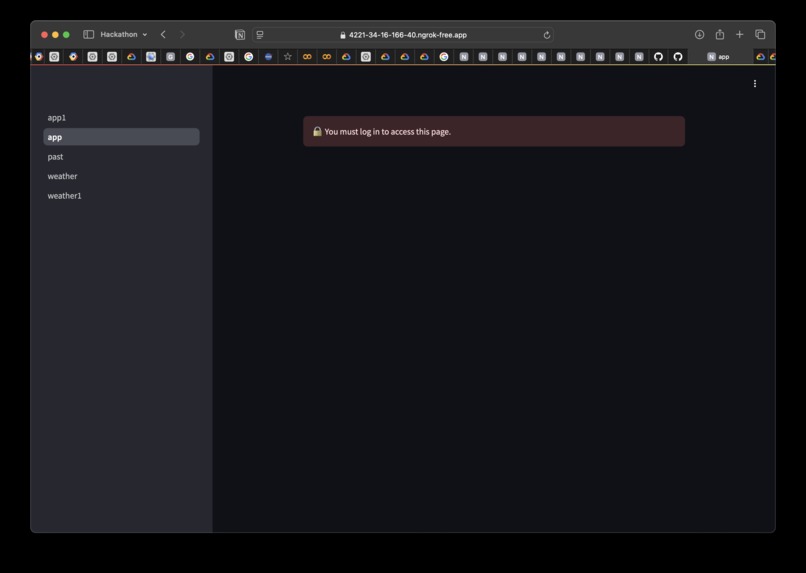
login
-
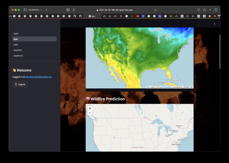
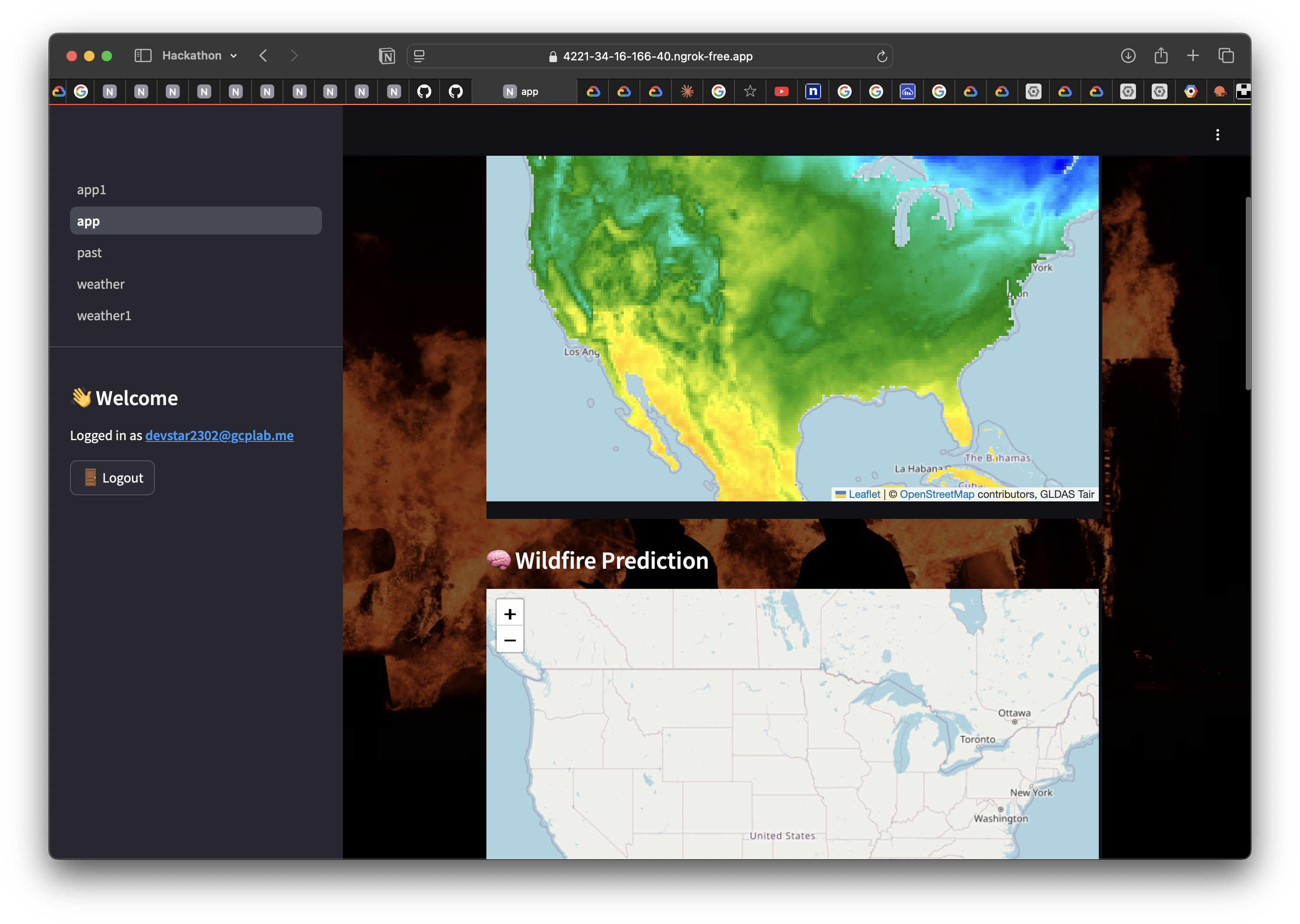
dash board of live & selected region prediction
-
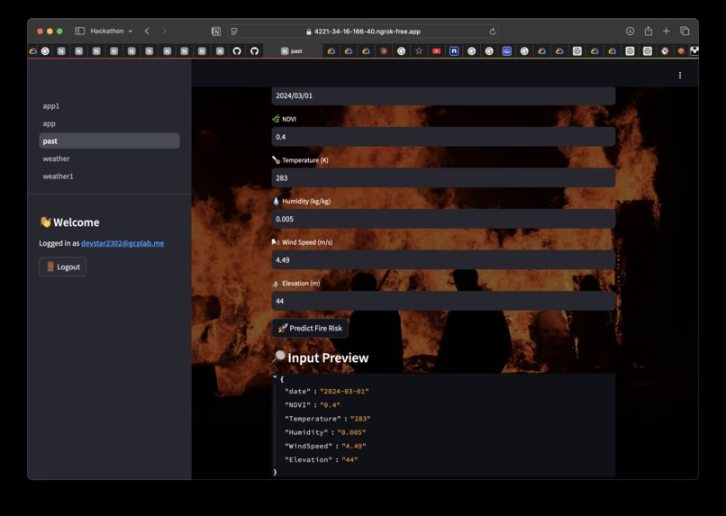
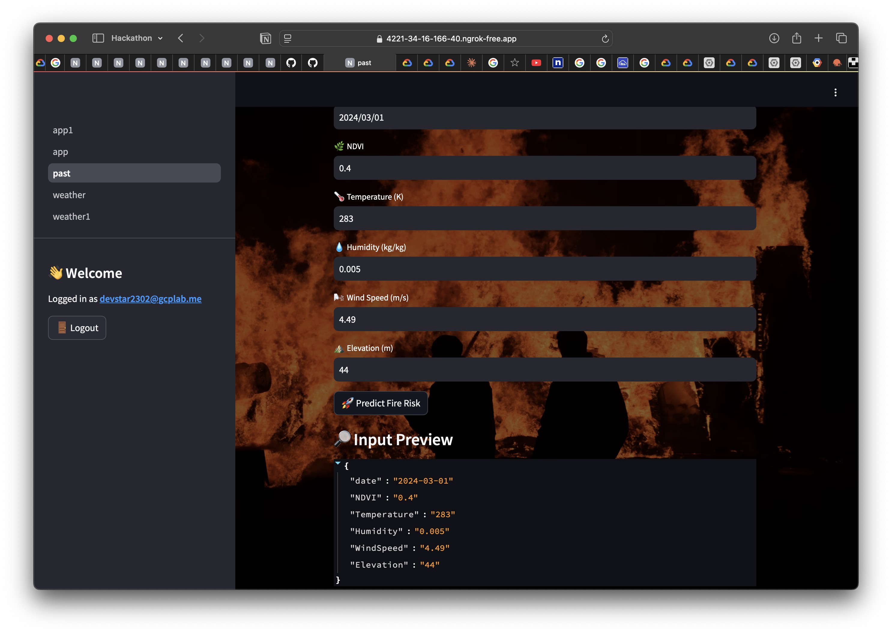
past weather report
-
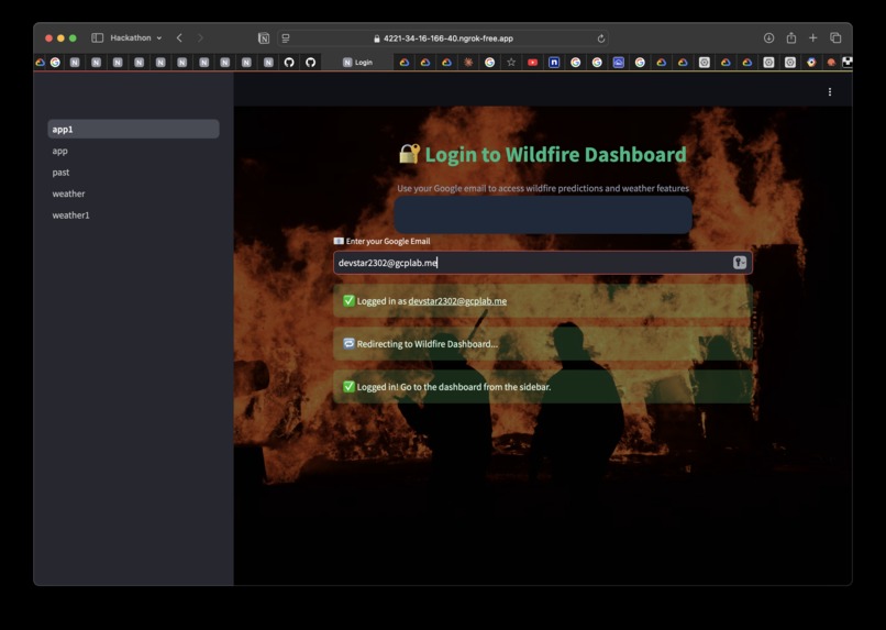
login successful
-
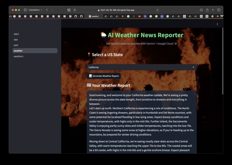
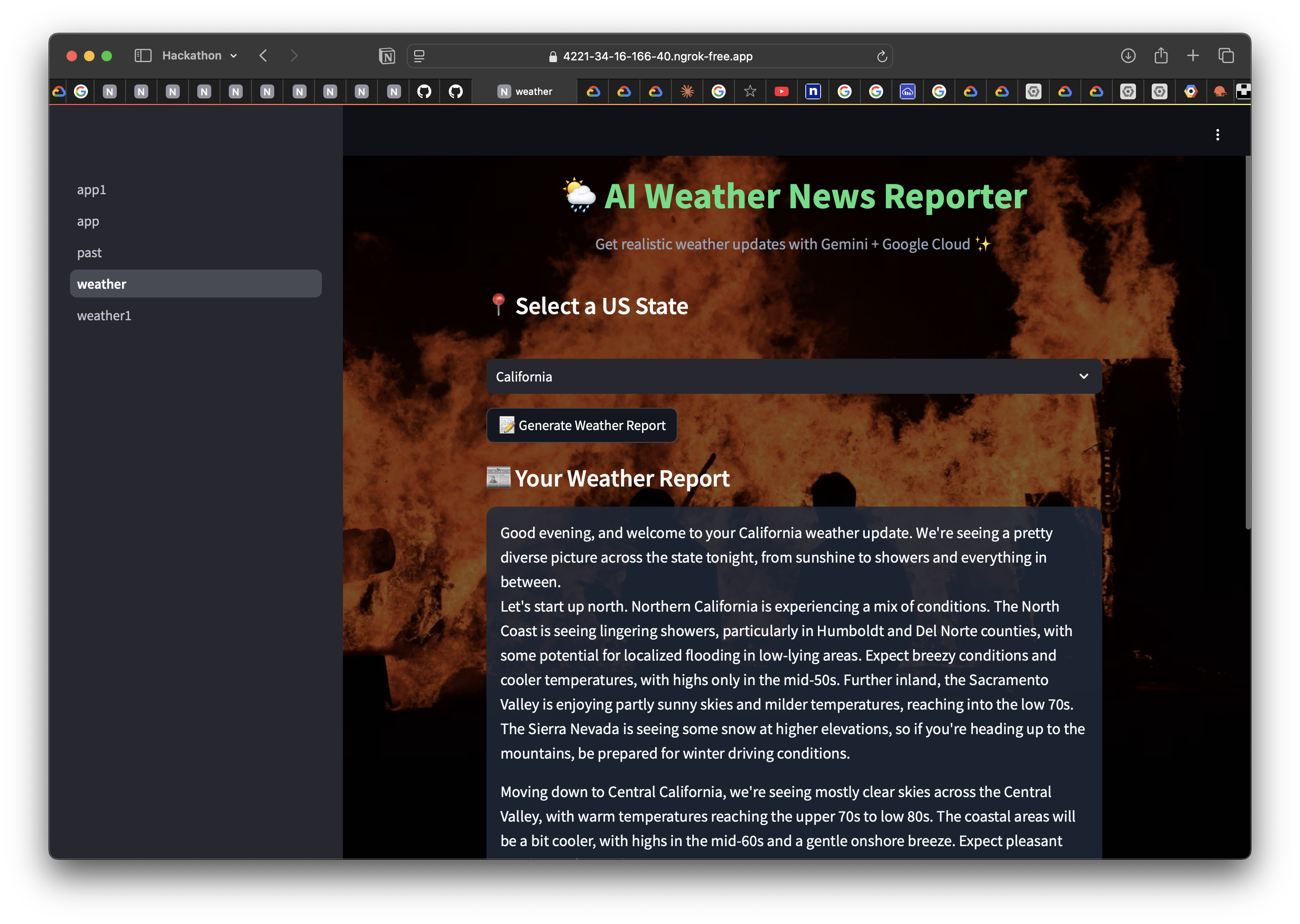
weather report by gemini and reports to the user
-
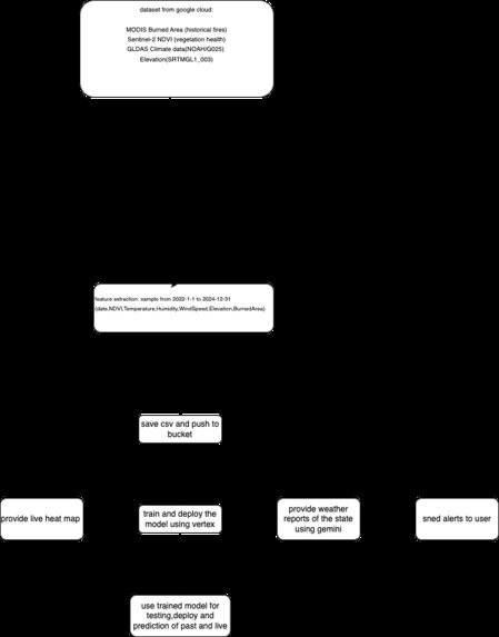
model architecture


Inspiration
Every year, wildfires claim thousands of acres of land, displace communities, and overwhelm emergency services. We were inspired by the urgent need for early detection and accessible communication in high-risk regions. Our mission: use AI and real-time data to give communities a life-saving head start.
What it does
Heat Sentinels is a wildfire and weather intelligence platform that:
🗺️ Predicts wildfire risk in real-time using satellite data + AI 📍 Allows interactive map-based risk prediction from any location 🧠 Uses Google Cloud’s Vertex AI for accurate classification 📬 Automatically sends generated weather reports via email ☁️ Stores historical weather reports in a Google Cloud bucket
How we built it
Frontend: Built in Streamlit with responsive styling for multiple pages ML Model: trained cloud model using vertex AI Deployment: Model deployed on Vertex AI and integrated via REST Data: Earth Engine API + GLDAS + Sentinel-2 for fetching NDVI, temperature, humidity Storage: Google Cloud Storage used to archive weather reports Email: Custom SMTP system that emails reports to authenticated users Auth: Lightweight Google SSO login via session control
Challenges we ran into
- Maintaining session state after login (auth persistence across pages) -deploying model to cloud & training model in cloud about 2 hours -Handling reloads during prediction while preserving user context -Animating real-time heat and cold wave maps with accurate overlays -text to speech due account limitation.
- application integration due to limitation of the account -Visual accuracy in plotting satellite features to user-selected coordinates
Accomplishments that we're proud of
Fully integrated real-time prediction system with Earth Engine + Vertex AI Delivered a multi-modal experience with maps, audio, and email Achieved a secure, multi-page app with login protection Stored and emailed custom weather reports on the fly
What we learned
Mastered Google Cloud's Vertex AI, Earth Engine, and storage pipelines Learned to structure a modular, multi-page Streamlit app Discovered tricks to optimize map interactivity and animation Found ways to combine LLM tools (Gemini) with traditional APIs Understood real-world challenges of delivering AI for climate impact
What's next for heat sentinels
SMS + WhatsApp wildfire alerts for mobile-first communities Provides spoken weather reports using Text-to-Speech Integrate MODIS + VIIRS fire detection in real time Launch a PWA or mobile app version for on-the-go users Enable users to subscribe to daily weather + fire briefings Collaborate with NGOs or fire departments for field deployment Improve model accuracy with historical burn data and terrain factors
Built With
- api
- bucket
- cloud
- gemini
- google-cloud
- llm
- model
- python
- vertex-ai

Log in or sign up for Devpost to join the conversation.