-
-
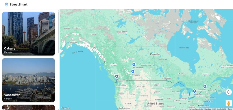
Homepage
-
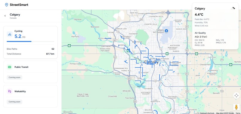
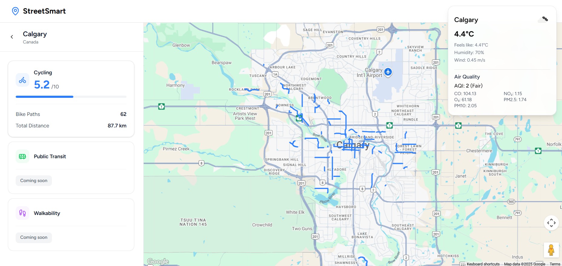
City Select Overview
-
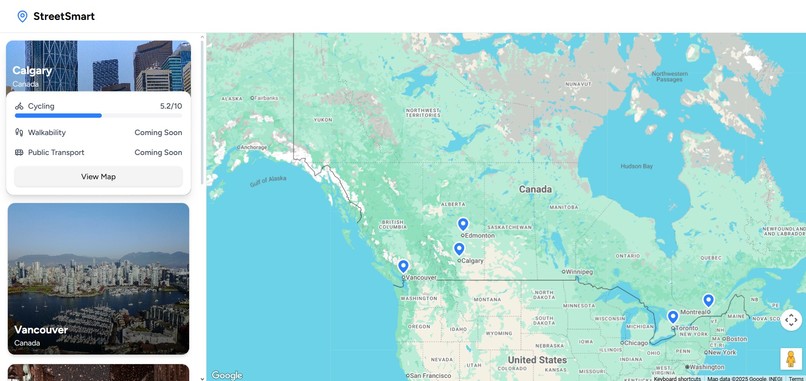
Card pull-up
-
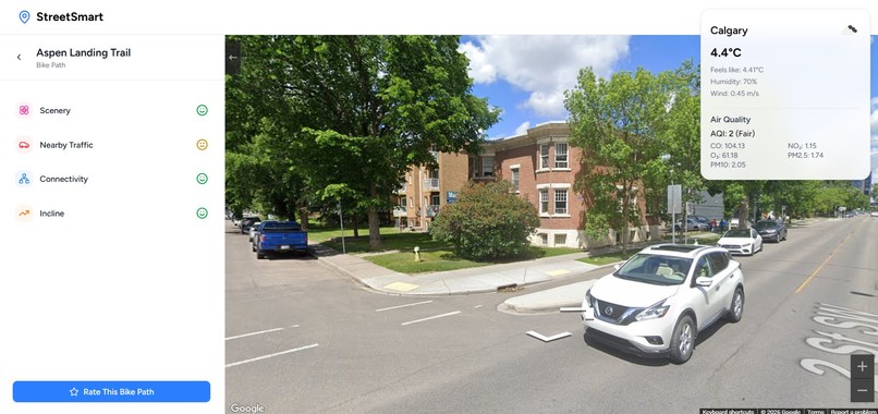
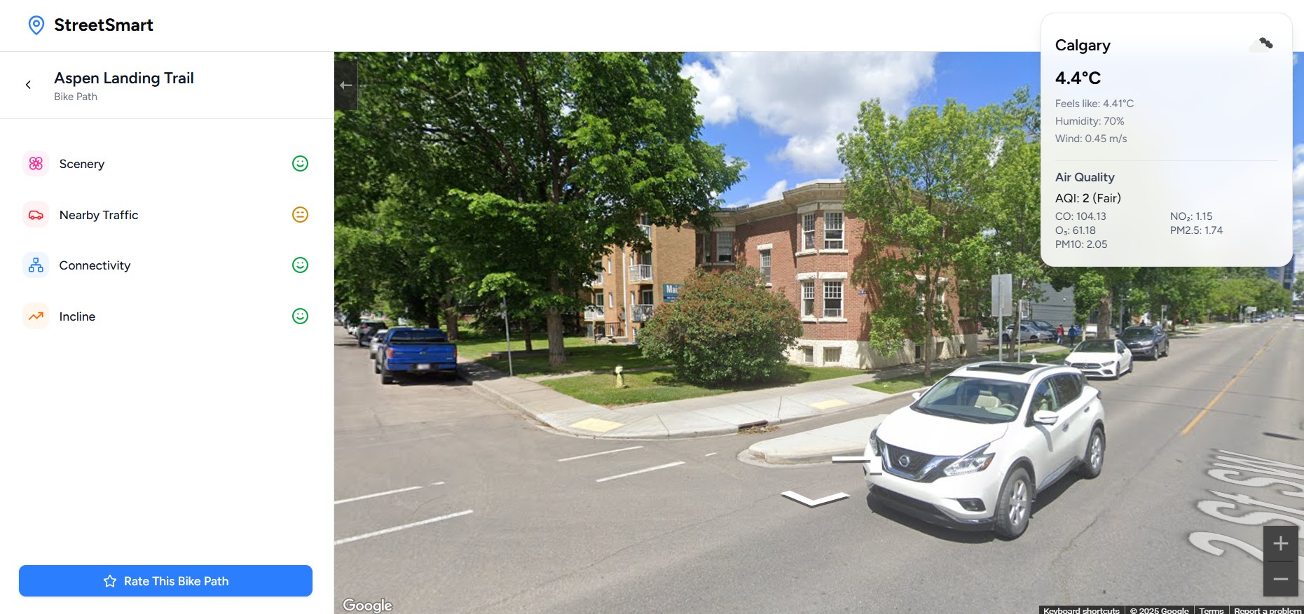
Street view with cycling reviews
-

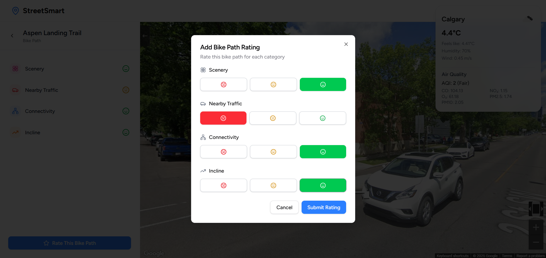
Send a Review!

Innovation & Creativity
- The Idea: We're not just mapping routes; we're rating the experience. We created StreetSmart - to ****highlight flaws in urban planning, drive social change and encourage people without cars (or even with cars) to take a healthier and cleaner approach to transportation. Rankings within cities can help bring to light data on the state of transportation and potentially encourage the creation of solutions to any problems that show up.
- Experience Ranking: Our core idea is bringing users data and recommendations based on other users’ experiences through ratings of various transport routes (Safety, Comfort, Scenery).
- Weather Conditions: We integrated a Weather API to provide real-time weather information that assists users in making informed, choices about their method of transportation.
- Other transportation features: The experience-rating concept is to be built to expand to other modes, including walking and public transportation.
Impact & Relevance to Prompt
- Focus on Inclusion: Directly encourages active transit for all individuals and vulnerable populations by suggesting safe, pleasant routes, solving an Inclusive Urban Design challenge.
- City Planning Data: Our system aggregates route scores to provide cities with crucial maintenance (e.g., a path with a consistently low Comfort and Safety scores needs work).
- Urban Sustainability: By making cycling more reliable and enjoyable, we act as a catalyst for shifting mobility, directly helping to reduce urban CO2 emission
Feasibility & Scalability
- Feasibility: OpenStreet Map was used and data from government sources. Comprehensive and high-quality datasets were limited and inconsistent therefore, only one trustable data set from government website was used.
- Practicality: The system is built as an API-focused, web application making it easy to implement, and ready for real-world use. A 3D view map is provided to give the user real-world information on what their route would physically look like, as well as dynamically updated real-time weather data to further assist in transportation planning!
Technical Execution
- Ranking Engine: Implemented a proprietary, weighted-average ranking algorithm that synthesizes ratings and route geometry to generate the definitive StreetSmart scores.
- External API Integration: Integrated OpenWeather API. The system fetches real-time, location-based weather data using a Flask-based backend to inform users with their choices of transportation methods.
User Experience & Design
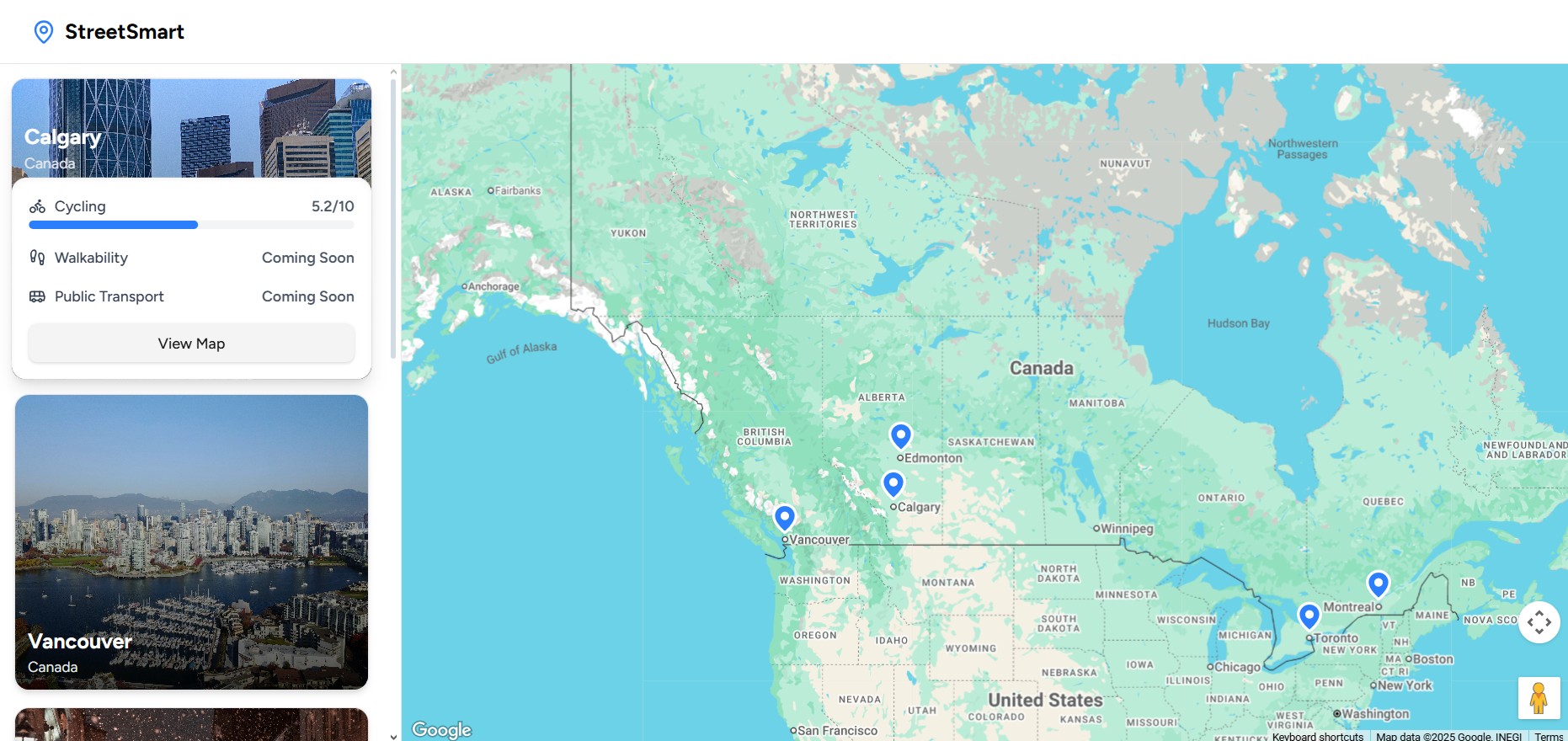
- Intuitive Design: The interface is modeled after Nomad List website ( ranking cities based on ratings). Data presents through both Grid View and Map View for various user’s choices.
- Essential Context: The ratings are displayed through emoji; green smiling face for positive and red frowning face for negative. Users can rate routes in real time as they view them and also explore the 3D view of the path for more interactive and realistic experience.
Built With
- flask
- google-maps
- javascript
- node.js
- openweatherapi
- python
- react


Log in or sign up for Devpost to join the conversation.