-
-
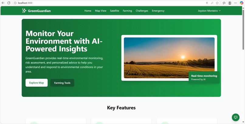
Home page
-
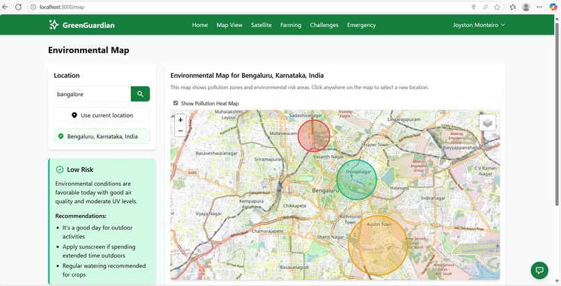
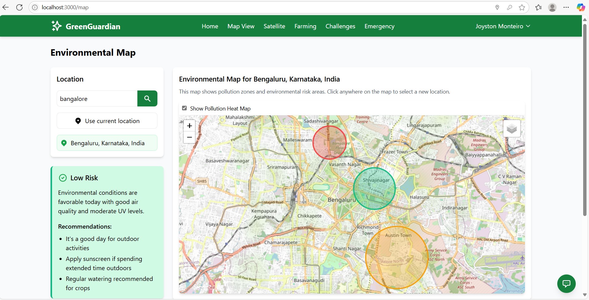
Map view page -shows pollutions
-
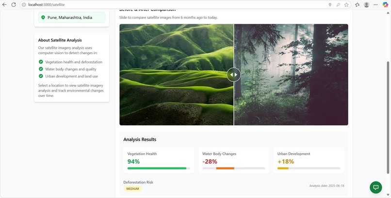
satellite page
-
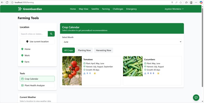
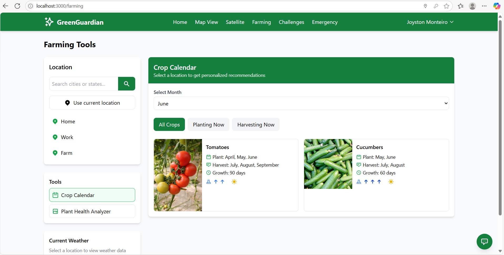
farming page -shows crops to grow in each month with tips
-

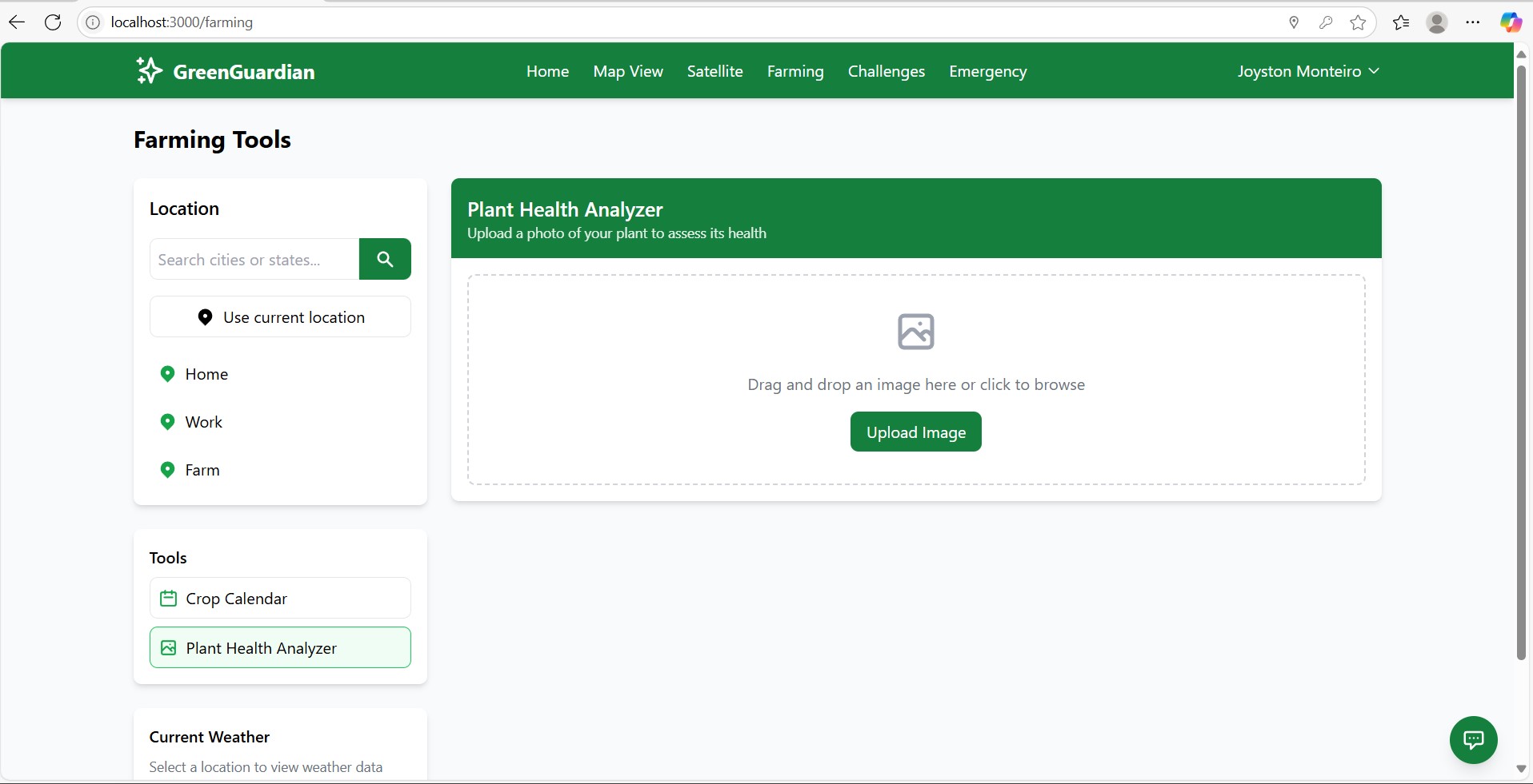
farming page -plant health analyzer
-
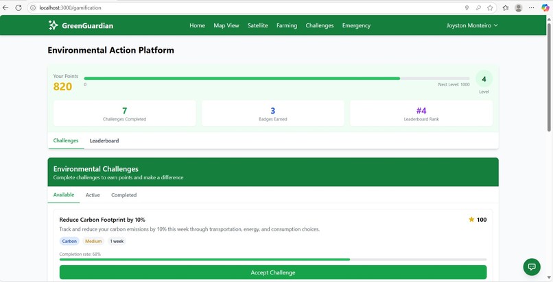
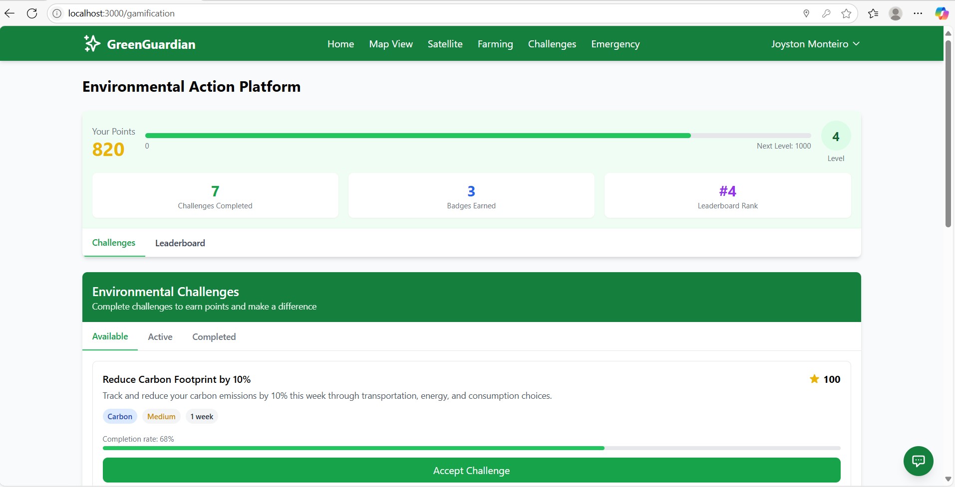
challenge page


Inspiration
Environmental degradation is accelerating—impacting health, agriculture, and ecosystems. I was inspired to create GreenGuardian as a response to the lack of accessible, localized, and actionable environmental data available to individuals and communities.
My goal is to empower citizens, farmers, planners, and environmental activists with real-time insights, satellite imagery, and personalized AI-driven guidance—all in one seamless platform.
How I Built It
GreenGuardian is built using a modern, intelligent tech stack combining geospatial mapping, real-time APIs, and AI copilots:
- Frontend: React.js + TypeScript for strong typing and fast UIs
- Styling: Tailwind CSS for clean, responsive design
- State Management: React Context API
- Routing: React Router
- Mapping: Leaflet.js for real-time geospatial rendering
- Authentication & Backend: Appwrite
- Environmental Data APIs:
- OpenWeatherMap (temperature, humidity, rainfall)
- AirQuality API (AQI, PM2.5, PM10)
- Satellite Imagery API (NDVI, vegetation changes)
- Geocoding Services (location search and mapping)
- OpenWeatherMap (temperature, humidity, rainfall)
AI-Powered Enhancements
- CopilotKit – Embedded in-app copilots that help users interact with environmental data more intuitively, suggest analysis, and offer AI-guided exploration of trends.
- Tavily – Used for AI-enhanced environmental context and information retrieval, such as explaining climate risks or defining environmental terms dynamically.
- Mem0 – Integrated for lightweight vector memory, enabling contextual responses based on a user’s past queries or preferences.
- Keywords AI – Powers natural language command parsing for user interactions and provides monitoring and tracing for AI operations, enhancing reliability and transparency in environmental data exploration.
These AI components made the app not just informative, but interactive and conversational.
What I Learned
- How to unify real-time data, historical patterns, and satellite imagery into one meaningful interface
- Practical usage of CopilotKit to build AI copilots tailored for geospatial data
- Using Tavily to provide reliable, AI-summarized environmental information
- Managing geocoding and reverse geocoding challenges
- Leveraging vector memory with Mem0 for smarter personalization
Challenges I Faced
- Synchronizing multiple real-time data sources with varying update intervals
- Handling edge cases in geolocation (remote areas, ambiguous place names)
- Teaching AI copilots to give accurate environmental advice without hallucinating
Built With
- airquality
- appwrite
- copilotkit
- keyword
- leaflet.js
- mem0
- openweathermap
- react.js
- tailwind
- tavily
- typescript


Log in or sign up for Devpost to join the conversation.