-
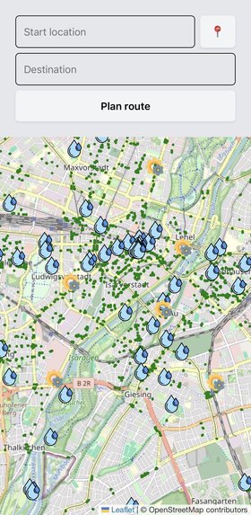
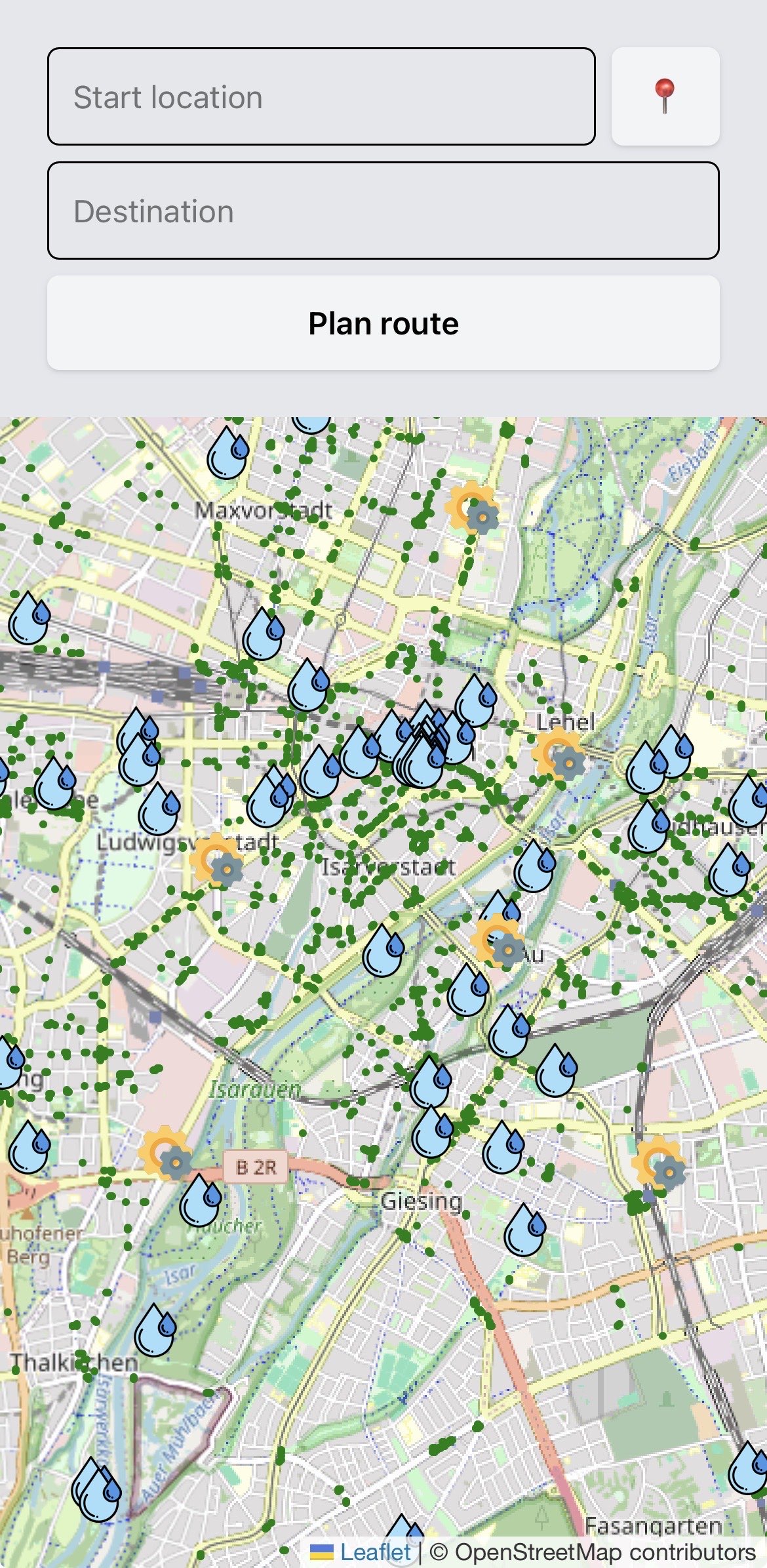
Starting screen
-
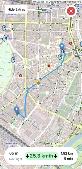
User is riding at a good speed
-
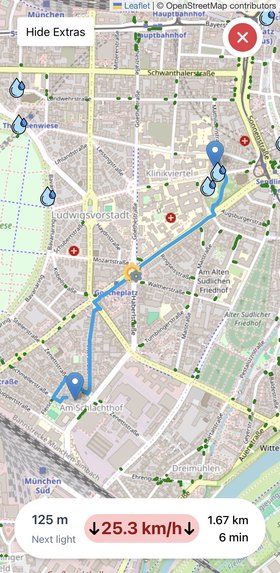
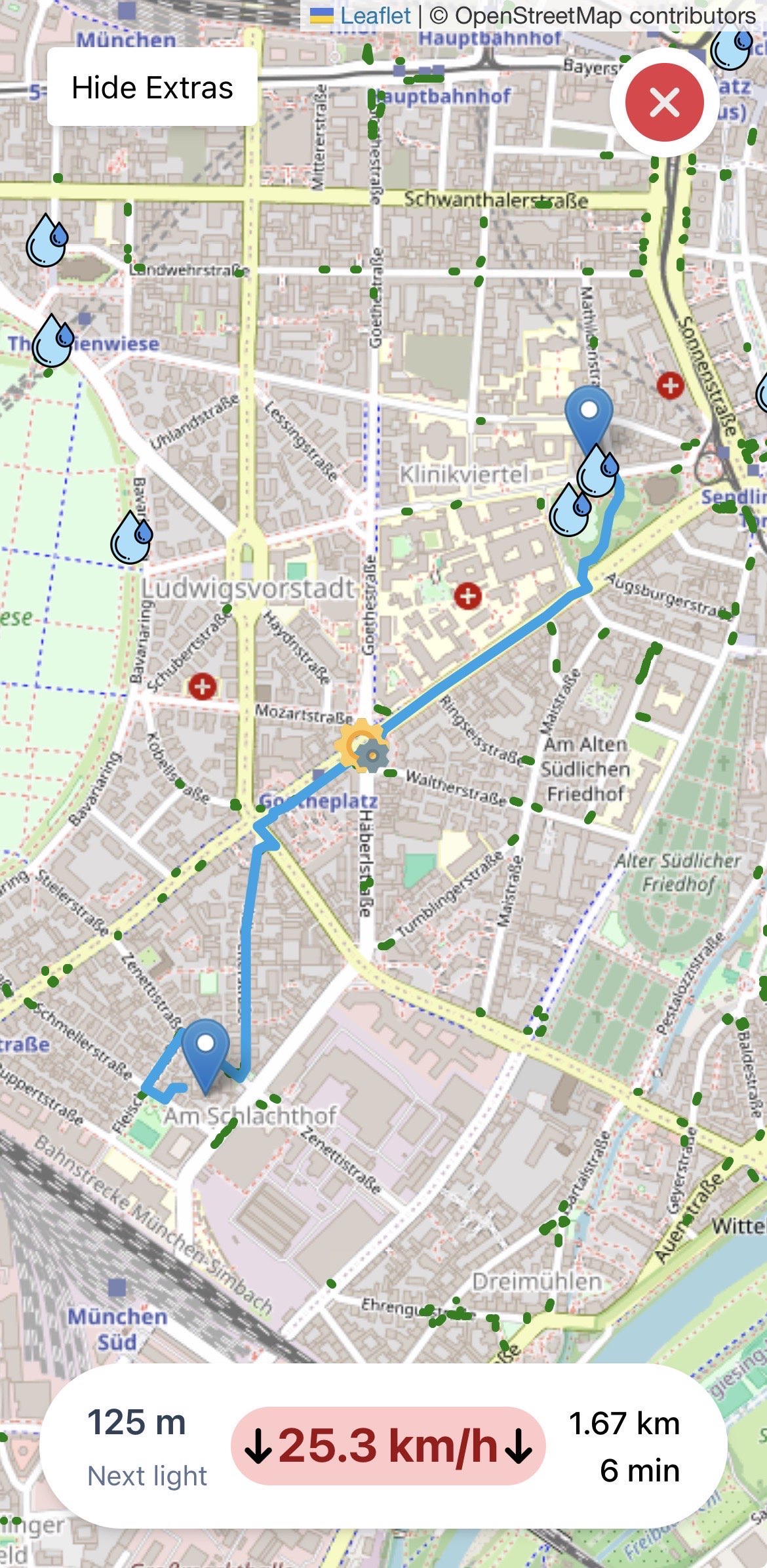
The user should slow down so they do not have to stop at the next traffic light
-
Inspiration
We got inspired by the complexity of the Munich traffic light system. How it adapts to cars and public transports. However sometimes a perfect solution is technically and logically not possible. We want to take cyclists out of this problematic stressful field, as they can adapt their speed more easily to the traffic lights and not the other way around.
What it does
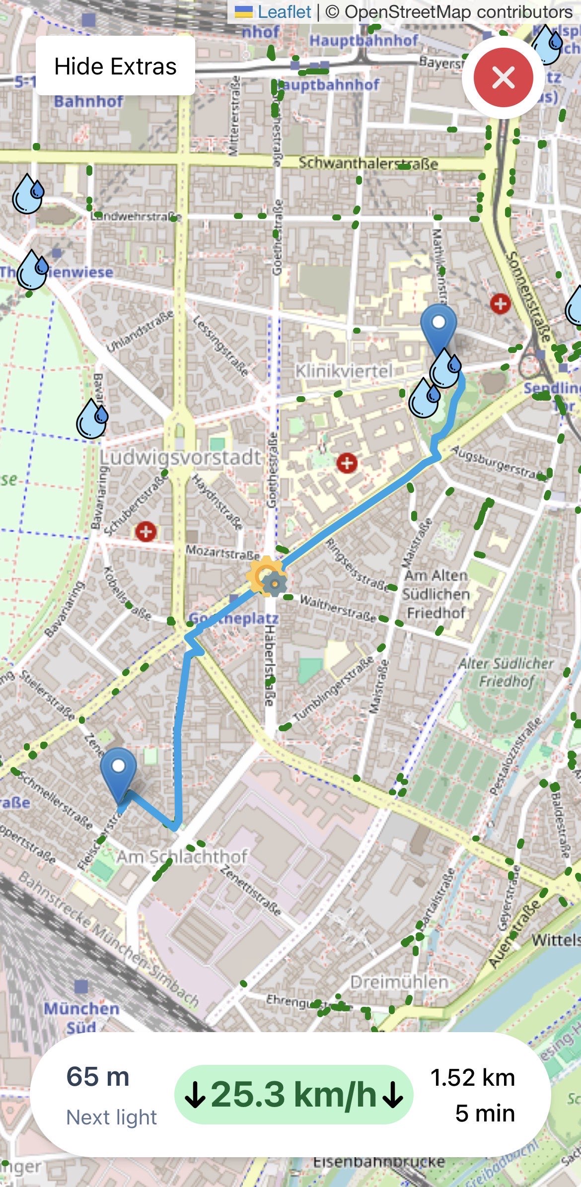
Our product is based on and enhances a navigation system. It keeps track of the next traffic light a cyclist has to pass and makes sure they reach it perfectly in time for the green light. The app can give suggestions on whether they should speed up or slow down even before the traffic light is visible to the cyclist. In addition the app can provide information about the nearest water dispenser, service station and parking space for bikes.
How we built it
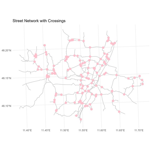
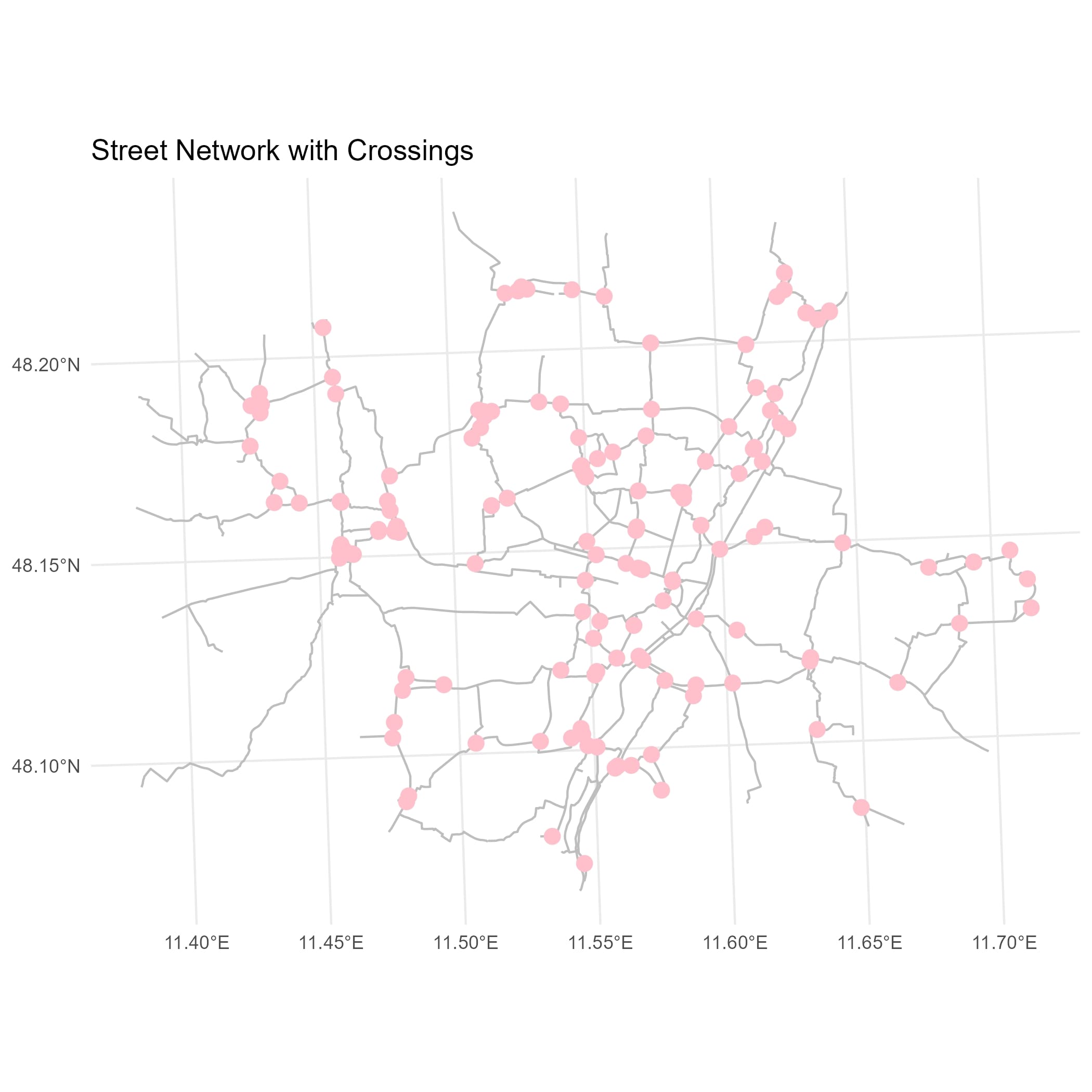
The most important parameters to fully implement our idea are the state the traffic light is in, the location of the cyclist and its speed. Using R, we analyzed the cyclable streets of Munich and extracted crossings, where possible traffic lights can be found. For many other points on these streets, we tried to determine the next crossing in each direction and the individual distance to it. We continued to design a map that shows bike parking possibilities, water dispensers and service stations in relation to the cyclable streets.
With Vue and Nuxt we implemented a working prototype of our webapp. We are using OpenStreetMap as a map and are tapping into the OpenRoutesService API. This enabled the autocompletion of inserted streetnames, getting the address of the users current location and calculating the route.
Challenges we ran into
It was not clear how data about the traffic light states is collected and how we can access it, so we continued to focus on the basic logic and did not worry about the live data. Designing an interface between R and Vue was a challenge we were not able to overcome.
Accomplishments that we're proud of
The prototype running on a mobile phone makes us especially proud. After entering a starting and an end point, it shows a cyclable route between these two. By clicking a button, icons of nearby water dispensers, service stations and bike parking spaces can be shown or hidden. It is also possible to show the user if they have to slow down or speed up altough the live data from traffic lights is missing.
What we learned
It was exciting to see the database and the structure behind Landeshaupstadt München and to dive a little into traffic management. Personally we were able to enlarge our knowledge about R and Vue and are greatful for this opportunity.
What's next for Green Wave
Besides the green light adaptation, other improvements for cyclist in the app are possible. The algorithm planning the route can be improved by prioritizing certain paths and detailed instructions provided to the user. The actual recommendation of slowing down or speeding up can be passed to an AI model, that takes into account the habbits and fitness of the cyclist. For the Landeshauptstadt München, our app could collect further data to complete the Radzählstellen.
Built With
- nuxt
- r
- vue

Log in or sign up for Devpost to join the conversation.