The Green Living Data Analysis Project aims to promote sustainable living by integrating various environmental datasets into a comprehensive knowledge graph. This project leverages data from satellite imagery, mapping services, and news articles to provide insights into green infrastructure, pollution levels, and related news.
The Agentic App dynamically retrieves and processes natural language queries based on user intent. It offers:
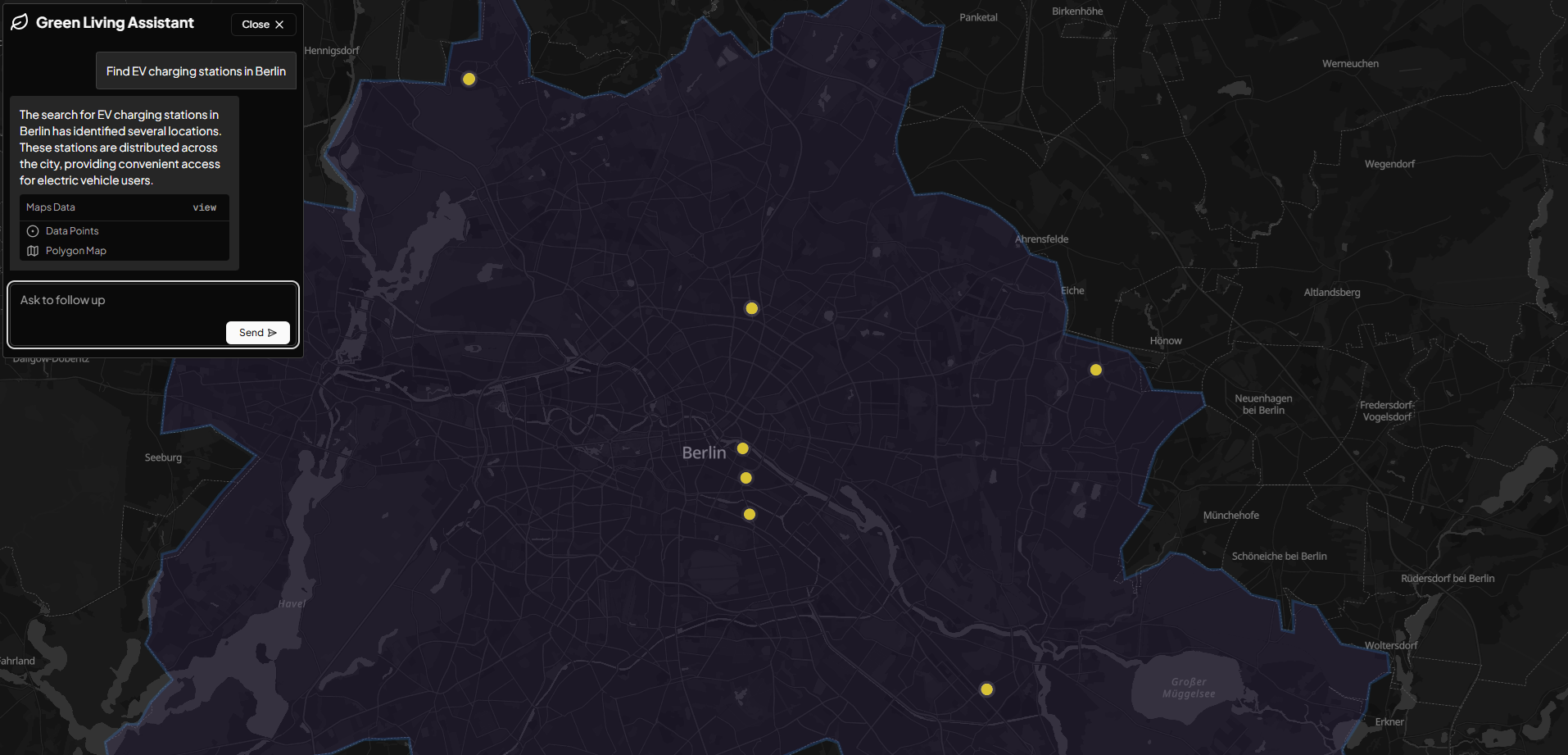
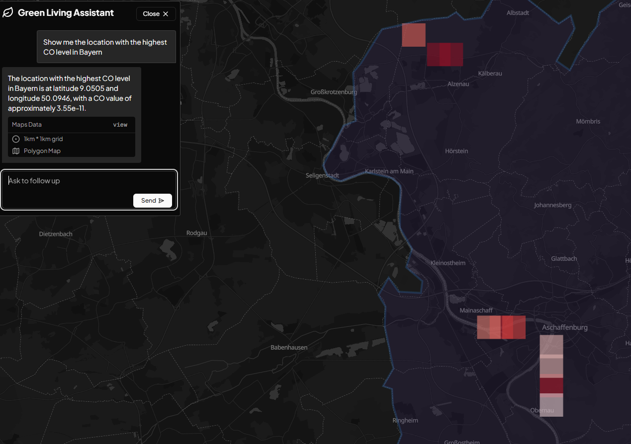
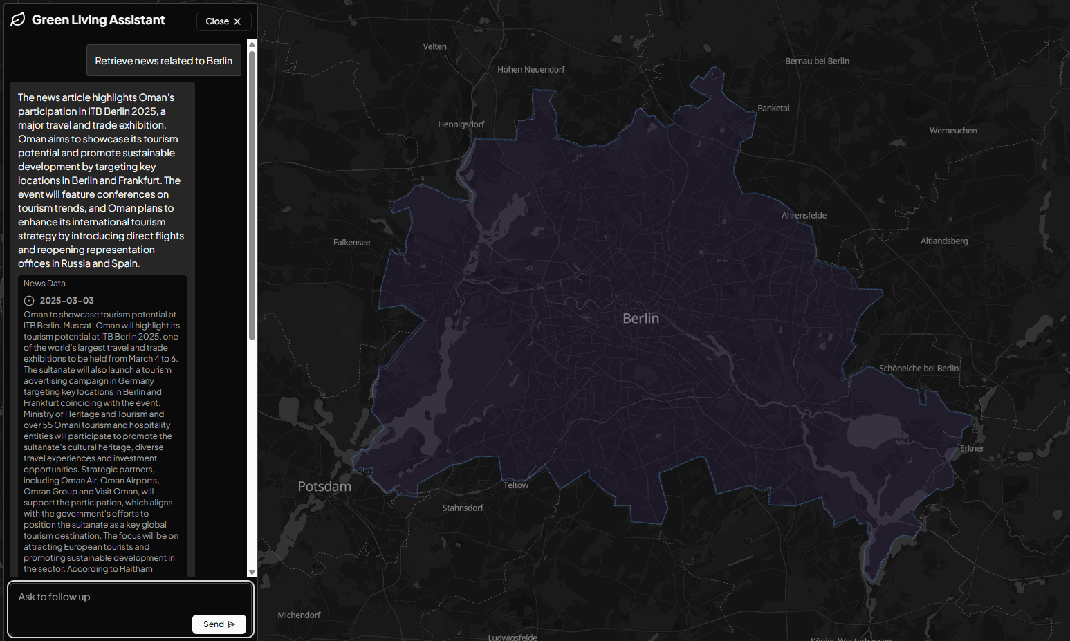
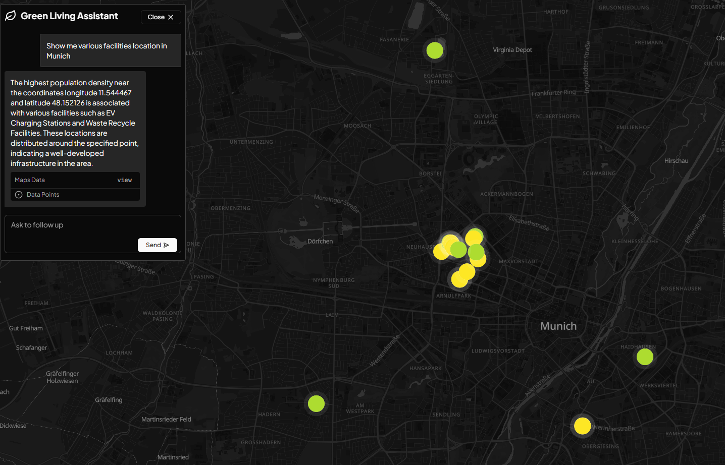
Geospatial Data Analysis: Provides insights into the distribution and accessibility of green infrastructure and pollutant levels. News Retrieval: Aggregates and analyzes news related to environmental issues to keep communities informed. Example Queries:
"Find EV charging stations in Berlin." "How many greenery lands are in Hamburg?" "Show me the location with the highest CO level in Bayern." Here how it's works

Log in or sign up for Devpost to join the conversation.