Inspiration
Today we have hundreds of applications in Android to show the map from one place to another. The technology is becoming much more and more sophisticated but it never show us what the condition of road is currently which mostly causes us a lot of problems. Ambulances, took patients in such hurry and they also had to take care of the patients health. A serious jump can cause a patient some severe injuries. Thinking about all of this we thought why not an application, that not only will show the map but will also describe the condition of the road.
What it does
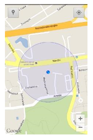
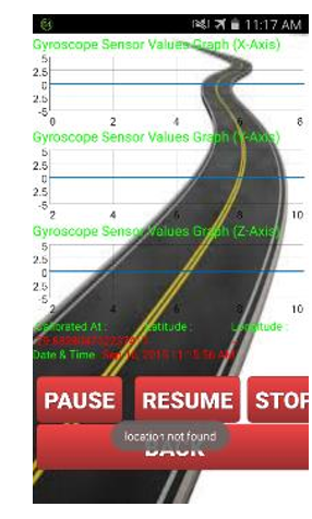
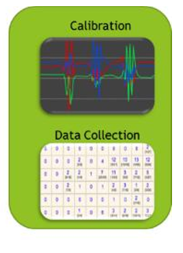
This Project is based on (gyroscope) mobile sensor. In which get readings from the sensor while traveling on the road. These readings are analyzed by algorithm. After analyzing the reading results have been generated. These results are shown on the Google maps. There is a need to identify good or bad road condition along parts of highways.
There is no tool or application which provides current road condition information. This application provides an inexpensive and easy to use smartphone based mechanism for collecting road condition information.
GPS Aware road profile will not only be help full in usually travelling but it will help in emergency situation and in military actions as well. Road situations provide reasons for many economic loses and casualties as well. Our project will help to pre-determine the condition of roads for emergency situations like for the movement of ambulance, for traveling under certain climatic conditions. And will also be helpful for military helicopters to find a certain plain surface in case of emergency.
How we built it
we four friends are always keen in discussing such stuff with the teachers. when we came to know about KPApps challenge, this was the time for us to take advantage of it, it took weeks get the idea. When we got the idea there were many problems ahead but with the help of teachers and our determination we were able to finalize a tool that could model our idea as an application
Challenges we ran into
There were many challenges we faced during the creation of this project. The most frustrating was to arrange time from our hectic university life. we were going through quizes and assignments than sessionals, it was really hard to arrange time for it, but we had scheduled and few hours from each night and discussion with teachers in the morning, only for this project. Secondly, the first idea and modeling of that idea was really a challenge because we discussed thousands but can't get to finalized one. After facing all these challenge the reason behind the selection of this project was also the ease in creating it because we had our back in experts of the field.
Accomplishments that we're proud of
We are proud the we worked in a team, a coordination we build and understood the team work is unimaginable. We finally were able to create something that is a prove of our hard work and determination for this project. Teachers and their appreciation is the most valuable is what we are proud of most.
What we learned
A team work was the most imperative learning that we did. everything else was just part of it.
What's next for GPS Aware Road Profiling Using Gyroscope
Obviously the tool we made is not the perfect one, lot of refinement is needed. And after that if this is deployed in every ambulance and vehicle it can save many issues and situation before they even occur.


Log in or sign up for Devpost to join the conversation.