-
-

GowanusAR poster
-
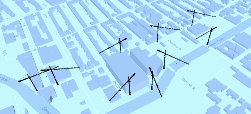
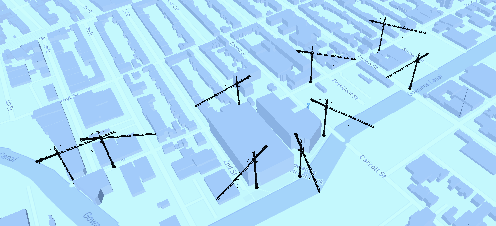
3D map view of cranes representing AR experience sites
-
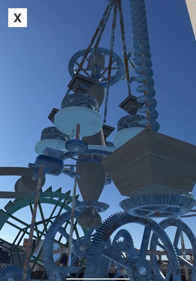
Animated 3D tide mill brought to life

Inspiration
We're interested in exploring the idea of "place" itself as a storytelling vessel, and what better medium to tell stories of place than location-based AR, with which the complexity of interweaving pasts, presents, and futures can be experienced in imaginative, open-ended ways? (And what better time to create location-based AR than following the recent release of Geospatial Creator??)
While researching the history of Brooklyn, we came across maps of underground waterways -- springs and streams built on top of centuries ago -- that all flow into the Gowanus Canal. This central waterway quickly became the "main character" of our immersive world. Its layers of history -- from colonial mills to industrial refineries and finally to a Superfund remediation project and re-zoned high-rise corridor in the modern day -- presented an exciting challenge to make sense of via a multimodal (m)app.
Questions we've carried with us throughout the project include:
- What is the story of water in the Gowanus?
- What is AR's potential within experimental documentary storytelling?
- What would a living, breathing story look like?
- What restorative, sustainable, and inclusive futures are possible for this neighborhood?
- How can we collaborate with diverse local voices to help bring these futures to life?
What it does
The GowanusAR iOS app, enabled by Google's Geospatial Creator, consists of a location-based AR walking tour through nine immersive experiences along the Gowanus Canal. You navigate along the tour via a 3D map displaying cranes -- representing the area's rapid development -- at each of the nine sites. Once you've arrived at the site, you can tap the crane to enter AR mode, scan your surroundings, and dive into a new layer of Gowanus' story, such as:
- within the inner workings of a colonial Tide Mill, representing the original draining of the area's salt marsh for farmland, rewired as a film projector
- seeing beneath the street to the 19th century sewer system, revealing the decision to combine sewer wastewater with surging stormwater
- data visualizations of added wastewater volumes and innovative stormwater harvesting systems superimposed on top of recently built and in-development high-rises
- visionary 3D models of the long-shuttered Community House at the Gowanus public housing project, now re-designed by architecture students in collaboration with residents to reflect their cultural visions and intergenerational needs
Whether local neighbors, innovative designers, visiting tourists, community activists, city politicians, or speculative artists, there are stories for everyone within this multifaceted app. We're excited to continue to evolve its contents alongside our deepening collaborations with the local community.
How we built it
There are many layers to the design and development of this app:
- The Geospatial Creator plugin for Unity was the app's anchor (literally), allowing us to build and iterate on complex experiences in the Unity Editor, geo-located within the 3D backdrop of the real sites where the content would be experienced around the canal
- We used the Proxima Runtime Inspector tool in builds to help more precisely re-position assets on site and save their transform values, to fine-tune their Geospatial Anchor locations back in the Unity Editor
- We used the Mapbox API to generate our 3D navigation map, which centers on the user's real-world location and rotates with the user's device for easy navigation
- We custom-built many of the assets, gathered archival materials from many sources, and created voiceovers from interviews we conducted, as well as AI text-to-speech technology (when telling voiceover stories as the "voice of Gaia")
Challenges we ran into
- We encountered performance issues with larger, resource-heavy scenes, and had to reduce poly counts and re-design content to get them running smoothly
- Some plugins that worked well in the Unity Editor while iterating didn't transfer well to AR mode, such as Zibra's Liquids plugin; we're excited to keep working with parameters to get them running beautifully on mobile and adding to the visual quality of the piece
- Time was perhaps our biggest challenge, as the scope of our app is pretty large, and we didn't decide to focus on submitting for this challenge until quite recently; we have a bunch of features we're still working on and plan to implement within the app in the coming weeks
- We tried to set up a backend CMS to make the tool more scalable and allow others to author their own sites and tours, but ran into technical challenges; we're excited to explore possible solutions more in-depth like Firebase and Echo3D going forward
Accomplishments that we're proud of
Overall, it's amazing to see how this story of many stories has synthesized into a coherent narrative and tour experience. We're proud of creating a robust, technically sophisticated app with just one developer, as well as a collaborative framework and -- network of collaborators -- for location-based, community-centered AR design and storytelling, with just a few team members' efforts of exploring and making connections in the Gowanus neighborhood
What we learned
We've learned so much about the Gowanus Canal and the rich and complex history of Brooklyn, as well as some amazing stories of environmental remediation, community activism, and reasons to be hopeful for the future development of the Superfund site, as well as similar areas for which Gowanus can be a model of sustainability.
On the technical side of things, we've learned just how powerful new dev tools can be: After having tried many AR localization techniques in the past, no tool has come close to Geospatial Creator in terms of speeding up technical workflows and allowing us to focus more on design and storytelling rather than debugging.
What's next for GowanusAR
We have many plans to continue designing and developing our app in the coming months:
- We hope to ship a more complete, performant, and content-rich app on the App Store by the end of this year; we'll also look into developing an Android version (made easy by working with Unity's AR Foundation cross-platform library)
- One of the content pieces we're most excited about fleshing out more is the dynamic water animations powered by Zibra.Ai Liquids plugin
- One of our main efforts going forward will be setting up the "authoring tool" side of the app, so that current and future collaborators can build their own scenes and even their own walking tours for different places
- We've been applying for various grants and exhibitions to support our continuing efforts to explore AR's potential in expanding the possibilities of telling stores of, in, and for fascinating places, especially powerful in a sustainability context (raising awareness about sustainability issues and gathering excitement about sustainable designs)
- Gooo-wanus! (onwARd)
Built With
- geospatial
- unity

Log in or sign up for Devpost to join the conversation.