-
-

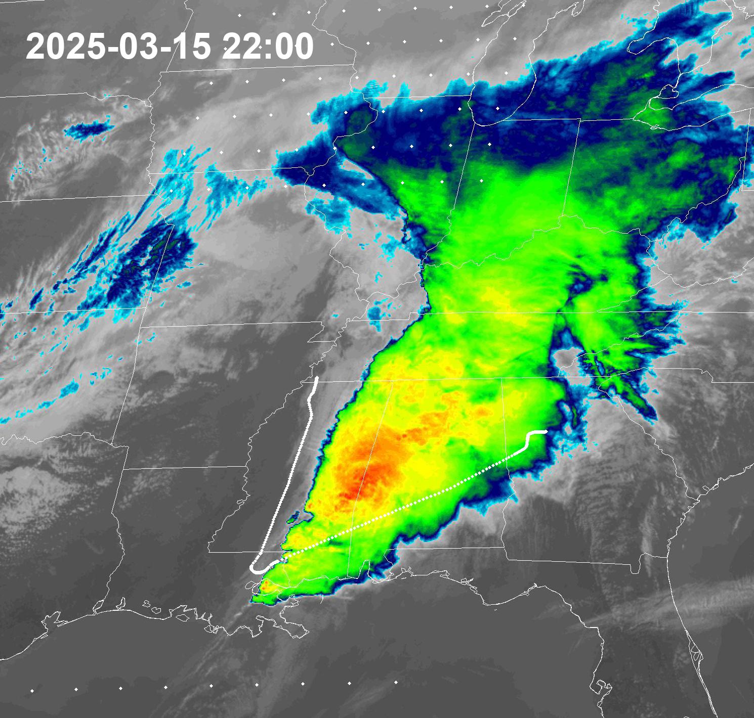
A good pilot from Delta Airlines Flight DL2778 – Pilot’s Expert Storm Evasion (15 Mar 2025)
Inspiration
Improve commercial aviation comfort and safety for passengers and crews in the context of severe turbulence during the commerical flights.
What it does
Mapping real-time geostationary satellite images during the commercial flight.
How we built it
Mapping geostationary satellite images with ADS-B flight data.
Challenges we ran into
We need to let pilots have these real-time satellite images.
Accomplishments that we're proud of
Some pilots are very skillful when the ADS-B flight tracks were mapped with geostationay satellite images.
What we learned
Geostationary staelllites mapped with real-time flight track can help pilots in navigatinve around the serere storms.
What's next for Good aviation pilots
Commercialisation
Built With
- fortran
- python

Log in or sign up for Devpost to join the conversation.