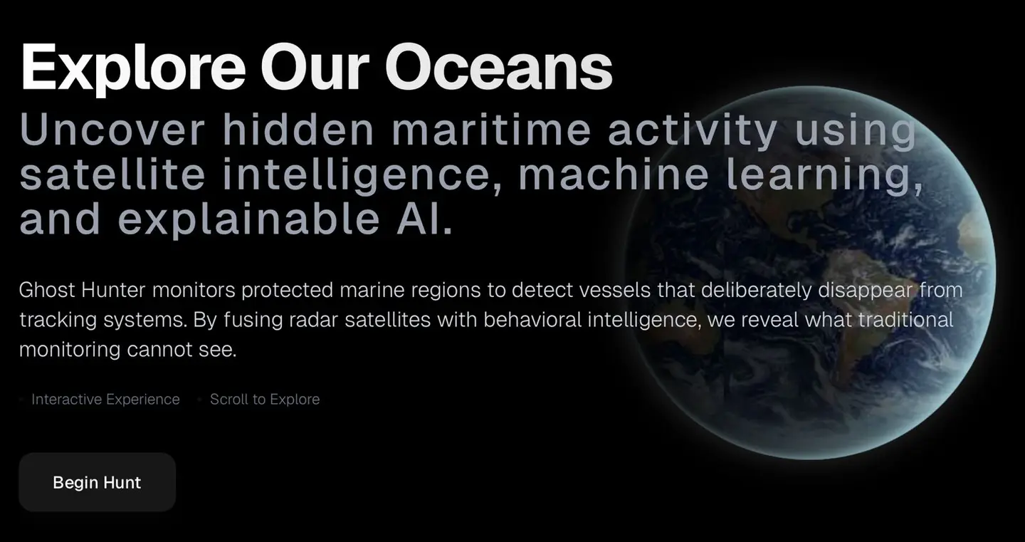
🌊 Ghost Hunter: Project Story
🚀 About the Project
Ghost Hunter is an AI-driven maritime intelligence system designed to detect “dark vessels”—ships that deliberately turn off their AIS (Automatic Identification System) to avoid tracking—within Marine Protected Areas (MPAs). These vessels pose a serious threat to marine ecosystems through illegal fishing and unauthorized activity.
The core idea behind Ghost Hunter is simple yet powerful:
👉 If vessels try to hide digitally, we detect them physically.
💡 What Inspired Us
Oceans cover more than 70% of the Earth, yet monitoring them remains incredibly difficult. While researching maritime surveillance, we discovered a critical loophole:
- Most tracking systems rely on AIS signals
- Illegal vessels simply turn off AIS to become invisible
This raised a fundamental question:
“What if we could detect vessels even when they don’t want to be seen?”
That question became the foundation of Ghost Hunter.
🛠️ How We Built It
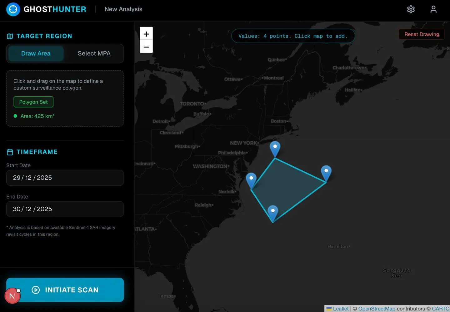
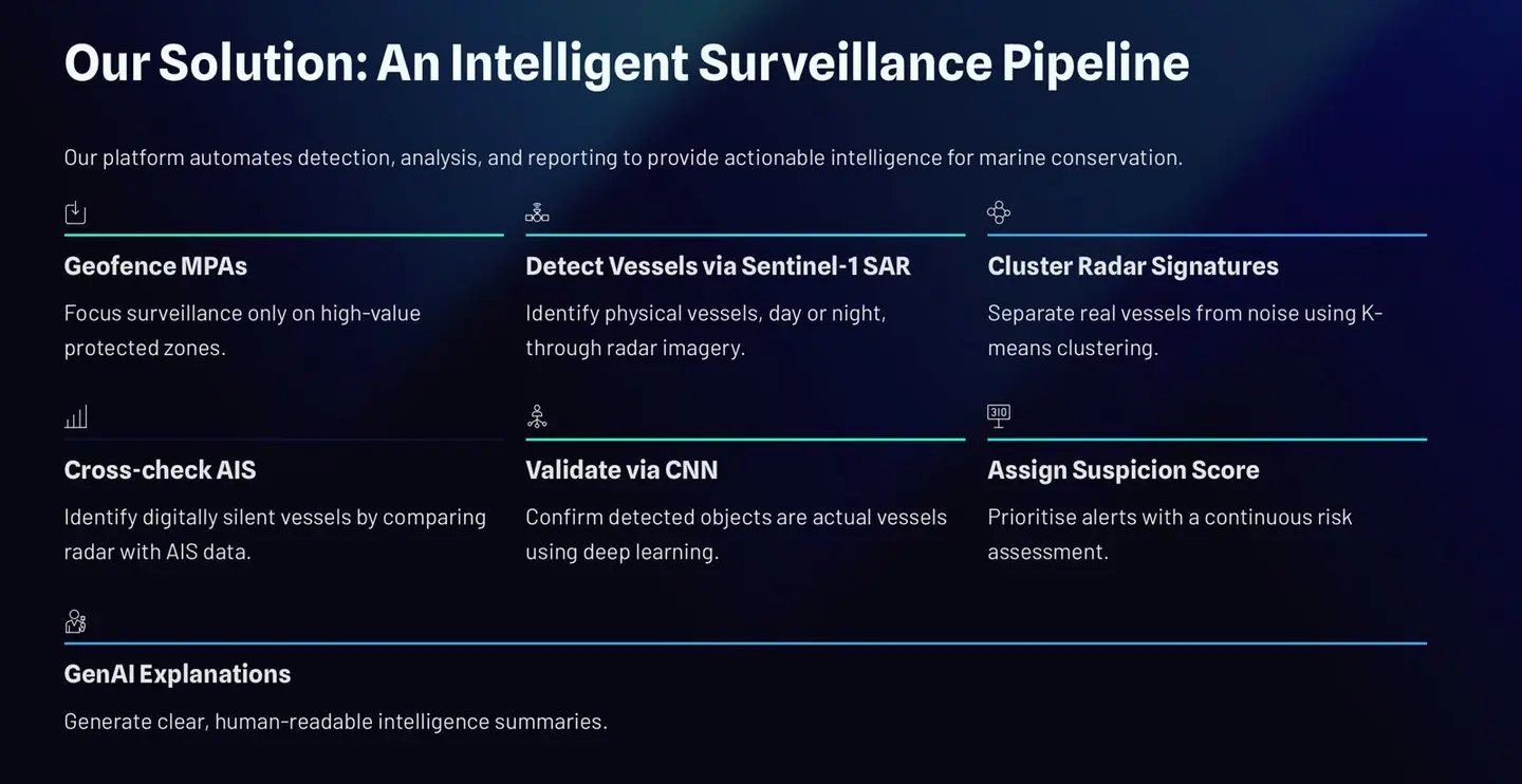
We designed Ghost Hunter as a multi-stage intelligence pipeline that transforms raw satellite data into actionable insights.
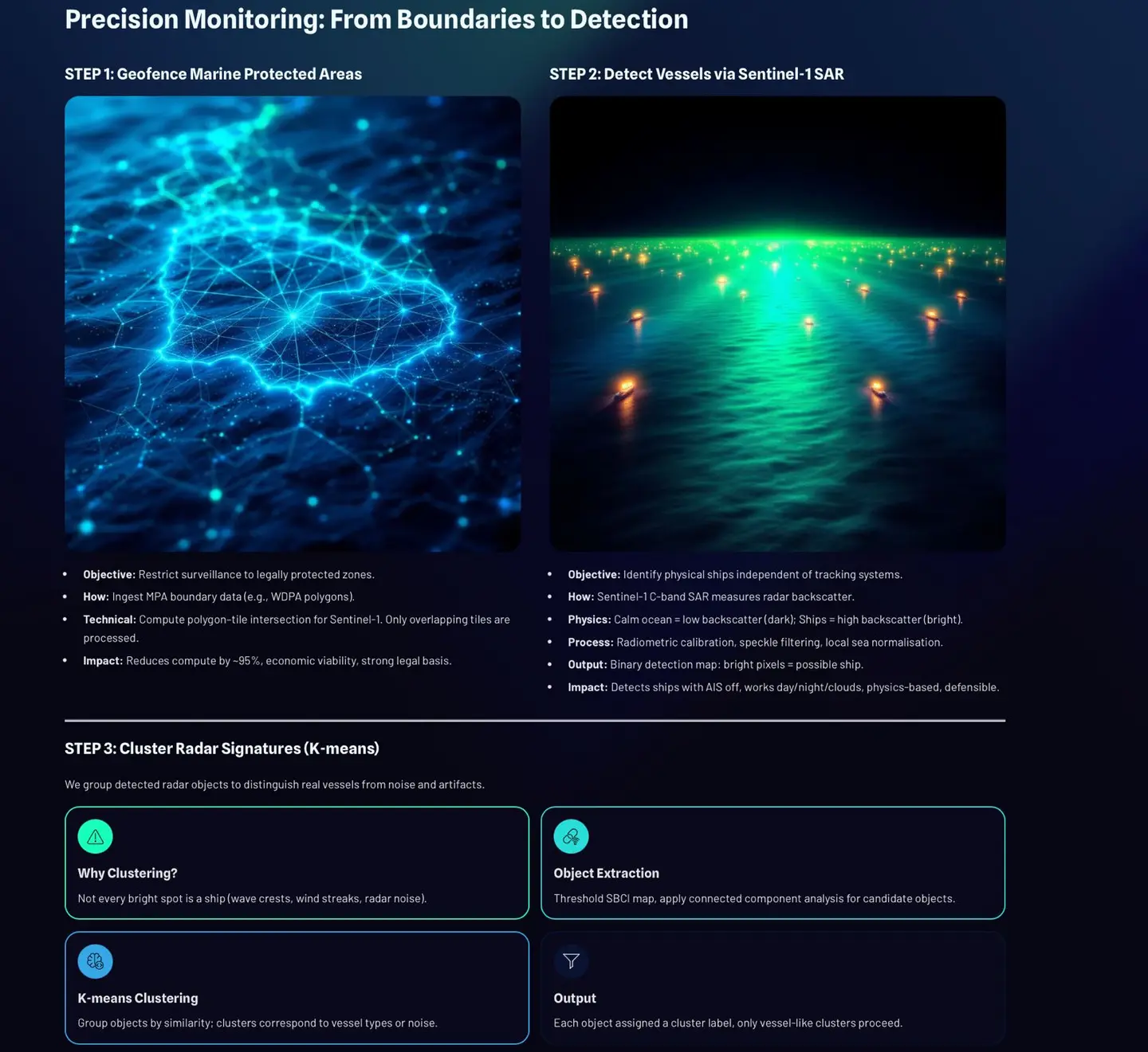
🔹 Phase 1: Physical Detection (Seeing the Invisible)
- Processed Sentinel-1 SAR satellite imagery
- Applied physics-based detection (SBCI) to identify ship-like structures
- Used K-Means clustering to remove ocean noise and isolate vessel candidates
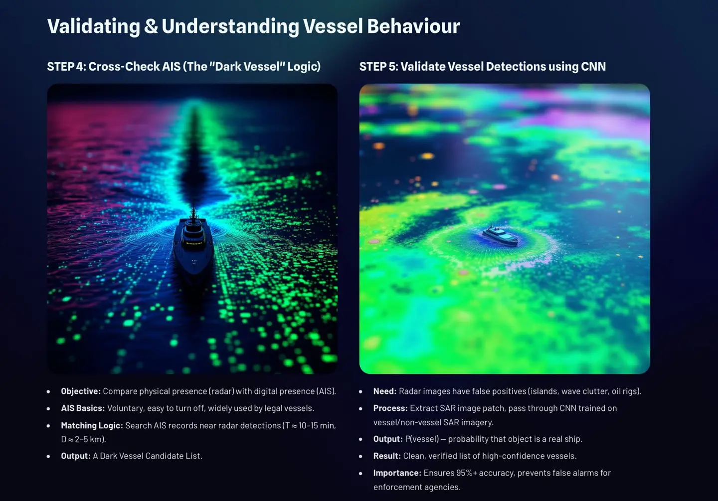
- Cross-referenced detections with AIS data:
- AIS present → Normal vessel
- AIS absent → 🚨 Dark vessel candidate
- AIS present → Normal vessel
🔹 Phase 2: Behavioral Intelligence (Understanding Intent)
Detection alone isn’t enough—we needed to understand behavior.
- Built a CNN classifier to validate real vessels vs noise
- Designed rule-based behavioral analysis:
- Vessel proximity (possible coordination)
- Fleet formations (illegal group activity)
- Movement patterns (suspicious intent)
We then combined all signals into a risk score (0–100):
$$ \text{Risk Score} = \sum (w_i \cdot f_i) $$
Where:
- fᵢ = behavioral or detection features
- wᵢ = importance weights
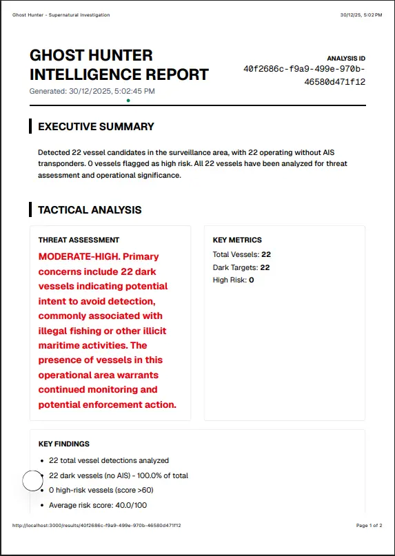
🔹 Final Output: Intelligence Reports
The system generates:
- Structured JSON outputs
- Human-readable reports
- Clear risk categorization: Low → Critical
This bridges the gap between raw satellite data and real-world enforcement.
📚 What We Learned
This project pushed us across multiple domains:
- 🌐 Remote Sensing – Understanding SAR imagery and its challenges
- 🤖 Machine Learning – CNNs, clustering, and feature engineering
- 📊 Data Fusion – Combining physical + behavioral signals
- 🧠 Explainable AI – Making outputs interpretable for decision-makers
- ⚙️ System Design – Building scalable, modular pipelines
One key realization:
Detection is easy. Interpretation is what creates impact.
⚔️ Challenges We Faced
1. 🚧 Lack of Real-Time Data
- SAR data is large and slow to download
- Limited free-tier APIs caused delays
2. 🧠 Behavior Modeling Limitations
- Initially tried LSTMs
- Failed due to sparse temporal data
- Switched to spatial + rule-based intelligence
3. ⚖️ Data Imbalance in CNN
- Mostly ship images → poor generalization
- Solved by generating synthetic sea patches
4. 💻 Compute Constraints
- Heavy processing not feasible in real-time
- Built a lightweight demo pipeline while keeping full system offline-capable
🌱 What’s Next
We see Ghost Hunter evolving into a real-world enforcement tool:
- 📍 Vessel trajectory tracking using Kalman Filters
- 🧠 Advanced behavior modeling with temporal data
- ⚡ Real-time detection with optimized pipelines
- 📱 Mobile apps for field officers
🌍 Final Thoughts
Ghost Hunter is more than a technical project—it’s a step toward protecting our oceans.
By combining satellite intelligence with AI, we turn invisibility into accountability.
Built With
- fastapi
- javascript
- next.js
- numpy
- python
- render
- scikit-learn
- sentinel-1sar
- tailwindcss
- typescript
- vercel


Log in or sign up for Devpost to join the conversation.