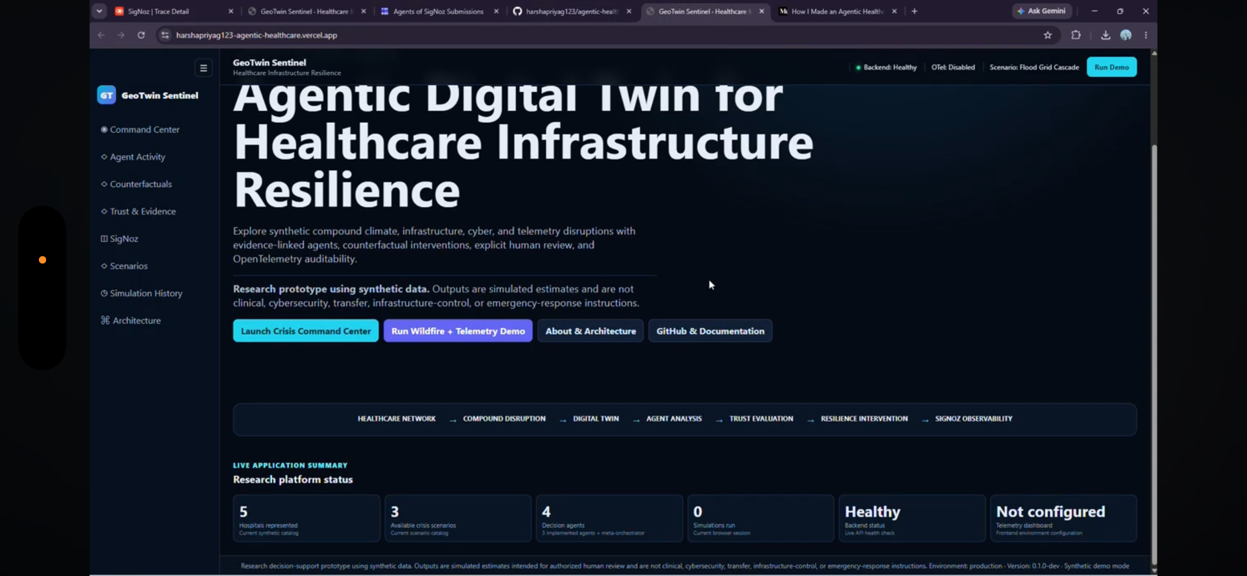
GeoTwin Sentinel — AI-Powered Geospatial Digital Twin for Proactive Risk Intelligence
Inspiration
Many critical events—extreme heat, air-quality deterioration, flooding, infrastructure stress, and environmental hazards—are deeply connected to where and when they happen.
Yet the information needed to understand these risks is often scattered across maps, environmental datasets, sensor feeds, infrastructure systems, and public data portals. Decision-makers may have plenty of data but still lack a clear picture of:
What is happening, where is the risk increasing, why is it happening, and what should we do next?
That inspired GeoTwin Sentinel.
We wanted to explore whether AI, geospatial intelligence, and digital-twin concepts could be combined to create a living representation of an area—one that doesn’t simply visualize historical information but helps identify emerging risks and explain them.
Our vision became:
Sense the environment. Understand the geography. Detect the risk. Explain the impact.
GeoTwin Sentinel turns fragmented spatial and environmental information into actionable intelligence.
⸻
What it does
GeoTwin Sentinel is an AI-powered geospatial digital-twin platform for monitoring, analyzing, and understanding location-based risks.
Instead of looking at individual datasets independently, the platform brings multiple risk signals together into a unified geospatial view.
GeoTwin Sentinel can analyze factors such as:
- Environmental conditions
- Air-quality indicators
- Extreme heat
- Traffic and mobility patterns
- Vegetation and land characteristics
- Community vulnerability
- Infrastructure conditions
- Geographic risk patterns
These signals can be transformed into risk layers and visualized geographically.
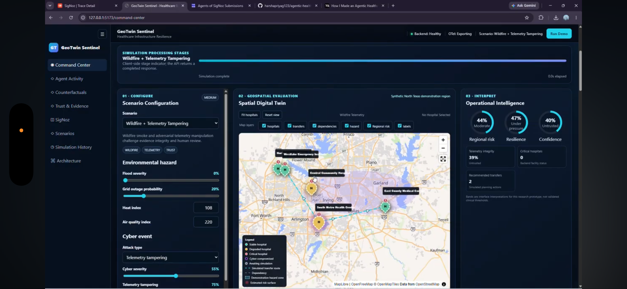
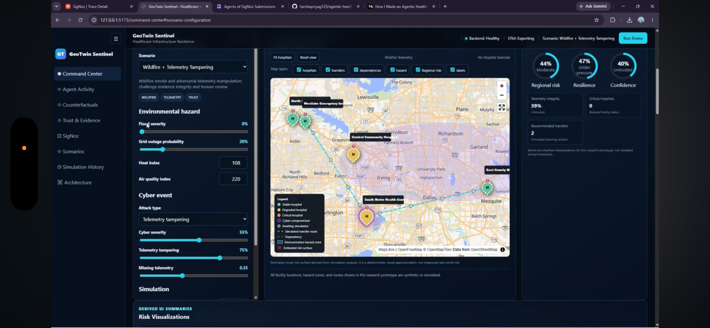
🗺️ Geospatial Risk Intelligence
GeoTwin Sentinel maps risk indicators geographically, allowing users to quickly identify areas experiencing elevated or overlapping risks.
🌎 Digital Twin
The platform creates a digital representation of the monitored environment.
Rather than treating a map as a static visualization, GeoTwin Sentinel treats geography as a dynamic system whose conditions can change over time.
🧠 AI-Powered Analysis
AI helps interpret complex risk information and translate technical indicators into understandable insights.
Instead of only presenting numbers, the system is designed to answer questions such as:
Why is this location considered high risk?
Which factors contribute most to the score?
What areas should be prioritized?
🚨 Risk Detection
Multiple signals can be combined to identify hotspots where environmental, geographic, infrastructure, or community risks intersect.
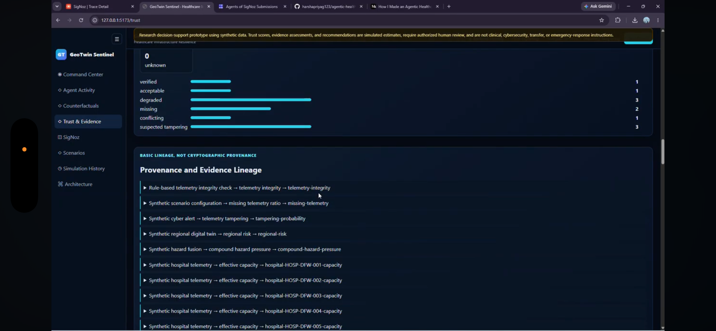
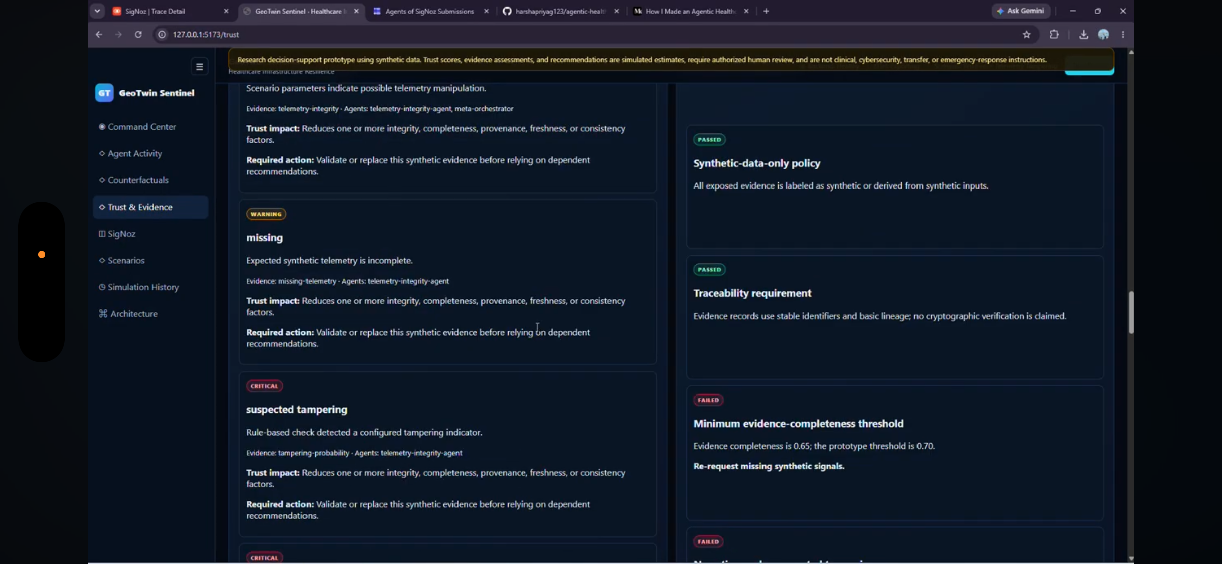
📊 Explainable Risk Scoring
GeoTwin Sentinel aims to make risk predictions understandable by showing the factors contributing to a location’s overall risk.
The goal is not just to display a red area on a map.
The goal is to explain why it is red.
⸻
How we built it
GeoTwin Sentinel combines geospatial engineering, data processing, AI, and interactive visualization.
Geospatial Data Pipeline
We process multiple location-based datasets and convert them into standardized geographic layers.
These datasets can represent environmental conditions, infrastructure, demographics, vegetation, traffic, and other risk indicators.
Risk Intelligence Engine
The platform combines these signals to generate geographic risk assessments.
Rather than depending on a single indicator, GeoTwin Sentinel considers how multiple conditions overlap within the same location.
AI Intelligence Layer
AI is used to transform complex geospatial results into human-readable explanations and actionable insights.
This allows the system to bridge the gap between raw spatial analytics and decision-making.
Interactive Mapping
The frontend provides an interactive geographic interface where users can explore:
- Risk hotspots
- Individual risk layers
- Geographic patterns
- Contributing factors
- Location-level insights
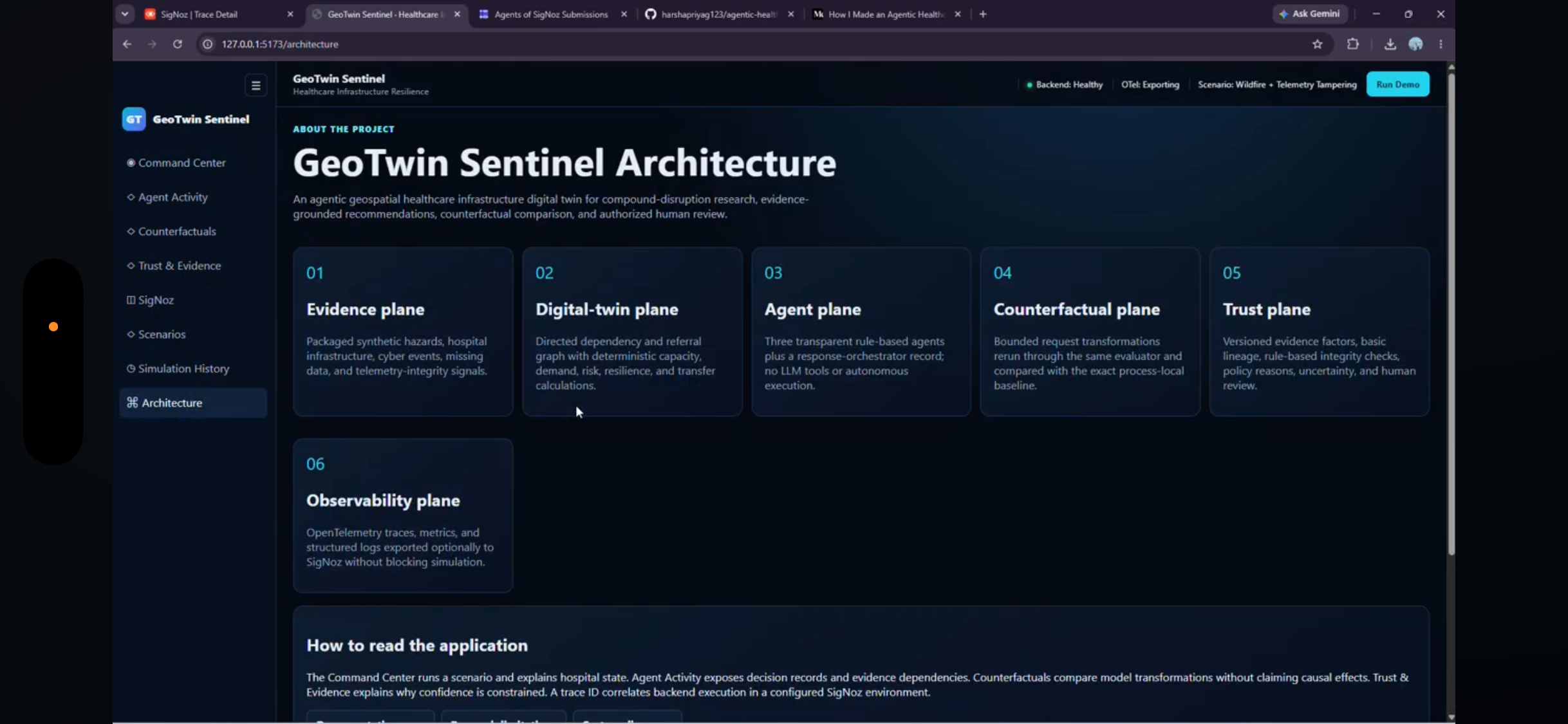
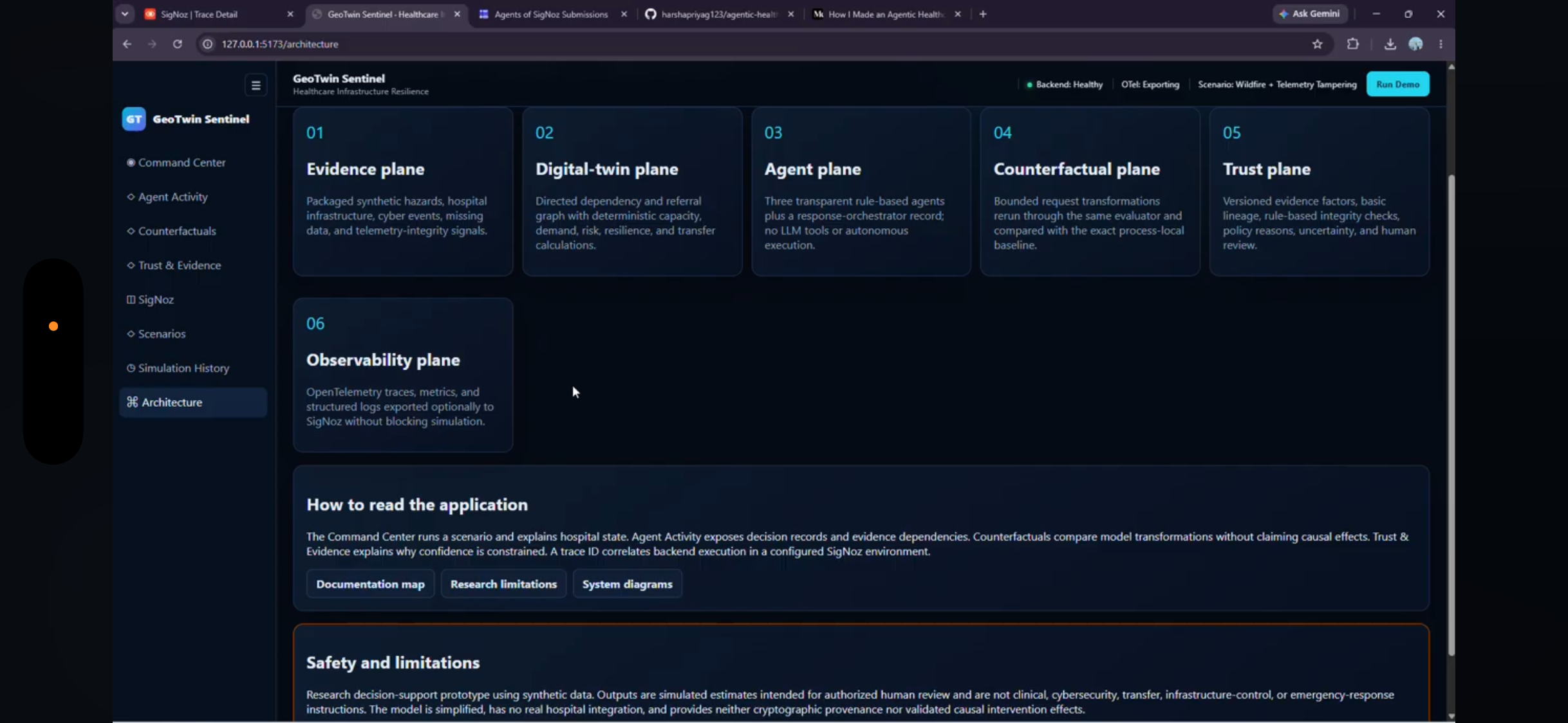
Digital-Twin Architecture
We designed the system around a modular architecture so additional data sources, sensors, models, and geographic regions can eventually be connected without rebuilding the entire platform.
The resulting workflow looks like:
Data Sources → Geospatial Processing → Risk Engine → Digital Twin → AI Analysis → Interactive Map → Actionable Insights
⸻
Challenges we ran into
One of our biggest challenges was combining heterogeneous geospatial datasets.
Different sources can use different geographic boundaries, coordinate systems, resolutions, timestamps, formats, and measurement scales.
Before meaningful risk analysis can happen, those datasets must be cleaned, normalized, geographically aligned, and interpreted correctly.
Another challenge was designing a risk model that remained understandable.
It would have been easy to generate a single score and display it on a map. But a risk score without context isn’t particularly useful.
We therefore focused on making the system capable of explaining the contributing signals behind geographic risk.
We also had to balance several engineering concerns:
- Geospatial processing performance
- Map rendering
- Data normalization
- API design
- Risk-score calculation
- AI integration
- Geographic accuracy
- User-friendly visualization
Building a system that combines all of these components taught us that geospatial AI requires much more than simply putting machine-learning predictions on a map.
⸻
Accomplishments that we’re proud of
We’re especially proud that GeoTwin Sentinel brings several technologies together into one coherent system:
Geospatial Intelligence + Digital Twins + AI + Risk Analytics + Interactive Visualization
Instead of building another static environmental dashboard, we designed the project around the idea of a living geographic intelligence layer.
We’re also proud of the project’s explainability-first approach.
GeoTwin Sentinel isn’t intended to simply tell users:
“This area has high risk.”
It aims to answer:
“This area has elevated risk because these environmental, geographic, infrastructure, and community factors are occurring together.”
That distinction transforms a visualization into a decision-support system.
⸻
What we learned
Building GeoTwin Sentinel taught us that location provides context that traditional datasets often miss.
Two places experiencing the same environmental condition may have very different levels of real-world risk because their infrastructure, vegetation, population characteristics, traffic exposure, and surrounding environment are different.
We also learned that digital twins become significantly more powerful when combined with AI.
The digital twin provides the state of the environment.
Geospatial analytics provides the spatial relationships.
AI provides the interpretation.
Together, they create something much closer to an intelligent decision-support system.
Most importantly, we learned that responsible AI for risk analysis needs explainability, transparency, and human oversight, particularly when insights could influence real-world decisions.
⸻
What’s next for GeoTwin Sentinel
Our long-term vision is to transform GeoTwin Sentinel into a real-time AI geospatial intelligence platform.
Future versions could integrate:
- Real-time IoT sensor feeds
- Live weather information
- Satellite imagery
- Air-quality monitoring
- Flood and extreme-weather alerts
- Traffic and mobility intelligence
- Infrastructure monitoring
- Predictive risk forecasting
- Automatic hotspot detection
- Historical risk comparisons
- AI-generated mitigation recommendations
- Community-level alerting
- Scenario simulation
One particularly exciting direction is predictive digital twins.
Instead of only asking:
“What is happening right now?”
GeoTwin Sentinel could eventually help answer:
“What is likely to happen next?”
Users could simulate scenarios such as extreme heat, worsening air quality, flooding, infrastructure disruption, or changing environmental conditions and see how geographic risk could evolve.
The ultimate vision is:
Observe → Map → Understand → Predict → Alert → Act
GeoTwin Sentinel represents our step toward turning maps from passive visualizations into intelligent systems capable of helping communities understand and prepare for emerging risks.
Built With
- ai
- fastapi
- geopandas
- javascript
- llm
- ml
- postgis
- postgresql
- python
- react
- vite

Log in or sign up for Devpost to join the conversation.