-
-
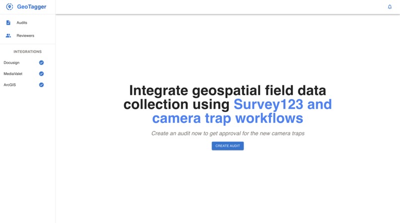
GeoTagger Landing page
-
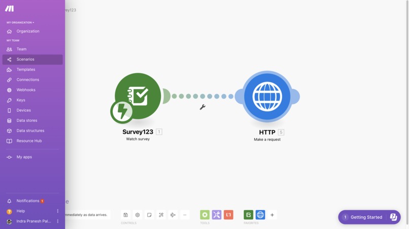
Survey 123 Webhook Integration
-

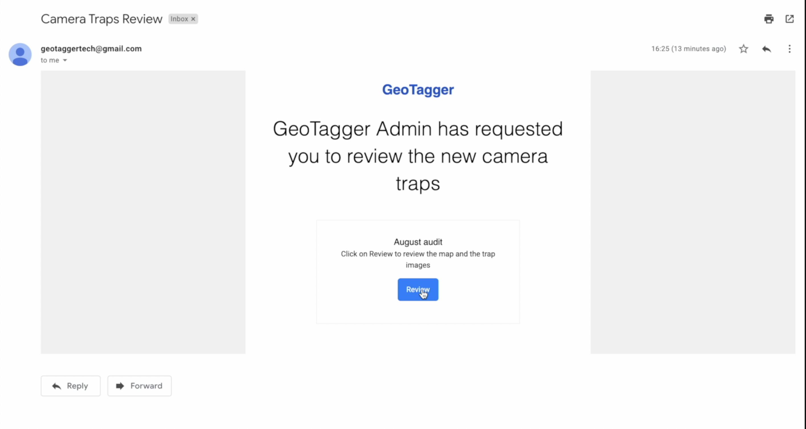
Review Email Template
-
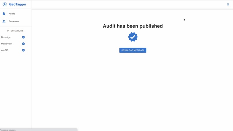
Successful Audit & Metadata download
-
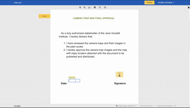
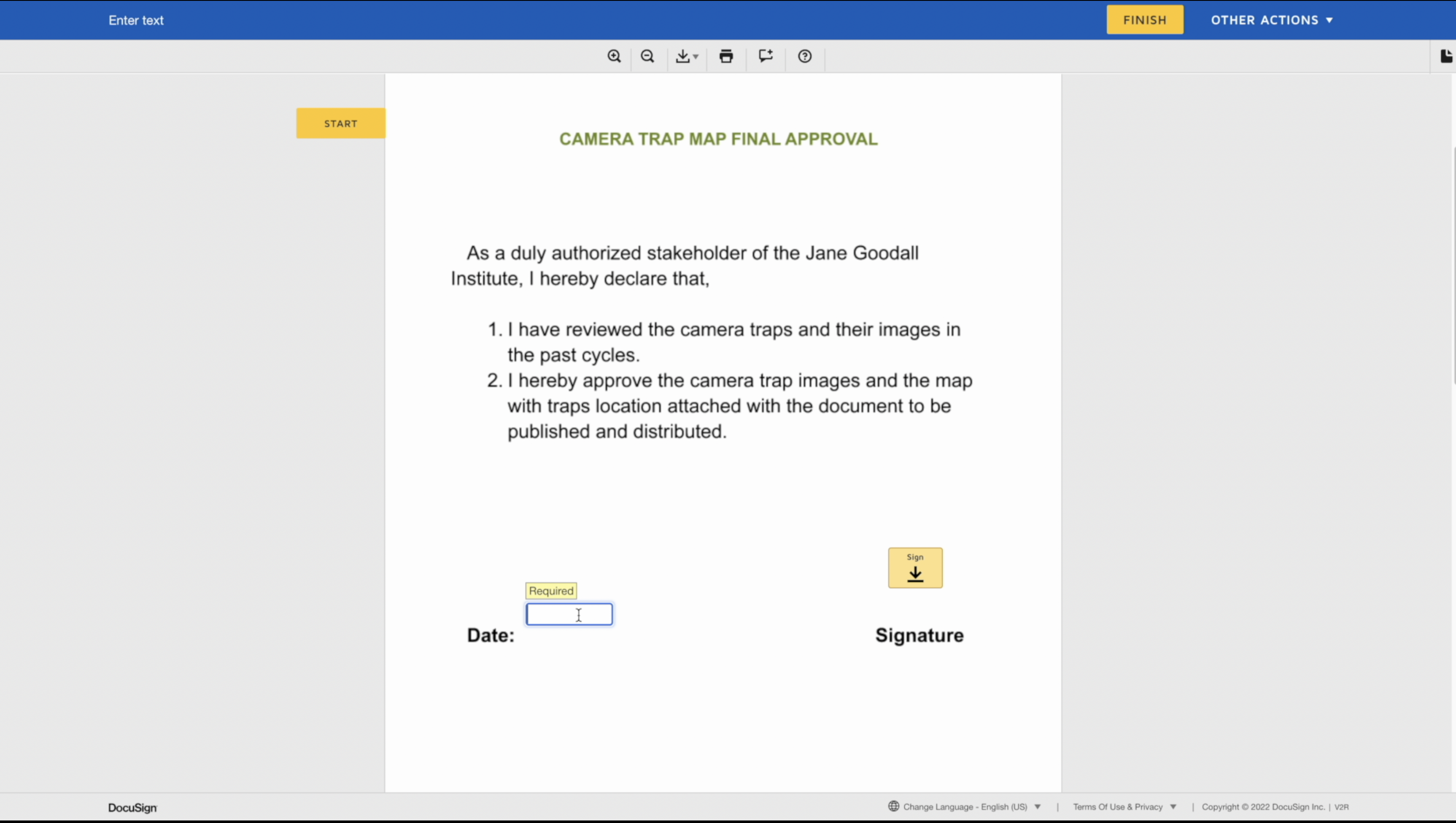
Final Agreement Signing


Inspiration
I have been always fond of DocuSign hackathons since 2020. This year, I was waiting for the announcement of this hackathon. As soon as the requirements were updated, I started working on this project.
What it does
GeoTagger helps the JGI to review, update and publish the camera traps location and their images. The application involves an admin user to run the portal. Once the JGI researchers fill out the survey on the Survey123 application, it triggers a webhook which automatically updates the trap details on the database. The admin can create an audit for the new traps and reviewers will be notified to review the audit. The trap locations get automatically added to the ArcGIS map. Once the marker is clicked on the map, the pictures of that particular trap will be populated. The reviewers can review the location of the camera traps and their images and give suggestions or corrections on the comment section. The admin can view the comments and make necessary changes and send the next review. Once everything is okay with the reviewers, the final agreement is sent in which the map of the camera traps is attached with the document on DocuSign. After signing the final agreement, the audit can be published and the metadata can be downloaded.
How we built it
GeoTagger is integrated with Survey123, MediaValet, DocuSign and ArcGIS.
Frontend Frontend is built using React, Typescript, Tailwind, Material-UI
Backend Backend is built using Node.js, Express.js, MySQL, Sequelize, sockets.io
DocuSign APIs used
- Envelopes (creating envelopes by using text tabs, draw tabs etc)
- Envelopes Status (get status of envelopes)
MediaValet APIs used
- OAuth API
- Categories API
- Assets API
- Search API
- Users API
ArcGIS API
- Geometry
- Graphic
- GraphicsLayer
- Map Export
Make automation Tool
Added a webhook for Survey123 submission using the Make automation tool and triggers the backend API.
Challenges we ran into
Mediavalet's access token lives only for 5 minutes and the documentation was a quite hard to find. It took a lot of time to figure out the refresh token. Also, fitting lot of integrations into the application was a hard task.
Accomplishments that we're proud of
I am proud that I was able to complete an end to end flow with lot of integrations.
What we learned
- Learnt a lot about Jane Goodall Institue and the importance of conserving chimpanzees.
- Got a deeper understanding of the Docusign APIs and ArcGIS APIs
What's next for GeoTagger
If my solution fits the requirements of the Jane Goodall Institute, I can work with improving the current solution by working on changes and improving the user experience !
Built With
- docusign
- esri
- express.js
- javascript
- make
- mediavalet
- react
- survey123
- typescript


Log in or sign up for Devpost to join the conversation.