Inspiration
When reviewing spatial data, knowing that a file is invalid is only the beginning. A GIS analyst needs to find the affected feature, understand the failed rule, and preserve the evidence for whoever handles the data next.
I wanted to explore how a conversational assistant could guide that process while keeping every explanation connected to verifiable findings.
What it does
Geospatial Quality Explorer is an Alexa+ web simulation for reviewing small vector datasets.
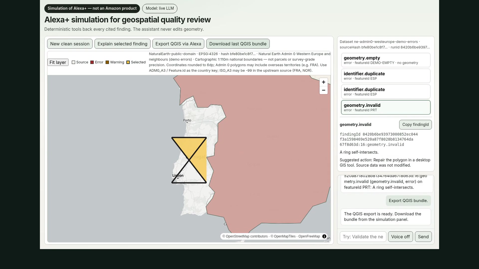
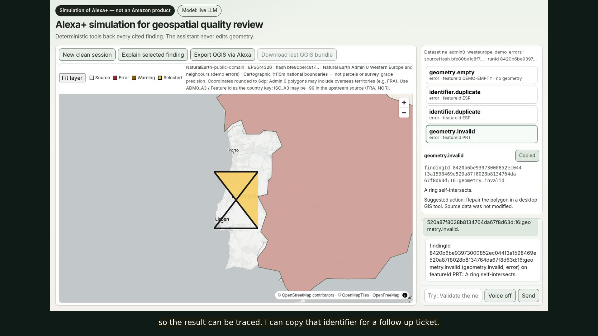
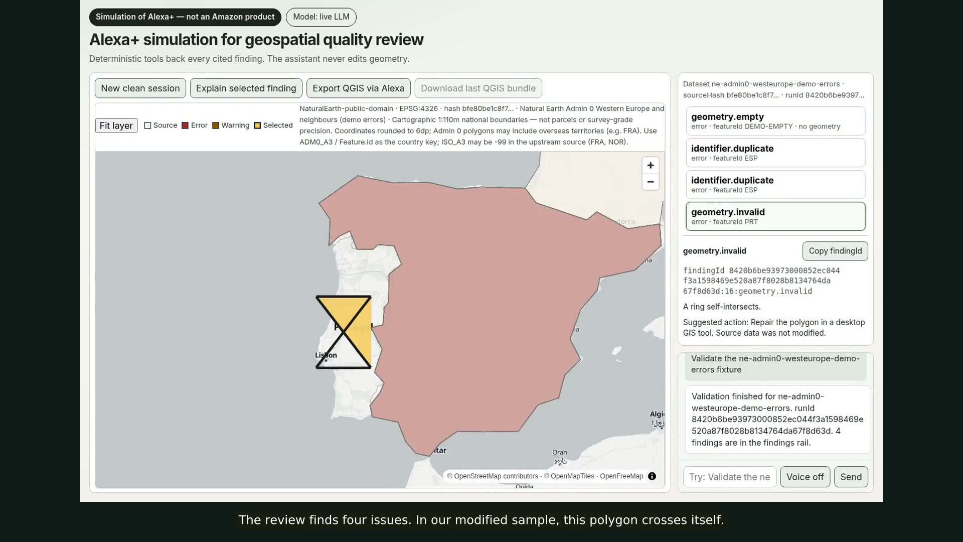
Users can ask the assistant to validate a dataset from the built-in catalog, inspect findings on an interactive map, explain a selected issue, and export the review as a QGIS bundle.
The demo uses a Natural Earth sample of Western Europe with deliberately introduced errors, including an invalid polygon, duplicate identifiers, and a missing geometry. These are controlled demonstration errors.
The assistant coordinates the workflow and explains tool results. A deterministic validation engine performs the actual checks.
How I built it
The project uses a shared TypeScript validation core, a React interface, and MapLibre GL JS for geographic context.
The conversational layer exposes bounded tools for listing datasets, running validation, retrieving findings, explaining individual issues, and exporting review artifacts.
A server-side OpenAI-compatible model connection through NaN handles tool orchestration when configured. A separately labeled deterministic mock allows reproduction without a model key.
The hosted simulation runs on Vercel with bundled datasets. This submission follows the simulated-experience route for the Alexa+ track.
I developed the project through an autonomous software factory with human approval gates, connecting ChatGPT/Codex for planning and review, Linear for task coordination, Cursor for implementation, and GitHub for pull requests and CI.
The reusable instructions, skills, and quality gates are published at https://github.com/Maciker/agent-workflow-code-ts.
The application's conversational model connection is provided through https://nan.builders/.
Challenges
Keeping the conversation grounded in evidence required explicit finding identifiers, tool contracts, and limits on what the assistant could do.
Adapting an existing local API for serverless hosting also required work on routing, configuration, and session recovery.
Browser compatibility exposed another challenge: an unavailable WebGL context could interrupt the entire interface. I added failure isolation so the conversation, findings list, and export can remain available.
Accomplishments
The project connects conversational requests to deterministic validation results, geographic context, and an export for continued review in QGIS.
The same validation logic supports command-line and conversational workflows. The source is available under the MIT license.
What I learned
An assistant can help users navigate a technical review without making the underlying technical decisions itself. Finding identifiers, rule explanations, and source metadata make its answers easier to inspect.
What's next
Test the workflow with GIS reviewers, verify the QGIS handoff across environments, and compare conversational review with the existing map and command-line workflows.
Work completed for this hackathon
This submission builds on an existing geospatial validation project. The hackathon work focuses on the conversational simulation, bounded tools, connected map and finding review, hosted deployment, and supporting delivery documentation.
Built With
- alexa
- llm
- maplibre
- node.js
- qgis
- react
- typescript
- vercel
- vite

Log in or sign up for Devpost to join the conversation.