-
-
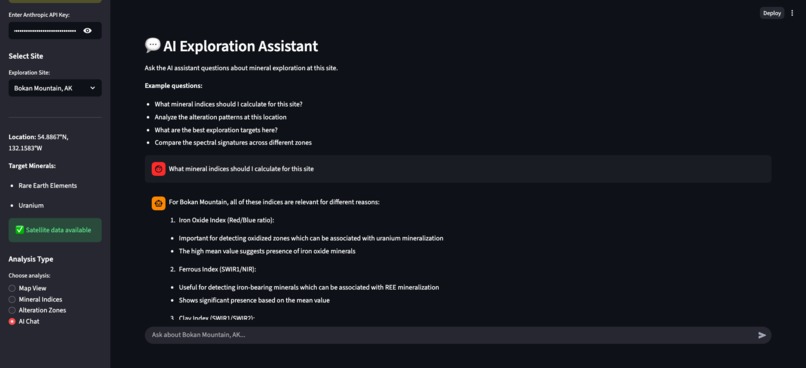
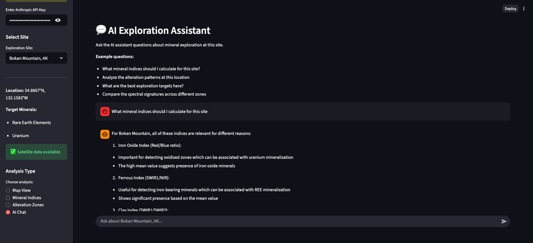
chat interface
-
index calculation

🎯 The Problem
- $8 trillion in critical minerals needed by 2050
- US imports 80% of rare earths from China - national security risk
- Billions of satellite images archived but underutilized
- Traditional mineral exploration: slow, expensive, risky
💡 Our Solution: GeoScout AI AI-powered mineral exploration platform that unlocks dormant Earth observation data using:
- Real satellite imagery (Sentinel-2, 10m resolution)
- MCP architecture (Model Context Protocol from Anthropic)
- Claude AI reasoning for geological interpretation
- LangGraph agents for intelligent analysis
🏗️ Architecture Satellite Data (Sentinel-2) ↓ MCP Server (exposes data as queryable tools) ↓ LangGraph Agent (orchestrates analysis) ↓ Claude AI (geological reasoning) ↓ Streamlit UI (interactive exploration)
🛰️ Live Demo Sites
- Mountain Pass, CA - Rare Earth Elements (carbonatite, 15% of global supply)
- Bingham Canyon, UT - Copper-Molybdenum (largest porphyry deposit)
- Bokan Mountain, AK - REE + Uranium (peralkaline granite)
All with 2024 imagery, 0% cloud cover
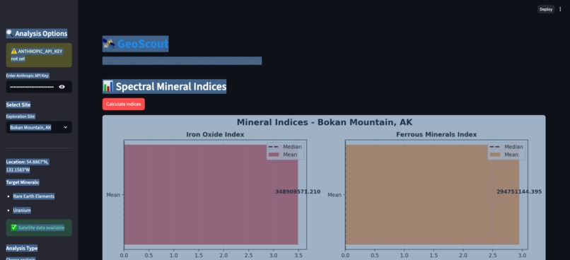
🔬 What It Does Spectral Mineral Indices:
- Iron Oxide Index (Red/Blue ratio) → Oxidized minerals, gossans
- Clay Alteration Index (SWIR bands) → Hydrothermal alteration zones
- Ferrous Index → Iron-bearing minerals
- NDVI → Vegetation masking
AI Capabilities:
- Natural language queries about mineral potential
- Automated spectral analysis
- Exploration target recommendations
- Multi-site comparative analysis
🚀 Why It Wins Technical Innovation:
✅ First geospatial application of MCP protocol ✅ Real satellite data, not mock/API wrapper ✅ Production-quality code (2,197 lines, fully functional) ✅ Secure data serving (MCP tool-level authentication)
Strategic Impact:
✅ Unlocks billions in archived satellite data ✅ Addresses critical mineral supply chain security ✅ Scalable to global coverage (any satellite sensor) ✅ Reduces exploration costs and timelines
Built in 3 hours. Cost: $2.28
📊 Key Metrics
- 3 sites analyzed with real 2024 Sentinel-2 data
- 6 spectral bands per scene (Blue, Green, Red, NIR, SWIR1, SWIR2)
- 30m spatial resolution (10m for visible/NIR)
- 4 specialized tools in MCP server
- Claude Sonnet 4 for geological reasoning
🎓 The Vision
- Today: 3 sites, Sentinel-2 data
- Tomorrow: Global coverage, multi-sensor fusion
- Future: Real-time mineral discovery at planetary scale
- Transform Earth observation from passive archive to active intelligence.
Built with Claude Code + Anthropic Claude AI Team: ClaAko (Claude + Ako) + Claude Code GitHub: https://github.com/ako1983/geoscout
Built With
- claude
- langchain
- langgrapgh
- mcp
- python

Log in or sign up for Devpost to join the conversation.