-
-

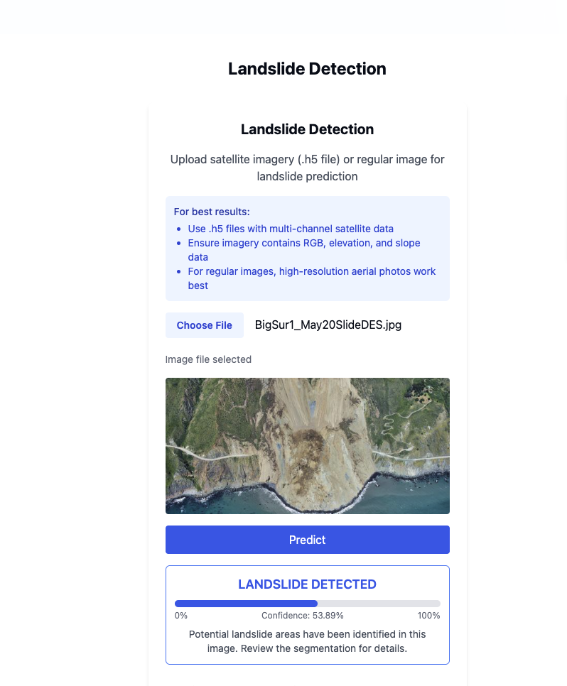
landslide
-
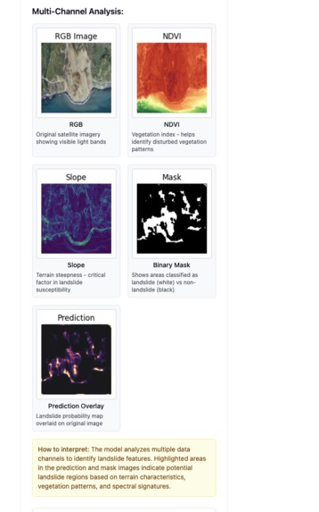
landslide multi channel segmentation
-
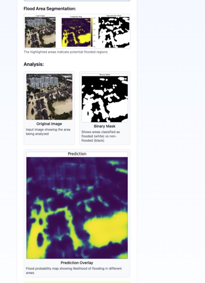
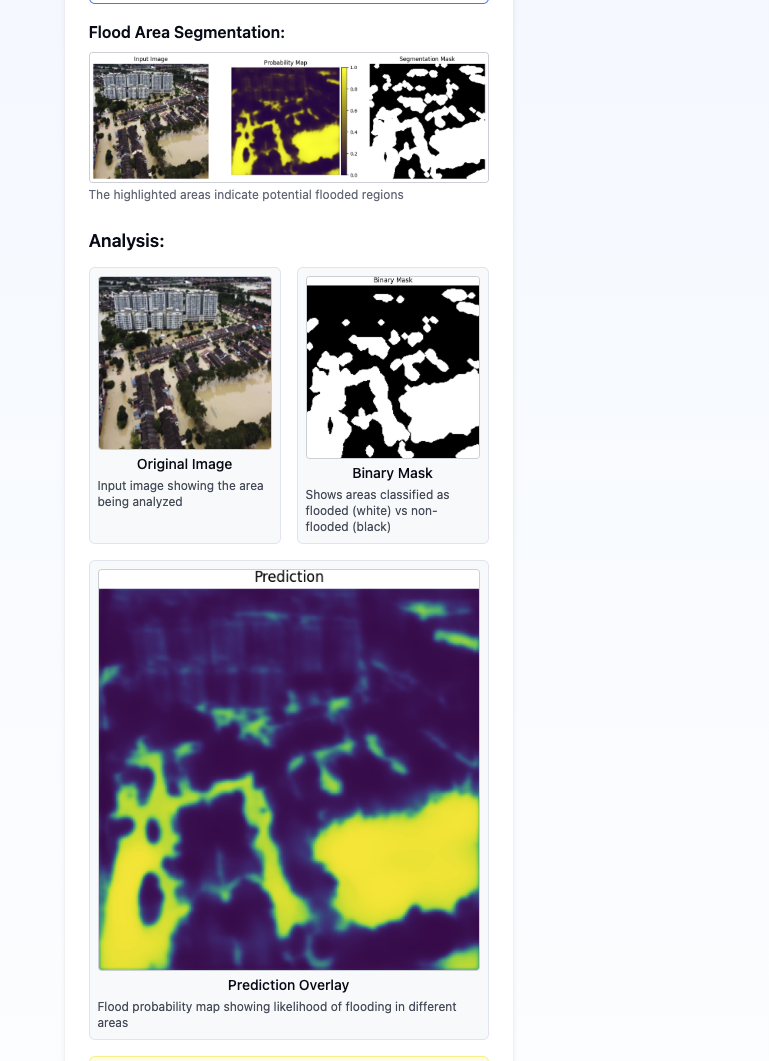
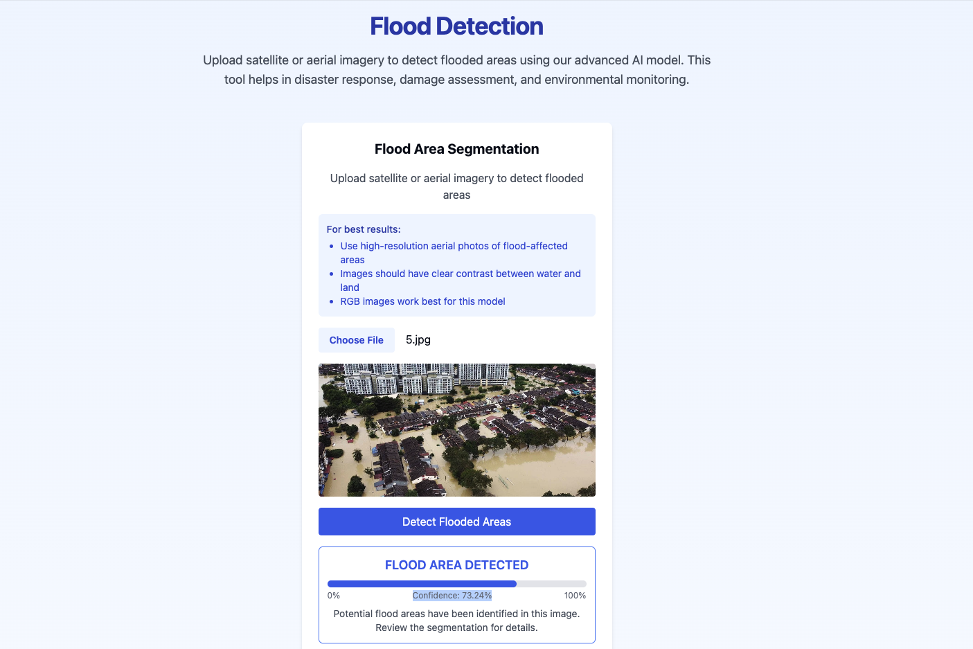
flood segmentation
-

flood
-
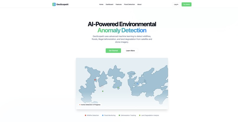
Homepage


Inspiration
Landslides and floods often result in disastrous events that have severe socio-economic and environmental consequences, especially in high-vulnerability areas. Therefore, it is important to identify and locate these events timely and accurately to respond to and mitigate the impacts. In this project, we mobilized a deep learning based detection and segmentation technique for landslide and flood affected areas in satellite images. We implement the semantic segmentation approach using a U-Net convolutional neural network, where the model outputs disaster-impacted areas as pixel-level masks. The system is trained with satellite data preprocessed situational datasets with a specified ground truth and was evaluated using metrics such as Intersection over Union (IoU), precision, recall and the F1-score. The masks produced by the model that delineated the impacted areas are visually overlaid on the satellite images for intuitive interpretation of model output. This work demonstrates a viable approach to conduct disaster detection using deep learning, and is a stepping-stone toward future integration for early warning systems and decision support systems.
What it does
1.Satellite Image-based Detection: Utilizes Landslide4Sense and Kaggle Flood Area Segmentation datasets for accurate geospatial analysis. 2.Deep Learning with U-Net: Employs U-Net architecture for pixel-wise segmentation of landslide and flood-affected regions. 3.Real-Time Segmentation Masks: Generates binary masks that overlay on satellite images to visualize disaster zones clearly. 4.Robust Evaluation Metrics: Model performance is measured using IoU, F1-score, precision, and recall for reliability.
How we built it
Model Architecture Implemented using U-Net architecture in Keras 1.Input Shape: (256, 256, 3) 2.Uses skip connections to retain spatial features 3.Final layer: 1-channel output with Sigmoid activation for binary segmentation
In this project,two semantic segmentation models based on deep learning methods to identify areas affected by landslides and floods using satellite images. The goal of this project is to provide accurate and interpretable geospatial information for assisting in the early detection of disasters, risk assessment, and decision-making during natural disaster events. The two models evaluated are as follows:
Landslide Segmentation Model: This model was trained with the Landslide4Sense dataset with a U-Net architecture. This model achieved an accuracy of 92.4% with the test set.
Flood Segmentation Model: This model was developed with the Kaggle Flood Area Segmentation dataset and was trained with a U-Net deep learning method. The accuracy of the flood model was 89.7% This indicates this model was also reasonable at isolating areas affected by flood disasters. In summary, this project GeoScope AI highlights the value of combining deep learning methods with satellite data in providing large scale and detailed disaster monitoring.
Challenges we ran into
1.Limited dataset diversity – Models are trained on region-specific datasets, which may not generalize well to all geographic areas. 2.Weather-related image disturbances – Cloud cover, haze, and seasonal changes in satellite imagery can reduce segmentation accuracy. 3.No real-time data integration – The current system works on pre-acquired images and does not support live satellite or GIS feeds. 4.Binary segmentation only – The system only detects affected vs. unaffected areas, lacking detailed classification (e.g., severity levels). 5.High computational requirements – Training deep learning models on large satellite images requires substantial processing power and memory.
Accomplishments that we're proud of
1.Predictions accurately identify flood zones with high IoU 2.Results visualized by overlaying segmentation masks on satellite inputs
What we learned
“GeoScope AI” is an exciting approach for detecting and segmenting flood and landslide-affected areas on satellite images using deep learning. As an application of semantic segmentation methods and particularly the U-Net architecture, GeoScope AI provides real-time mapping of disaster-affected areas, useful for situational awareness, emergency response, response planning, and environmental monitoring.This project depicts how AI can fundamentally change how we traditionally monitor disasters. With automated, scalable, and interpretable visualizations. Using open datasets for model validation such as Landslide4Sense data and the Kaggle Flood Segmentation Dataset, we have been able to create models to identify landscape changes (e.g., landslide extent and impact) and flooding patterns that workplaces and their managers can use with an unprecedented accuracy. GeoScope AI contributes to efforts to avoid and alleviate challenges associated with disasters but also represent future opportunities of integrating AI-based solutions into other geospatial challenges.
What's next for GeoScopeAI
1.GIS platform integration – Connect the system with GIS tools for real-time visualization and map-based analysis. 2.Transfer learning with pretrained models – Use pre trained encoders to improve accuracy and reduce training time. 3.Multi-class segmentation – Extend the model to detect multiple disaster classes or land cover types, not just binary segmentation. 4.Predictive analytics integration – Incorporate temporal data to forecast potential landslide or flood zones based on trends.

Log in or sign up for Devpost to join the conversation.