Inspiration
AI, GIS and remote sensing techniques.
What it does
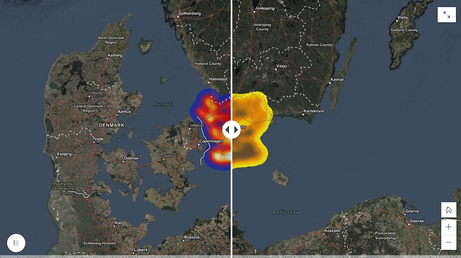
Shows satellite metadata as a spatial map
How I built it:
I have chosen randomly geo-points in south Sweden, then I retrieved the indicators(soil moisture and temp) from satellite images for the same acquasition, and finally I used interpolation and euclidean distance techniques to get colorful layer that represent the data by ArcGIS.
Challenges I ran into
Find a good satellite images that have these data.
Accomplishments that I'm proud of
Who I could build my own dataset and merge it with many App.
What I learned
How I could manipulate with data.
What's next for Georeferencing Soil moisture and Temp data
To retrieve CO2, ethane or NDVI data for a certain location and create a time series analysis besides maps by Tableau, this time.

Log in or sign up for Devpost to join the conversation.