-
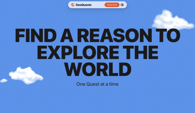
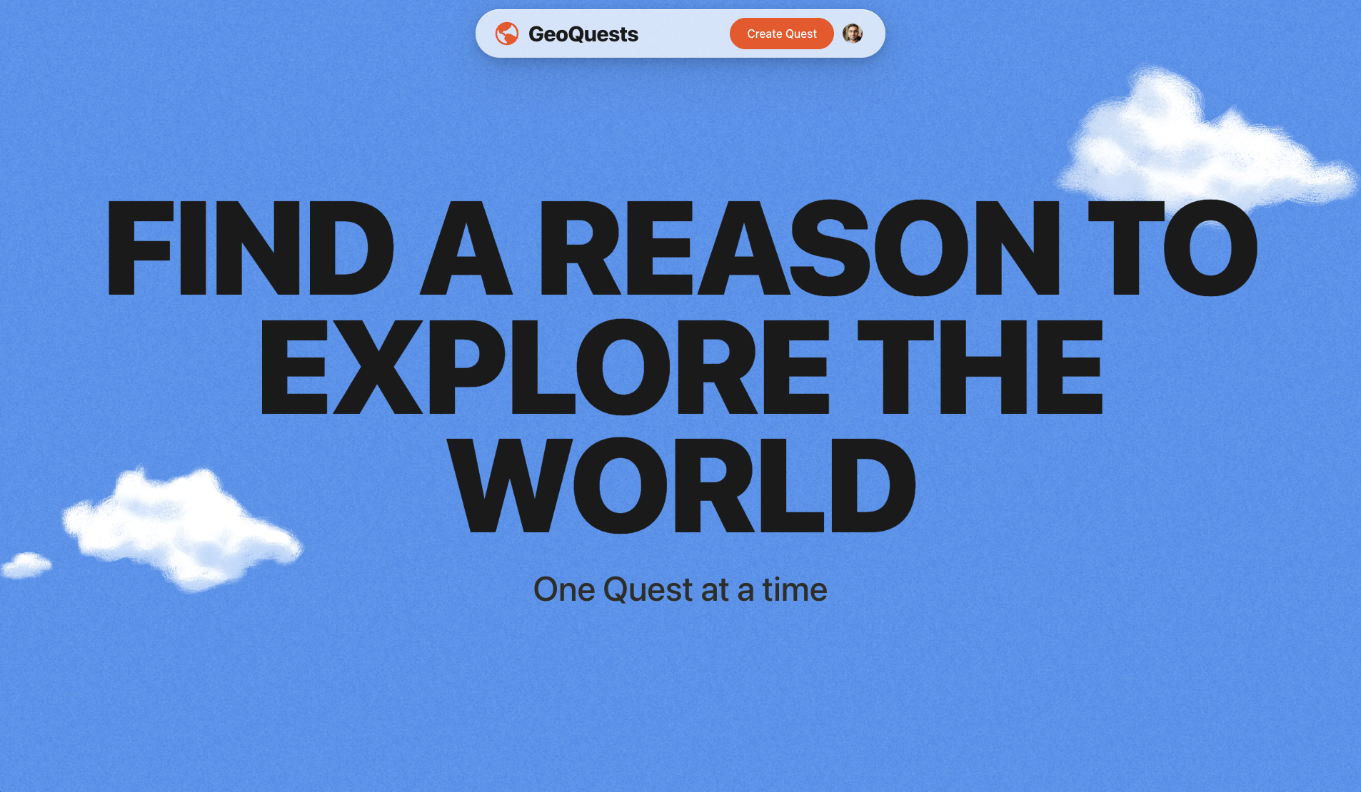
The world is waiting to be explored
-

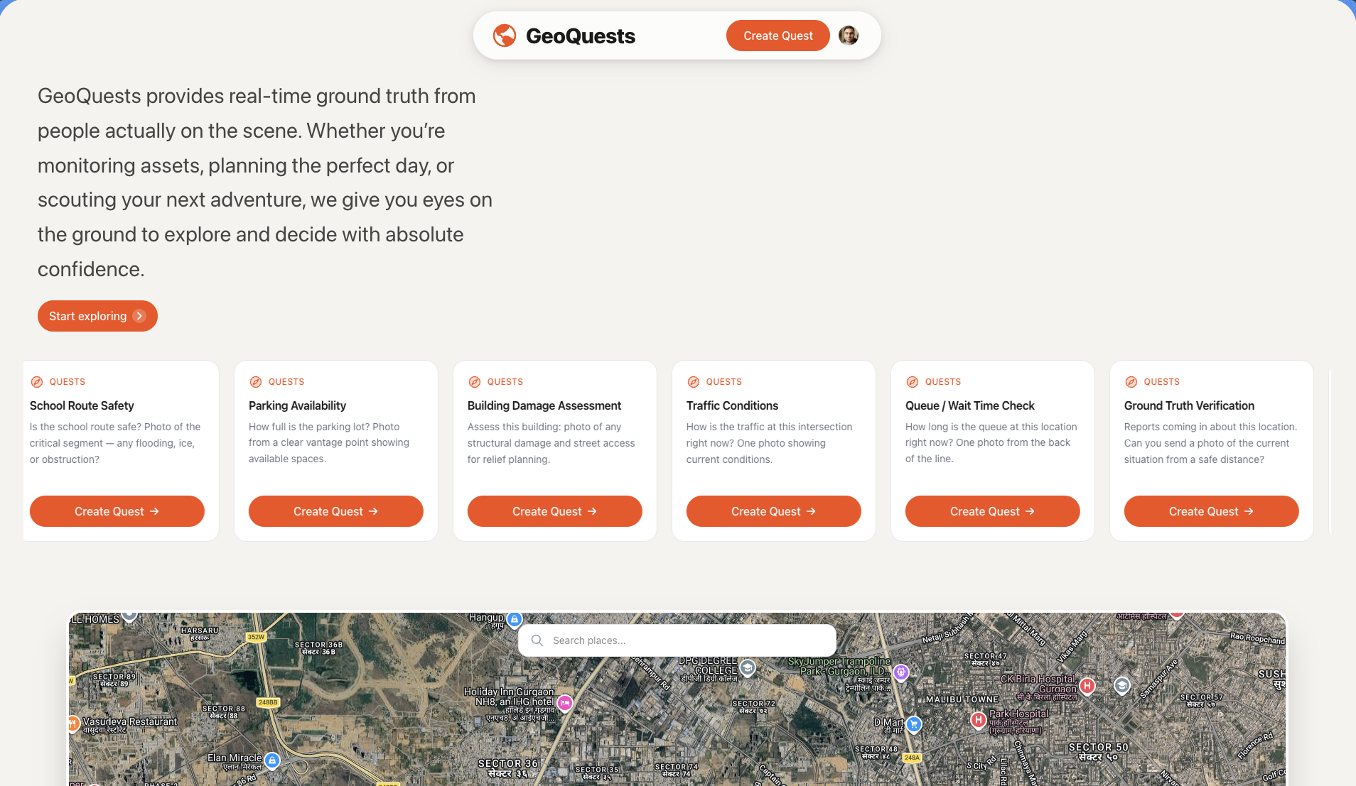
Create quests, get answers and make better decisions
-
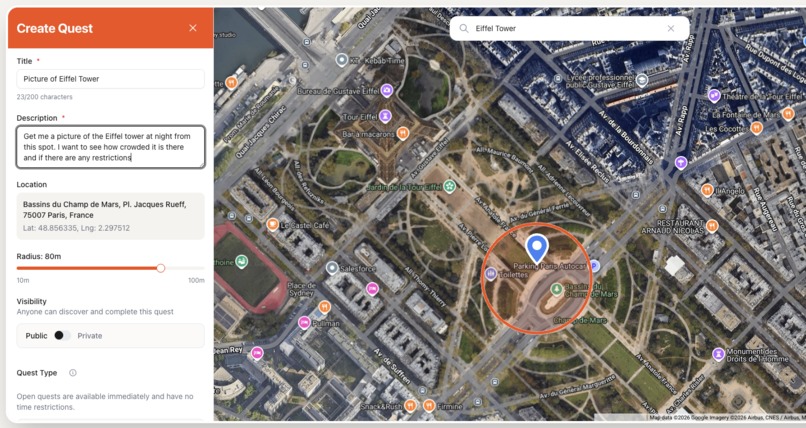
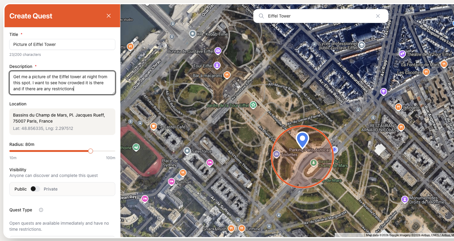
Adding a quest near the Eiffel Tower
-
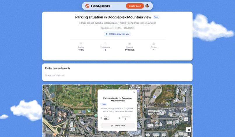
Is parking available today in Googleplex ?
-
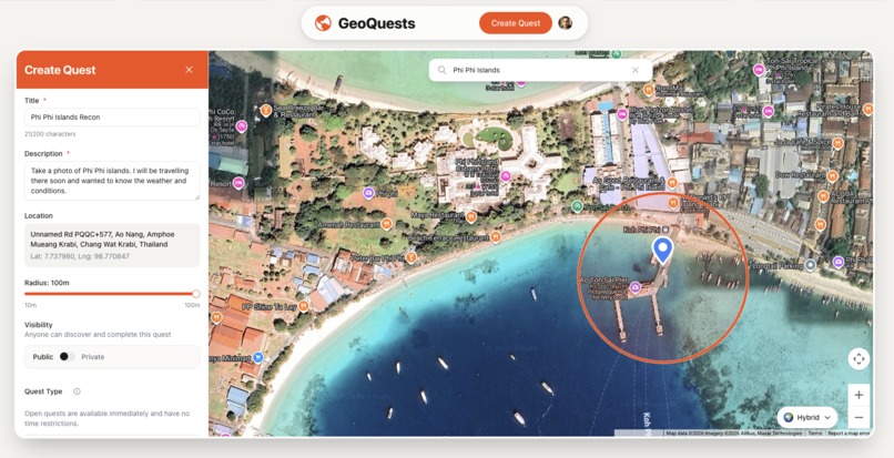
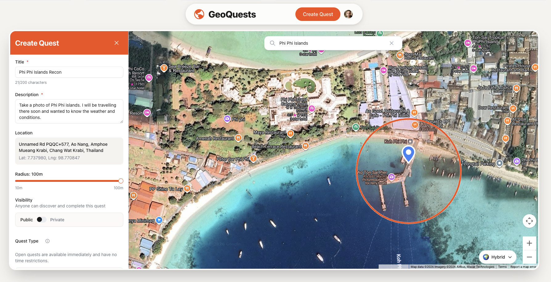
Quest on Phi Phi Island Thailand
-
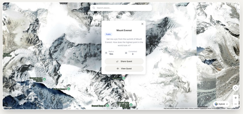
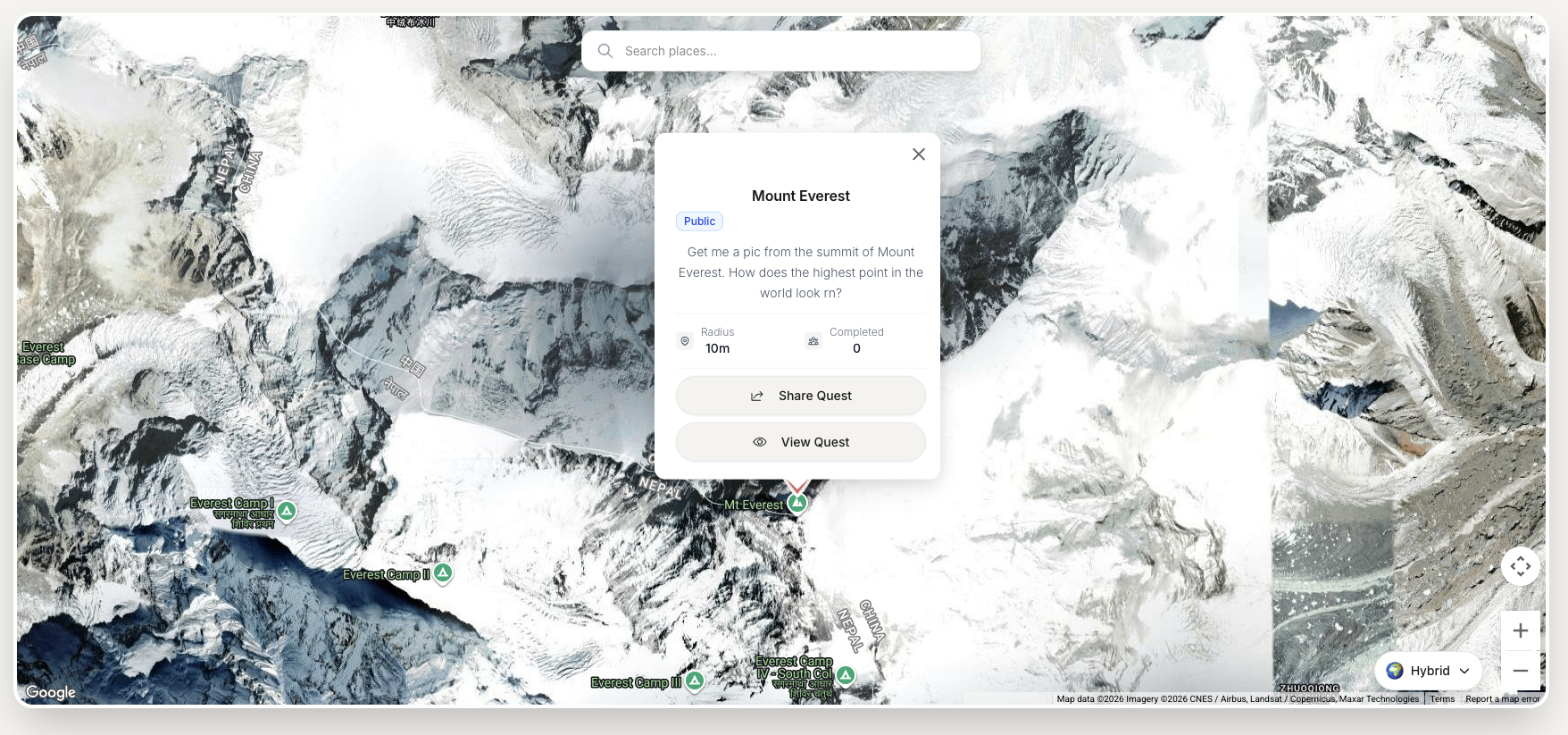
Whats going on Mount Everest rn?
-

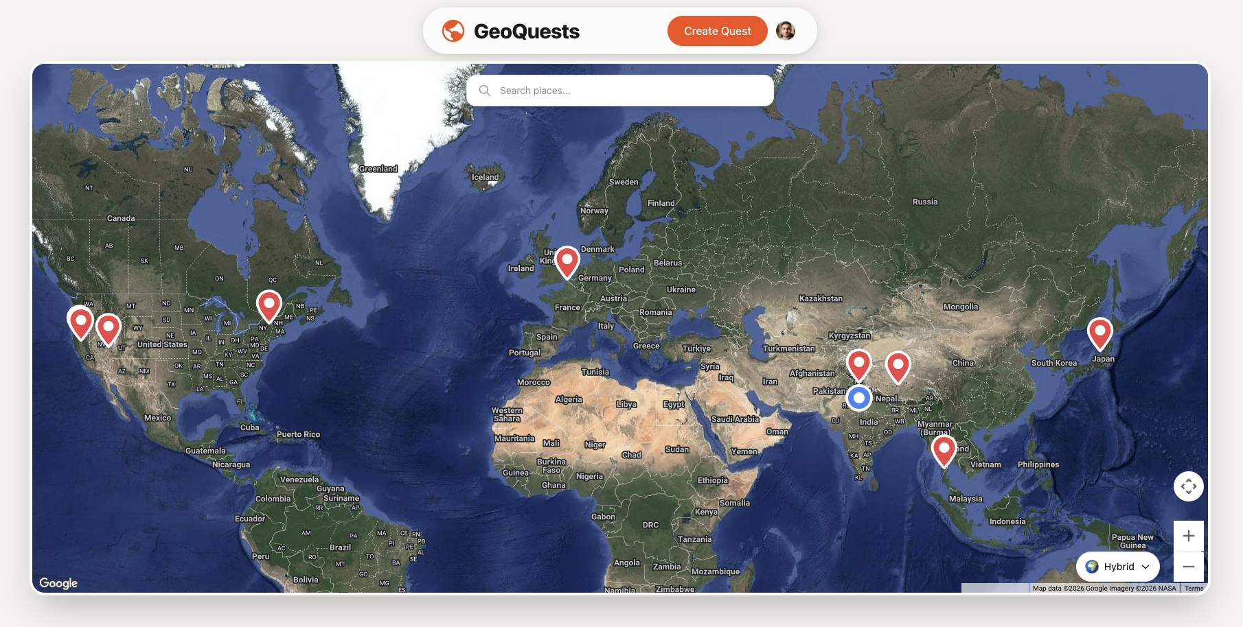
Find out how the world looks right now

Inspiration
The world changes faster than maps can update. Google Street View is often years old, Snapchat is random, and satellite imagery lacks the "feeling" of a place. We wanted to bridge the gap between digital maps and physical reality such that adventurers, journalists and individuals can take better decisions with fresh information about a place.
But deeper than that, we wanted to give people a reason to go outside. In an age of doom-scrolling, we wanted to gamify the act of touching grass. We were inspired by the thrill of treasure hunts, pokemon go, the peace of a gentle wind on a mountain trail, and the joy of sending a postcard from a hidden gem. We built GeoQuests to turn the entire world into a game board where exploration is the currency.
What it does
GeoQuests is a crowd-sourced location intelligence platform that replaces outdated maps with verified, fresh visuals taken by people on the scene.
For Requestors: You drop a pin anywhere on Earth whether you need to check a queue at a club, validate a real estate asset, report an event as a journalist or see if the autumn leaves have turned color in Kyoto.
For Hunters: Users nearby receive a "Quest." They go to the location, capture a photo/video through our GPS-locked camera, and earn money, digital badges or do it for fun.
The Core Loop: It connects those who need "eyes on the ground" with those who are already there, verified by AI to ensure the photo is fresh, safe and accurate.
How I built it
We architected the system to be "Trust-First" using a modern geospatial stack:
Frontend: Built with Next.js for a snappy, server-rendered React experience, using Google maps for the interactive Quest map.
Backend: Powered by Python FastAPI. We chose Python to seamlessly integrate our Gemini AI and Computer Vision pipelines.
Database: We used PostgreSQL with PostGIS. This allows us to perform high-speed geospatial queries efficiently.
The Trust Layer (The Sentinel): This was the most important part of the platform which solved the safety issue. We built a custom AI Verification Agent using Gemini. When a photo is submitted, the agent checks the GPS metadata, timestamps, and analyzes the image content to match the request description. This Trust layer assigns the photograph a score using Gemini based on the content. This way we provide verified, safe and correct photos to the quest creators.
Challenges I ran into
- Our biggest concern was safety. We didn't want the app to be used for surveillance. We implemented strict AI moderation that rejects requests targeting specific people, vehicles, or private residential zones using Gemini. It is still a work on progress with lots of improvements planned.
Accomplishments that I'm proud of
- The trust layer. Gemini is multimodal this unlocks a new paradigm for verification and safety checks. It looks at the images and verifies if it follows the platform guidelines. We are now having a system where the data is being verified for being correct and safe without it ever reaching any humans first. This feels revolutionary as it helps GeoQuests uphold its core tenets of exploration and fun without compromising on trust, safety and scalability.
What I learned
- Grit. There was a lot of code and broken pieces. Only with patience and grit was I able to finish. I vibe coded a lot of the app but implemented proper architecture and testing framework to make it work well and stop it from breaking. We are at a new frontier of software development and it feels truly amazing.
What's next for GeoQuests
I want to write an MCP server that lets anyone and even AI agents create quests. This will help AI agents get real time locational intelligence from the ground for their tasks. I feel this is very important for the upcoming Agentic world where agents would need real world ground truth to help them decide and take actions. Moreover I will be implementing a face blur service that will blur the faces of people in the quest images. This will help further uphold our tenets of safety and trust.
Built With
- fastapi
- gemini
- google-cloud
- nextjs
- postgis
- postgresql
- railway


Log in or sign up for Devpost to join the conversation.