-
-

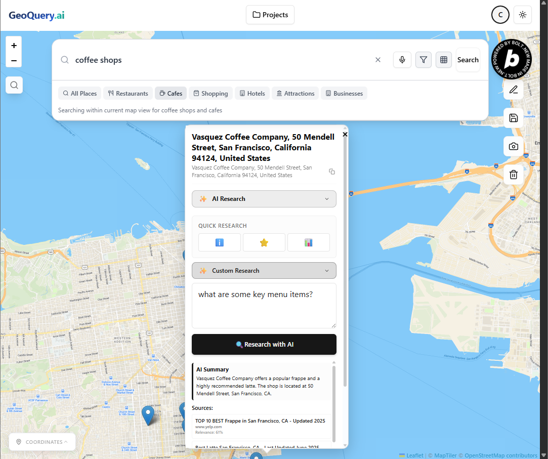
GeoQuery.ai Interface - POI Marker with AI prompt Result - Light Mode (powered by Maptiler/Tavily)
-
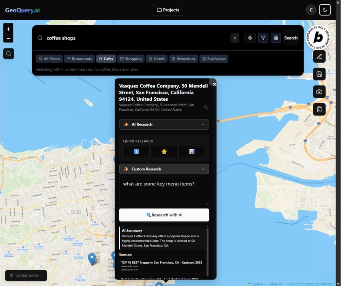
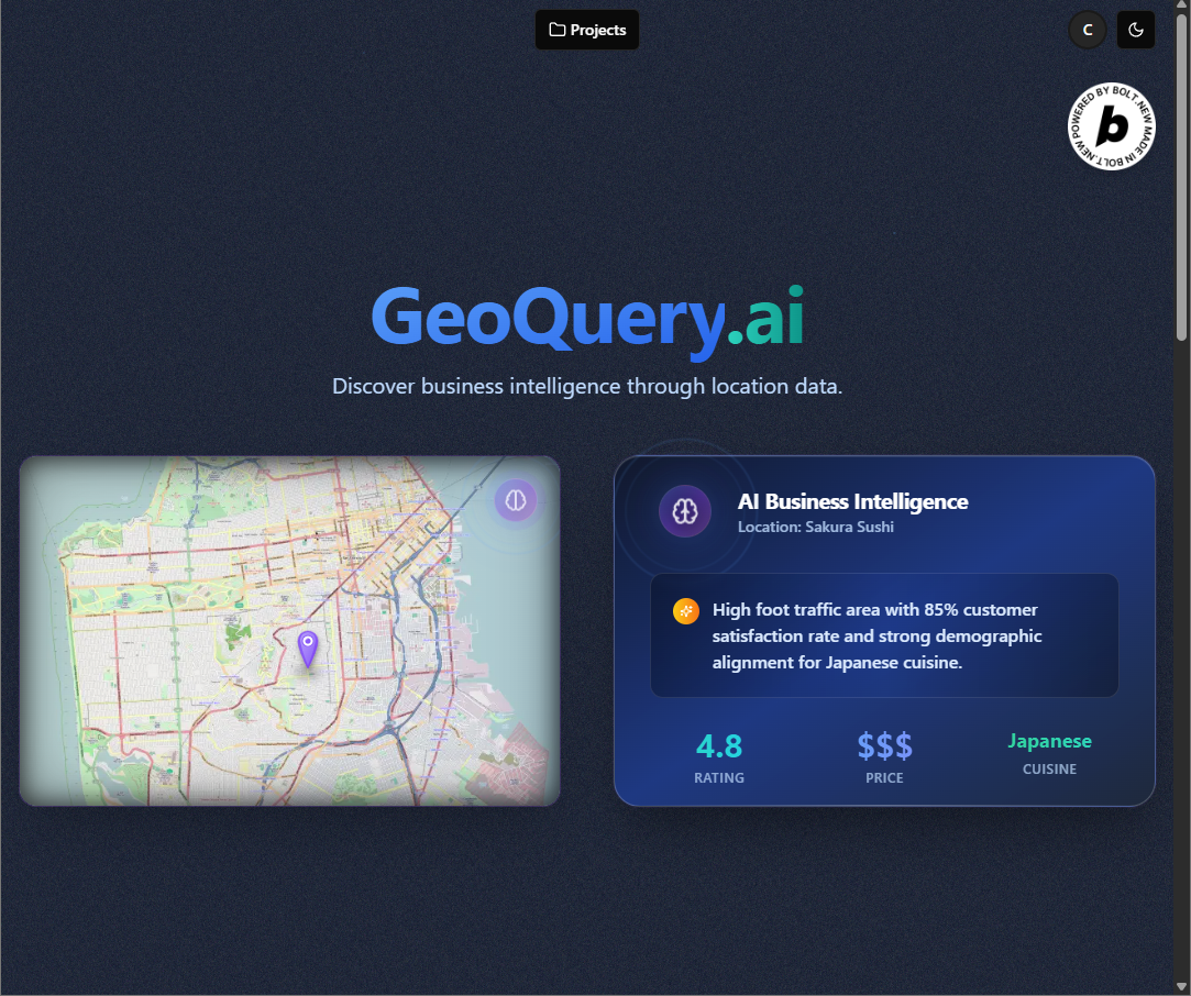
GeoQuery.ai Interface - POI Marker with AI prompt Result - Dark Mode (powered by Maptiler/Tavily)
-
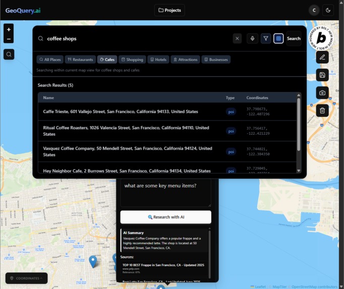
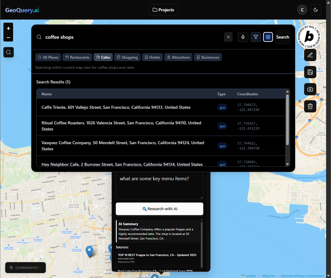
GeoQuery.ai Interface - POI Marker Results Table (powered by Maptiler)
-

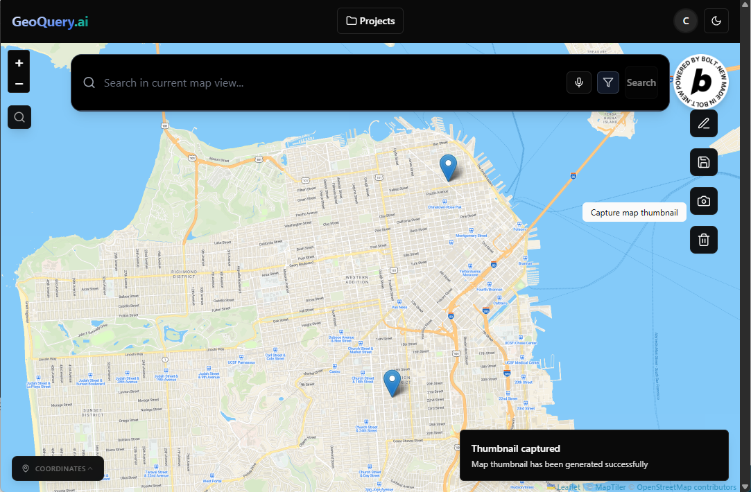
GeoQuery.ai Interface - Automatic Map Thumbnail Generation (powered by Supabase)
-
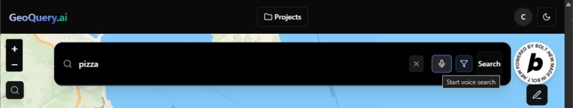
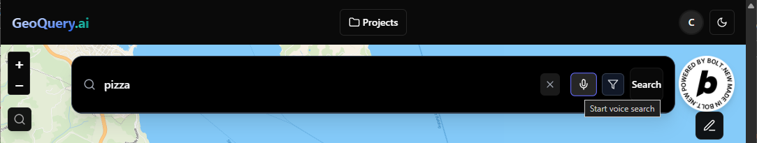
GeoQuery.ai Interface - Speech to Text Search (powered by ElevenLabs)
-

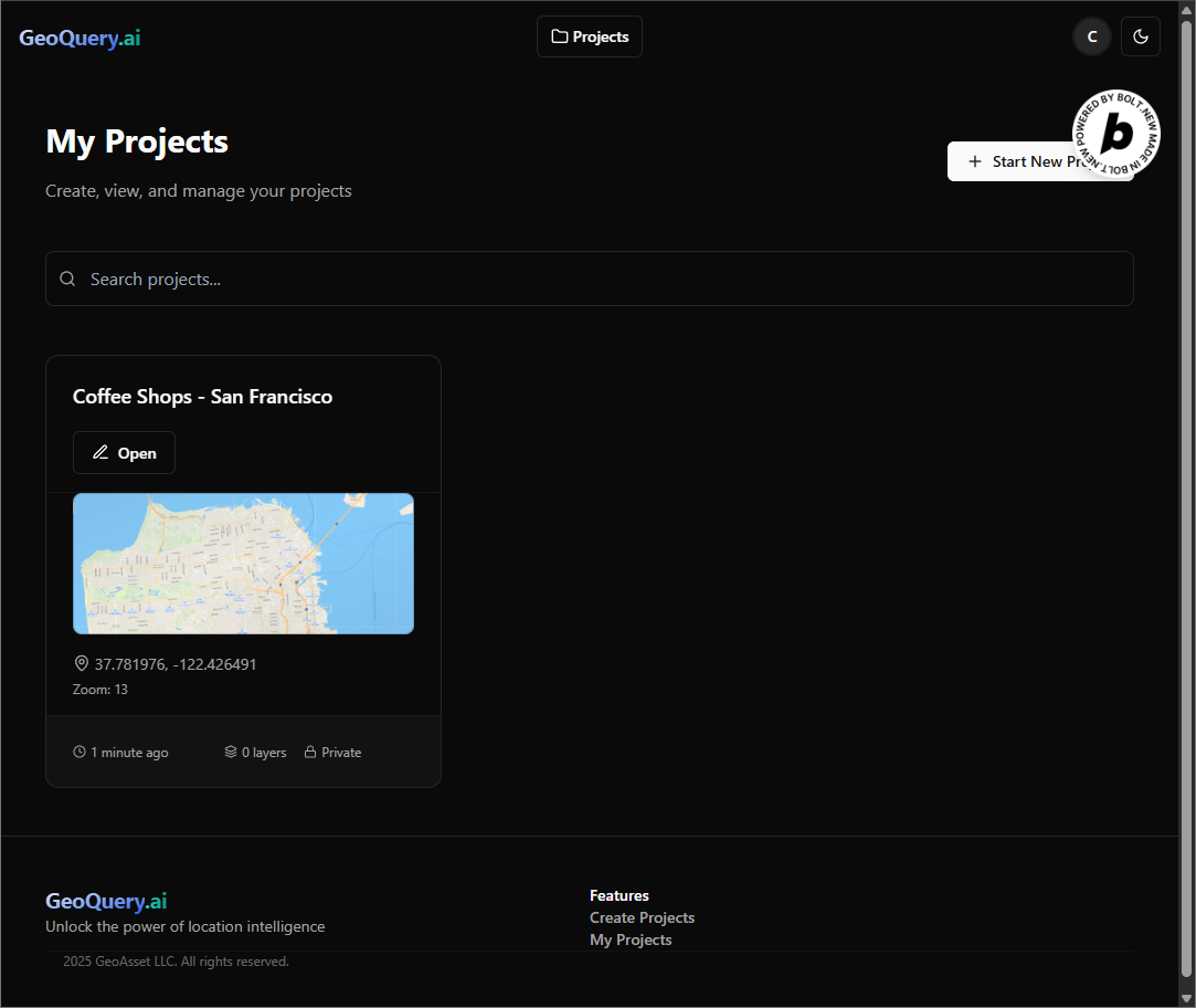
GeoQuery.ai Project Page - Saved Projects with editable titles (powered by Supabase)
-
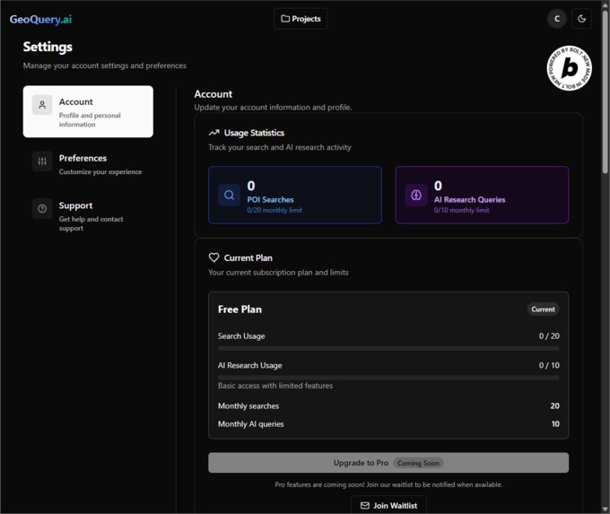
GeoQuery.ai Settings Page (powered by Supabase)
-
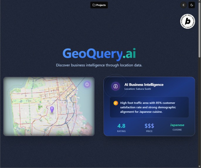
GeoQuery.ai Home Page
-

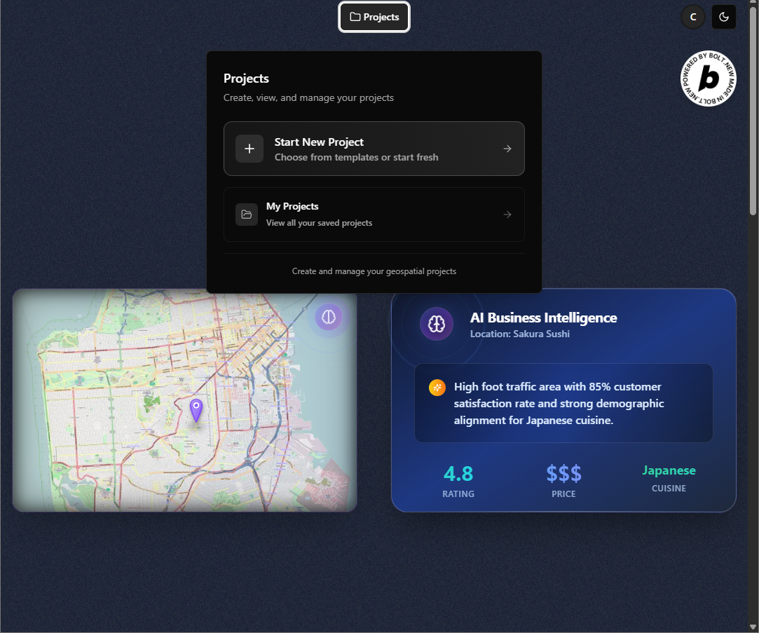
GeoQuery.ai Home Page - Create/View Project Button
-

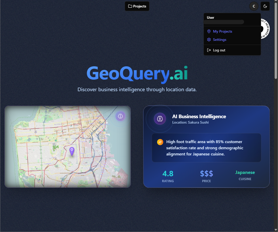
GeoQuery.ai Home Page - User Menu Button
-
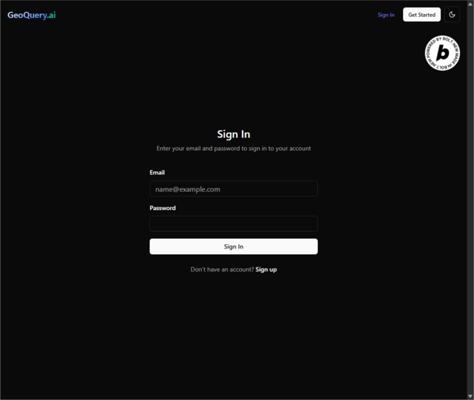
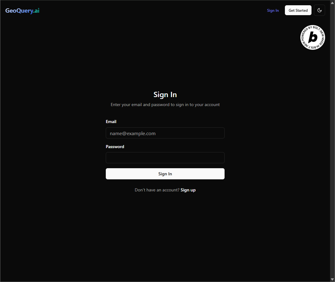
GeoQuery.ai Auth - Sign In (powered by Supabase)
-
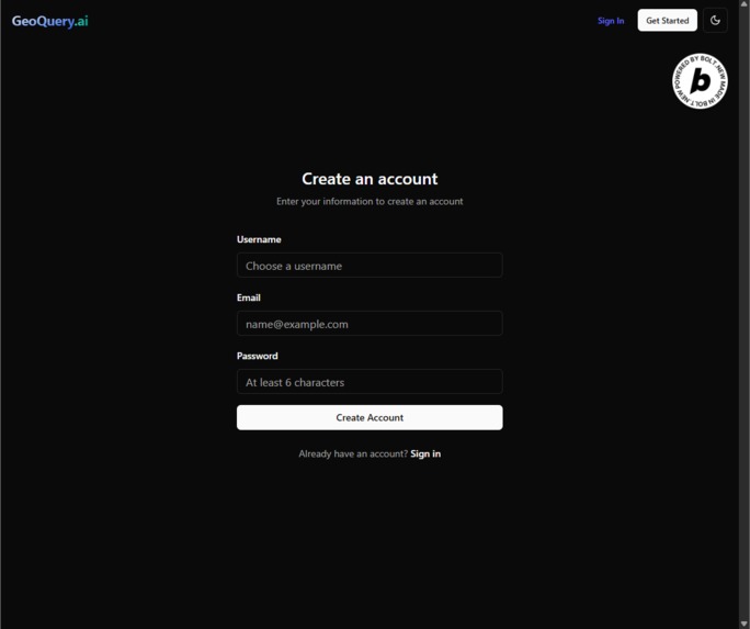
GeoQuery.ai Auth - Sign Up (powered by Supabase)


Headline
AI-Powered Interactive Mapping Platform with Voice Search and Real-Time Geospatial Analysis
Inspiration
With an extensive background in the geospatial developer space, I've aimed to always try to make amazing products that are centered around maps. I've always wanted to strive to make the user experience of using maps more beneficial in an efficient way for anyone in the world.
Enter Bolt.new, this application lets anyone with limited experience of coding an application to develop new innovative solutions. I saw the coder potential when it first launched last year, month by month I dabbled and tested using Bolt, getting better and better every time I used it. With this new tool, I was able to be confident enough to develop a new application.
What's the inspiration you say? Well Google maps let you move around the map and query different businesses for research, but I thought, what if you could add an AI component to every search result? After I went on searching, I didn't really find anything out there that was well suited for this. So, with the confidence of using Bolt and inspired by the hackathon, I aimed to make this a reality, and the result was better what I imagined.
What it does
Within this I had an idea of which could be foundational for every organization to instantly query a location, search for anything on the map. Then the magic part is using AI LLMs to search what you wanted to search with a custom query after clicking each map pin. If a user doesn't want to use a custom query, a few helpful prompt options such as "General Information", "Recent Reviews & Ratings" and "Customer Demographics".
The platform also provides user persistence and client-side storage of all search results, improving the user's experience. Additionally, GeoQuery.ai features voice-assisted interactions powered by ElevenLabs, allowing users to perform searches by voice and have results read aloud for hands-free operation.
The user process is as follows: User signs up → creates a blank template of a map → search location using the location search tool → User saves project (optional capture thumbnail button based on user's view) → User searches anything in the search box → results are displayed via map markers → user clicks any map marker to do a custom AI query about each marker → user can save project and can exit and return anytime to see the same results (on the same machine).
How we built it
Recently I found in research the power of RAG (Retrieval-Augmented Generation) and LLMs, where an API could do a SERP like search based on a query which can allow an LLM to access the most up to date information. With this new LLM technology in mind, I aimed to provide this via a map search engine where POI locations could be the retrieval data for the agent behind each LLM prompt within Tavily API. That in return could provide a result centered on the user's custom query, a very interesting way to learn about each search result, all without leaving the map!
We built GeoQuery.ai using a modern tech stack centered around React, TypeScript, and Vite for the frontend, with Maptiler/Leaflet powering our interactive mapping interface and POI location data. Supabase serves as our backend, providing PostgreSQL database management, user authentication, and real-time data synchronization. We integrated ElevenLabs for voice AI capabilities and Tavily for AI-powered research enhancement. The UI leverages Tailwind CSS, Radix UI for accessibility, and Framer Motion for smooth animations.
Challenges we ran into
The most challenging part of creating this application is making it run correctly and without errors, numerous errors where Tavily wouldn't use the information that Maptiler API provided but eventually found a solution to just use the exported results of Maptiler first and then use Tavily API to use it in its AI LLM prompt instead of all at once. Also the Maptiler API documentation for POI information wasn't very thorough, I really had to do a lot of research to improve the quality of the output results.
Another challenge is that Maptiler API strictly prevents the use of any output data such as POI results in any external database such as Supabase. The solution is that I was able to see in the TOS that local storage could be utilized to cache information on the client's side. This effectively improves the user's experience as it can provide user persistence and save the user's progress by saving all the POI markers on a user's machine.
We also faced complexity in integrating multiple AI services (ElevenLabs and Tavily) while maintaining smooth user experience and managing API rate limits, as well as balancing the rich feature set with performance when handling large datasets of POI markers.
Accomplishments that we're proud of
Being able to connect all the APIs to work together is amazing, seeing the end results of business reviews, customer demographics. Also, Supabase tables tracking each query / AI query beneficial for when I configure pricing down the line. Seeing an active representation of what I was searching for is truly satisfying.
We're particularly proud of creating a seamless voice-assisted mapping experience that allows hands-free interaction with geographic data. Our automatic project persistence system ensures users never lose their work, even for unsaved projects. The integration of AI-powered research with traditional mapping creates a unique value proposition that sets GeoQuery.ai apart from existing solutions.
What we learned
I've learned that I only scratched the surface in what bolt can do, and my journey in using the tool has just started. One thing I've learned is that using a map API like Maptiler may seem easy at first but if the documentation for additional features is not very clear, it might be a hassle, combining that with newer technologies such as RAG LLMs Agents, it is difficult to put those two things together. I want to assist any person out there with the right tools to understand the current market conditions, and I believe GeoQuery can provide this.
This project also taught us the importance of thoughtful API integration when working with multiple AI services and valuable lessons about state management in complex React applications. The experience highlighted how voice AI can transform user interactions with data visualization tools, opening up new possibilities for accessible computing.
What's next for GeoQuery.ai
GeoQuery has a long road ahead, I would like to expand its features to improve the value of the application:
Tiered Pricing Structure with Stripe Integration Planning freemium model with premium tiers based on query volume with advanced premium features like 3rd-party API integration, collaboration tools, and unlimited projects. Pricing will be competitive and transparent.
AI Query Database Automatic persistence and intelligent archiving of all AI searches based on user patterns and collaborative sharing capabilities.
Drawing & Annotation Tools Custom polygons, rich multimedia annotations by layers and exportable annotated maps for complete workspace functionality.
Premium API Integration Yelp Fusion and TripAdvisor APIs providing real-time reviews, ratings, business hours, and high-quality imagery for enhanced POI intelligence.
AI Chatbot Assistant Natural language processing for conversational queries, proactive insights, and intelligent location recommendations based on user preferences.
Automated Market Report Generation Comprehensive area analysis including demographics, competition mapping, market opportunities, and customizable industry-specific templates. For the entire zip code or current map view. Generally, ways to help inspire users to find out the best ideal places for new opportunities for a particular query.
Advanced Market Visualizations We plan to greatly expand visualizations of POI search results such as heatmaps, choropleth maps, or even immersive 3D views, to provide deeper insights into each search.
Mobile-First Development Expo-based iOS app with GPS integration, offline capabilities, photo geotagging, and touch-optimized interface, etc.
Real-Time Collaboration Simultaneous multi-user editing, version control, change tracking, and integrated team communication for distributed geographic projects. (this will be the most challenging)
Offline Support Download map regions, cache search results, and maintain full functionality with limited internet connectivity for field work scenarios.
Built With
- bolt.new
- cache
- elevenlabs
- framer
- leaflet.js
- local-storage
- lucide
- maptiler
- postgresql
- radix
- react
- supabase
- tailwind
- tavily
- typescript
- vite

Log in or sign up for Devpost to join the conversation.