-
-
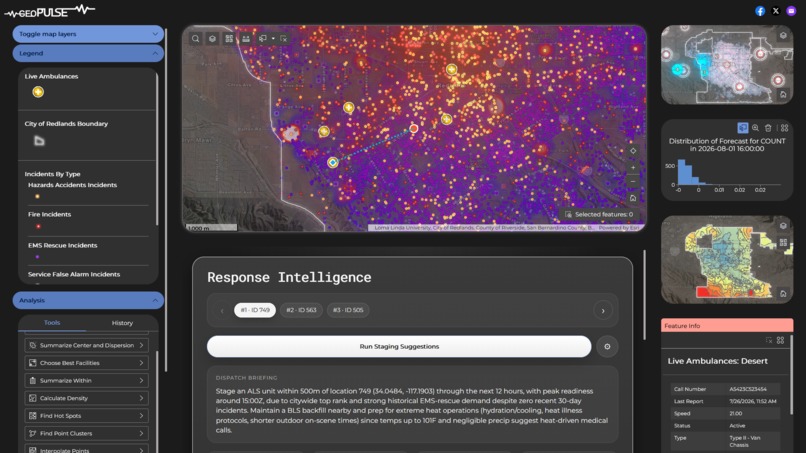
GeoPulse Command Dashboard
-
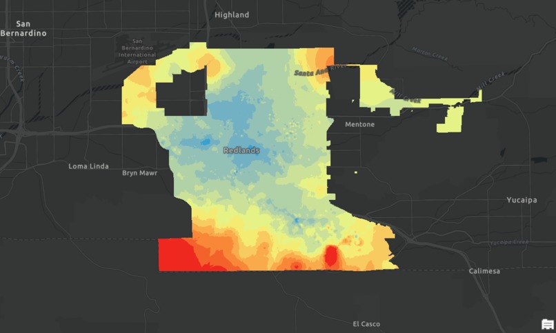
Response Times Interpolated Map (Heat Map)
-
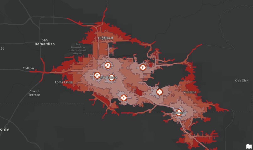
Network Analysis - Travel Times from Fire Stations
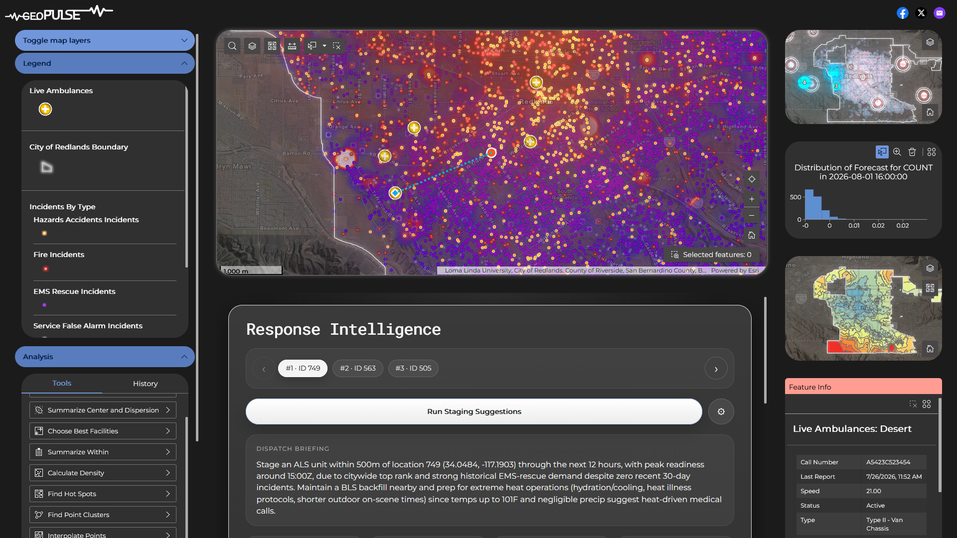
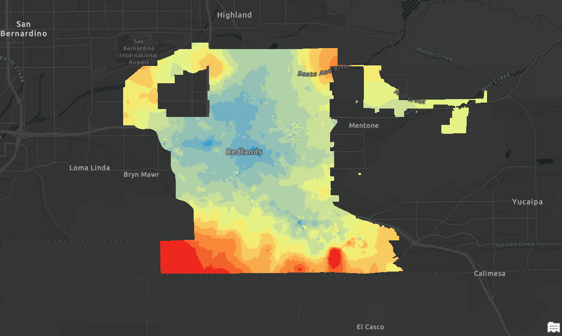
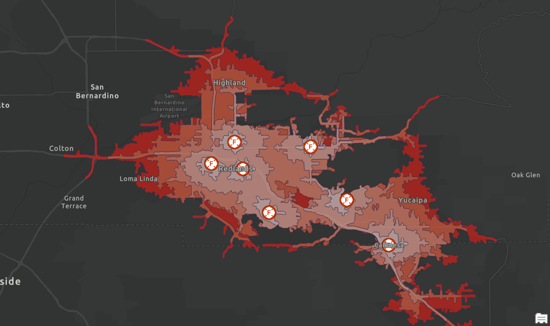
GeoPulse
Inspiration
Emergency response agencies have to make critical decisions about where to position ambulances before the next emergency occurs. Many of these decisions are based on coverage zones, historical experience, or known events, but emergency demand is constantly changing throughout the day.
As we started exploring EMS data, we saw an opportunity to use GIS to help agencies make more informed deployment decisions. Instead of simply reacting to emergencies, we wanted to identify patterns, forecast potential demand, and help position resources ahead of time.
That's what led us to create GeoPulse.
What It Does
GeoPulse is a decision-support application that helps EMS agencies proactively deploy resources using forecasting, spatial analysis, and optimization.
GeoPulse:
- Identifies historical incident hotspots
- Forecasts areas with increased likelihood of future incidents
- Recommends ambulance staging locations
- Evaluates response coverage and travel times
- Explains why recommendations are being made
The goal is simple: help agencies position resources more strategically and improve emergency response.
How We Built It
We built GeoPulse using ArcGIS and a variety of public datasets, including NFIRS emergency response data, weather information, smoke forecasts, road networks, hospital locations, and EMS resource locations.
Using ArcGIS Pro, we performed Hot Spot Analysis, Kernel Density Analysis, and Space-Time Cube analysis to identify patterns in emergency demand.
We then used Network Analyst to evaluate travel times, service coverage, and potential staging locations. These analyses allowed us to identify areas with elevated demand and determine locations that could improve response coverage.
Finally, we brought everything together in ArcGIS Experience Builder, creating an application where users can explore incident patterns, view recommendations, and better understand where resources should be deployed.
Challenges We Faced
We ran into a number of technical challenges while building GeoPulse.
Some of the biggest challenges involved troubleshooting analysis workflows, validating our results, gaining access to the ArcGIS products we needed, and hosting the application through IIS.
We also spent time working through connectivity and API-related issues while developing some of the intelligent recommendation functionality. Bringing together spatial analysis, forecasting, network analysis, and a web application into a single workflow was not always straightforward.
Like any hackathon project, we had a lot of ideas and not a lot of time, so one of our biggest challenges was prioritizing the features that would provide the most value while ensuring everything worked together before the final presentation.
What We Learned
This project gave us experience working with several ArcGIS products and showed us how powerful GIS can be when it comes to decision-making.
We learned how spatial analysis, forecasting, and network analysis can work together to support real-world operations. We also gained a better understanding of how to take analytical outputs and turn them into information that can support operational decisions.
Most importantly, we learned that the value isn't just in creating maps—it's in helping people make better decisions using the information those maps provide.
What's Next?
GeoPulse currently focuses on EMS deployment, but there are many opportunities for future growth.
Potential next steps include:
- CAD integration
- Real-time resource optimization
- Live traffic and environmental conditions
- Fire response applications
- Multi-agency coordination
- Additional forecasting capabilities
- Expanded operational decision support tools
We believe the same framework could be expanded to support a broader emergency response ecosystem and help agencies make even more informed deployment decisions.
GeoPulse
Predict. Position. Respond.
Built With
- arcgispro
- arcpy
- experiencebuilder
- python
- react
- typescript



Log in or sign up for Devpost to join the conversation.