-
-
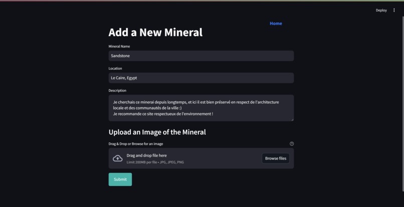
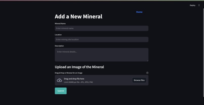
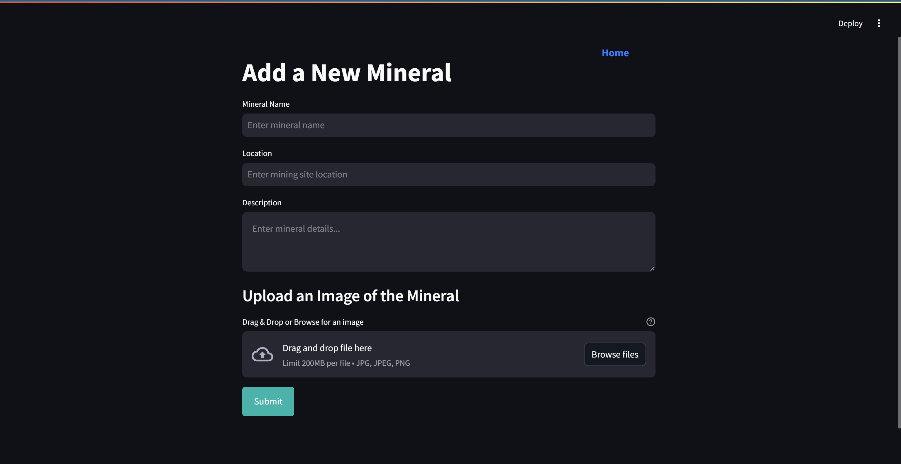
Ajout d'un minéral
-
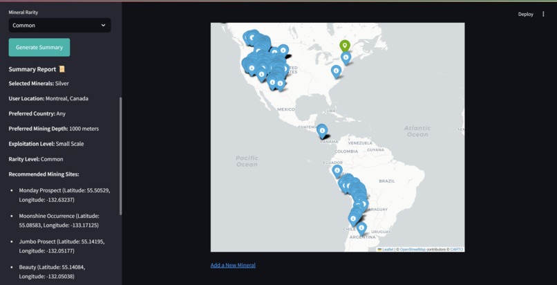
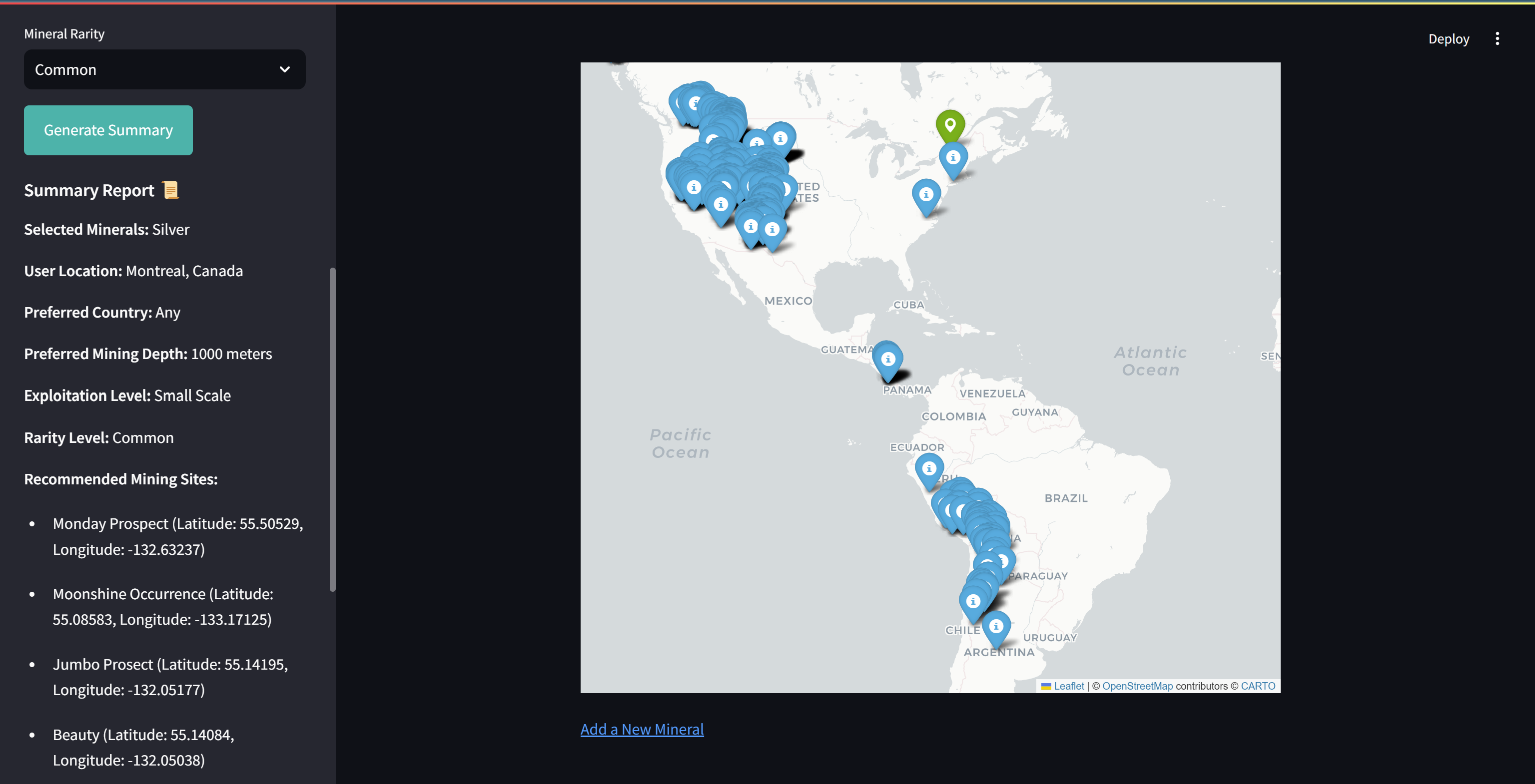
Génération d'un plan de minage
-
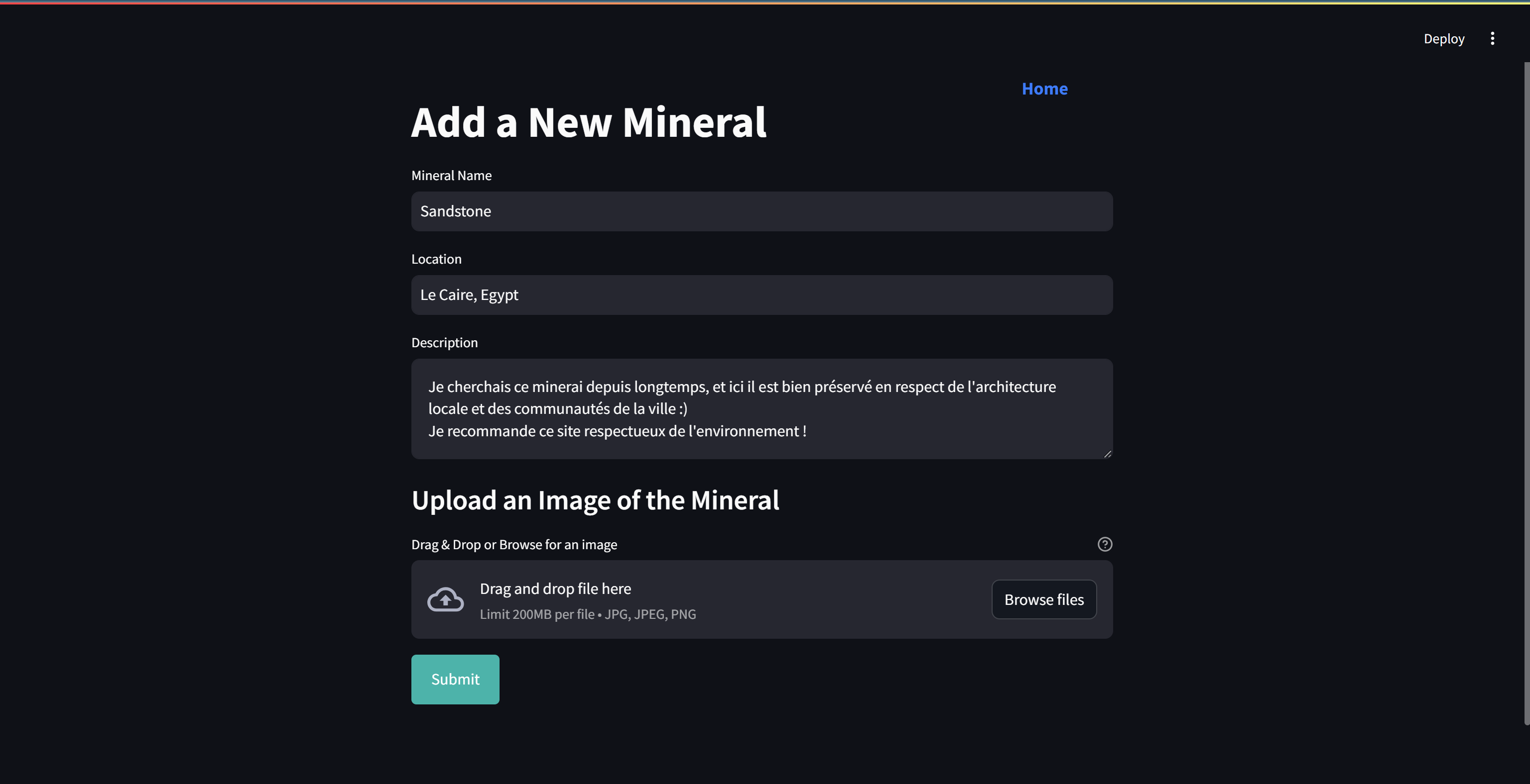
Ajout d'un minéral
-

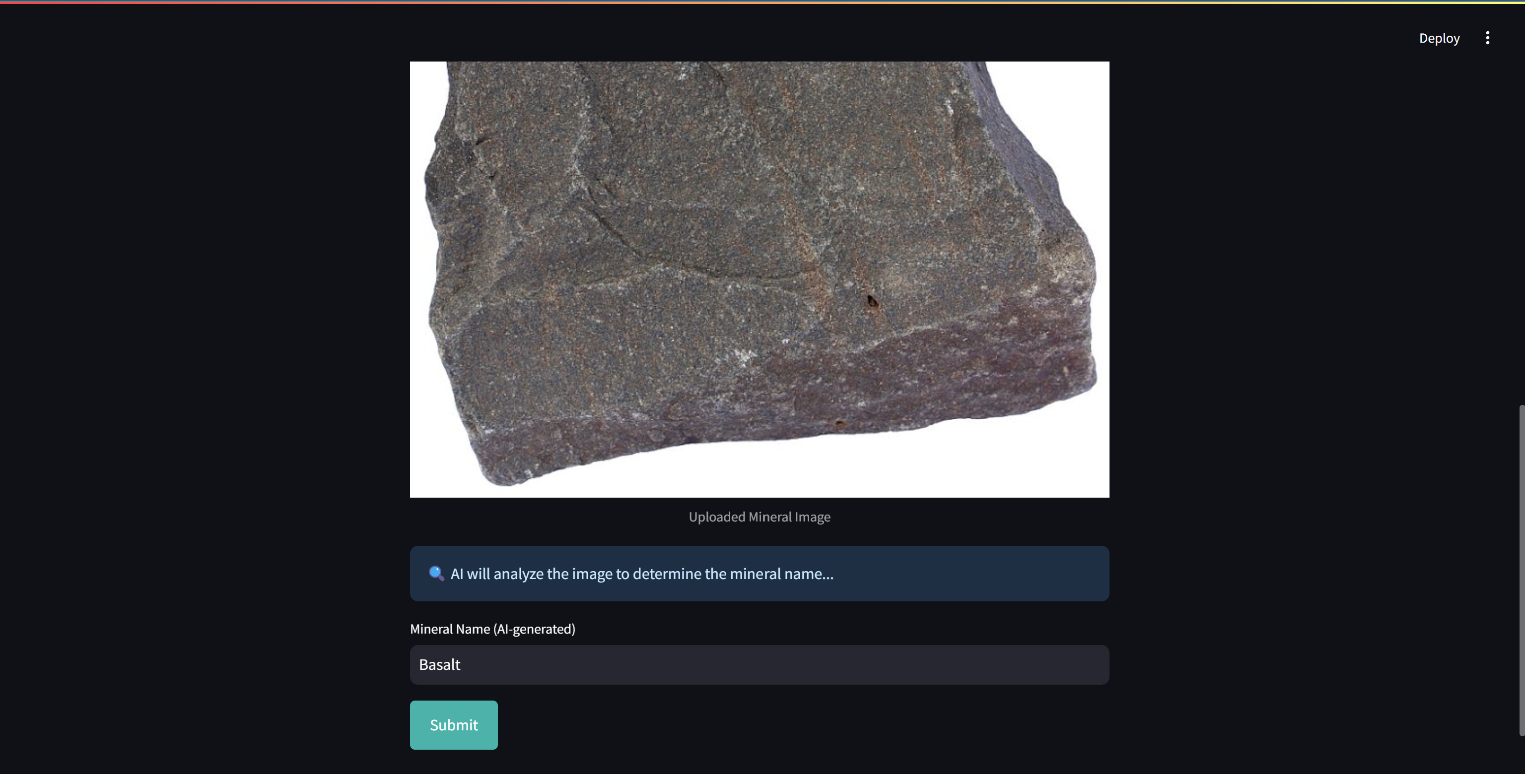
Ajout d'un minéral via IA
-
Page d'accueil

Inspiration
GeoMining was born from our passion for responsible resource management and the desire to revolutionize mineral exploration. We were inspired by the need to harness modern technology—like interactive maps and artificial intelligence—to make mining data more accessible and sustainable.
What it does
GeoMining enables users to:
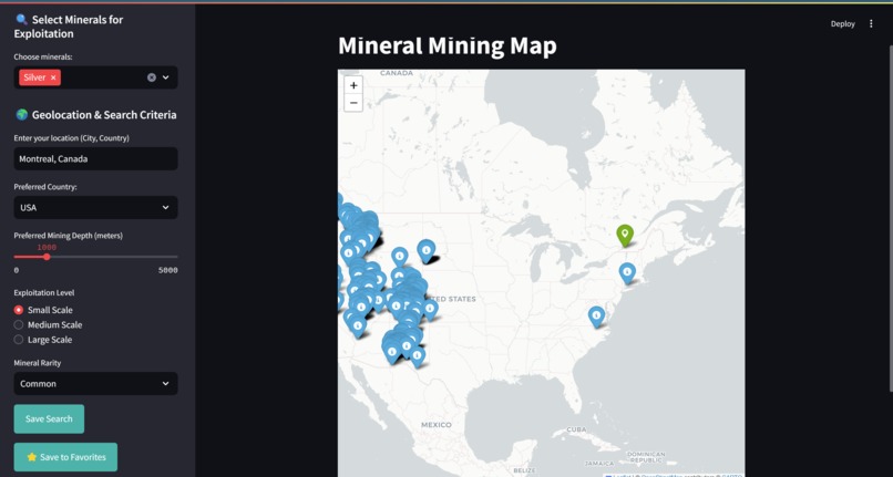
- Discover Mining Sites: Search for mineral deposits and view their locations on an interactive map.
- Leverage Geolocation: Find nearby mining areas based on your current location.
- Identify Minerals: Upload images of minerals and have them automatically identified using an AI-powered CNN.
- Generate Reports: Save your searches and export detailed reports in CSV and PDF formats.
- Integrate Sustainability: Apply filters that consider environmental and social criteria for a responsible approach to mining.
How we built it
We built GeoMining by integrating several technologies:
- Backend: Developed RESTful APIs using Flask and stored data in MongoDB.
- Frontend: Created an intuitive user interface with Streamlit, and integrated interactive mapping via Folium and Leaflet.
- Geolocation: Leveraged GeoPy to incorporate geolocation services.
- Data Handling: Utilized Pandas and FPDF to manage data and generate reports.
- Artificial Intelligence: Implemented a Convolutional Neural Network (CNN) using TensorFlow for accurate mineral identification.
- Collaboration: Divided the work among our team members to focus on AI, UI, backend, and overall integration.
Challenges we ran into
- Integration Complexity: Merging diverse technologies (mapping, AI, geolocation, data handling) into a cohesive platform.
- Data Accuracy: Ensuring the AI accurately identifies minerals and that geolocation data is precise.
- Performance: Balancing real-time responsiveness with processing complex data sets.
- Sustainability Criteria: Embedding environmental and social factors into the search and filtering process.
Accomplishments that we're proud of
- Successfully integrating an AI-driven mineral identification system within an interactive, geolocated map.
- Creating a user-friendly platform that streamlines the discovery and reporting of mining sites.
- Building a robust, scalable backend that supports real-time data updates and sustainable decision-making.
- Achieving a collaborative development process that allowed us to overcome technical challenges together.
What we learned
- Full-Stack Integration: How to effectively combine front-end and back-end technologies with AI modules.
- AI Implementation: The intricacies of training and deploying a CNN for real-world image classification.
- Sustainable Development: The importance of integrating environmental and social criteria into technology solutions.
- Team Collaboration: How clear communication and task division are key to tackling complex projects.
What's next for GeoMining
- Enhanced Sustainability Filters: Implement more detailed environmental impact indicators and ecological data.
- User Authentication: Develop a secure login system to personalize and protect user contributions.
- Mobile Optimization: Refine the interface for better performance on mobile devices.
- Advanced Reporting: Expand the reporting features to include more customization and interactive analytics.
- Community Features: Introduce collaborative tools such as forums or review systems to share insights and best practices in sustainable mining.

Log in or sign up for Devpost to join the conversation.